world.wikisort.org - USA
Quinter is a city in Gove County, Kansas, United States.[1] As of the 2020 census, the population of the city was 929.[3]
Quinter, Kansas | |
|---|---|
City | |
 View from Interstate 70 (2006) | |
 Location within Gove County and Kansas | |
 KDOT map of Gove County (legend) | |
| Coordinates: 39°3′57″N 100°14′13″W[1] | |
| Country | United States |
| State | Kansas |
| County | Gove |
| Founded | 1885 (Familton) |
| Incorporated | 1909 (Quinter) |
| Named for | James Quinter |
| Area | |
| • Total | 1.00 sq mi (2.60 km2) |
| • Land | 1.00 sq mi (2.60 km2) |
| • Water | 0.00 sq mi (0.00 km2) |
| Elevation | 2,667 ft (813 m) |
| Population (2020)[3] | |
| • Total | 929 |
| • Density | 930/sq mi (360/km2) |
| Time zone | UTC-6 (CST) |
| • Summer (DST) | UTC-5 (CDT) |
| ZIP code | 67752 |
| Area code | 785 |
| FIPS code | 20-58250 [1] |
| GNIS ID | 471350 [1] |
| Website | cityofquinter.com |
History
The city of Quinter is built at the location of an old railroad switching site called Melota. A town named Familton[1] was built there in 1885, consisting originally of a hotel.[4] The U.S. Government would not establish a post office under the Familton name, because of possible confusion with other names in the state, so another had to be chosen. The name Quinter was settled upon, after Rev. James Quinter, a local Baptist Brethren minister.[5]
The city has received some slight national publicity in November 2006 when longtime resident Waldo McBurney, age 104, was proclaimed the oldest worker in the United States, and in 2020.[6][7]
Geography
Quinter is located at 39°3′57″N 100°14′13″W (39.065706, -100.236828).[8] According to the United States Census Bureau, the city has a total area of 0.99 square miles (2.56 km2), all of it land.[9]
Demographics
| Historical population | |||
|---|---|---|---|
| Census | Pop. | %± | |
| 1910 | 450 | — | |
| 1920 | 383 | −14.9% | |
| 1930 | 570 | 48.8% | |
| 1940 | 481 | −15.6% | |
| 1950 | 741 | 54.1% | |
| 1960 | 776 | 4.7% | |
| 1970 | 930 | 19.8% | |
| 1980 | 951 | 2.3% | |
| 1990 | 945 | −0.6% | |
| 2000 | 961 | 1.7% | |
| 2010 | 918 | −4.5% | |
| 2020 | 929 | 1.2% | |
| U.S. Decennial Census | |||

2010 census
As of the census[10] of 2010, there were 918 people, 374 households, and 251 families residing in the city. The population density was 927.3 inhabitants per square mile (358.0/km2). There were 425 housing units at an average density of 429.3 per square mile (165.8/km2). The racial makeup of the city was 98.3% White, 0.3% African American, 0.4% Asian, 0.3% from other races, and 0.7% from two or more races. Hispanic or Latino of any race were 2.2% of the population.
There were 374 households, of which 29.1% had children under the age of 18 living with them, 58.8% were married couples living together, 6.1% had a female householder with no husband present, 2.1% had a male householder with no wife present, and 32.9% were non-families. 29.9% of all households were made up of individuals, and 18.5% had someone living alone who was 65 years of age or older. The average household size was 2.30 and the average family size was 2.87.
The median age in the city was 47.9 years. 23.6% of residents were under the age of 18; 6% were between the ages of 18 and 24; 17.3% were from 25 to 44; 24.5% were from 45 to 64; and 28.6% were 65 years of age or older. The gender makeup of the city was 47.2% male and 52.8% female.
2000 census
As of the census[11] of 2000, there were 961 people, 393 households, and 257 families residing in the city. The population density was 978.0 people per square mile (378.6/km2). There were 463 housing units at an average density of 471.2 per square mile (182.4/km2). The racial makeup of the city was 97.40% White, 0.10% African American, 0.31% Asian, 0.94% from other races, and 1.25% from two or more races. Hispanic or Latino of any race were 1.25% of the population. There were 393 households, out of which 28.2% had children under the age of 18 living with them, 61.1% were married couples living together, 3.3% had a female householder with no husband present, and 34.4% were non-families. 33.8% of all households were made up of individuals, and 22.6% had someone living alone who was 65 years of age or older. The average household size was 2.31 and the average family size was 2.97.
In the city the population was spread out, with 24.8% under the age of 18, 4.5% from 18 to 24, 19.0% from 25 to 44, 20.2% from 45 to 64, and 31.5% who were 65 years of age or older. The median age was 46 years. For every 100 females, there were 81.3 males. For every 100 females age 18 and over, there were 74.6 males.
The median income for a household in the city was $32,098, and the median income for a family was $41,111. Males had a median income of $25,313 versus $17,292 for females. The per capita income for the city was $15,588. About 5.4% of families and 7.6% of the population were below the poverty line, including 9.8% of those under age 18 and 6.4% of those age 65 or over.
Transportation
The concurrent Interstate 70 and U.S. Route 40 pass just south of the city. Old U.S. Route 40 and the current K-212 pass through the city, as does a major Union Pacific railroad line.[12]
Notable people
- Brent Barrett, American actor and tenor
- Vaughn Flora, Kansas state legislator
- Scott Huffman, 1996 Olympic pole vaulter and former American record holder
- Tracey Mann, Lieutenant Governor of Kansas, 2018-2019
- Robert Maxwell, World War II combat veteran and Medal of Honor recipient
- Waldo McBurney, centenarian
- Maggie McIntosh, Maryland State legislator
See also
- Monument Rocks (Kansas)
References
- "Quinter, Kansas", Geographic Names Information System, United States Geological Survey
- "2019 U.S. Gazetteer Files". United States Census Bureau. Retrieved July 24, 2020.
- "Profile of Quinter, Kansas in 2020". United States Census Bureau. Archived from the original on November 26, 2021. Retrieved November 26, 2021.
- Blackmar, Frank Wilson (1912). Kansas: A Cyclopedia of State History, Volume 2. Standard Publishing Company. pp. 530.
- History Of Gove County, Kansas; 1930. Archived December 29, 2011, at the Wayback Machine
- http://www.kansas.com/mld/kansas/news/state/15912412.htm%5B%5D
- Hughes, Trevor (December 12, 2020). "Deadliest place in America: They shrugged off the pandemic, then their family and friends started dying". USA TODAY. Retrieved 2020-12-12.
- "US Gazetteer files: 2010, 2000, and 1990". United States Census Bureau. 2011-02-12. Retrieved 2011-04-23.
- "US Gazetteer files 2010". United States Census Bureau. Archived from the original on January 12, 2012. Retrieved 2012-07-06.
- "U.S. Census website". United States Census Bureau. Retrieved 2012-07-06.
- "U.S. Census website". United States Census Bureau. Retrieved 2008-01-31.
- DeLorme. Kansas Atlas & Gazetteer. 4th ed. Yarmouth: DeLorme, 2009, 31. ISBN 0-89933-342-7.
Further reading
External links
- City of Quinter
- Quinter - Directory of Public Officials
- USD 293, local school district
- Quinter City Map, KDOT
Municipalities and communities of Gove County, Kansas, United States | ||
|---|---|---|
County seat: Gove City | ||
| Cities | 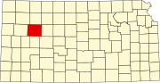 | |
| Ghost towns | ||
| Townships | ||
| Footnotes | ‡This community also has portions in an adjacent county or counties. | |
| ||
Authority control | |
|---|---|
| General | |
| National libraries | |
| Other | |
На других языках
[de] Quinter
Quinter ist eine Stadt im Gove County im US-Bundesstaat Kansas in den Vereinigten Staaten mit 961 Einwohnern (Stand: Volkszählung 2000). Der Ort liegt im Nordwesten von Gove County und hat eine Fläche von 2,5 km² ohne nennenswerte Wasserfläche.- [en] Quinter, Kansas
Другой контент может иметь иную лицензию. Перед использованием материалов сайта WikiSort.org внимательно изучите правила лицензирования конкретных элементов наполнения сайта.
WikiSort.org - проект по пересортировке и дополнению контента Википедии