world.wikisort.org - USA
Larrabee Township is a township in Gove County, Kansas, USA. As of the 2000 census, its population was 80.
Larrabee Township | |
|---|---|
Township | |
 Location in Gove County | |
| Coordinates: 38°47′06″N 100°15′49″W | |
| Country | United States |
| State | Kansas |
| County | Gove |
| Area | |
| • Total | 143.39 sq mi (371.39 km2) |
| • Land | 143.37 sq mi (371.34 km2) |
| • Water | 0.02 sq mi (0.05 km2) 0.01% |
| Elevation | 2,362 ft (720 m) |
| Population (2000) | |
| • Total | 80 |
| • Density | 0.6/sq mi (0.2/km2) |
| GNIS feature ID | 0471401 |
Geography
Larrabee Township covers an area of 143.39 square miles (371.4 km2) and contains no incorporated settlements. According to the USGS, it contains two cemeteries: Alanthus and Morning Star.
The streams of Big Windy Creek, Indian Creek and Sand Creek run through this township.
Transportation
Larrabee Township contains one airport or landing strip, Castle Rock Ranch Airport.
References
External links
Municipalities and communities of Gove County, Kansas, United States | ||
|---|---|---|
County seat: Gove City | ||
| Cities | 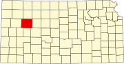 | |
| Ghost towns | ||
| Townships | ||
| Footnotes | ‡This community also has portions in an adjacent county or counties. | |
| ||
Текст в блоке "Читать" взят с сайта "Википедия" и доступен по лицензии Creative Commons Attribution-ShareAlike; в отдельных случаях могут действовать дополнительные условия.
Другой контент может иметь иную лицензию. Перед использованием материалов сайта WikiSort.org внимательно изучите правила лицензирования конкретных элементов наполнения сайта.
Другой контент может иметь иную лицензию. Перед использованием материалов сайта WikiSort.org внимательно изучите правила лицензирования конкретных элементов наполнения сайта.
2019-2025
WikiSort.org - проект по пересортировке и дополнению контента Википедии
WikiSort.org - проект по пересортировке и дополнению контента Википедии