world.wikisort.org - USA
Leawood /ˈliːwʊd/ is a city in Johnson County, Kansas, United States,[1] and is part of the Kansas City metropolitan area. As of the 2020 census, the population of the city was 33,902.[3]
Leawood, Kansas | |
|---|---|
City | |
 Location within Johnson County and Kansas | |
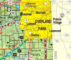 KDOT map of Johnson County (legend) | |
| Coordinates: 38°58′00″N 94°37′01″W[1] | |
| Country | United States |
| State | Kansas |
| County | Johnson |
| Founded | 1920s |
| Incorporated | 1948 |
| Named for | Oscar Lee |
| Government | |
| • Mayor | Peggy Dunn |
| Area | |
| • Total | 15.21 sq mi (39.38 km2) |
| • Land | 15.11 sq mi (39.12 km2) |
| • Water | 0.10 sq mi (0.26 km2) |
| Elevation | 942 ft (287 m) |
| Population (2020)[3] | |
| • Total | 33,902 |
| • Density | 2,200/sq mi (860/km2) |
| Time zone | UTC-6 (CST) |
| • Summer (DST) | UTC-5 (CDT) |
| ZIP code | 66206, 66207, 66209, 66211, 66224 [4] |
| Area code | 913 |
| FIPS code | 20-39075 [5] |
| GNIS ID | 479275 [6] |
| Website | leawood.org |
History
19th century
After the 1803 Louisiana Purchase, the area east of present-day Leawood opened for settlement. The Santa Fe Trail which ran through the area also contributed to the development of the area. The Border Ruffian War (1855-1857), part of a larger conflict known as Bleeding Kansas, damaged the local economy as pro-slavery activists from the slave state of Missouri attacked settlers, traders, and those traveling along the Santa Fe Trail. Conditions improved with the founding of Oxford, Kansas, the predecessor of Leawood. The township was destroyed by the American Civil War, and there was little left by 1865.[7]
Leawood was named for Oscar G. Lee, the original land owner of the town site.[8]
20th century
Modern Leawood was established in the 1920s, after Oscar G. Lee, a retired police chief from Oklahoma, moved to Johnson County. He supervised the construction of Lee Boulevard for public use.
In 1948, a housing development by the Kroh brothers led to the incorporation as a city. On November 30, 1948, Leawood became a city of the third class with a population of less than 2,000. By 1959, it had become a city of the second class. As of 2014[update], it is a city of the first class with approximately 32,800 residents.[7]
As of 2015[update], it was one of the Kansas City metropolitan area's wealthiest suburbs, alongside Mission Hills, Kansas, the Country Club Plaza neighborhood, and Olathe, Kansas. Particularly the neighborhoods of Hallbrook, Mission Hill Estates, and Tuscany Reserve were all rated in the top 1%, according to a widely cited research professor.[9]
Geography
According to the United States Census Bureau, the city has a total area of 15.16 square miles (39.26 km2), of which, 15.06 square miles (39.01 km2) of it is land and 0.10 square miles (0.26 km2) is water.[10]
The city is bordered on three sides by the cities of Overland Park and Prairie Village, Kansas and on the fourth by Kansas City, Missouri. The city's land area is approximately 75% developed and growth is expected to continue in the future.[11]
Demographics
| Historical population | |||
|---|---|---|---|
| Census | Pop. | %± | |
| 1950 | 1,167 | — | |
| 1960 | 7,466 | 539.8% | |
| 1970 | 10,349 | 38.6% | |
| 1980 | 13,360 | 29.1% | |
| 1990 | 19,693 | 47.4% | |
| 2000 | 27,656 | 40.4% | |
| 2010 | 31,867 | 15.2% | |
| 2020 | 33,902 | 6.4% | |
| U.S. Decennial Census 2010-2020[3] | |||
In an analysis by Bloomberg News, Leawood is cited as the 68th richest city in America by household income.[12] According to a 2007 estimate, the median income for a household in the city was $117,896, and the median income for a family was $136,871.[13] Males had a median income of $90,546 versus $43,933 for females. The per capita income for the city was $49,139. About 0.5% of families and 1.3% of the population were below the poverty line, including 0.5% of those under age 18 and 2.8% of those age 65 or over.
2010 census
As of the census[14] of 2010, there were 31,867 people, 11,781 households, and 9,367 families living in the city.[15] The population density was 2,116.0 inhabitants per square mile (817.0/km2). There were 12,384 housing units at an average density of 822.3 per square mile (317.5/km2). The racial makeup of the city was 92.3% White, 1.9% African American, 0.1% Native American, 3.8% Asian, 0.4% from other races, and 1.4% from two or more races. Hispanic or Latino of any race were 2.2% of the population.
There were 11,781 households, of which 38.0% had children under the age of 18 living with them, 72.7% were married couples living together, 4.8% had a female householder with no husband present, 2.0% had a male householder with no wife present, and 20.5% were non-families. 18.1% of all households were made up of individuals, and 9.6% had someone living alone who was 65 years of age or older. The average household size was 2.70 and the average family size was 3.09.
The median age in the city was 44.7 years. 28.1% of residents were under the age of 18; 4.3% were between the ages of 18 and 24; 18% were from 25 to 44; 34.3% were from 45 to 64; and 15.3% were 65 years of age or older. The gender makeup of the city was 48.5% male and 51.5% female.
The city has become more Democratic in voting since 2016, going from majority conservative to a reliably swing district with near parity in party identification and fundraising.[16] The city is evenly divided 50/50 Democratic-Republican.[citation needed]
2000 census
As of the census[5] of 2000, there were 27,656 people, 9,841 households, and 8,118 families living in the city. The population density was 1,833.4 people per square mile (708.1/km2). There were 10,129 housing units at an average density of 671.5 per square mile (259.3/km2). The racial makeup of the city was 95.19% White, 1.46% African American, 0.14% Native American, 2.18% Asian, 0.01% Pacific Islander, 0.25% from other races, and 0.77% from two or more races. Hispanic or Latino of any race were 1.30% of the population.
There were 9,841 households, out of which 41.4% had children under the age of 18 living with them, 76.0% were married couples living together, 5.1% had a female householder with no husband present, and 17.5% were non-families. 15.2% of all households were made up of individuals, and 6.5% had someone living alone who was 65 years of age or older. The average household size was 2.81 and the average family size was 3.14.
In the city, the population was spread out, with 30.2% under the age of 18, 4.2% from 18 to 24, 23.2% from 25 to 44, 29.8% from 45 to 64, and 12.6% who were 65 years of age or older. The median age was 41 years. For every 100 females, there were 96.1 males. For every 100 females age 18 and over, there were 93.3 males.
Religion
Leawood is home to the main campus of the United Methodist Church of the Resurrection, which is the largest church in the Kansas City Metropolitan Area and the largest Methodist church in the country with 22,000 members and an average weekly attendance of 13,600.[17] In 2017, one of the world's largest stained glass works, costing $3.4 million, was established as part of the church's building, depicting stories of Jesus and Martin Luther King Jr.[18]
Leawood is also home to three Catholic parishes: Church of the Nativity, Curé of Ars and St. Michael the Archangel.
Economy
Top employers
According to Leawood's 2017 Comprehensive Annual Financial Report,[19] the top employers in the city were:
| # | Employer | # of Employees |
|---|---|---|
| 1 | AMC Theatres Support Center | 450 |
| 2 | Reece & Nichols | 415 |
| 3 | American Academy of Family Physicians | 362 |
| 4 | Blue Valley Unified School District | 346 |
| 5 | Select Quote | 290 |
| 6 | City of Leawood | 256 |
| 7 | Murphy-Hoffman Company | 250 |
| 8 | Nueterra Holdings Company | 184 |
| 9 | DEMDACO | 150 |
| 10 | Bukaty Companies | 120 |
Shopping Centers
Town Center Plaza is home to a number of upscale stores with few or no other locations in the Kansas City area.
Government
Law enforcement
The Leawood Police Department is the main department in the city of Leawood, the Johnson County Sheriff's Office also assists as well. The Leawood Police Department was formed on January 18, 1949. The agency was formed when Robert E. Combs became the city's first chief of police. The first officers hired on were unpaid volunteers who wanted to help their community. By 1971 the city had gradually started paying patrol officers, and in 1986 the agency had reached 26 officers, 6 civilians and 1 dispatcher. Now the agency has around 60 officers. Currently the Leawood Police Department enrolls officers in the Johnson County Regional Police Academy who, following their graduation, join the agency, raising the number of officers hired.[20] Leawood Police Officers have a dark navy blue uniform, dark blue pants, as well as black shoes or boots, and a badge with the department's insignia on it along with the Kansas state logo.
The Kansas Highway Patrol rarely patrols the city unless there is a major event. The Leawood police chief is Dale Finger, who has been chief since 2021.[21]
Education
Schools
Two public school districts serve Leawood -- Shawnee Mission School District and Blue Valley USD 229.[22]
Libraries
The Johnson County Library serves the residents of Leawood.[23]
In June 2014, Leawood city officials shut down a Little Free Library due to city ordinance prohibiting free-standing structures in the front yards of residential homes.[24] The family of the 9-year-old boy who built the structure created a Facebook page to support amendment of Leawood's city code.[25] Another resident of the city who erected a Little Free Library was threatened with a $25 fine. There are discussions among the city's residents in working with the city to amend its code regarding free-standing structures in residents' front yards.[26]
Notable people
Notable individuals who were born in and/or have lived in Leawood, include co-founder of Garmin Corporation Min Kao,[27] romance novelist Julie Garwood,[28] U.S. Representative from Missouri Karen McCarthy,[29] baseball pitcher Dan Quisenberry,[30] and founder of Hallmark Cards, Joyce Clyde Hall.[31]
Sister cities
 Yilan City, Taiwan Province, Republic of China (Taiwan) (1988)[32]
 Gezer Regional Council, Israel (2003)[33]
References
- Geographic Names Information System (GNIS) details for Leawood, Kansas; United States Geological Survey (USGS); October 13, 1978.
- "2019 U.S. Gazetteer Files". United States Census Bureau. Retrieved July 24, 2020.
- "QuickFacts; Leawood, Kansas; Population, Census, 2020 & 2010". United States Census Bureau. Archived from the original on August 23, 2021. Retrieved August 23, 2021.
- United States Postal Service (2012). "USPS - Look Up a ZIP Code". Retrieved 2012-02-15.
- "U.S. Census website". United States Census Bureau. Retrieved 2008-01-31.
- "US Board on Geographic Names". United States Geological Survey. 2007-10-25. Retrieved 2008-01-31.
- "CITY OF LEAWOOD COMPREHENSIVE PLAN UPDATE 2016" (PDF). 2016. Retrieved December 29, 2017.
- "Leawood, Kansas". JoCoHistory. Johnson County Museum. Archived from the original on 14 July 2014. Retrieved 12 June 2014.
- "Kansas City's wealthiest areas: Where they are and how they compare to other rich U.S. neighborhoods". www.bizjournals.com. Retrieved 2020-11-28.
- "US Gazetteer files 2010". United States Census Bureau. Archived from the original on 2012-07-02. Retrieved 2012-07-06.
- "About Leawood". City of Leawood. Archived from the original on 5 February 2015. Retrieved 5 February 2015.
- del Giudice, Vincent; Lu, Wei (March 22, 2017). "America's 100 Richest Places". Bloomberg News.
{{cite web}}: CS1 maint: url-status (link) - U.S. Census Leawood KS Archived February 10, 2020, at archive.today
- "American FactFinder Leawood city Kansas". United States Census Bureau. Archived from the original on 13 February 2020. Retrieved 6 September 2018.
- "2010 City Population and Housing Occupancy Status". U.S. Census Bureau. Archived from the original on April 11, 2015. Retrieved March 6, 2011.
- "Politics & Voting in Leawood, Kansas". Bestplaces.net. 2019-10-06. Retrieved 2022-09-07.
- "Archived copy" (PDF). Archived from the original (PDF) on 2016-04-06. Retrieved 2015-01-09.
{{cite web}}: CS1 maint: archived copy as title (link) - "Breaking the boundaries of stained glass". CBS News.
- "City of Leawood, Kansas Comprehensive Annual Financial Report: for the Year ended December 31, 2017" (PDF). Leawood.org. Retrieved 2019-03-31.
- [dead link]
- "Police – City of Leawood, KS". Leawood.org. Retrieved 2022-09-07.
- "Leawood Schools". City of Leawood. Retrieved 2 July 2019.
- "JoCoLibrary". JoCoLibrary. 2011-05-02. Retrieved 2012-11-17.
- "City Forces 9-Year-Old Boy to Move "Little Free Library" From Front Yard". 20 June 2014.
- "Spencer's Little Free Library". Facebook. 19 June 2014.
- "City to fine owners of Little Free Libraries". 18 June 2014. Archived from the original on 25 May 2016. Retrieved 23 June 2014.
- http://www.kansas.com/news/business/article1105086.html [bare URL]
- "Picks and Pans Review: Talking With...Julie Garwood". People. 1997-04-28. Retrieved 2016-04-01.
- Phillips, Anessa (2010-10-18). "Alumna Congresswoman passes". University News. Retrieved 2016-04-01.
- "Dan Quisenberry Dead At 45". CBS News. 1998-09-30. Retrieved 2016-04-01.
- Pace, Eric (1982-10-30). "J.c. Hall, Hallmark Founder, Is Dead". The New York Times. ISSN 0362-4331. Retrieved 2020-01-03.
- "US-Taiwan Connect. List of Sister Cities". Archived from the original on 2015-01-12. Retrieved 2015-07-12.
- "Gezer Region of Israel". City of Leawood, KS. Retrieved 2021-03-23.
Further reading
External links
Municipalities and communities of Johnson County, Kansas, United States | ||
|---|---|---|
County seat: Olathe | ||
| Cities |  | |
| Unincorporated communities |
| |
| Townships | ||
| Footnotes | ‡This community also has portions in an adjacent county or counties. | |
| ||
Kansas City metropolitan area's cities and counties | ||
|---|---|---|
| Central city |  | |
| Largest cities (over 100,000 in 2000) | ||
| Medium-sized cities (10,000 to 100,000 in 2000) | ||
| Smaller Cities (between 5,000 and 9,900 in 2010) | ||
| Counties | ||
Authority control | |
|---|---|
| General | |
| National libraries | |
| Other |
|
На других языках
[de] Leawood (Kansas)
Leawood ist eine Stadt im US-Bundesstaat Kansas im Johnson County mit 34.727 Einwohnern (Stand: 2019). Bei Leawood handelt es sich um einen Vorort innerhalb der Metropolregion Kansas City mit vorwiegend gutsituierter Bevölkerung.- [en] Leawood, Kansas
Другой контент может иметь иную лицензию. Перед использованием материалов сайта WikiSort.org внимательно изучите правила лицензирования конкретных элементов наполнения сайта.
WikiSort.org - проект по пересортировке и дополнению контента Википедии