world.wikisort.org - USA
Gardner is a city in Johnson County, Kansas, United States.[8] As of the 2020 census, the population of the city was 23,287.[3] It is located inside of the Kansas City metropolitan area.
Gardner, Kansas | |
|---|---|
City | |
 Main & Elm Street (2022) | |
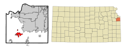 Location within Johnson County and Kansas | |
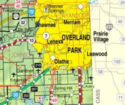 KDOT map of Johnson County (legend) | |
| Coordinates: 38°48′45″N 94°55′7″W | |
| Country | United States |
| State | Kansas |
| County | Johnson |
| Founded | 1857 |
| Incorporated | 1887 |
| Named for | Henry Gardner |
| Government | |
| • Type | Mayor–Council |
| • Mayor | Todd Winters[1] |
| • City Administrator | Jim Pruetting |
| Area | |
| • Total | 10.31 sq mi (26.72 km2) |
| • Land | 10.28 sq mi (26.61 km2) |
| • Water | 0.04 sq mi (0.10 km2) |
| Elevation | 1,060 ft (320 m) |
| Population (2020)[3] | |
| • Total | 23,287 |
| • Estimate (2021)[4] | 23,942 |
| • Density | 2,300/sq mi (870/km2) |
| Time zone | UTC-6 (CST) |
| • Summer (DST) | UTC-5 (CDT) |
| ZIP codes | 66030-66031 [5] |
| Area code | 913 |
| FIPS code | 20-25425 [6] |
| GNIS ID | 479553 [7] |
| Website | gardnerkansas.gov |
History
Gardner was founded where the Santa Fe Trail and the Oregon/California Trails divided. The Santa Fe Trail sent travelers southwest through Santa Fe and Albuquerque toward Los Angeles and San Diego. The Oregon/California Trails bore west for a few miles before turning north toward the Kansas River valley, followed the Big Blue River into present-day Nebraska, followed the Platte River west, and ultimately split in present-day Wyoming, Idaho or Utah.[9]
Gardner was founded as a Free-Stater settlement in 1857. Settled primarily by emigrants from Massachusetts, it was named for Henry Gardner,[10] then governor of Massachusetts. Four years after its establishment, it became the first community in Johnson County — and perhaps the first in the state — to experience an attack by Confederate forces.[11]
The first post office in Gardner was established in 1858.[12]
Geography
Gardner is located at 38°48′45″N 94°55′7″W (38.812367, -94.918621).[13] According to the United States Census Bureau, the city has a total area of 10.21 square miles (26.44 km2), of which 10.16 square miles (26.31 km2) is land and 0.05 square miles (0.13 km2) is water.[14]
Climate
The climate in this area is characterized by hot, humid summers and generally mild to cool winters. According to the Köppen Climate Classification system, Gardner has a humid subtropical climate, abbreviated "Cfa" on climate maps.[15]
Demographics
| Historical population | |||
|---|---|---|---|
| Census | Pop. | %± | |
| 1880 | 203 | — | |
| 1890 | 515 | 153.7% | |
| 1900 | 475 | −7.8% | |
| 1910 | 514 | 8.2% | |
| 1920 | 514 | 0.0% | |
| 1930 | 493 | −4.1% | |
| 1940 | 510 | 3.4% | |
| 1950 | 676 | 32.5% | |
| 1960 | 1,619 | 139.5% | |
| 1970 | 1,839 | 13.6% | |
| 1980 | 2,392 | 30.1% | |
| 1990 | 3,191 | 33.4% | |
| 2000 | 9,396 | 194.5% | |
| 2010 | 19,123 | 103.5% | |
| 2020 | 23,287 | 21.8% | |
| 2021 (est.) | 23,942 | [4] | 2.8% |
| U.S. Decennial Census 2010-2020[3] | |||
2010 census
As of the census[16] of 2010, there were 19,123 people, 6,644 households, and 4,938 families living in the city.[17] The population density was 1,889.6 inhabitants per square mile (729.6/km2). There were 7,300 housing units at an average density of 721.3 per square mile (278.5/km2). The racial makeup of the city was 89.7% White, 3.0% African American, 0.5% Native American, 1.9% Asian, 1.8% from other races, and 3.0% from two or more races. Hispanic or Latino of any race were 6.2% of the population.
There were 6,644 households, of which 49.7% had children under the age of 18 living with them, 58.9% were married couples living together, 10.3% had a female householder with no husband present, 5.1% had a male householder with no wife present, and 25.7% were non-families. 20.1% of all households were made up of individuals, and 5% had someone living alone who was 65 years of age or older. The average household size was 2.85 and the average family size was 3.31.
The median age in the city was 30 years. 33.2% of residents were under the age of 18; 6.6% were between the ages of 18 and 24; 37.7% were from 25 to 44; 17.1% were from 45 to 64; and 5.3% were 65 years of age or older. The gender makeup of the city was 49.9% male and 50.1% female.
2000 census
As of the census[6] of 2000, there were 9,396 people, 3,307 households, and 2,460 families living in the city. The population density was 1,898.5 people per square mile (732.9/km2). There were 3,533 housing units at an average density of 713.8 per square mile (275.6/km2). The racial makeup of the city was 94.13% White, 1.21% African American, 0.49% Native American, 1.05% Asian, 0.01% Pacific Islander, 1.26% from other races, and 1.85% from two or more races. Hispanic or Latino of any race were 2.99% of the population. 26.8% were of German, 18.2% American, 11.5% Irish and 5.6% English ancestry according to Census 2000.
There were 3,307 households, out of which 47.8% had children under the age of 18 living with them, 58.5% were married couples living together, 11.1% had a female householder with no husband present, and 25.6% were non-families. 19.5% of all households were made up of individuals, and 5.6% had someone living alone who was 65 years of age or older. The average household size was 2.80 and the average family size was 3.23.
In the city, the population was spread out, with 33.1% under the age of 18, 8.4% from 18 to 24, 38.4% from 25 to 44, 13.7% from 45 to 64, and 6.4% who were 65 years of age or older. The median age was 29 years. For every 100 females, there were 96.9 males. For every 100 females age 18 and over, there were 93.7 males.
As of 2000 the median income for a household in the city was $50,807, and the median income for a family was $54,554. Males had a median income of $37,438 versus $27,553 for females. The per capita income for the city was $20,434. About 5.3% of families and 6.0% of the population were below the poverty line, including 6.1% of those under age 18 and 9.2% of those age 65 or over.
Economy
BNSF Railway built a refueling plant and office in Edgerton which is 3 miles from western Gardner. It opened in May 2013 and employs about 200.[citation needed]
Largest employers
According to the City's 2015 Comprehensive Annual Financial Report,[18] the largest employers in the city are:
| # | Employer | # of Employees |
|---|---|---|
| 1 | Unified School District No. 231 | 800 |
| 2 | Walmart | 250 |
| 3 | Meadowbrook Rehabilitation Hospital | 174 |
| 4 | Epic Landscape Productions | 172 |
| 5 | Coleman | 167 |
| 6 | City of Gardner | 135 |
| 7 | TradeNet Publishing | 130 |
| 8 | Price Chopper | 130 |
| 9 | Medical Lodge of Gardner | 102 |
| 10 | D.O.T. Label, Inc (ITW) | 87 |
Government
The mayor of Gardner is Todd Winters, who was sworn in on December 6, 2021. The city council is made up of five (5) at-large members, each of whom serve rotating 4-year terms.[1]
Education
Gardner is part of the USD 231 school district. Located in Gardner are six out of the seven elementary schools (Edgerton Elementary is the only school in the district not located in Gardner). These include Gardner Elementary, Sunflower Elementary, Madison Elementary, Nike Elementary, Grand Star Elementary, and Moonlight Elementary. The district also has three middle schools, Wheatridge, Trail Ridge, and Pioneer Ridge, and one high school (Gardner-Edgerton High School) all located in Gardner.
Library
The Johnson County Library maintains a branch in Gardner.[19]
Notable people
Notable individuals who were born in and/or have lived in Gardner include:
- Ray McIntire (1918-1996), engineer, inventor[20]
- Bubba Starling (1992- ), baseball center fielder[21]
- John Means (1993- ), baseball pitcher
See also
- California Trail
- Oregon Trail
- Santa Fe Trail
References
- "Governing Body". City of Gardner Kansas. Archived from the original on February 3, 2022.
- "2019 U.S. Gazetteer Files". United States Census Bureau. Retrieved July 24, 2020.
- "QuickFacts; Gardner, Kansas; Population, Census, 2020 & 2010". United States Census Bureau. Archived from the original on August 24, 2021. Retrieved August 24, 2021.
- "City and Town Population Totals: 2020-2021". United States Census Bureau. May 16, 2022. Retrieved June 3, 2022.
- United States Postal Service (2012). "USPS - Look Up a ZIP Code". Retrieved 2012-02-15.
- "U.S. Census website". United States Census Bureau. Retrieved 2008-01-31.
- "US Board on Geographic Names". United States Geological Survey. 2007-10-25. Retrieved 2008-01-31.
- "Geographic Names Information System". United States Geological Survey. Retrieved 2008-01-31.
- Crease, Craig. "History of Gardner". City of Gardner. Archived from the original on 2014-04-15.
- Gannett, Henry (1905). The Origin of Certain Place Names in the United States. Govt. Print. Off. pp. 134.
- Gardner History, Gardner Historical Museum. Accessed 2018-08-21.
- "Kansas Post Offices, 1828-1961 (archived)". Kansas Historical Society. Archived from the original on October 9, 2013. Retrieved 11 June 2014.
- "US Gazetteer files: 2010, 2000, and 1990". United States Census Bureau. 2011-02-12. Retrieved 2011-04-23.
- "US Gazetteer files 2010". United States Census Bureau. Archived from the original on 2012-07-02. Retrieved 2012-07-06.
- Climate Summary for Gardner, Kansas
- "U.S. Census website". United States Census Bureau. Retrieved 2012-07-06.
- "2010 City Population and Housing Occupancy Status". U.S. Census Bureau. Retrieved March 6, 2011.[dead link]
- "City of Gardner, Kansas 2015 Comprehensive Annual Financial Report For the fiscal year ended December 31, 2015" (PDF). Retrieved March 2, 2017.
- Johnson County Library
- Thompson, D. (2011-03-12). "Gardner Scientist Honored by State Project". The Gardner News. Retrieved 2016-04-01.[permanent dead link]
- "Bubba Starling". Baseball-Reference.com. Retrieved 2016-04-01.
Further reading
External links
Municipalities and communities of Johnson County, Kansas, United States | ||
|---|---|---|
County seat: Olathe | ||
| Cities |  | |
| Unincorporated communities |
| |
| Townships | ||
| Footnotes | ‡This community also has portions in an adjacent county or counties. | |
| ||
Kansas City metropolitan area's cities and counties | ||
|---|---|---|
| Central city |  | |
| Largest cities (over 100,000 in 2000) | ||
| Medium-sized cities (10,000 to 100,000 in 2000) | ||
| Smaller Cities (between 5,000 and 9,900 in 2010) | ||
| Counties | ||
Authority control | |
|---|---|
| General | |
| National libraries | |
На других языках
[de] Gardner (Kansas)
Gardner ist eine Stadt im US-Bundesstaat Kansas im Johnson County mit 22.031 Einwohnern (Stand: 2019). Bei Gardner handelt es sich um einen Vorort innerhalb der Metropolregion Kansas City.- [en] Gardner, Kansas
Другой контент может иметь иную лицензию. Перед использованием материалов сайта WikiSort.org внимательно изучите правила лицензирования конкретных элементов наполнения сайта.
WikiSort.org - проект по пересортировке и дополнению контента Википедии