world.wikisort.org - USA
St. Francis is a city in and the county seat of Cheyenne County, Kansas, United States.[1] As of the 2020 census, the population of the city was 1,263.[3]
St. Francis, Kansas | |
|---|---|
City and County seat | |
 Cheyenne County Courthouse (2010) | |
 Location within Cheyenne County and Kansas | |
 KDOT map of Cheyenne County (legend) | |
| Coordinates: 39°46′17″N 101°48′3″W[1] | |
| Country | United States |
| State | Kansas |
| County | Cheyenne |
| Founded | 1887 |
| Incorporated | 1903 |
| Area | |
| • Total | 0.86 sq mi (2.22 km2) |
| • Land | 0.86 sq mi (2.22 km2) |
| • Water | 0.00 sq mi (0.00 km2) |
| Elevation | 3,320 ft (1,010 m) |
| Population (2020)[3] | |
| • Total | 1,263 |
| • Density | 1,500/sq mi (570/km2) |
| Time zone | UTC-6 (CST) |
| • Summer (DST) | UTC-5 (CDT) |
| ZIP code | 67756 |
| Area code | 785 |
| FIPS code | 20-62175 [1] |
| GNIS ID | 470970 [1] |
| Website | stfranciskansas.com |
History
St. Francis was founded in 1887.[4] The city may have been named for the wife of its founder.[5]
Geography
St. Francis is located at 39°46′17″N 101°48′3″W (39.771389, -101.800717).[6] According to the United States Census Bureau, the city has a total area of 0.87 square miles (2.25 km2), all of it land.[7]
Climate
St. Francis experiences a semi-arid climate (Köppen BSk) with cold, dry winters and hot, wetter summers.
| Climate data for St. Francis, Kansas | |||||||||||||
|---|---|---|---|---|---|---|---|---|---|---|---|---|---|
| Month | Jan | Feb | Mar | Apr | May | Jun | Jul | Aug | Sep | Oct | Nov | Dec | Year |
| Record high °F (°C) | 81 (27) |
83 (28) |
92 (33) |
97 (36) |
103 (39) |
109 (43) |
111 (44) |
110 (43) |
105 (41) |
104 (40) |
89 (32) |
80 (27) |
111 (44) |
| Average high °F (°C) | 41.0 (5.0) |
47.1 (8.4) |
54.8 (12.7) |
64.4 (18.0) |
73.8 (23.2) |
85.7 (29.8) |
91.3 (32.9) |
89.3 (31.8) |
80.9 (27.2) |
69.2 (20.7) |
52.1 (11.2) |
43.5 (6.4) |
66.1 (18.9) |
| Daily mean °F (°C) | 27.2 (−2.7) |
32.4 (0.2) |
39.9 (4.4) |
49.2 (9.6) |
59.6 (15.3) |
70.8 (21.6) |
76.3 (24.6) |
74.2 (23.4) |
64.8 (18.2) |
52.2 (11.2) |
37.7 (3.2) |
29.5 (−1.4) |
51.2 (10.6) |
| Average low °F (°C) | 13.3 (−10.4) |
17.7 (−7.9) |
25.0 (−3.9) |
34.0 (1.1) |
45.3 (7.4) |
55.9 (13.3) |
61.3 (16.3) |
59.0 (15.0) |
48.6 (9.2) |
35.2 (1.8) |
23.3 (−4.8) |
15.5 (−9.2) |
36.2 (2.3) |
| Record low °F (°C) | −25 (−32) |
−25 (−32) |
−20 (−29) |
0 (−18) |
17 (−8) |
33 (1) |
41 (5) |
33 (1) |
18 (−8) |
3 (−16) |
−9 (−23) |
−31 (−35) |
−31 (−35) |
| Average precipitation inches (mm) | 0.51 (13) |
0.49 (12) |
1.17 (30) |
1.73 (44) |
3.14 (80) |
2.57 (65) |
2.97 (75) |
2.12 (54) |
1.16 (29) |
1.04 (26) |
0.76 (19) |
0.40 (10) |
18.06 (457) |
| Source 1: NOAA (normals, 1971–2000) [8] | |||||||||||||
| Source 2: The Weather Channel (Records) [9] | |||||||||||||
Demographics
| Historical population | |||
|---|---|---|---|
| Census | Pop. | %± | |
| 1910 | 492 | — | |
| 1920 | 733 | 49.0% | |
| 1930 | 944 | 28.8% | |
| 1940 | 1,041 | 10.3% | |
| 1950 | 1,892 | 81.7% | |
| 1960 | 1,594 | −15.8% | |
| 1970 | 1,725 | 8.2% | |
| 1980 | 1,610 | −6.7% | |
| 1990 | 1,495 | −7.1% | |
| 2000 | 1,497 | 0.1% | |
| 2010 | 1,329 | −11.2% | |
| 2020 | 1,263 | −5.0% | |
| U.S. Decennial Census | |||
2010 census
As of the 2010 census,[10] there were 1,329 people, 650 households and 357 families residing in the city. The population density was 1,527.6 per square mile (589.8/km2). There were 768 housing units at an average density of 882.8 per square mile (340.9/km2). The racial make-up of the city was 98.2% White, 0.1% African American, 0.2% Native American, 1.1% Asian, 0.2% from other races and 0.2% from two or more races. Hispanic or Latino of any race were 3.8% of the population.
There were 650 households, of which 21.1% had children under the age of 18 living with them, 44.8% were married couples living together, 6.6% had a female householder with no husband present, 3.5% had a male householder with no wife present and 45.1% were non-families. 42.5% of all households were made up of individuals and 24.7% had someone living alone who was 65 years of age or older. The average household size was 1.97 and the average family size was 2.67.
The median age was 51.7 years. 18.7% of residents were under the age of 18, 5.1% were between the ages of 18 and 24, 17.8% were from 25 to 44, 26.8% were from 45 to 64 and 31.8% were 65 years of age or older. The sex ratio was 48.9% male and 51.1% female.
2000 census
As of the 2000 census,[11] there were 1,497 people, 669 households and 426 families residing in the city. The population density was 1,771.2 per square mile (683.9/km2). There were 766 housing units at an average density of 906.3 per square mile (349.9/km2). The racial make-up of the city was 97.80% White, 0.20% African American, 0.07% Native American, 0.47% Asian, 0.07% Pacific Islander, 0.53% from other races and 0.87% from two or more races. Hispanic or Latino of any race were 2.27% of the population.
There were 669 households, of which 25.3% had children under the age of 18 living with them, 54.7% were married couples living together, 6.7% had a female householder with no husband present and 36.2% were non-families. 34.8% of all households were made up of individuals and 20.8% had someone living alone who was 65 years of age or older. The average household size was 2.16 and the average family size was 2.76.
21.7% of the population were under the age of 18, 6.1% from 18 to 24, 21.9% from 25 to 44, 18.9% from 45 to 64 and 31.4% were 65 years of age or older. The median age was 45 years. For every 100 females, there were 91.2 males. For every 100 females age 18 and over, there were 83.4 males.
The median household income was $30,842 and the median family income was $36,250. Males had a median income of $25,484 and females $19,167. The per capita income was $16,714. About 8.9% of families and 11.8% of the population were below the poverty line, including 18.3% of those under age 18 and 8.4% of those age 65 or over.
Education
The community is served by St. Francis USD 297 public school district.
Notable people
- Ron Evans, astronaut and, as a member of Apollo 17, one of 24 people to have orbited the Moon
- Ray Stafford, Olympian
See also
- Burns, Kansas, was originally named St. Francis
References
- "St. Francis, Kansas", Geographic Names Information System, United States Geological Survey
- "2019 U.S. Gazetteer Files". United States Census Bureau. Retrieved July 24, 2020.
- "Profile of St. Francis, Kansas in 2020". United States Census Bureau. Archived from the original on November 13, 2021. Retrieved November 13, 2021.
- Kansas State Historical Society (1916). Biennial Report of the Board of Directors of the Kansas State Historical Society. Kansas State Printing Plant. pp. 159.
- Blackmar, Frank Wilson (1912). Kansas: A Cyclopedia of State History. Vol. 2. Standard Publishing Company. pp. 619. - "Profile for Saint Francis, Kansas". ePodunk. Archived from the original on January 22, 2005. Retrieved June 27, 2022.[unreliable source?]
- "US Gazetteer files: 2010, 2000, and 1990". United States Census Bureau. February 12, 2011. Retrieved April 23, 2011.
- "US Gazetteer files 2010". United States Census Bureau. Archived from the original on January 25, 2012. Retrieved July 6, 2012.
- "Climatography of the United States NO.81" (PDF). National Oceanic and Atmospheric Administration. Retrieved January 16, 2011.
- "Monthly Averages for St. Francis, KS". The Weather Channel. Retrieved January 16, 2011.
- "U.S. Census website". United States Census Bureau. Retrieved July 6, 2012.
- "U.S. Census website". United States Census Bureau. Retrieved January 31, 2008.
Further reading
External links
- City of St. Francis
- St. Francis - Directory of Public Officials
- St. Francis USD 297, local school district
- St. Francis City Map, KDOT
Municipalities and communities of Cheyenne County, Kansas, United States | ||
|---|---|---|
County seat: St. Francis | ||
| Cities | 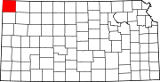 | |
| Unincorporated communities |
| |
| Ghost towns | ||
| Townships | ||
| ||
Другой контент может иметь иную лицензию. Перед использованием материалов сайта WikiSort.org внимательно изучите правила лицензирования конкретных элементов наполнения сайта.
WikiSort.org - проект по пересортировке и дополнению контента Википедии