world.wikisort.org - USA
Stockton is a city in and the county seat of Rooks County, Kansas, United States.[1] As of the 2020 census, the population of the city was 1,480.[3]
Stockton, Kansas | |
|---|---|
City and County seat | |
 Rooks County Courthouse (2014) | |
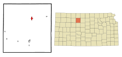 Location within Rooks County and Kansas | |
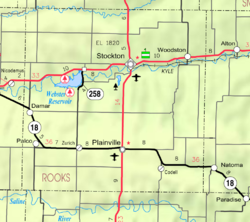 KDOT map of Rooks County (legend) | |
| Coordinates: 39°26′11″N 99°16′18″W[1] | |
| Country | United States |
| State | Kansas |
| County | Rooks |
| Founded | 1872 |
| Incorporated | 1879 |
| Named for | Cattle |
| Area | |
| • Total | 1.66 sq mi (4.29 km2) |
| • Land | 1.66 sq mi (4.29 km2) |
| • Water | 0.00 sq mi (0.00 km2) |
| Elevation | 1,798 ft (548 m) |
| Population (2020)[3] | |
| • Total | 1,480 |
| • Density | 890/sq mi (340/km2) |
| Time zone | UTC-6 (CST) |
| • Summer (DST) | UTC-5 (CDT) |
| ZIP code | 67669 |
| Area code | 785 |
| FIPS code | 20-68350 [1] |
| GNIS ID | 472238 [1] |
| Website | stocktonks.com |
History
19th century
Stockton was founded in 1872.[4] A large share of the first settlers were cattle dealers, or stockmen, and they named their new home Stocktown, or as it soon became Stockton.[5] Stockton was incorporated as a city in 1879.[6]
Stockton is located on the natural trail up the valley of the South Solomon River and where the military supply trail from Fort Kearney, Nebraska, to Fort Hays, Kansas, crossed the South Solomon River. Stockton survived & grew during the thirteen years from founding until the arrival of the railroad in 1885.[citation needed]
Stockton was once a sundown town, where African Americans living in Nicodemus were not welcome after dark.[7]
20th century
Stockton was featured in British author Tony Parker's 1989 book Bird, Kansas in which he transcribed tape recorded interviews with local residents.[8]
Geography
Stockton is located at 39°26′11″N 99°16′18″W (39.436328, -99.271641).[9] According to the United States Census Bureau, the city has a total area of 2.23 square miles (5.78 km2), all of it land.[10]
Area attractions
- Rooks County Historical Society Frank Walker Museum
Demographics
| Historical population | |||
|---|---|---|---|
| Census | Pop. | %± | |
| 1880 | 411 | — | |
| 1890 | 880 | 114.1% | |
| 1900 | 1,030 | 17.0% | |
| 1910 | 1,317 | 27.9% | |
| 1920 | 1,324 | 0.5% | |
| 1930 | 1,291 | −2.5% | |
| 1940 | 1,418 | 9.8% | |
| 1950 | 1,867 | 31.7% | |
| 1970 | 1,818 | — | |
| 1980 | 1,825 | 0.4% | |
| 1990 | 1,507 | −17.4% | |
| 2000 | 1,558 | 3.4% | |
| 2010 | 1,329 | −14.7% | |
| 2020 | 1,480 | 11.4% | |
| U.S. Decennial Census | |||
2010 census
As of the census[11] of 2010, there were 1,329 people, 606 households, and 369 families residing in the city. The population density was 596.0 inhabitants per square mile (230.1/km2). There were 743 housing units at an average density of 333.2 per square mile (128.6/km2). The racial makeup of the city was 97.1% White, 0.5% African American, 0.6% Native American, 0.2% Asian, 0.2% from other races, and 1.4% from two or more races. Hispanic or Latino of any race were 2.3% of the population.
There were 606 households, of which 26.2% had children under the age of 18 living with them, 47.5% were married couples living together, 9.4% had a female householder with no husband present, 4.0% had a male householder with no wife present, and 39.1% were non-families. 36.1% of all households were made up of individuals, and 17% had someone living alone who was 65 years of age or older. The average household size was 2.13 and the average family size was 2.74.
The median age in the city was 46.1 years. 21.2% of residents were under the age of 18; 7.3% were between the ages of 18 and 24; 19.7% were from 25 to 44; 30.7% were from 45 to 64; and 21.1% were 65 years of age or older. The gender makeup of the city was 47.2% male and 52.8% female.
2000 census
As of the census[12] of 2000, there were 1,558 people, 636 households, and 403 families residing in the city. The population density was 1,198.2 people per square mile (462.7/km2). There were 745 housing units at an average density of 573.0 per square mile (221.3/km2). The racial makeup of the city was 93.97% White, 2.82% African American, 0.58% Native American, 0.19% Asian, 1.16% from other races, and 1.28% from two or more races. Hispanic or Latino of any race were 1.93% of the population.
There were 636 households, out of which 28.8% had children under the age of 18 living with them, 50.9% were married couples living together, 9.7% had a female householder with no husband present, and 36.5% were non-families. 35.4% of all households were made up of individuals, and 23.4% had someone living alone who was 65 years of age or older. The average household size was 2.21 and the average family size was 2.85.
In the city, the population was spread out, with 22.9% under the age of 18, 5.5% from 18 to 24, 26.8% from 25 to 44, 19.7% from 45 to 64, and 25.0% who were 65 years of age or older. The median age was 42 years. For every 100 females, there were 102.9 males. For every 100 females age 18 and over, there were 99.5 males.
The median income for a household in the city was $31,125, and the median income for a family was $38,603. Males had a median income of $26,458 versus $19,688 for females. The per capita income for the city was $17,205. About 6.3% of families and 9.1% of the population were below the poverty line, including 14.4% of those under age 18 and 8.0% of those age 65 or over.
Education
Stockton is part of Unified School District 271.[13]
Notable people
Notable individuals who were born in and/or have lived in Stockton include:
- Elam Bartholomew (1852-1934), Horticulturalist and Botanist[14]
- Dale Dodrill (1926-2019), football defensive tackle[15]
- Roy Fisher (1918-1999), editor, reporter[16]
- Lorenzo Fuller (1919-2011), singer, musician and actor.[17]
- Ken Randle (1923-2011), Project leader for the NASA Futures Team responsible for the Grand Tour which became the Voyager Mission and Mariner 10, AIAA Distinguished Service for getting legislation through Congress for National Space Week Award[18]
- Mal Stevens (1900-1979), football halfback, coach, surgeon[19]
See also
- Webster Reservoir and Webster State Park
References
- "Stockton, Kansas", Geographic Names Information System, United States Geological Survey
- "2019 U.S. Gazetteer Files". United States Census Bureau. Retrieved July 24, 2020.
- "Profile of Stockton, Kansas in 2020". United States Census Bureau. Archived from the original on March 15, 2022. Retrieved March 15, 2022.
- "Origin of Town Names" (PDF). Solomon Valley Highway 24 Heritage Alliance. p. 3. Retrieved 9 April 2018.
- Kansas State Historical Society (1916). Biennial Report of the Board of Directors of the Kansas State Historical Society. Kansas State Printing Plant. pp. 277.
- Blackmar, Frank Wilson (1912). Kansas: A Cyclopedia of State History, Volume 2. Standard Publishing Company. pp. 767.
- Bates, Angela (February 17, 2005). "Black History Month: Postcard from Kansas". Talk of the Nation (Interview). Interviewed by Frank Stasio. Washington, D.C.: NPR.
So the only remaining dugout in the area that was used by the people that traveled from Stockton—traveled to Stockton from Nicodemus to do their trading and all, had to stay in that dugout, and it's still there, and it's because they had a sundown law.
- Liu, Jonathan H. "Review: Welcome to Utopia Explores Small-Town Life". WIRED. Retrieved 29 January 2018.
- "US Gazetteer files: 2010, 2000, and 1990". United States Census Bureau. 2011-02-12. Retrieved 2011-04-23.
- "US Gazetteer files 2010". United States Census Bureau. Archived from the original on January 12, 2012. Retrieved 2012-07-06.
- "U.S. Census website". United States Census Bureau. Retrieved 2012-07-06.
- "U.S. Census website". United States Census Bureau. Retrieved 2008-01-31.
- "Stockton USD 271". Retrieved 2017-01-03.
- "Elam Bartholomew". Kansas Historical Society. Retrieved February 25, 2018.
- "Dale Dodrill". Pro-Football-Reference.com. Retrieved 2016-06-16.
- Pace, Eric (1999-03-29). "Roy M. Fisher, 80, Journalist and Teacher". The New York Times. Retrieved 2016-06-16.
- "Lorenzo Fuller, a Kansas legend", African American Registry. Retrieved 8 January 2019
- "NASA Past and Future: A Personal Memoir | APPEL Knowledge Services".
- "Mal Stevens". National Football Foundation. Retrieved 2016-06-16.
Further reading
External links
| Wikimedia Commons has media related to Stockton, Kansas. |
- City of Stockton
- Stockton - Directory of Public Officials, League of Kansas Municipalities
- Historic Images, Wichita State University Library
- Stockton city map, KDOT
Municipalities and communities of Rooks County, Kansas, United States | ||
|---|---|---|
County seat: Stockton | ||
| Cities |  | |
| Unincorporated community |
| |
| Ghost towns | ||
| Townships |
| |
| Footnotes | †This community is designated a Census-Designated Place (CDP) by the United States Census Bureau. | |
| ||
Authority control | |
|---|---|
| General | |
| National libraries | |
Другой контент может иметь иную лицензию. Перед использованием материалов сайта WikiSort.org внимательно изучите правила лицензирования конкретных элементов наполнения сайта.
WikiSort.org - проект по пересортировке и дополнению контента Википедии