world.wikisort.org - USA
Haysville is a city in Sedgwick County, Kansas, United States,[1] and a suburb of Wichita. As of the 2020 census, the population of the city was 11,262.[4][5] Haysville is known as the "Peach Capital of Kansas".[6]
Haysville, Kansas | |
|---|---|
City | |
 Location within Sedgwick County and Kansas | |
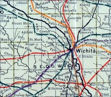
 KDOT map of Sedgwick County (legend) | |
| Coordinates: 37°33′50″N 97°21′11″W[1] | |
| Country | United States |
| State | Kansas |
| County | Sedgwick |
| Founded | 1891 |
| Platted | 1891 |
| Incorporated | 1951 |
| Named for | W.W. Hays |
| Government | |
| • Type | Mayor–Council |
| • Mayor | Russ Kessler[2] |
| Area | |
| • Total | 4.66 sq mi (12.06 km2) |
| • Land | 4.65 sq mi (12.04 km2) |
| • Water | 0.01 sq mi (0.03 km2) |
| Elevation | 1,260 ft (380 m) |
| Population | |
| • Total | 11,262 |
| • Density | 2,400/sq mi (930/km2) |
| Time zone | UTC-6 (CST) |
| • Summer (DST) | UTC-5 (CDT) |
| ZIP code | 67060 |
| Area code | 316 |
| FIPS code | 20-31125 [1] |
| GNIS ID | 481653 [1] |
| Website | haysville-ks.com |
History
W.W. Hays came to this area in the early 1870s. In 1891, he platted land that he owned so a town could be built.[7] The Haysville State Bank was established in 1919.[8] Truck farming supported a lot of the families in the area. In 1874 a grist mill was built on the bank of the Cowskin to process corn that was harvested in the area. Haysville's first school was built in 1876 at a location that may have been near what are now the Water Department facilities. Haysville appears in Colton's New Sectional Map of the State of Kansas as early as 1879.[9]
In 1887, the Chicago, Kansas and Nebraska Railway Company built a branch line north–south from Herington through Haysville to Caldwell.[10] It was renamed in 1891 to Chicago, Rock Island and Pacific Railway which shut down in 1980, renamed in 1980 to Oklahoma, Kansas and Texas Railroad, merged in 1988 to Missouri Pacific Railroad, merged in 1997 to the current Union Pacific Railroad. Most locals still refer to this railroad as the "Rock Island". In 1903 a depot was opened and passenger trains shuttled people to and from Wichita.
On May 3, 1999, a tornado rated F4 on the Fujita scale struck Haysville, killing 4 people in Haysville. Damage to structures included 150 homes and 27 businesses. The tornado continued into Wichita causing damage to the South side of the city, killing an additional 2 people in Wichita.[11] All of Haysville's historic district was destroyed. The only thing left standing on the east side of main was the original bank vault.[citation needed]
Geography
Haysville is located at 37°33′50″N 97°21′11″W (37.563787, -97.353044).[12] According to the United States Census Bureau, the city has a total area of 4.62 square miles (11.97 km2), of which, 4.61 square miles (11.94 km2) is land and 0.01 square miles (0.03 km2) is water.[13]
Area Events
- Haysville Fall Festival. The annual three-day event takes place in and around Riggs Park. The Fall Festival celebrates its 30th year on October 17–19 in 2014.[14]
- Village Christmas. Each year in the beginning of December. Celebrated in the Historic District of Haysville. Hot cocoa, carriage rides, choir performances, Santa, and more.[15]
- Community Expo is held in April at the Haysville Community Library or Haysville Activity Center (HAC).[15]
- Springnanigans is a festival for kids held in May in the Haysville Historic District.[15]
- Fourth of July Celebration is held in Riggs Park. Fireworks show in the evening.[15]
Demographics
| Historical population | |||
|---|---|---|---|
| Census | Pop. | %± | |
| 1960 | 5,836 | — | |
| 1970 | 6,531 | 11.9% | |
| 1980 | 8,006 | 22.6% | |
| 1990 | 8,364 | 4.5% | |
| 2000 | 8,502 | 1.6% | |
| 2010 | 10,826 | 27.3% | |
| 2020 | 11,262 | 4.0% | |
| U.S. Decennial Census 2010-2020[5] | |||
Haysville is part of the Wichita, KS Metropolitan Statistical Area.
2010 census
As of the census[16] of 2010, there were 10,826 people, 3,857 households, and 2,932 families living in the city.[17] The population density was 2,348.4 inhabitants per square mile (906.7/km2). There were 4,087 housing units at an average density of 886.6 per square mile (342.3/km2). The racial makeup of the city was 92.7% White, 0.6% African American, 1.2% Native American, 0.9% Asian, 1.2% from other races, and 3.5% from two or more races. Hispanic or Latino of any race were 4.6% of the population.
There were 3,857 households, of which 44.0% had children under the age of 18 living with them, 56.0% were married couples living together, 13.9% had a female householder with no husband present, 6.2% had a male householder with no wife present, and 24.0% were non-families. 20.7% of all households were made up of individuals, and 9.8% had someone living alone who was 65 years of age or older. The average household size was 2.78 and the average family size was 3.20.
The median age in the city was 32.8 years. 30.4% of residents were under the age of 18; 8.8% were between the ages of 18 and 24; 26.9% were from 25 to 44; 21.7% were from 45 to 64; and 12.1% were 65 years of age or older. The gender makeup of the city was 48.0% male and 52.0% female.
2000 census
As of the census[18] of 2000, there were 8,502 people, 3,021 households, and 2,350 families living in the city. The population density was 2,422.8 people per square mile (935.2/km2). There were 3,167 housing units at an average density of 902.5 per square mile (348.4/km2). The racial makeup of the city was 93.86% White, 0.53% African American, 1.14% Native American, 0.53% Asian, 0.01% Pacific Islander, 1.41% from other races, and 2.52% from two or more races. Hispanic or Latino of any race were 3.20% of the population.
There were 3,021 households, out of which 42.4% had children under the age of 18 living with them, 62.0% were married couples living together, 11.1% had a female householder with no husband present, and 22.2% were non-families. 19.1% of all households were made up of individuals, and 8.6% had someone living alone who was 65 years of age or older. The average household size was 2.78 and the average family size was 3.18.
In the city, the population was spread out, with 30.8% under the age of 18, 8.5% from 18 to 24, 28.8% from 25 to 44, 20.5% from 45 to 64, and 11.4% who were 65 years of age or older. The median age was 34 years. For every 100 females, there were 98.3 males. For every 100 females age 18 and over, there were 94.0 males.
The median income for a household in the city was $46,667, and the median income for a family was $50,118. Males had a median income of $37,626 versus $23,681 for females. The per capita income for the city was $18,484. About 2.9% of families and 4.4% of the population were below the poverty line, including 4.8% of those under age 18 and 7.5% of those age 65 or over.
Economics
- Norland Plastics
Government
The Haysville government consists of a mayor and eight council members. The council meets the 2nd Monday of each month at 7PM.[2]
- City Hall, 200 W Grand.
Education
The city of Haysville is served by Haysville USD 261.
- Campus High School, located in Wichita, but serves as the High School of Haysville, Kansas USD 261.
- Haysville High School (formerly Haysville Alternative High School) also serves Haysville teens
- Haysville Middle School
- Haysville West Middle School
- Freeman Elementary
- Nelson Elementary
- Oatville Elementary
- Prairie Elementary
- Rex Elementary
- Ruth Clark Elementary
- Tri-City Day School
See also
- April 26, 1991 tornado outbreak
References
- "Haysville, Kansas", Geographic Names Information System, United States Geological Survey
- Haysville - Directory of Public Officials Archived 2011-05-05 at the Wayback Machine
- "2019 U.S. Gazetteer Files". United States Census Bureau. Retrieved July 24, 2020.
- "Profile of Haysville, Kansas in 2020". United States Census Bureau. Archived from the original on November 14, 2021. Retrieved November 14, 2021.
- "QuickFacts; Haysville, Kansas; Population, Census, 2020 & 2010". United States Census Bureau. Archived from the original on 2021-08-26. Retrieved August 25, 2021.
- Brackman, Barbara (1997). Kansas Trivia. Thomas Nelson Inc. p. 27. ISBN 9781418553814.
- Brief History Of Haysville With Photos Archived 2012-11-02 at the Wayback Machine
- A Brief History Of Haysville With Photos Archived 2015-02-01 at the Wayback Machine
- "Digitized Kansas Map Collection".
- "Rock Island Rail History". Archived from the original on 2011-06-19. Retrieved 2011-04-17.
- "Info on the May 3rd 1999 Haysville tornado". National Weather Service. Retrieved 23 September 2015.
- "US Gazetteer files: 2010, 2000, and 1990". United States Census Bureau. 2011-02-12. Retrieved 2011-04-23.
- "US Gazetteer files 2010". United States Census Bureau. Archived from the original on 2012-01-25. Retrieved 2012-07-06.
- Haysville Fall Festival
- Haysville Annual Events Archived 2012-04-26 at the Wayback Machine
- "U.S. Census website". United States Census Bureau. Retrieved 2012-07-06.
- "2010 City Population and Housing Occupancy Status". U.S. Census Bureau. Retrieved March 6, 2011.[dead link]
- "U.S. Census website". United States Census Bureau. Retrieved 2008-01-31.
Further reading
External links
| Wikimedia Commons has media related to Haysville, Kansas. |
- City of Haysville
- Haysville - Directory of Public Officials
- Haysville Fall Festival
- Haysville city map, KDOT
Municipalities and communities of Sedgwick County, Kansas, United States | ||
|---|---|---|
County seat: Wichita | ||
| Cities |  | |
| Unincorporated communities |
| |
| Townships | ||
| Footnotes | †This community is designated a Census-Designated Place (CDP) by the United States Census Bureau. ‡This community also has portions in an adjacent county or counties. | |
| ||
Authority control | |
|---|---|
| General | |
| National libraries | |
Другой контент может иметь иную лицензию. Перед использованием материалов сайта WikiSort.org внимательно изучите правила лицензирования конкретных элементов наполнения сайта.
WikiSort.org - проект по пересортировке и дополнению контента Википедии