world.wikisort.org - USA
Brookville is a city in Saline County, Kansas, United States.[1] As of the 2020 census, the population of the city was 247.[3]
Brookville, Kansas | |
|---|---|
City | |
 Location within Saline County and Kansas | |
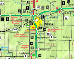 KDOT map of Saline County (legend) | |
| Coordinates: 38°46′24″N 97°52′5″W[1] | |
| Country | United States |
| State | Kansas |
| County | Saline |
| Founded | 1870 |
| Platted | 1870 |
| Incorporated | 1871 |
| Area | |
| • Total | 0.57 sq mi (1.49 km2) |
| • Land | 0.57 sq mi (1.49 km2) |
| • Water | 0.00 sq mi (0.00 km2) |
| Elevation | 1,362 ft (415 m) |
| Population (2020)[3] | |
| • Total | 247 |
| • Density | 430/sq mi (170/km2) |
| Time zone | UTC-6 (CST) |
| • Summer (DST) | UTC-5 (CDT) |
| ZIP code | 67425 |
| Area code | 785 |
| FIPS code | 20-08575 [1] |
| GNIS ID | 476780 [1] |
History
Brookville was laid out in 1870 when the Kansas Pacific Railway was extended to that point.[4] The first post office in Brookville was established in February 1870.[5]
Geography
Brookville is located at 38°46′24″N 97°52′5″W (38.773464, -97.868015).[6] According to the United States Census Bureau, the city has a total area of 0.57 square miles (1.48 km2), all of it land.[7]
Climate
The climate in this area is characterized by hot, humid summers and generally mild to cool winters. According to the Köppen Climate Classification system, Brookville has a humid subtropical climate, abbreviated "Cfa" on climate maps.[8]
Demographics
| Historical population | |||
|---|---|---|---|
| Census | Pop. | %± | |
| 1870 | 201 | — | |
| 1880 | 511 | 154.2% | |
| 1890 | 345 | −32.5% | |
| 1900 | 292 | −15.4% | |
| 1910 | 280 | −4.1% | |
| 1920 | 212 | −24.3% | |
| 1930 | 237 | 11.8% | |
| 1940 | 221 | −6.8% | |
| 1950 | 213 | −3.6% | |
| 1960 | 246 | 15.5% | |
| 1970 | 238 | −3.3% | |
| 1980 | 259 | 8.8% | |
| 1990 | 226 | −12.7% | |
| 2000 | 259 | 14.6% | |
| 2010 | 262 | 1.2% | |
| 2020 | 247 | −5.7% | |
| U.S. Decennial Census | |||
It is part of the Salina Micropolitan Statistical Area.[9]
2010 census
As of the 2010 census[update],[10] there were 262 people, 101 households, and 72 families residing in the city. The population density was 459.6 inhabitants per square mile (177.5/km2). There were 113 housing units at an average density of 198.2 per square mile (76.5/km2). The racial makeup of the city was 94.3% White, 0.4% Native American, 0.4% Pacific Islander, 1.5% from other races, and 3.4% from two or more races. Hispanic or Latino of any race were 5.0% of the population.
There were 101 households, of which 38.6% had children under the age of 18 living with them, 54.5% were married couples living together, 8.9% had a female householder with no husband present, 7.9% had a male householder with no wife present, and 28.7% were non-families. 23.8% of all households were made up of individuals, and 7% had someone living alone who was 65 years of age or older. The average household size was 2.59 and the average family size was 2.97.
The median age in the city was 39 years. 27.9% of residents were under the age of 18; 7.5% were between the ages of 18 and 24; 25.2% were from 25 to 44; 28.7% were from 45 to 64; and 10.7% were 65 years of age or older. The gender makeup of the city was 54.6% male and 45.4% female.
2000 census

As of the 2000 census[update],[11] there were 259 people, 104 households, and 74 families residing in the city. The population density was 441.9 inhabitants per square mile (170.6/km2). There were 115 housing units at an average density of 196.2 per square mile (75.8/km2). The racial makeup of the city was 98.46% White, 0.39% Native American, and 1.16% from two or more races. Hispanic or Latino of any race were 6.18% of the population.
There were 104 households, out of which 30.8% had children under the age of 18 living with them, 64.4% were married couples living together, 4.8% had a female householder with no husband present, and 27.9% were non-families. 26.0% of all households were made up of individuals, and 12.5% had someone living alone who was 65 years of age or older. The average household size was 2.49 and the average family size was 2.97.
In the city, the population was spread out, with 23.9% under the age of 18, 8.5% from 18 to 24, 30.5% from 25 to 44, 24.3% from 45 to 64, and 12.7% who were 65 years of age or older. The median age was 39 years. For every 100 females, there were 115.8 males. For every 100 females age 18 and over, there were 109.6 males.
The median income for a household in the city was $32,250, and the median income for a family was $45,417. Males had a median income of $30,625 versus $24,000 for females. The per capita income for the city was $18,945. About 9.1% of families and 18.4% of the population were below the poverty line, including 27.8% of those under the age of eighteen and 15.6% of those 65 or over.
Education
The community is served by Ell-Saline USD 307 public school district. Ell-Saline schools are located in Brookville. The Ell-Saline school mascot is Cardinals.
Prior to school unification as Ell-Saline High School, the Brookville High School mascot was Brookville Cardinals.[12] The Brookville Cardinals won the Kansas State High School boys class BB basketball championship in 1952.[13]
In popular culture
One scene of the 1980 film Up the Academy was filmed in Brookville, where the boys drive off without paying for fuel.
See also
- National Register of Historic Places listings in Saline County, Kansas
References
- "Brookville, Kansas", Geographic Names Information System, United States Geological Survey, United States Department of the Interior
- "2019 U.S. Gazetteer Files". United States Census Bureau. Retrieved July 24, 2020.
- "Profile of Brookville, Kansas in 2020". United States Census Bureau. Archived from the original on November 13, 2021. Retrieved November 13, 2021.
- History of the State of Kansas: Containing a Full Account of Its Growth from an Uninhabited Territory to a Wealthy and Important State. A. T. Andreas. 1883. p. 706.
- "Kansas Post Offices, 1828-1961". Kansas Historical Society. Archived from the original on October 9, 2013. Retrieved 23 June 2014.
- "US Gazetteer files: 2010, 2000, and 1990". United States Census Bureau. 2011-02-12. Retrieved 2011-04-23.
- "US Gazetteer files 2010". United States Census Bureau. Archived from the original on 2012-07-02. Retrieved 2012-07-06.
- Climate Summary for Brookville, Kansas
- Nussle, Jim (2008-11-20). "Micropolitan Statistical Areas" (PDF). List 1-9. Office of Management and Budget, Executive Office of the President. p. 97. Retrieved 2010-04-02.
- "U.S. Census website". United States Census Bureau. Retrieved 2012-07-06.
- "U.S. Census website". United States Census Bureau. Retrieved 2008-01-31.
- "The good ole days", The Salina Journal, 1 December 1994, p.17.
- "Basketball". KSHSAA. Retrieved 3 January 2017.
Further reading
External links
- Brookville - Directory of Public Officials
- Brookville Hotel removed from Historic Register
- Brookville city map, KDOT
Municipalities and communities of Saline County, Kansas, United States | ||
|---|---|---|
County seat: Salina | ||
| Cities |  | |
| Unincorporated communities |
| |
| Townships |
| |
| Footnotes | †This community is designated a Census-Designated Place (CDP) by the United States Census Bureau. ‡This community also has portions in an adjacent county or counties. | |
| ||
Другой контент может иметь иную лицензию. Перед использованием материалов сайта WikiSort.org внимательно изучите правила лицензирования конкретных элементов наполнения сайта.
WikiSort.org - проект по пересортировке и дополнению контента Википедии