world.wikisort.org - USA
Hedville is an unincorporated community in Ohio Township, Saline County, Kansas, United States.[1] It lies along Hedville Road and a Kansas and Oklahoma Railroad line, 1.0 mile (1.6 km) south of Interstate 70, northwest of Salina.
Hedville, Kansas | |
|---|---|
Unincorporated community | |
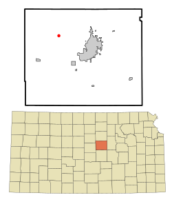 Location within Saline County and Kansas | |
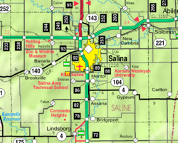 KDOT map of Saline County (legend) | |
| Coordinates: 38°51′46″N 97°45′41″W[1] | |
| Country | United States |
| State | Kansas |
| County | Saline |
| Elevation | 1,273 ft (388 m) |
| Time zone | UTC-6 (CST) |
| • Summer (DST) | UTC-5 (CDT) |
| ZIP code | 67401 |
| Area code | 785 |
| FIPS code | 20-31250 [1] |
| GNIS ID | 476784 [1] |
Geography
Mulberry Creek flows through the community.[2] Its elevation is 1,270 feet (387 m), and it is located at 38°51′46″N 97°45′41″W (38.8627816, -97.7614282).[3]
Demographics
As a part of Saline County, Hedville is a part of the Salina, Kansas micropolitan area.[4]
Education
The community is served by Ell–Saline USD 307 public school district.
References
- "Hedville, Kansas", Geographic Names Information System, United States Geological Survey, United States Department of the Interior
- DeLorme. Kansas Atlas & Gazetteer. 4th ed. Yarmouth: DeLorme, 2009, 48. ISBN 0-89933-342-7.
- U.S. Geological Survey Geographic Names Information System: Hedville, Kansas
- Update of Statistical Area Definitions and Guidance on Their Uses Archived 2008-11-17 at the Wayback Machine, Office of Management and Budget, 2007-11-20. Accessed 2008-08-14.
Further reading
External links
Municipalities and communities of Saline County, Kansas, United States | ||
|---|---|---|
County seat: Salina | ||
| Cities |  | |
| Unincorporated communities | ||
| Townships |
| |
| Footnotes | †This community is designated a Census-Designated Place (CDP) by the United States Census Bureau. ‡This community also has portions in an adjacent county or counties. | |
| ||
Текст в блоке "Читать" взят с сайта "Википедия" и доступен по лицензии Creative Commons Attribution-ShareAlike; в отдельных случаях могут действовать дополнительные условия.
Другой контент может иметь иную лицензию. Перед использованием материалов сайта WikiSort.org внимательно изучите правила лицензирования конкретных элементов наполнения сайта.
Другой контент может иметь иную лицензию. Перед использованием материалов сайта WikiSort.org внимательно изучите правила лицензирования конкретных элементов наполнения сайта.
2019-2025
WikiSort.org - проект по пересортировке и дополнению контента Википедии
WikiSort.org - проект по пересортировке и дополнению контента Википедии