world.wikisort.org - USA
Harvey County (county code HV) is a county located in the U.S. state of Kansas. As of the 2020 census, the county population was 34,024.[1] Its county seat and most populous city is Newton.[2]
Harvey County | |
|---|---|
County | |
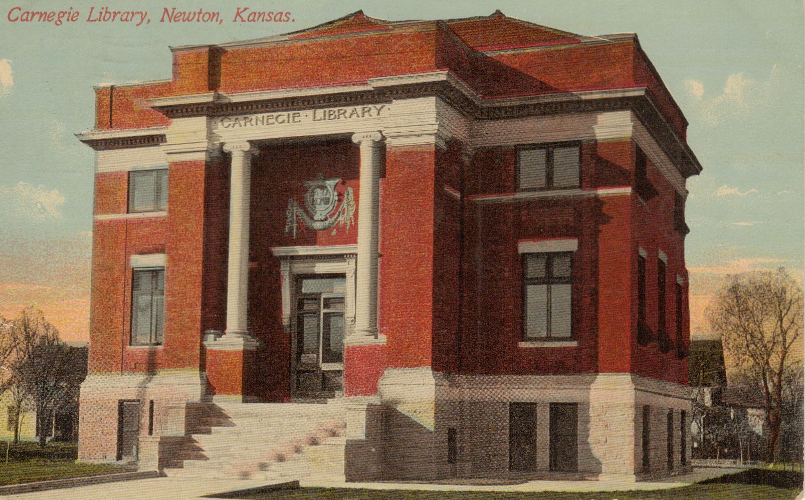 Former Carnegie Library in Kansas, currently is the Harvey County Historical Museum | |
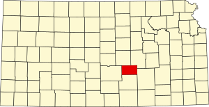 Location within the U.S. state of Kansas | |
 Kansas's location within the U.S. | |
| Coordinates: 38°03′N 97°26′W | |
| Country | |
| State | |
| Founded | March 7, 1872 |
| Named for | James Harvey |
| Seat | Newton |
| Largest city | Newton |
| Area | |
| • Total | 541 sq mi (1,400 km2) |
| • Land | 540 sq mi (1,400 km2) |
| Population (2020)[1] | |
| • Total | 34,024 |
| • Density | 63.0/sq mi (24.3/km2) |
| Time zone | UTC−6 (Central) |
| • Summer (DST) | UTC−5 (CDT) |
| Congressional district | 4th |
| Website | harveycounty.com |
History

In 1854, the Kansas Territory was organized, then in 1861 Kansas became the 34th U.S. state.
In 1871, the Atchison, Topeka and Santa Fe Railway extended a main line from Emporia to Newton.[3]
In 1872, Harvey County was founded, and named in honor of the fifth Governor of Kansas James M. Harvey.[4]
Geography
According to the U.S. Census Bureau, the county has a total area of 541 square miles (1,400 km2), of which 540 square miles (1,400 km2) is land and 1.0 square mile (2.6 km2) (0.2%) is water.[5] The Little Arkansas River flows through the county.
Adjacent counties
- Marion County (northeast)
- Butler County (east)
- Sedgwick County (south)
- Reno County (west)
- McPherson County (northwest)
Demographics
| Historical population | |||
|---|---|---|---|
| Census | Pop. | %± | |
| 1880 | 11,451 | — | |
| 1890 | 17,601 | 53.7% | |
| 1900 | 17,591 | −0.1% | |
| 1910 | 19,200 | 9.1% | |
| 1920 | 20,744 | 8.0% | |
| 1930 | 22,120 | 6.6% | |
| 1940 | 21,712 | −1.8% | |
| 1950 | 21,698 | −0.1% | |
| 1960 | 25,865 | 19.2% | |
| 1970 | 27,236 | 5.3% | |
| 1980 | 30,531 | 12.1% | |
| 1990 | 31,028 | 1.6% | |
| 2000 | 32,869 | 5.9% | |
| 2010 | 34,684 | 5.5% | |
| 2020 | 34,024 | −1.9% | |
| U.S. Decennial Census[6] 1790-1960[7] 1900-1990[8] 1990-2000[9] 2010-2020[1] | |||

Harvey County is part of the Wichita, KS Metropolitan Statistical Area.
2000 census
As of the 2000 census,[10] there were 32,869 people, 12,581 households, and 8,932 families residing in the county. The population density was 61 people per square mile (24/km2). There were 13,378 housing units at an average density of 25 per square mile (10/km2). The racial makeup of the county was 91.04% White, 1.59% Black or African American, 0.52% Native American, 0.52% Asian, 0.03% Pacific Islander, 4.17% from other races, and 2.14% from two or more races. Hispanic or Latino of any race were 7.97% of the population.
There were 12,581 households, out of which 32.80% had children under the age of 18 living with them, 60.20% were married couples living together, 7.70% had a female householder with no husband present, and 29.00% were non-families. 25.80% of all households were made up of individuals, and 11.60% had someone living alone who was 65 years of age or older. The average household size was 2.50 and the average family size was 3.00.
In the county, the population was spread out, with 26.00% under the age of 18, 9.10% from 18 to 24, 26.50% from 25 to 44, 21.60% from 45 to 64, and 16.80% who were 65 years of age or older. The median age was 38 years. For every 100 females, there were 94.50 males. For every 100 females age 18 and over, there were 91.60 males.
The median income for a household in the county was $40,907, and the median income for a family was $48,793. Males had a median income of $35,037 versus $22,492 for females. The per capita income for the county was $18,715. About 4.20% of families and 6.40% of the population were below the poverty line, including 7.50% of those under age 18 and 5.00% of those age 65 or over.
Government
Presidential elections
| Year | Republican | Democratic | Third party | |||
|---|---|---|---|---|---|---|
| No. | % | No. | % | No. | % | |
| 2020 | 10,182 | 58.52% | 6,747 | 38.78% | 470 | 2.70% |
| 2016 | 8,668 | 58.11% | 5,068 | 33.98% | 1,180 | 7.91% |
| 2012 | 8,588 | 60.08% | 5,373 | 37.59% | 333 | 2.33% |
| 2008 | 9,006 | 57.40% | 6,318 | 40.27% | 367 | 2.34% |
| 2004 | 9,534 | 63.10% | 5,331 | 35.28% | 245 | 1.62% |
| 2000 | 8,271 | 60.44% | 4,591 | 33.55% | 822 | 6.01% |
| 1996 | 8,382 | 57.79% | 4,918 | 33.91% | 1,204 | 8.30% |
| 1992 | 6,259 | 41.71% | 5,047 | 33.63% | 3,700 | 24.66% |
| 1988 | 6,893 | 54.23% | 5,503 | 43.29% | 315 | 2.48% |
| 1984 | 8,507 | 64.06% | 4,599 | 34.63% | 174 | 1.31% |
| 1980 | 7,045 | 54.56% | 4,173 | 32.32% | 1,694 | 13.12% |
| 1976 | 6,624 | 51.00% | 6,003 | 46.22% | 360 | 2.77% |
| 1972 | 8,287 | 67.23% | 3,555 | 28.84% | 485 | 3.93% |
| 1968 | 6,682 | 61.64% | 3,351 | 30.91% | 808 | 7.45% |
| 1964 | 4,979 | 47.81% | 5,306 | 50.95% | 130 | 1.25% |
| 1960 | 7,798 | 68.38% | 3,537 | 31.02% | 69 | 0.61% |
| 1956 | 7,367 | 70.20% | 3,084 | 29.39% | 43 | 0.41% |
| 1952 | 7,154 | 70.87% | 2,726 | 27.00% | 215 | 2.13% |
| 1948 | 5,270 | 57.72% | 3,615 | 39.59% | 245 | 2.68% |
| 1944 | 5,339 | 61.35% | 3,300 | 37.92% | 64 | 0.74% |
| 1940 | 5,539 | 56.76% | 4,087 | 41.88% | 133 | 1.36% |
| 1936 | 4,456 | 45.28% | 5,357 | 54.44% | 28 | 0.28% |
| 1932 | 4,192 | 49.28% | 4,091 | 48.09% | 224 | 2.63% |
| 1928 | 6,330 | 77.62% | 1,748 | 21.43% | 77 | 0.94% |
| 1924 | 4,499 | 58.96% | 1,744 | 22.86% | 1,387 | 18.18% |
| 1920 | 4,454 | 63.09% | 2,457 | 34.80% | 149 | 2.11% |
| 1916 | 3,479 | 48.98% | 3,131 | 44.08% | 493 | 6.94% |
| 1912 | 703 | 17.70% | 1,499 | 37.74% | 1,770 | 44.56% |
| 1908 | 2,305 | 58.30% | 1,475 | 37.30% | 174 | 4.40% |
| 1904 | 2,362 | 70.66% | 690 | 20.64% | 291 | 8.70% |
| 1900 | 2,266 | 56.65% | 1,658 | 41.45% | 76 | 1.90% |
| 1896 | 2,082 | 54.57% | 1,678 | 43.98% | 55 | 1.44% |
| 1892 | 2,025 | 52.80% | 0 | 0.00% | 1,810 | 47.20% |
| 1888 | 2,145 | 54.25% | 1,065 | 26.93% | 744 | 18.82% |
Laws
Following amendment to the Kansas Constitution in 1986, the county remained a prohibition, or "dry", county until 1996, when voters approved the sale of alcoholic liquor by the individual drink with a 30% food sales requirement.[12]
The county voted "No" on the 2022 Kansas Value Them Both Amendment, an anti-abortion ballot measure, by 53% to 47% despite backing Donald Trump with 59% of the vote to Joe Biden's 39% in the 2020 presidential election.[13]
Education
Colleges
- Bethel College in North Newton
- Hesston College in Hesston
Unified school districts
- Burrton USD 369
- Newton USD 373
- Sedgwick USD 439
- Halstead–Bentley USD 440
- Hesston USD 460
- School district office in neighboring county
- Remington USD 206
- Peabody–Burns USD 398
- Goessel USD 411
- Moundridge USD 423
Communities

Cities
Unincorporated communities
Ghost town
- Annelly
- Van Arsdale
Townships
Harvey County is divided into fifteen townships. The cities of Halstead and Newton are considered governmentally independent and are excluded from the census figures for the townships. In the following table, the population center is the largest city (or cities) included in that township's population total, if it is of a significant size.
| Township | FIPS | Population center |
Population | Population density /km2 (/sq mi) |
Land area km2 (sq mi) | Water area km2 (sq mi) | Water % | Geographic coordinates |
|---|---|---|---|---|---|---|---|---|
| Alta | 01500 | 221 | 2 (6) | 93 (36) | 0 (0) | 0.48% | 38°7′27″N 97°38′44″W | |
| Burrton | 09600 | 1,143 | 12 (32) | 93 (36) | 0 (0) | 0.17% | 38°1′32″N 97°39′55″W | |
| Darlington | 17025 | 601 | 7 (17) | 92 (35) | 0 (0) | 0.10% | 37°57′5″N 97°19′32″W | |
| Emma | 21025 | 4,181 | 45 (116) | 93 (36) | 0 (0) | 0% | 38°8′10″N 97°25′46″W | |
| Garden | 25300 | 294 | 3 (8) | 93 (36) | 0 (0) | 0% | 38°7′44″N 97°32′14″W | |
| Halstead | 29625 | 353 | 4 (10) | 92 (35) | 0 (0) | 0.07% | 38°2′9″N 97°31′51″W | |
| Highland | 31875 | 415 | 5 (12) | 92 (35) | 0 (0) | 0.19% | 38°7′38″N 97°19′9″W | |
| Lake | 37825 | 173 | 2 (5) | 92 (36) | 1 (0) | 1.05% | 37°57′46″N 97°39′7″W | |
| Lakin | 38150 | 357 | 4 (10) | 92 (35) | 0 (0) | 0.06% | 37°57′18″N 97°32′20″W | |
| Macon | 43925 | 1,056 | 11 (30) | 92 (36) | 0 (0) | 0% | 38°2′8″N 97°24′58″W | |
| Newton | 50500 | 1,950 | 28 (73) | 69 (27) | 0 (0) | 0.07% | 38°3′27″N 97°19′31″W | |
| Pleasant | 56250 | 439 | 5 (12) | 93 (36) | 1 (0) | 0.81% | 38°2′27″N 97°12′8″W | |
| Richland | 59350 | 360 | 4 (10) | 94 (36) | 0 (0) | 0.20% | 37°57′39″N 97°12′1″W | |
| Sedgwick | 63825 | 1,711 | 18 (48) | 93 (36) | 0 (0) | 0% | 37°56′24″N 97°25′22″W | |
| Walton | 75225 | 552 | 6 (15) | 95 (37) | 0 (0) | 0.06% | 38°7′26″N 97°13′1″W | |
| Sources: "Census 2000 U.S. Gazetteer Files". U.S. Census Bureau, Geography Division. Archived from the original on August 2, 2002. | ||||||||
See also
- National Register of Historic Places listings in Harvey County, Kansas
- List of people from Harvey County, Kansas
- March 1990 Central US tornado outbreak
- Chisholm Trail
|
|
References
- "QuickFacts; Harvey County, Kansas; Population, Census, 2020 & 2010". United States Census Bureau. Archived from the original on August 16, 2021. Retrieved August 16, 2021.
- "Find a County". National Association of Counties. Retrieved June 7, 2011.
- Santa Fe Rail History
- History of the State of Kansas: Containing a Full Account of Its Growth from an Uninhabited Territory to a Wealthy and Important State. A. T. Andreas. 1883. p. 772.
- "US Gazetteer files: 2010, 2000, and 1990". United States Census Bureau. February 12, 2011. Retrieved April 23, 2011.
- "U.S. Decennial Census". United States Census Bureau. Retrieved July 26, 2014.
- "Historical Census Browser". University of Virginia Library. Retrieved July 26, 2014.
- "Population of Counties by Decennial Census: 1900 to 1990". United States Census Bureau. Retrieved July 26, 2014.
- "Census 2000 PHC-T-4. Ranking Tables for Counties: 1990 and 2000" (PDF). United States Census Bureau. Retrieved July 26, 2014.
- "U.S. Census website". United States Census Bureau. Retrieved January 31, 2008.
- "Dave Leip's Atlas of U.S. Presidential Elections".
- "Map of Wet and Dry Counties". Alcoholic Beverage Control, Kansas Department of Revenue. November 2006. Archived from the original on October 8, 2007. Retrieved December 26, 2007.
- Panetta, Grace (August 3, 2022). "14 of the 19 Kansas counties that rejected an anti-abortion amendment voted for Trump in 2020". Business Insider. Retrieved August 3, 2022.
- Notes
Further reading
- County
- Mitchell Map of Harvey County, Kansas; Grant Mitchell; 15 pages; 1926.
- Standard Atlas of Harvey County, Kansas; Geo. A. Ogle & Co; 70 pages; 1918.
- Plat Book of Harvey County, Kansas; North West Publishing Co; 34 pages; 1902.
- Historical Atlas of Harvey County, Kansas; 33 pages; John P. Edwards; 1882.
- Newton
- Bernhard Warkentin and the Kansas Mennonite Pioneers; David A. Haury; Mennonite Life; December 1974.
External links
- County
- Harvey County - Official
- Harvey County - Directory of Public Officials
- Harvey County - Economic Development Council
- Historical
- Maps
- Harvey County Maps: Current, Historic, KDOT
- Kansas Highway Maps: Current, Historic, KDOT
- Kansas Railroad Maps: Current, 1996, 1915, KDOT and Kansas Historical Society
Places adjacent to Harvey County, Kansas | ||||||||||||||||
|---|---|---|---|---|---|---|---|---|---|---|---|---|---|---|---|---|
| ||||||||||||||||
Municipalities and communities of Harvey County, Kansas, United States | ||
|---|---|---|
County seat: Newton | ||
| Cities |  | |
| Unincorporated communities | ||
| Ghost town | ||
| Townships | ||
| Footnotes | ‡This community also has portions in an adjacent county or counties. | |
| ||
Topeka (capital) | |
| Topics |
|
| Society |
|
| Regions |
|
| Largest cities |
|
| Counties |
|
| Lists |
|
Authority control | |
|---|---|
| General | |
| National libraries | |
На других языках
[de] Harvey County
Harvey County[1] ist ein County im Bundesstaat Kansas der Vereinigten Staaten. Der Verwaltungssitz (County Seat) ist Newton.- [en] Harvey County, Kansas
[ru] Харви (округ)
Ха́рви[1] (англ. Harvey) — округ Канзаса, расположенный в юго-центральной части штата, центральной части США. Административным центром и самый крупным городом округа является Ньютон. По данным переписи 2012 года, население округа составляет 34 852 человек[2]. Округ является частью Района статистики города Уичито (Канзас).Другой контент может иметь иную лицензию. Перед использованием материалов сайта WikiSort.org внимательно изучите правила лицензирования конкретных элементов наполнения сайта.
WikiSort.org - проект по пересортировке и дополнению контента Википедии