world.wikisort.org - USA
Inman is a city in McPherson County, Kansas, United States.[1] As of the 2020 census, the population of the city was 1,341.[3]
Inman, Kansas | |
|---|---|
City | |
 Main Street in Inman (2012) | |
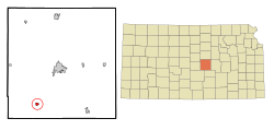 Location within McPherson County and Kansas | |
 KDOT map of McPherson County (legend) | |
| Coordinates: 38°13′49″N 97°46′22″W[1] | |
| Country | United States |
| State | Kansas |
| County | McPherson |
| Incorporated | 1887 |
| Named for | Henry Inman |
| Area | |
| • Total | 0.80 sq mi (2.06 km2) |
| • Land | 0.77 sq mi (1.99 km2) |
| • Water | 0.03 sq mi (0.07 km2) |
| Elevation | 1,522 ft (464 m) |
| Population (2020)[3] | |
| • Total | 1,341 |
| • Density | 1,700/sq mi (650/km2) |
| Time zone | UTC-6 (CST) |
| • Summer (DST) | UTC-5 (CDT) |
| ZIP code | 67546 |
| Area code | 620 |
| FIPS code | 20-34275 [1] |
| GNIS ID | 477722 [1] |
| Website | inmanks.org |
History

For millennia, the land now known as Kansas was inhabited by Native Americans. In 1803, most of modern Kansas was secured by the United States as part of the Louisiana Purchase. In 1854, the Kansas Territory was organized, then in 1861 Kansas became the 34th U.S. state. In 1867, McPherson County was founded.
It was founded in 1887 as Aiken.[citation needed] It was renamed Inman, in 1889, after Major Henry Inman,[4] who was first the namesake for Lake Inman, located approximately 4 miles (6 km) east of the town.[5]
In 1887, the Chicago, Kansas and Nebraska Railway built a main line from Herington through Inman to Pratt.[6] In 1888, this line was extended to Liberal. Later, it was extended to Tucumcari, New Mexico and El Paso, Texas. It foreclosed in 1891 and taken over by Chicago, Rock Island and Pacific Railway, which shut down in 1980 and reorganized as Oklahoma, Kansas and Texas Railroad, merged in 1988 with Missouri Pacific Railroad, merged in 1997 with Union Pacific Railroad. Most locals still refer to this railroad as the "Rock Island".
Geography
Inman is located at 38°13′49″N 97°46′22″W (38.230355, -97.772773).[7] According to the United States Census Bureau, the city has a total area of 0.59 square miles (1.53 km2), all of it land.[8]
Climate
The climate in this area is characterized by hot, humid summers and generally mild to cool winters. According to the Köppen Climate Classification system, Inman has a humid subtropical climate, abbreviated "Cfa" on climate maps.[9]
Demographics
| Historical population | |||
|---|---|---|---|
| Census | Pop. | %± | |
| 1900 | 352 | — | |
| 1910 | 484 | 37.5% | |
| 1920 | 482 | −0.4% | |
| 1930 | 533 | 10.6% | |
| 1940 | 507 | −4.9% | |
| 1950 | 615 | 21.3% | |
| 1960 | 729 | 18.5% | |
| 1970 | 836 | 14.7% | |
| 1980 | 947 | 13.3% | |
| 1990 | 1,035 | 9.3% | |
| 2000 | 1,142 | 10.3% | |
| 2010 | 1,377 | 20.6% | |
| 2020 | 1,341 | −2.6% | |
| U.S. Decennial Census | |||
2010 census
As of the census[10] of 2010, there were 1,377 people, 513 households, and 347 families residing in the city. The population density was 2,333.9 inhabitants per square mile (901.1/km2). There were 566 housing units at an average density of 959.3 per square mile (370.4/km2). The racial makeup of the city was 96.0% White, 0.1% African American, 0.4% Native American, 0.3% Asian, 0.7% from other races, and 2.5% from two or more races. Hispanic or Latino of any race were 3.1% of the population.
There were 513 households, of which 31.0% had children under the age of 18 living with them, 59.6% were married couples living together, 5.7% had a female householder with no husband present, 2.3% had a male householder with no wife present, and 32.4% were non-families. 29.4% of all households were made up of individuals, and 19.5% had someone living alone who was 65 years of age or older. The average household size was 2.45 and the average family size was 3.04.
The median age in the city was 45.2 years. 23.5% of residents were under the age of 18; 6.6% were between the ages of 18 and 24; 19.7% were from 25 to 44; 20% were from 45 to 64; and 30.1% were 65 years of age or older. The gender makeup of the city was 47.1% male and 52.9% female.
2000 census
As of the census[11] of 2000, there were 1,142 people, 494 households, and 334 families residing in the city. The population density was 2,106.0 people per square mile (816.5/km2). There were 518 housing units at an average density of 955.2 per square mile (370.4/km2). The racial makeup of the city was 98.42% White, 0.35% Native American, 0.44% from other races, and 0.79% from two or more races. Hispanic or Latino of any race were 1.40% of the population.[12][13]
There were 494 households, out of which 27.1% had children under the age of 18 living with them, 61.3% were married couples living together, 4.9% had a female householder with no husband present, and 32.2% were non-families. 30.2% of all households were made up of individuals, and 21.7% had someone living alone who was 65 years of age or older. The average household size was 2.31 and the average family size was 2.87.
In the city, the population was spread out, with 24.3% under the age of 18, 7.2% from 18 to 24, 22.4% from 25 to 44, 16.7% from 45 to 64, and 29.3% who were 65 years of age or older. The median age was 42 years. For every 100 females, there were 93.6 males. For every 100 females age 18 and over, there were 88.2 males.
The median income for a household in the city was US$31,648, and the median income for a family was $40,804. Males had a median income of $31,875 versus $19,615 for females. The per capita income for the city was $17,290. About 2.9% of families and 5.7% of the population were below the poverty line, including 6.2% of those under age 18 and 6.1% of those age 65 or over.
Education
The community is served by Inman USD 448 public school district. Inman has two schools:
- Inman Jr-Sr High School
- Inman Elementary School
Sports
The Inman Teutons have won the following Kansas State High School championships:
- 1947 Boys Basketball - Class B [14]
- 1956 Boys Basketball - Class B [14]
- 1967 Boys Basketball - Class B [14]
- 1967 Boys Track & Field (Indoor) - Class B [15]
- 1971 Boys Track & Field (Indoor) - Class 2A [15]
- 1989 Girls Volleyball - Class 2A [16]
- 1993 Girls Basketball - Class 2A [14]
- 1994 Boys Basketball - Class 2A [14]
- 1994 Girls Volleyball - Class 2A [16]
Notable people
- Dean Wade, basketball player
See also
- List of people from McPherson County, Kansas
- Threshing Stone
- Santa Fe Trail
References
- "Inman, Kansas", Geographic Names Information System, United States Geological Survey, United States Department of the Interior
- "2019 U.S. Gazetteer Files". United States Census Bureau. Retrieved July 24, 2020.
- "Profile of Inman, Kansas in 2020". United States Census Bureau. Archived from the original on November 12, 2021. Retrieved November 12, 2021.
- Richard G. Hardorff (2006). Washita Memories: Eyewitness Views of Custer's Attack on Black Kettle's Village. University of Oklahoma Press. p. 101. ISBN 978-0-8061-3759-9.
- Kansas (1881). Combined Kansas Reports. Kansas State Printing Plant. p. 7.
- "Rock Island Rail History". Archived from the original on 2011-06-19. Retrieved 2011-04-17.
- "US Gazetteer files: 2010, 2000, and 1990". United States Census Bureau. 2011-02-12. Retrieved 2011-04-23.
- "US Gazetteer files 2010". United States Census Bureau. Archived from the original on 2012-01-25. Retrieved 2012-07-06.
- Climate Summary for Inman, Kansas
- "U.S. Census website". United States Census Bureau. Retrieved 2012-07-06.
- "U.S. Census website". United States Census Bureau. Retrieved 2008-01-31.
- U.S. Census Bureau - 2000 Census, Population and Housing Unit Counts for Kansas
- U.S. Census Bureau - 1990 Census, Population and Housing Unit Counts for Kansas
- "Basketball". KSHSAA. Retrieved 3 January 2017.
- "Track & Field". KSHSAA. Retrieved 6 January 2017.
- "Volleyball". KSHSAA. Retrieved 3 January 2017.
Further reading
- A Centennial History, Inman, Kansas, 1887-1987; Inman Heritage Association; 1987.
- Hoffnungsau in Kansas; A.J. Dyck; Mennonite Life; October 1949.
External links
- Inman - Official
- Inman - Directory of Public Officials, League of Kansas Municipalities
- Historic Images of Inman, Special Photo Collections at Wichita State University Library
- Inman city map, KDOT
Municipalities and communities of McPherson County, Kansas, United States | ||
|---|---|---|
County seat: McPherson | ||
| Cities |  | |
| Unincorporated communities | ||
| Townships |
| |
| Footnotes | †This community is designated a Census-Designated Place (CDP) by the United States Census Bureau. | |
| ||
Authority control | |
|---|---|
| General | |
| National libraries | |
Другой контент может иметь иную лицензию. Перед использованием материалов сайта WikiSort.org внимательно изучите правила лицензирования конкретных элементов наполнения сайта.
WikiSort.org - проект по пересортировке и дополнению контента Википедии