world.wikisort.org - USA
Neosho Rapids is a city in Lyon County, Kansas, United States.[1] As of the 2020 census, the population of the city was 229.[4]
Neosho Rapids, Kansas | |
|---|---|
City | |
 Location within Lyon County and Kansas | |
 KDOT map of Lyon County (legend) | |
| Coordinates: 38°22′7″N 95°59′31″W[1] | |
| Country | United States |
| State | Kansas |
| County | Lyon |
| Platted | 1855 |
| Incorporated | 1923 [2] |
| Named for | Rapids on Neosho River |
| Government | |
| • Type | Mayor–Council |
| Area | |
| • Total | 0.51 sq mi (1.32 km2) |
| • Land | 0.51 sq mi (1.31 km2) |
| • Water | 0.01 sq mi (0.02 km2) |
| Elevation | 1,093 ft (333 m) |
| Population (2020)[4] | |
| • Total | 229 |
| • Density | 450/sq mi (170/km2) |
| Time zone | UTC-6 (CST) |
| • Summer (DST) | UTC-5 (CDT) |
| ZIP code | 66864 |
| Area code | 620 |
| FIPS code | 20-49875 [1] |
| GNIS ID | 477546 [1] |
History
Neosho Rapids was previously called Italia then Florence, and was laid out in 1855.[5] It was named Neosho Rapids in 1857 from the whitewater on the Neosho River.[5][6]
LIFE magazine did a 5-page feature article in the December 24, 1945, issue of servicemen coming home to the town for their first Christmas after WWII.[7]
Geography
Neosho Rapids is located at 38°22′7″N 95°59′31″W (38.368716, -95.991901).[8] According to the United States Census Bureau, the city has a total area of 0.51 square miles (1.32 km2), of which 0.50 square miles (1.29 km2) is land and 0.01 square miles (0.03 km2) is water.[9]
Climate
The climate in this area is characterized by hot, humid summers and generally mild to cool winters. According to the Köppen Climate Classification system, Neosho Rapids has a humid subtropical climate, abbreviated "Cfa" on climate maps.[10]
Demographics
| Historical population | |||
|---|---|---|---|
| Census | Pop. | %± | |
| 1880 | 80 | — | |
| 1890 | 308 | 285.0% | |
| 1910 | 256 | — | |
| 1920 | 267 | 4.3% | |
| 1930 | 306 | 14.6% | |
| 1940 | 253 | −17.3% | |
| 1950 | 204 | −19.4% | |
| 1960 | 178 | −12.7% | |
| 1970 | 234 | 31.5% | |
| 1980 | 289 | 23.5% | |
| 1990 | 235 | −18.7% | |
| 2000 | 274 | 16.6% | |
| 2010 | 265 | −3.3% | |
| 2020 | 229 | −13.6% | |
| U.S. Decennial Census | |||
Neosho Rapids is part of the Emporia Micropolitan Statistical Area.
2010 census
As of the census[11] of 2010, there were 265 people, 105 households, and 67 families residing in the city. The population density was 530.0 inhabitants per square mile (204.6/km2). There were 119 housing units at an average density of 238.0 per square mile (91.9/km2). The racial makeup of the city was 98.1% White and 1.9% from two or more races. Hispanic or Latino of any race were 3.4% of the population.
There were 105 households, of which 33.3% had children under the age of 18 living with them, 50.5% were married couples living together, 7.6% had a female householder with no husband present, 5.7% had a male householder with no wife present, and 36.2% were non-families. 29.5% of all households were made up of individuals, and 16.2% had someone living alone who was 65 years of age or older. The average household size was 2.48 and the average family size was 3.03.
The median age in the city was 38.5 years. 25.3% of residents were under the age of 18; 7.5% were between the ages of 18 and 24; 24.1% were from 25 to 44; 27.1% were from 45 to 64; and 15.8% were 65 years of age or older. The gender makeup of the city was 49.1% male and 50.9% female.
2000 census
As of the census[12] of 2000, there were 274 people, 104 households, and 79 families residing in the city. The population density was 561.9 people per square mile (215.9/km2). There were 115 housing units at an average density of 235.9 per square mile (90.6/km2). The racial makeup of the city was 96.35% White, 1.82% African American, 0.36% from other races, and 1.46% from two or more races. Hispanic or Latino of any race were 2.19% of the population.
There were 104 households, out of which 35.6% had children under the age of 18 living with them, 64.4% were married couples living together, 4.8% had a female householder with no husband present, and 24.0% were non-families. 20.2% of all households were made up of individuals, and 7.7% had someone living alone who was 65 years of age or older. The average household size was 2.53 and the average family size was 2.90.
In the city, the population was spread out, with 26.3% under the age of 18, 4.4% from 18 to 24, 31.8% from 25 to 44, 23.4% from 45 to 64, and 14.2% who were 65 years of age or older. The median age was 39 years. For every 100 females, there were 112.4 males. For every 100 females age 18 and over, there were 100.0 males.
The median income for a household in the city was $29,423, and the median income for a family was $35,250. Males had a median income of $28,750 versus $20,000 for females. The per capita income for the city was $13,239. About 6.2% of families and 10.8% of the population were below the poverty line, including 2.8% of those under the age of eighteen and 36.9% of those 65 or over.
Education
The community is served by Southern Lyon County USD 252 public school district.
See also
- Great Flood of 1951
References
- "Neosho Rapids, Kansas", Geographic Names Information System, United States Geological Survey, United States Department of the Interior
- "City of Neosho Rapids". The League of Kansas Municipalities. May 24, 2019.
- "2019 U.S. Gazetteer Files". United States Census Bureau. Retrieved July 24, 2020.
- "Profile of Neosho Rapids, Kansas in 2020". United States Census Bureau. Archived from the original on May 3, 2022. Retrieved May 3, 2022.
- Blackmar, Frank Wilson (1912). Kansas: A Cyclopedia of State History, Volume 2. Standard Publishing Company. p. 351.
- Heim, Michael (2007). Exploring Kansas Highways. p. 9. ISBN 9780974435886.
- Old Photos: Old-Timey Christmas
- "US Gazetteer files: 2010, 2000, and 1990". United States Census Bureau. 2011-02-12. Retrieved 2011-04-23.
- "US Gazetteer files 2010". United States Census Bureau. Archived from the original on 2012-01-25. Retrieved 2012-07-06.
- Climate Summary for Neosho Rapids, Kansas
- "U.S. Census website". United States Census Bureau. Retrieved 2012-07-06.
- "U.S. Census website". United States Census Bureau. Retrieved 2008-01-31.
Further reading
External links
Municipalities and communities of Lyon County, Kansas, United States | ||
|---|---|---|
County seat: Emporia | ||
| Cities | 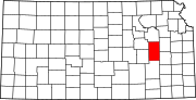 | |
| Unincorporated communities | ||
| Townships |
| |
| ||
Другой контент может иметь иную лицензию. Перед использованием материалов сайта WikiSort.org внимательно изучите правила лицензирования конкретных элементов наполнения сайта.
WikiSort.org - проект по пересортировке и дополнению контента Википедии