world.wikisort.org - France
Oisy-le-Verger (French pronunciation: [wazi lə vɛʁʒe]) is a commune in the Pas-de-Calais department in the Hauts-de-France region of France.[2]
Oisy-le-Verger | |
|---|---|
Commune | |
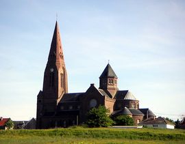 The church of Oisy-le-Verger | |
 Coat of arms | |
Location of Oisy-le-Verger  | |
 Oisy-le-Verger  Oisy-le-Verger | |
| Coordinates: 50°15′03″N 3°07′29″E | |
| Country | France |
| Region | Hauts-de-France |
| Department | Pas-de-Calais |
| Arrondissement | Arras |
| Canton | Bapaume |
| Intercommunality | CC Osartis Marquion |
| Government | |
| • Mayor (2020–2026) | Marie-Christine Guenot |
| Area 1 | 11.36 km2 (4.39 sq mi) |
| Population | 1,195 |
| • Density | 110/km2 (270/sq mi) |
| Time zone | UTC+01:00 (CET) |
| • Summer (DST) | UTC+02:00 (CEST) |
| INSEE/Postal code | 62638 /62860 |
| Elevation | 32–77 m (105–253 ft) (avg. 78 m or 256 ft) |
| 1 French Land Register data, which excludes lakes, ponds, glaciers > 1 km2 (0.386 sq mi or 247 acres) and river estuaries. | |
Geography
Oisy-le-Verger is a farming village situated 15 miles (24 km) east of Arras, at the junction of the D21 and D14 roads.
Population
| Year | Pop. | ±% p.a. |
|---|---|---|
| 1968 | 1,328 | — |
| 1975 | 1,310 | −0.19% |
| 1982 | 1,278 | −0.35% |
| 1990 | 1,301 | +0.22% |
| 1999 | 1,260 | −0.36% |
| 2007 | 1,285 | +0.25% |
| 2012 | 1,251 | −0.53% |
| 2017 | 1,217 | −0.55% |
| Source: INSEE[3] | ||
Places of interest
- The church of St. Didier, dating from the twentieth century.
- Traces of an old castle and watermill.
- Remains of the Cistercian abbey founded in 1227.
- A pre-Roman menhir.
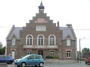
- The museum, housed in the mairie (town hall).
See also
References
- "Populations légales 2019". The National Institute of Statistics and Economic Studies. 29 December 2021.
- INSEE commune file
- Population en historique depuis 1968, INSEE
Wikimedia Commons has media related to Oisy-le-Verger.
Authority control | |
|---|---|
| General |
|
| National libraries | |
This Arras arrondissement, Pas-de-Calais geographical article is a stub. You can help Wikipedia by expanding it. |
На других языках
[de] Oisy-le-Verger
Oisy-le-Verger ist eine französische Gemeinde mit 1195 Einwohnern (Stand 1. Januar 2019) im Département Pas-de-Calais in der Region Hauts-de-France. Sie gehört zum Arrondissement Arras und zum Kanton Bapaume.- [en] Oisy-le-Verger
Текст в блоке "Читать" взят с сайта "Википедия" и доступен по лицензии Creative Commons Attribution-ShareAlike; в отдельных случаях могут действовать дополнительные условия.
Другой контент может иметь иную лицензию. Перед использованием материалов сайта WikiSort.org внимательно изучите правила лицензирования конкретных элементов наполнения сайта.
Другой контент может иметь иную лицензию. Перед использованием материалов сайта WikiSort.org внимательно изучите правила лицензирования конкретных элементов наполнения сайта.
2019-2026
WikiSort.org - проект по пересортировке и дополнению контента Википедии
WikiSort.org - проект по пересортировке и дополнению контента Википедии