world.wikisort.org - USA
Godfrey is a village in Madison County, Illinois, United States. The population was 17,982 at the 2010 census.[2] Godfrey is located within the Riverbend portion of the Greater St. Louis metropolitan area.
Godfrey | |
|---|---|
Village | |
 Location of Godfrey in Madison County, Illinois. | |
 Location of Illinois in the United States | |
| Coordinates: 38°56′53″N 90°12′10″W | |
| Country | United States |
| State | Illinois |
| County | Madison |
| Area | |
| • Total | 36.35 sq mi (94.15 km2) |
| • Land | 34.40 sq mi (89.08 km2) |
| • Water | 1.96 sq mi (5.07 km2) |
| Population (2020) | |
| • Total | 17,825 |
| • Density | 518.24/sq mi (200.10/km2) |
| Time zone | UTC-6 (CST) |
| • Summer (DST) | UTC-5 (CDT) |
| ZIP Code(s) | 62035 |
| Area code | 618 |
| FIPS code | 17-30094 |
| Wikimedia Commons | Godfrey, Illinois |
| Website | www |
Geography
Godfrey is located at 38°56′53″N 90°12′10″W (38.948097, -90.202886).[3]
According to the 2010 census, Godfrey has a total area of 36.638 square miles (94.89 km2), of which 34.64 square miles (89.72 km2) (or 94.55%) is land and 1.998 square miles (5.17 km2) (or 5.45%) is water.[4]
The southwestern boundary of the village is a wall of limestone bluffs along the Mississippi River. Approximately 12 miles (19 km) upstream is the mouth of the Illinois River. The Missouri River empties into the Mississippi 10 miles (16 km) downstream. Godfrey retains the status of a village and is a mixture of small business, agriculture, and upper middle class housing developments.
History
The village is named for Captain Benjamin Godfrey,[5] a native New Englander, who arrived in the area in 1832. 1838 saw the establishment of the Monticello Female Seminary, later renamed Monticello College. Captain Godfrey, the father of eight daughters, was an advocate of higher education for women and made a large donation of funds and land for the college. Monticello operated as a two-year college for women until the campus was sold in 1970 to establish Lewis and Clark Community College. Monticello's final class graduated in 1971.
The nearby mouth of the Missouri River was the starting point for the expedition of Lewis and Clark[6][7][8]
Demographics
| Historical population | |||
|---|---|---|---|
| Census | Pop. | %± | |
| 1880 | 85 | — | |
| 1890 | 228 | 168.2% | |
| 1990 | 15,660 | — | |
| 2000 | 16,286 | 4.0% | |
| 2010 | 17,982 | 10.4% | |
| 2020 | 17,825 | −0.9% | |
| U.S. Decennial Census[9] | |||
At the 2000 census there were 16,286 people, 6,427 households, and 4,698 families living in the village. The population density was 472.3 inhabitants per square mile (182.4/km2). There were 6,694 housing units at an average density of 194.1 per square mile (74.9/km2). The racial makeup of the village was 94.06% White, 4.04% African American, 0.31% Native American, 0.65% Asian, 0.01% Pacific Islander, 0.19% from other races, and 0.74% from two or more races. Hispanic or Latino of any race were 0.98%.[10]
Of the 6,427 households 29.7% had children under the age of 18 living with them, 62.2% were married couples living together, 8.0% had a female householder with no husband present, and 26.9% were non-families. 23.3% of households were one person and 11.4% were one person aged 65 or older. The average household size was 2.46 and the average family size was 2.90.
The age distribution was 22.6% under the age of 18, 6.3% from 18 to 24, 26.8% from 25 to 44, 26.5% from 45 to 64, and 17.8% 65 or older. The median age was 42 years. For every 100 females, there were 95.6 males. For every 100 females age 18 and over, there were 92.1 males.
The median household income was $50,342 and the median family income was $57,971. Males had a median income of $43,017 versus $27,870 for females. The per capita income for the village was $25,292. About 3.2% of families and 5.9% of the population were below the poverty line, including 5.1% of those under age 18 and 2.5% of those age 65 or over.
Notable people
- Zoe Akins - Pulitzer Prize-winning poet and playwright, attended school in Godfrey
- Craig Hentrich - NFL punter from 1994 - 2009
- John Madson - freelance naturalist, tallgrass prairie ecosystems[11]
- Ellis Wainwright - brewer, art collector and socialite
References
- "2020 U.S. Gazetteer Files". United States Census Bureau. Retrieved March 15, 2022.
- "Profile of General Population and Housing Characteristics: 2010 Demographic Profile Data (DP-1): Godfrey village, Illinois". United States Census Bureau. Retrieved January 23, 2012.
- "US Gazetteer files: 2010, 2000, and 1990". United States Census Bureau. 2011-02-12. Retrieved 2011-04-23.
- "G001 - Geographic Identifiers - 2010 Census Summary File 1". United States Census Bureau. Archived from the original on 2020-02-13. Retrieved 2015-08-03.
- Gannett, Henry (1905). The Origin of Certain Place Names in the United States. Govt. Print. Off. pp. 139.
- "National Geographic: Lewis & Clark—The Journey Begins". www.nationalgeographic.com. Retrieved 2016-05-22.
- "Lewis & Clark - Montana's Missouri River Country". Montana's Missouri River Country. Retrieved 2016-05-22.
- Reclamation, Bureau of. "Lewis and Clark: A Missouri River Adventure". www.usbr.gov. Retrieved 2016-05-22.
- "Census of Population and Housing". Census.gov. Retrieved June 4, 2015.
- "U.S. Census website". United States Census Bureau. Retrieved 2008-01-31.
- Price, John T. (June 2014). The Tallgrass Prairie Reader. Iowa City, Iowa: University of Iowa Press. p. 184. ISBN 9781609382469.
External links
| Counties |  | |
|---|---|---|
| Major cities (25,000+) |
| |
| Cities (5,000-25,000) | ||
| Communities (1,000-5,000) |
| |
| Interstates |
| |
| Airports | ||
| Colleges |
| |
| Sports teams |
| |
Municipalities and communities of Madison County, Illinois, United States | ||
|---|---|---|
County seat: Edwardsville | ||
| Cities |
|  |
| Villages | ||
| Townships | ||
| CDPs | ||
| Other communities | ||
| Footnotes | ‡This populated place also has portions in an adjacent county or counties | |
| ||
| Topics |
|  |
|---|---|---|
| Central city | ||
| Largest cities (over 50,000 in 2020) | ||
| Medium-sized cities (over 20,000 in 2020) | ||
| Largest towns and villages (over 10,000 in 2020) |
| |
| Missouri counties | ||
| Illinois counties | ||
| Subregions |
| |
| Counties | 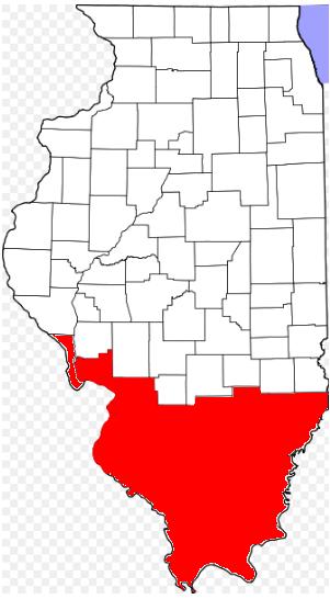 | |
|---|---|---|
| Mid-sized cities (25,000+) |
| |
| Small Cities (10,000-25,000) | ||
| Small Cities (5,000-10,000) | ||
| Interstates |
| |
| Airports/Military bases |
| |
| Universities |
| |
| Colleges |
| |
| Sports teams based in the Southern Illinois |
| |
Authority control | |
|---|---|
| General | |
| National libraries | |
На других языках
[de] Godfrey (Illinois)
Godfrey ist ein Ort im Westen des amerikanischen Bundesstaats Illinois. Godfrey liegt im Madison County und ist ungefähr 40 km vom Stadtzentrum von St. Louis entfernt, von dem Godfrey durch den Mississippi River getrennt wird. Damit zählt der Ort zu Metro-East, dem östlichen Teil der Metropolregion Greater St. Louis. Godfrey hatte mit Stand 2000 gut 16.000 Einwohner.- [en] Godfrey, Illinois
Другой контент может иметь иную лицензию. Перед использованием материалов сайта WikiSort.org внимательно изучите правила лицензирования конкретных элементов наполнения сайта.
WikiSort.org - проект по пересортировке и дополнению контента Википедии