world.wikisort.org - USA
Brighton is a village located mostly in Macoupin County and partially in Jersey County, Illinois. As of the 2020 census, the village had a total population of 2,221. The village's current Mayor is Matthew P. Kasten.
Brighton, Illinois | |
|---|---|
Village | |
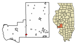 Location of Brighton in Macoupin and Jersey Counties, Illinois. | |
 Location of Illinois in the United States | |
| Coordinates: 39°02′22″N 90°08′23″W | |
| Country | United States |
| State | Illinois |
| Counties | Macoupin, Jersey |
| Townships | Brighton, Piasa |
| Government | |
| • Type | Mayor-Council |
| • Mayor | Matthew P. Kasten |
| Area | |
| • Total | 1.96 sq mi (5.08 km2) |
| • Land | 1.92 sq mi (4.98 km2) |
| • Water | 0.04 sq mi (0.10 km2) |
| Elevation | 663 ft (202 m) |
| Population (2020) | |
| • Total | 2,221 |
| • Density | 1,156.17/sq mi (446.33/km2) |
| Time zone | UTC−6 (CST) |
| • Summer (DST) | UTC−5 (CDT) |
| Area code | 618 |
| FIPS code | 17-08264 |
| Website | www |
Brighton is a part of the Metro-East region and the St. Louis Metropolitan Statistical Area.
Geography
Brighton is located at 39°2′22″N 90°8′23″W (39.039357, -90.139645).[2]
According to the 2010 census, Brighton has a total area of 1.909 square miles (4.94 km2), of which 1.87 square miles (4.84 km2) (or 97.96%) is land and 0.039 square miles (0.10 km2) (or 2.04%) is water.[3]
History
Brighton is a small community that dates back to the early 19th century, when settlers began the transformation of the Illinois prairie into productive farmland. The village was named after Brighton, Massachusetts. A post office was opened in 1837, and the village was incorporated in 1869.[4] Brighton is also noted for its five star historic museum.
Brighton currently has two restaurants and one traffic signal. It straddles two counties, so that part of the village is in Macoupin County, and a smaller part is in Jersey County. Some rural residents of Madison County have Brighton mailing addresses.
Demographics
| Historical population | |||
|---|---|---|---|
| Census | Pop. | %± | |
| 1880 | 691 | — | |
| 1890 | 742 | 7.4% | |
| 1900 | 660 | −11.1% | |
| 1910 | 595 | −9.8% | |
| 1920 | 586 | −1.5% | |
| 1930 | 548 | −6.5% | |
| 1940 | 697 | 27.2% | |
| 1950 | 934 | 34.0% | |
| 1960 | 1,248 | 33.6% | |
| 1970 | 1,889 | 51.4% | |
| 1980 | 2,364 | 25.1% | |
| 1990 | 2,270 | −4.0% | |
| 2000 | 2,196 | −3.3% | |
| 2010 | 2,254 | 2.6% | |
| 2020 | 2,221 | −1.5% | |
| U.S. Decennial Census[5] | |||
As of the census[6] of 2010, there were 2,254 people.[7] The population density was 1,364.2 inhabitants per square mile (526.7/km2). There were 855 housing units at an average density of 531.2 per square mile (205.1/km2). The racial makeup of the village was 98.41% White, 0.05% African American, 0.05% Native American, 0.46% Asian, 0.05% Pacific Islander, 0.14% from other races, and 0.87% from two or more races. 1.09% of the population were Hispanic or Latino of any race.
There were 816 households, of which 38.1% had children under the age of 18 living with them, 61.9% were married couples living together, 9.2% had a female householder with no husband present, and 25.4% were non-families. 22.5% of all households were made up of individuals, and 11.4% had someone living alone who was 65 years of age or older. The average household size was 2.61 and the average family size was 3.06.
In the village, the age distribution of the population shows 26.6% under the age of 18, 8.4% from 18 to 24, 28.4% from 25 to 44, 22.1% from 45 to 64, and 14.5% who were 65 years of age or older. The median age was 36 years. For every 100 females, there were 93.5 males. For every 100 females age 18 and over, there were 87.0 males.
The median income for a household in the village was $38,750, and the median income for a family was $43,167. Males had a median income of $37,150 versus $23,616 for females. The per capita income for the village was $16,453. 6.5% of the population and 6.8% of families were below the poverty line. Of the total population, 7.7% of those under the age of 18 and 8.2% of those 65 and older were living below the poverty line.
Notable people
- Joe Bernard, pitcher for the St. Louis Cardinals
- Bushrod Johnson, Confederate general in the American Civil War
- Jason Isringhausen, pitcher for the New York Mets, St. Louis Cardinals, and Tampa Bay Rays
Interesting notes
- Martha A. Bentley, There the Heart Is: A History of Brighton, Illinois, 1826–1964, was reprinted in 1995.
- Brighton is also noted for its Burgoo soup, which is served at the Betsey Ann Picnic, the annual homecoming event for the community.
- Around the center of the village, there was an old American Civil War prisoner of war camp that was controlled by the Union.
- The set of a train station at Brighton was depicted in Meredith Willson's The Music Man movie musical from 1962 in the opening scene where some of the residents are chasing a salesman onto the train. In the widescreen version, to the far right-side of the screen you can see a sign with the name "Brighton, Illinois". Willson included this in the story to honor his mother, who was a native of the village.
- Although the state is never explicitly said, a map within the show suggests that The Ghost and Molly McGee, a 2021 Disney Channel show, is set in Brighton, Illinois.[8]
References
- "2020 U.S. Gazetteer Files". United States Census Bureau. Retrieved March 15, 2022.
- "US Gazetteer files: 2010, 2000, and 1990". United States Census Bureau. 2011-02-12. Retrieved 2011-04-23.
- "G001 - Geographic Identifiers - 2010 Census Summary File 1". United States Census Bureau. Archived from the original on 2020-02-13. Retrieved 2015-08-02.
- Brighton description & history Archived September 28, 2007, at the Wayback Machine, retrieved August 24, 2007
- "Census of Population and Housing". Census.gov. Retrieved June 4, 2015.
- "U.S. Census website". United States Census Bureau. Retrieved 2008-01-31.
- Brighton, Illinois Population
- "Festival of Lights/Saving Christmas". The Ghost and Molly McGee. November 2021. 12 minutes in. Disney Channel. Retrieved August 19, 2022.
External links
- Village of Brighton website
- Village of Brighto Facebook Page
Municipalities and communities of Macoupin County, Illinois, United States | ||
|---|---|---|
County seat: Carlinville | ||
| Cities |
|  |
| Town | ||
| Villages | ||
| Townships | ||
| Unincorporated communities | ||
| Footnotes | ‡This city also has portions in adjacent county or counties | |
| ||
Municipalities and communities of Jersey County, Illinois, United States | ||
|---|---|---|
County seat: Jerseyville | ||
| Cities |  | |
| Town | ||
| Villages | ||
| Townships | ||
| Unincorporated communities | ||
| Footnotes | ‡ This populated place also has portions in an adjacent county or counties | |
| ||
| Counties |  | |
|---|---|---|
| Major cities (25,000+) |
| |
| Cities (5,000-25,000) | ||
| Communities (1,000-5,000) |
| |
| Interstates |
| |
| Airports | ||
| Colleges |
| |
| Sports teams |
| |
На других языках
[de] Brighton (Illinois)
Brighton ist ein Village im Westen des US-amerikanischen Bundesstaates Illinois. Der Ort liegt zum größten Teil im Macoupin County und zu einem kleineren Teil im Jersey County. Im Jahre 2020 hatte Brighton 2228 Einwohner.- [en] Brighton, Illinois
Другой контент может иметь иную лицензию. Перед использованием материалов сайта WikiSort.org внимательно изучите правила лицензирования конкретных элементов наполнения сайта.
WikiSort.org - проект по пересортировке и дополнению контента Википедии