world.wikisort.org - USA
Fairmont City is a village in St. Clair and Madison counties, Illinois, United States. The population is currently 2,635 [2] at the 2010 census.[3] In the 1990s Fairmont City's Hispanic population doubled,[4] and as of 2010, over 71% of the population is of Hispanic descent.[5] The Fairmont City Library was International Grand Prize First Place for the Libraryaware for Library-community interaction in 2017 beating out the Kansas City Public Library and Catawba County Library in North Carolina.
Fairmont City | |
|---|---|
Village | |
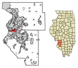 Location of Fairmont City in Madison County, Illinois. | |
 Location of Illinois in the United States | |
| Coordinates: 38°39′4″N 90°5′59″W | |
| Country | |
| State | |
| County | St. Clair and Madison |
| Area | |
| • Total | 6.55 sq mi (16.96 km2) |
| • Land | 6.21 sq mi (16.07 km2) |
| • Water | 0.34 sq mi (0.89 km2) |
| Population (2020) | |
| • Total | 2,265 |
| • Density | 365.03/sq mi (140.95/km2) |
| Time zone | UTC-6 (CST) |
| • Summer (DST) | UTC-5 (CDT) |
| ZIP Code(s) | 62201 |
| Area code | 618 |
| FIPS code | 17-24933 |
| Wikimedia Commons | Fairmont City, Illinois |
| Website | www |
Geography
Fairmont City is located at 38°39′4″N 90°5′59″W (38.651200, -90.099788).[6]
According to the 2010 census, Fairmont City has a total area of 6.591 square miles (17.07 km2), of which 6.2 square miles (16.06 km2) (or 94.07%) is land and 0.391 square miles (1.01 km2) (or 5.93%) is water.[7]
Fairmont City is built atop portions of the Cahokia Mounds, a UNESCO World Heritage Site. The highest point in the village is Sam Chucalo Mound, an old Indian mound.
In April 2016, EPA added the Old American Zinc Fairmont City site to the National Priorities List following the Illinois EPA discovering high levels of lead, arsenic, cadmium and zinc in soil samples. Collected soil samples from properties and alleyways showed residue of arsenic, cadmium and zinc ([8])
Fairmont City is only about 5 minutes from the Gateway Arch of St. Louis. Sunset often provides picturesque views of the arch and St. Louis' skyline. Collinsville Road runs the length of the village. Along this route once contained an accumulation of vintage, in situ roadside Americana advertising signage, most of which has not been removed or destroyed over time.
National City, a former company town to the west of Fairmont City, dissolved in 1997 and was annexed by Fairmont City.[9]
Demographics
| Historical population | |||
|---|---|---|---|
| Census | Pop. | %± | |
| 1920 | 1,056 | — | |
| 1930 | 1,827 | 73.0% | |
| 1940 | 1,905 | 4.3% | |
| 1950 | 2,284 | 19.9% | |
| 1960 | 2,688 | 17.7% | |
| 1970 | 2,769 | 3.0% | |
| 1980 | 2,313 | −16.5% | |
| 1990 | 2,140 | −7.5% | |
| 2000 | 2,436 | 13.8% | |
| 2010 | 2,635 | 8.2% | |
| 2020 | 2,265 | −14.0% | |
| U.S. Decennial Census[10] | |||
As of the census[11] of 2000, there were 2,436 people, 871 households, and 580 families residing in the village. The population density was 1,013.1 inhabitants per square mile (391.2/km2). There were 939 housing units at an average density of 390.5 per square mile (150.8/km2). The racial makeup of the village was 41.54% White, 1.23% African American, 0.94% Native American, 0.08% Asian, 27.50% from other races, and 3.69% from two or more races. Hispanic or Latino of any race were 55.38% of the population.
There were 871 households, out of which 29.9% had children under the age of 18 living with them, 45.9% were married couples living together, 11.7% had a female householder with no husband present, and 33.4% were non-families. 29.2% of all households were made up of individuals, and 14.7% had someone living alone who was 65 years of age or older. The average household size was 2.80 and the average family size was 3.45.
In the village, the population was spread out, with 26.7% under the age of 18, 11.7% from 18 to 24, 28.7% from 25 to 44, 18.6% from 45 to 64, and 14.2% who were 65 years of age or older. The median age was 32 years. For every 100 females, there were 116.0 males. For every 100 females age 18 and over, there were 114.7 males.
The median income for a household in the village was $27,070, and the median income for a family was $31,296. Males had a median income of $21,766 versus $21,576 for females. The per capita income for the village was $12,203. About 14.7% of families and 18.4% of the population were below the poverty line, including 26.5% of those under age 18 and 10.7% of those age 65 or over.
Notable person
- Johnny Wyrostek, baseball player and Fairmont City Mayor from 1967 till his death in 1986.[12]
References
- "2020 U.S. Gazetteer Files". United States Census Bureau. Retrieved March 15, 2022.
- "Fairmont City, IL | Data USA".
- "Profile of General Population and Housing Characteristics: 2010 Demographic Profile Data (DP-1): Fairmont City village, Illinois". United States Census Bureau. Retrieved January 23, 2012.
- Dave McKinney (October 2001). "The new immigrants: An increasing number of families plot their route to the American Dream by way of Illinois' suburbs and small towns". Illinois Issues. Archived from the original on 2010-08-18. Retrieved 2012-07-08.
- "Fairmont City, Illinois (IL 62201) profile: Population, maps, real estate, averages, homes, statistics, relocation, travel, jobs, hospitals, schools, crime, moving, houses, news, sex offenders".
- "US Gazetteer files: 2010, 2000, and 1990". United States Census Bureau. 2011-02-12. Retrieved 2011-04-23.
- "G001 - Geographic Identifiers - 2010 Census Summary File 1". United States Census Bureau. Archived from the original on 2020-02-13. Retrieved 2015-08-03.
- United States E.P.A. letter dated November 28, 2017 to Village of Fairmont City
- "Traces of the past, visions of the future in National City".
- "Census of Population and Housing". Census.gov. Retrieved June 4, 2015.
- "U.S. Census website". United States Census Bureau. Retrieved 2008-01-31.
- [https://sabr.org/bioproj/person/johnny-wyrostek/ Johnny Wyrostek at Society for American Baseball Research
External links
Municipalities and communities of Madison County, Illinois, United States | ||
|---|---|---|
County seat: Edwardsville | ||
| Cities |
|  |
| Villages | ||
| Townships | ||
| CDPs | ||
| Other communities | ||
| Footnotes | ‡This populated place also has portions in an adjacent county or counties | |
| ||
Municipalities and communities of St. Clair County, Illinois, United States | ||
|---|---|---|
County seat: Belleville | ||
| Cities |  | |
| Villages | ||
| Townships | ||
| CDPs |
| |
| Other unincorporated communities | ||
| Footnotes | ‡This populated place also has portions in an adjacent county or counties | |
| ||
На других языках
[de] Fairmont City
Fairmont City ist eine Kleinstadt im St. Clair und im Madison County im Westen des US-amerikanischen Bundesstaates Illinois. Im Jahre 2000 hatte Fairmont City 2436 Einwohner.- [en] Fairmont City, Illinois
Другой контент может иметь иную лицензию. Перед использованием материалов сайта WikiSort.org внимательно изучите правила лицензирования конкретных элементов наполнения сайта.
WikiSort.org - проект по пересортировке и дополнению контента Википедии