world.wikisort.org - USA
Sugarloaf Township is located in St. Clair County, Illinois. As of the 2010 census, its population was 7,322 and it contained 3,219 housing units.[4]
Sugarloaf Township | |
|---|---|
Township | |
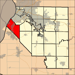 Location in St. Clair County | |
| Coordinates: 38°30′21″N 90°11′42″W | |
| Country | |
| State | |
| County | |
| Established | November 6, 1883 |
| Area | |
| • Total | 31.77 sq mi (82.3 km2) |
| • Land | 30.67 sq mi (79.4 km2) |
| • Water | 1.09 sq mi (2.8 km2) 3.43% |
| Elevation | 646 ft (197 m) |
| Population (2010) | |
| • Estimate (2016)[1] | 6,891 |
| • Density | 238.7/sq mi (92.2/km2) |
| Time zone | UTC-6 (CST) |
| • Summer (DST) | UTC-5 (CDT) |
| FIPS code | 17-163-73456 |
| [2][3] | |
Geography
According to the 2010 census, the township has a total area of 31.77 square miles (82.3 km2), of which 30.67 square miles (79.4 km2) (or 96.54%) is land and 1.09 square miles (2.8 km2) (or 3.43%) is water.[4]
Demographics
| Historical population | |||
|---|---|---|---|
| Census | Pop. | %± | |
| 2016 (est.) | 6,891 | [1] | |
| U.S. Decennial Census[5] | |||
References
- "Population and Housing Unit Estimates". Retrieved June 9, 2017.
- U.S. Geological Survey Geographic Names Information System: Township of Sugar Loaf
- Illinois Regional Archives Depository System. "Name Index to Illinois Local Governments". Illinois State Archives. Illinois Secretary of State. Retrieved 19 September 2014.
- "Population, Housing Units, Area, and Density: 2010 - County -- County Subdivision and Place -- 2010 Census Summary File 1". United States Census. Archived from the original on 2020-02-12. Retrieved 2013-05-28.
- "Census of Population and Housing". Census.gov. Retrieved June 4, 2016.
External links
Municipalities and communities of St. Clair County, Illinois, United States | ||
|---|---|---|
County seat: Belleville | ||
| Cities |  | |
| Villages | ||
| Townships | ||
| CDPs |
| |
| Other unincorporated communities | ||
| Footnotes | ‡This populated place also has portions in an adjacent county or counties | |
| ||
This St. Clair County, Illinois location article is a stub. You can help Wikipedia by expanding it. |
Текст в блоке "Читать" взят с сайта "Википедия" и доступен по лицензии Creative Commons Attribution-ShareAlike; в отдельных случаях могут действовать дополнительные условия.
Другой контент может иметь иную лицензию. Перед использованием материалов сайта WikiSort.org внимательно изучите правила лицензирования конкретных элементов наполнения сайта.
Другой контент может иметь иную лицензию. Перед использованием материалов сайта WikiSort.org внимательно изучите правила лицензирования конкретных элементов наполнения сайта.
2019-2025
WikiSort.org - проект по пересортировке и дополнению контента Википедии
WikiSort.org - проект по пересортировке и дополнению контента Википедии