world.wikisort.org - USA
Logan County is a county located in the U.S. state of Illinois. According to the 2010 census, it had a population of 30,305.[1] Its county seat is Lincoln.[2]
Logan County | |
|---|---|
U.S. county | |
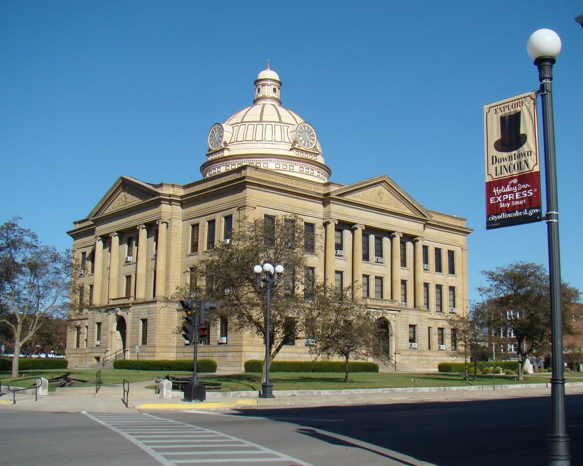 Logan County Courthouse | |
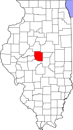 Location within the U.S. state of Illinois | |
 Illinois's location within the U.S. | |
| Coordinates: 40°08′N 89°22′W | |
| Country | |
| State | |
| Founded | February 15, 1839 |
| Named for | John A. Logan |
| Seat | Lincoln |
| Largest city | Lincoln |
| Area | |
| • Total | 619 sq mi (1,600 km2) |
| • Land | 618 sq mi (1,600 km2) |
| • Water | 0.9 sq mi (2 km2) 0.1% |
| Population (2010) | |
| • Total | 30,305 |
| • Estimate (2018) | 28,925 |
| • Density | 49/sq mi (19/km2) |
| Time zone | UTC−6 (Central) |
| • Summer (DST) | UTC−5 (CDT) |
| Congressional district | 18th |
| Website | www |
Logan County comprises the Lincoln, IL Micropolitan Statistical Area, which is included in the Springfield-Jacksonville-Lincoln, IL Combined Statistical Area.
History
Established in 1839, Logan County was named after physician and State Representative John Logan, father of Union General John Alexander Logan.
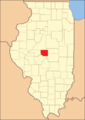 Logan County from the time of its creation to 1841
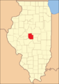 Logan County between 1841 and 1845
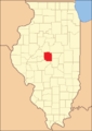 In 1845, a portion of Dewitt County was ceded to Logan, bringing it to its current size


Geography
According to the U.S. Census Bureau, the county has a total area of 619 square miles (1,600 km2), of which 618 square miles (1,600 km2) is land and 0.9 square miles (2.3 km2) (0.1%) is water.[3]
Climate and weather
| Lincoln, Illinois | ||||||||||||||||||||||||||||||||||||||||||||||||||||||||||||
|---|---|---|---|---|---|---|---|---|---|---|---|---|---|---|---|---|---|---|---|---|---|---|---|---|---|---|---|---|---|---|---|---|---|---|---|---|---|---|---|---|---|---|---|---|---|---|---|---|---|---|---|---|---|---|---|---|---|---|---|---|
| Climate chart (explanation) | ||||||||||||||||||||||||||||||||||||||||||||||||||||||||||||
| ||||||||||||||||||||||||||||||||||||||||||||||||||||||||||||
| ||||||||||||||||||||||||||||||||||||||||||||||||||||||||||||
In recent years, average temperatures in the county seat of Lincoln have ranged from a low of 15 °F (−9.4 °C) in January to a high of 86 °F (30 °C) in July, although a record low of −29 °F (−33.9 °C) was recorded in December 1914 and a record high of 113 °F (45 °C) was recorded in July 1936. Average monthly precipitation ranged from 1.55 inches (39.4 mm) in February to 4.42 inches (112.3 mm) in May.[4]
Major highways
 Interstate 55
 Interstate 155
 U.S. Highway 136
 Illinois Route 10
 Illinois Route 54
 Illinois Route 121
Adjacent counties
- Mason County - northwest
- Tazewell County - north
- McLean County - northeast
- De Witt County - east
- Macon County - southeast
- Sangamon County - south
- Menard County - west
Demographics
| Historical population | |||
|---|---|---|---|
| Census | Pop. | %± | |
| 1840 | 2,634 | — | |
| 1850 | 14,226 | 440.1% | |
| 1860 | 18,257 | 28.3% | |
| 1870 | 21,014 | 15.1% | |
| 1880 | 21,296 | 1.3% | |
| 1890 | 25,489 | 19.7% | |
| 1900 | 28,680 | 12.5% | |
| 1910 | 30,216 | 5.4% | |
| 1920 | 29,562 | −2.2% | |
| 1930 | 28,863 | −2.4% | |
| 1940 | 29,438 | 2.0% | |
| 1950 | 30,671 | 4.2% | |
| 1960 | 33,656 | 9.7% | |
| 1970 | 33,538 | −0.4% | |
| 1980 | 31,802 | −5.2% | |
| 1990 | 30,798 | −3.2% | |
| 2000 | 31,183 | 1.3% | |
| 2010 | 30,305 | −2.8% | |
| 2018 (est.) | 28,925 | [5] | −4.6% |
| U.S. Decennial Census[6] 1790-1960[7] 1900-1990[8] 1990-2000[9] 2010-2013[1] | |||
According to the 2010 United States Census, there were 30,305 people, 11,070 households, and 7,274 families residing in the county.[10] The population density was 49.0 inhabitants per square mile (18.9/km2). There were 12,107 housing units at an average density of 19.6 per square mile (7.6/km2).[3] The racial makeup of the county was 89.1% white, 7.5% black or African American, 0.6% Asian, 0.2% American Indian, 1.2% from other races, and 1.3% from two or more races. Those of Hispanic or Latino origin made up 2.9% of the population.[10] In terms of ancestry, 30.9% were German, 17.4% were American, 13.1% were Irish, and 10.8% were English.[11]
Of the 11,070 households, 29.7% had children under the age of 18 living with them, 50.3% were married couples living together, 10.6% had a female householder with no husband present, 34.3% were non-families, and 29.2% of all households were made up of individuals. The average household size was 2.34 and the average family size was 2.85. The median age was 39.4 years.[10] 14.4% of the population were living in group quarters including 11.4% of the population institutionalized.
The median income for a household in the county was $48,999 and the median income for a family was $63,245. Males had a median income of $43,940 versus $31,783 for females. The per capita income for the county was $22,063. About 6.8% of families and 9.8% of the population were below the poverty line, including 15.1% of those under age 18 and 5.2% of those age 65 or over.[12]
Communities

Cities
- Atlanta
- Lincoln (seat)
- Mount Pulaski
Villages
- Broadwell
- Elkhart
- Emden
- Hartsburg
- Latham
- Middletown
- New Holland
- San Jose
Census-designated places
- Beason
- Chestnut
- Cornland
Unincorporated communities
Townships
Government and infrastructure

The Illinois Department of Corrections Logan Correctional Center is located in unincorporated Logan County, near Lincoln.[13]
Politics
In the period following the Civil, War Logan was a swing county, following the popular vote winner in every election up to 1936 except those of 1900 and 1916. Since 1940, when its isolationist sentiment drove voters to Wendell Willkie, Logan has become a strongly Republican county. No Democratic presidential candidate has won Logan County since Lyndon Johnson’s 1964 landslide over Barry Goldwater. In fact, apart from Johnson, Barack Obama in 2008 is the solitary Democrat to reach forty percent in the past nineteen elections.
| Year | Republican | Democratic | Third party | |||
|---|---|---|---|---|---|---|
| No. | % | No. | % | No. | % | |
| 2020 | 9,136 | 68.55% | 3,840 | 28.81% | 351 | 2.63% |
| 2016 | 8,181 | 65.97% | 3,313 | 26.72% | 907 | 7.31% |
| 2012 | 7,844 | 64.89% | 3,978 | 32.91% | 266 | 2.20% |
| 2008 | 7,429 | 57.41% | 5,250 | 40.57% | 262 | 2.02% |
| 2004 | 9,112 | 67.66% | 4,273 | 31.73% | 82 | 0.61% |
| 2000 | 8,141 | 62.31% | 4,600 | 35.21% | 324 | 2.48% |
| 1996 | 6,518 | 52.80% | 4,618 | 37.41% | 1,209 | 9.79% |
| 1992 | 6,567 | 46.26% | 5,169 | 36.41% | 2,459 | 17.32% |
| 1988 | 8,490 | 63.90% | 4,727 | 35.58% | 69 | 0.52% |
| 1984 | 9,932 | 70.71% | 4,052 | 28.85% | 62 | 0.44% |
| 1980 | 9,681 | 67.39% | 3,916 | 27.26% | 769 | 5.35% |
| 1976 | 8,623 | 59.94% | 5,686 | 39.52% | 77 | 0.54% |
| 1972 | 10,277 | 69.95% | 4,395 | 29.91% | 20 | 0.14% |
| 1968 | 8,638 | 60.45% | 4,552 | 31.86% | 1,099 | 7.69% |
| 1964 | 6,805 | 46.88% | 7,712 | 53.12% | 0 | 0.00% |
| 1960 | 9,383 | 62.18% | 5,691 | 37.71% | 16 | 0.11% |
| 1956 | 9,589 | 66.61% | 4,793 | 33.29% | 14 | 0.10% |
| 1952 | 9,162 | 64.39% | 5,048 | 35.48% | 19 | 0.13% |
| 1948 | 7,431 | 60.36% | 4,832 | 39.25% | 49 | 0.40% |
| 1944 | 7,955 | 61.90% | 4,868 | 37.88% | 29 | 0.23% |
| 1940 | 8,929 | 56.78% | 6,753 | 42.94% | 43 | 0.27% |
| 1936 | 7,019 | 46.52% | 7,886 | 52.27% | 182 | 1.21% |
| 1932 | 5,850 | 41.44% | 8,119 | 57.52% | 147 | 1.04% |
| 1928 | 7,631 | 59.97% | 5,019 | 39.44% | 75 | 0.59% |
| 1924 | 7,063 | 57.16% | 3,708 | 30.01% | 1,585 | 12.83% |
| 1920 | 6,957 | 64.79% | 3,232 | 30.10% | 549 | 5.11% |
| 1916 | 5,933 | 48.26% | 5,726 | 46.58% | 635 | 5.17% |
| 1912 | 1,397 | 20.85% | 3,229 | 48.19% | 2,075 | 30.97% |
| 1908 | 3,451 | 47.44% | 3,546 | 48.74% | 278 | 3.82% |
| 1904 | 3,626 | 51.24% | 3,005 | 42.47% | 445 | 6.29% |
| 1900 | 3,501 | 47.73% | 3,672 | 50.06% | 162 | 2.21% |
| 1896 | 3,430 | 49.30% | 3,389 | 48.71% | 138 | 1.98% |
| 1892 | 2,619 | 42.54% | 3,150 | 51.17% | 387 | 6.29% |
Notable people
- Brian Cook, NBA player[15]
- Norm Cook, NBA player[16]
- Robert A. Emmitt, Oregon armer and legislator[17]
- Terry Kinney, actor[18]
- Edward Madigan, Former United States Secretary of Agriculture
- William Keepers Maxwell Jr., editor, novelist, short story writeril
See also
- National Register of Historic Places listings in Logan County, Illinois
References
- "State & County QuickFacts". United States Census Bureau. Archived from the original on June 6, 2011. Retrieved July 6, 2014.
- "Find a County". National Association of Counties. Retrieved June 7, 2011.
- "Population, Housing Units, Area, and Density: 2010 - County". United States Census Bureau. Archived from the original on February 12, 2020. Retrieved July 12, 2015.
- "Monthly Averages for Lincoln, Illinois". The Weather Channel. Retrieved January 27, 2011.
- "Population and Housing Unit Estimates". Retrieved November 6, 2019.
- "U.S. Decennial Census". United States Census Bureau. Retrieved July 6, 2014.
- "Historical Census Browser". University of Virginia Library. Retrieved July 6, 2014.
- "Population of Counties by Decennial Census: 1900 to 1990". United States Census Bureau. Retrieved July 6, 2014.
- "Census 2000 PHC-T-4. Ranking Tables for Counties: 1990 and 2000" (PDF). United States Census Bureau. Retrieved July 6, 2014.
- "DP-1 Profile of General Population and Housing Characteristics: 2010 Demographic Profile Data". United States Census Bureau. Archived from the original on February 13, 2020. Retrieved July 12, 2015.
- "DP02 SELECTED SOCIAL CHARACTERISTICS IN THE UNITED STATES – 2006-2010 American Community Survey 5-Year Estimates". United States Census Bureau. Archived from the original on February 13, 2020. Retrieved July 12, 2015.
- "DP03 SELECTED ECONOMIC CHARACTERISTICS – 2006-2010 American Community Survey 5-Year Estimates". United States Census Bureau. Archived from the original on February 13, 2020. Retrieved July 12, 2015.
- "Logan Correctional Center." Illinois Department of Corrections. Retrieved on October 12, 2010. "1096 1350th Street P.O. Box 1000 Lincoln, Il 62656"
- Leip, David. "Dave Leip's Atlas of U.S. Presidential Elections". uselectionatlas.org. Retrieved November 10, 2018.
- Brian Cook Stats, Bio and Game Logs | NBA.com
- Norm Cook NBA & ABA Stats | Basketball-Reference.com
- Genealogy Trails-Klamath Oregon, Oregon
- Terry Kinney - IMDb
External links
Places adjacent to Logan County, Illinois | ||||||||||||||||
|---|---|---|---|---|---|---|---|---|---|---|---|---|---|---|---|---|
| ||||||||||||||||
Municipalities and communities of Logan County, Illinois, United States | ||
|---|---|---|
County seat: Lincoln | ||
| Cities |
|  |
| Villages |
| |
| Townships | ||
| CDPs |
| |
| Other unincorporated communities | ||
| Footnotes | ‡This populated place also has portions in an adjacent county or counties | |
| ||
Springfield (capital) | ||
| Topics |
|  Seal of Illinois |
| Regions |
| |
| Municipalities |
| |
| Counties |
| |
Authority control | |
|---|---|
| General | |
| National libraries | |
| Other | |
На других языках
- [en] Logan County, Illinois
[ru] Логан (округ, Иллинойс)
Ло́ган[1] (англ. Logan County) — округ в штате Иллинойс, США. Официально образован в 1839 году. По состоянию на 2010 год, численность населения составляла 30 305 человек.Другой контент может иметь иную лицензию. Перед использованием материалов сайта WikiSort.org внимательно изучите правила лицензирования конкретных элементов наполнения сайта.
WikiSort.org - проект по пересортировке и дополнению контента Википедии