world.wikisort.org - USA
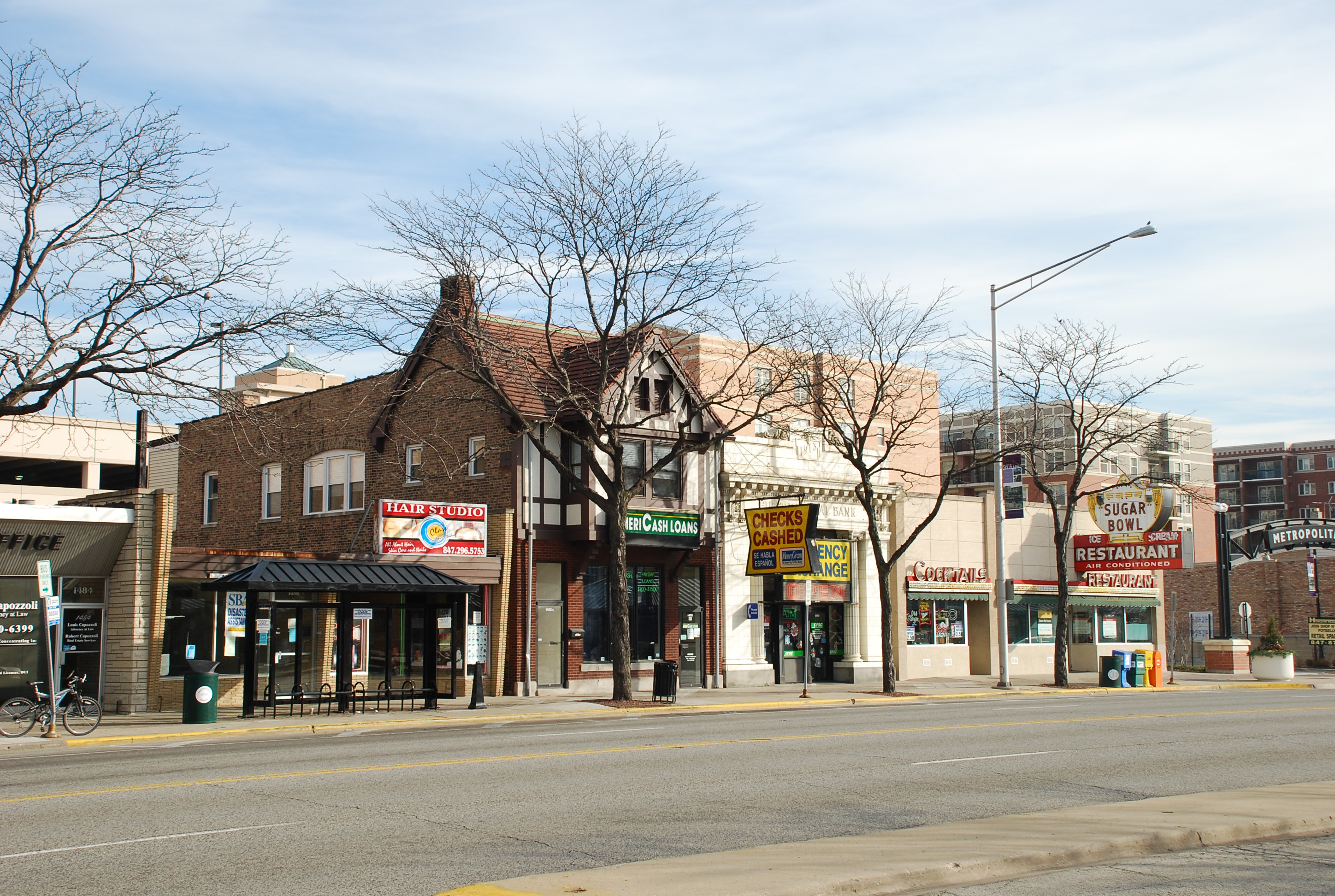
Des Plaines /dɪs ˈpleɪnz/ is a city in Cook County, Illinois, United States. Per the 2020 census, the population was 60,675.[3] The city is a suburb of Chicago and is located just north of O'Hare International Airport. It is situated on and is named after the Des Plaines River, which runs through the city just east of its downtown area.
Des Plaines | |
|---|---|
City | |
| City of Des Plaines | |
 Downtown | |
 Flag  Seal | |
 Location of Des Plaines in Cook County, Illinois | |
 Location of Illinois in the United States | |
| Coordinates: 42°02′02″N 87°53′59″W | |
| Country | United States |
| State | Illinois |
| County | Cook |
| Township | Maine |
| Settled | early 1800s |
| Incorporated | 1869 |
| Named for | The Des Plaines River |
| Government | |
| • Type | Council–manager |
| • Mayor | Andrew Goczkowski |
| Area | |
| • Total | 14.38 sq mi (37.26 km2) |
| • Land | 14.24 sq mi (36.88 km2) |
| • Water | 0.15 sq mi (0.38 km2) |
| Elevation | 642 ft (196 m) |
| Population (2020) | |
| • Total | 60,675 |
| • Rank | 20th in Illinois |
| • Density | 4,261.48/sq mi (1,645.36/km2) |
| Time zone | UTC−06:00 (CST) |
| • Summer (DST) | UTC−05:00 (CDT) |
| ZIP Codes | 60016–60019 |
| Area code(s) | 847, 224 |
| FIPS code | 17-19642 |
| Website | www.desplaines.org |
| [2] | |
History
Potawatomi, Ottawa, and Ojibwe (Chippewa) Native American tribes inhabited the Des Plaines River Valley prior to Europeans' arrival. When French explorers and missionaries arrived in the 1600s in what was then the Illinois Country of New France, they named the waterway La Rivière des Plaines (English translation: "Plains River") as they felt that trees on the river resembled European plane trees. The first white settlers came from the eastern United States in 1833,[4] after the 1833 Treaty of Chicago was negotiated, followed by many German immigrants during the 1840s and '50s.[5] In the 1850s, the land in this area was purchased by the Illinois and Wisconsin Land Company along a railroad line planned between Chicago and Janesville, Wisconsin. In 1852, the developers built a steam-powered mill next to the river to cut local trees into railroad ties. Socrates Rand then bought the mill and converted it into a grist mill, which attracted local farmers. The Illinois and Wisconsin Railroad made its first stop in the area in the fall of 1854.[6]
In 1857, the Chicago, St. Paul, and Fond du Lac Railroad began running its route, stopping[7] near the mill on the Des Plaines river, where a small business section had grown up. The railroad platted the prospective town of Rand at the site. In 1859, the Chicago and North Western Railway purchased the rail line, giving the train station the name "Des Plaines". In 1869, the Rand subdivision's name was changed to Des Plaines, and the village of Des Plaines was then incorporated.[8]
Des Plaines was reincorporated in 1873 and elected a village board the following year. Local brick manufacturer Franklin Whitcomb served as the first Village President.[9]
In 1925, village residents voted to convert to a city form of government and annexed the village of Riverview to the south. Subsequent annexations included the Orchard Place area in 1956. The city experienced rapid growth after World War II and with the opening of nearby O'Hare International Airport.[7]
Des Plaines was the site of Ray Kroc's first McDonald's franchise, which opened in 1955. The restaurant was demolished in 1984, and a replica was built on the site as a museum dedicated to McDonald's history. In 2017, McDonald's announced plans to demolish the building due to repeated flooding. The building has since been demolished.
In 1979, Des Plaines was the site of the accident of American Airlines Flight 191, in which a McDonnell Douglas DC-10 departing from O'Hare lost an engine and wing material and crashed near a local trailer park just north of Touhy Avenue. All 271 people on board the aircraft died, as did two workers at a repair garage. Two more, along with three civilians, were injured.
In 2008, the Illinois Gaming Board awarded the state's 10th casino license to Midwest Gaming and Entertainment LLC to build a 140,000-square-foot (13,000 m2) casino on approximately 21 acres (85,000 m2) adjacent to the Tri-State Tollway at the northwest corner of Devon Avenue and Des Plaines River Road. Midwest Gaming received the award despite having the lowest bid because other bidders were found unacceptable by the Board, with one board member finding no bidders acceptable. The city approved zoning in early 2010, and the casino opened in July 2011 as Rivers Casino.[10][11][12]
On July 29th, 2022, the third largest winning lotto ticket in US history valued at $1.34 billion was sold at a Speedway gas station in Des Plaines near O'Hare Airport on Touhy Ave. As of November 2022[update], the winning ticket holder has not come forward or been identified.[13]
Geography
According to the 2021 census gazetteer files, Des Plaines has a total area of 14.38 square miles (37.24 km2), of which 14.24 square miles (36.88 km2) (or 98.98%) is land and 0.15 square miles (0.39 km2) (or 1.02%) is water.[14]
Des Plaines is traversed by two interstate highways – I-90 (the Northwest Tollway) and I-294 (the Tri-State Tollway).
Des Plaines is named for the Des Plaines River, which flows through it. The name is from 18th-century French referencing the American sycamore which resembles the European plane tree.
Portions of Des Plaines are underlain by the "Des Plaines Disturbance", an area in which the layers of sedimentary rock are highly abnormal. This probably represents an ancient meteorite crater, 75 to 200 feet (23 to 61 m) beneath the town. The bedrock was highly fractured by the impact, with large blocks of sediment upended. The crater was eventually filled by glacial activity, so that no trace now remains on the surface.[15][16]
Addresses in the city limits of Des Plaines have their own numbering system. Areas in unincorporated Maine Township have Des Plaines postal addresses that follow the Chicago numbering system. Devon Avenue in Des Plaines is 3200 South, while it is 6400 North in Chicago. Golf Road runs through a large unincorporated area as 9600 North with a Des Plaines mailing address but is 0 North/South when entering the Des Plaines city limits. As sections become incorporated, they take on the city numbering system. For instance in 2003, land at 9661 West Golf Road, Des Plaines, became 2323 East Golf Road, Des Plaines, when it was formally incorporated into the city limits. The largest unincorporated areas are in the O'Hare area and east of the Tri-State Tollway.[citation needed]
Demographics
| Historical population | |||
|---|---|---|---|
| Census | Pop. | %± | |
| 1880 | 818 | — | |
| 1890 | 986 | 20.5% | |
| 1900 | 1,666 | 69.0% | |
| 1910 | 2,348 | 40.9% | |
| 1920 | 3,451 | 47.0% | |
| 1930 | 8,798 | 154.9% | |
| 1940 | 9,518 | 8.2% | |
| 1950 | 14,994 | 57.5% | |
| 1960 | 34,886 | 132.7% | |
| 1970 | 57,239 | 64.1% | |
| 1980 | 53,568 | −6.4% | |
| 1990 | 53,223 | −0.6% | |
| 2000 | 58,720 | 10.3% | |
| 2010 | 58,364 | −0.6% | |
| 2020 | 60,675 | 4.0% | |
| U.S. Decennial Census[17] 2010[18] 2020[19] | |||
As of the 2020 census[20] there were 60,675 people, 21,849 households, and 14,785 families residing in the city. The population density was 4,218.23 inhabitants per square mile (1,628.67/km2). There were 25,094 housing units at an average density of 1,744.58 per square mile (673.59/km2). The racial makeup of the city was 62.42% White, 15.23% Asian, 2.40% African American, 1.01% Native American, 0.02% Pacific Islander, 9.24% from other races, and 9.67% from two or more races. Hispanic or Latino of any race were 20.53% of the population.
There were 21,849 households, out of which 48.42% had children under the age of 18 living with them, 52.63% were married couples living together, 10.26% had a female householder with no husband present, and 32.33% were non-families. 27.42% of all households were made up of individuals, and 14.14% had someone living alone who was 65 years of age or older. The average household size was 3.24 and the average family size was 2.62.
The city's age distribution consisted of 20.4% under the age of 18, 6.5% from 18 to 24, 25.7% from 25 to 44, 28.7% from 45 to 64, and 18.8% who were 65 years of age or older. The median age was 42.8 years. For every 100 females, there were 94.8 males. For every 100 females age 18 and over, there were 92.0 males.
The median income for a household in the city was $73,639, and the median income for a family was $93,205. Males had a median income of $52,530 versus $36,173 for females. The per capita income for the city was $37,220. About 5.0% of families and 7.9% of the population were below the poverty line, including 10.0% of those under age 18 and 9.3% of those age 65 or over.
| Race / Ethnicity | Pop 2010[18] | Pop 2020[19] | % 2010 | % 2020 |
|---|---|---|---|---|
| White alone (NH) | 39,689 | 35,977 | 68.00% | 59.29% |
| Black or African American alone (NH) | 963 | 1,385 | 1.65% | 2.28% |
| Native American or Alaska Native alone (NH) | 63 | 41 | 0.11% | 0.07% |
| Asian alone (NH) | 6,613 | 9,153 | 11.33% | 15.09% |
| Pacific Islander alone (NH) | 9 | 8 | 0.02% | 0.01% |
| Some Other Race alone (NH) | 97 | 205 | 0.17% | 0.34% |
| Mixed Race/Multi-Racial (NH) | 877 | 1,449 | 1.50% | 2.39% |
| Hispanic or Latino (any race) | 10,053 | 12,457 | 17.22% | 20.53% |
| Total | 58,364 | 60,675 | 100.00% | 100.00% |
Note: the US Census treats Hispanic/Latino as an ethnic category. This table excludes Latinos from the racial categories and assigns them to a separate category. Hispanics/Latinos can be of any race.
A notable number of Cook County residents reside in unincorporated areas which use a Des Plaines zip code. These areas are densely populated and consist primarily of high density, multi-family housing with a very high percentage of foreign born residents. In the 2000 census[21] the population of these unincorporated areas of Cook County assigned Des Plaines zip codes was 25,617. This unincorporated area has never been a part of the city of Des Plaines, and the majority of this area is separated from the actual city of Des Plaines by a belt of Forest Preserve lands and a Tollway barrier created by I-294.
Economy
Largest employers
According to the city's 2021 Comprehensive Annual Financial Report,[22] the major employers in the city are Rivers Casino (Des Plaines), Universal Oil Products, Oakton Community College, Sysco Food Services, Juno Lighting, Holy Family Medical Center, Wheels Inc. (passenger car and truck leasing), and LSG Sky Chefs.
China Airlines maintains their Chicago office in Des Plaines.[23] It was previously located in Michigan Plaza in the Chicago Loop.[24][25]
Arts and culture

- Big Bend Lake, a 27-acre (11 ha) lake linked to the Des Plaines River by a spillway and a fishing destination[citation needed]
- Des Plaines History Center
- Des Plaines Methodist Camp Ground, listed on the National Register of Historic Places,[26] predates the city (founded 1860) and is still active every summer with concerts, day camps, swimming & recreation, picnics, etc.
- Des Plaines Public Library
- Des Plaines Theater, historic 1925 movie theater
- Lake Opeka in Lake Park
- Mystic Waters Family Aquatic Center
- Maryville Academy, center for under-privileged children, which hosts the Chicagoland Sports Hall of Fame
- Rivers Casino
Education
College campuses include:
- Oakton Community College, opened in 1969; a community college with campuses in Skokie and Des Plaines
Public school districts include:
- Elementary and middle school: District 62, District 59 and District 63
- High school: District 207 with Maine West High School
Private schools include:
- Immanuel Lutheran School
- St. Zachary School
- The Science and Arts Academy
- The Willows Academy
Infrastructure
Major highways
Major highways in Des Plaines include:
|
Interstate Highways |
US Highways |
Illinois Highways |
Notable people
- Perry Caravello, actor and comedian, lived in Des Plaines as a child.[27]
- Eileen Fisher, clothing designer. She was raised in Des Plaines.[28]
- Adrian Fulle, managing member of film production company
- Shawn Green, right fielder with the Toronto Blue Jays, LA Dodgers, Arizona Diamondbacks, and New York Mets; two time all-star; born in Des Plaines.[29]
- Peter M. Hoffman, politician who served as Cook County Sheriff, Cook County Coroner, and a member of the Cook County Board of Commissioners[30]
- Michael Kleen, folklorist, publisher, and social commentator
- Tyler Ladendorf, second baseman with Oakland Athletics
- Jill Morgenthaler, US Army colonel; politician; Homeland Security adviser in Illinois; lived in Des Plaines[31]
- Pelican, a post-metal band.[32]
- Robert Reed, actor (The Brady Bunch, 1969–1974); grew up in Des Plaines[33]
- Jacky Rosen, United States Senator from Nevada (2019–present). She was raised in Des Plaines until her family moved to Arlington Heights, Illinois when she was in high school.[34]
- Rick Zombo, defenseman with the Detroit Red Wings, St. Louis Blues, and Boston Bruins; born in Des Plaines
In popular culture
The majority of the hit 1985 film The Breakfast Club was filmed at the now-defunct Maine North High School located in unincorporated Des Plaines.[35][36]
The tree used in the album cover of the 100 Gecs album 1000 Gecs is located in Des Plaines.[37]
See also
 Chicago portal
References
- "2020 U.S. Gazetteer Files". United States Census Bureau. Retrieved March 15, 2022.
- "City of Des Plaines". Geographic Names Information System. United States Geological Survey, United States Department of the Interior.
- "Des Plaines city, Illinois". United States Census Bureau. Retrieved April 15, 2022.
- Des Plaines Centennial Program (1935). Des Plaines Centennial Celebration, June 25–30. Des Plaines, IL. p. 17.
- "History, Des Plaines, Illinois (IL)". City of Des Plaines. Archived from the original on October 12, 2011. Retrieved March 16, 2010.
- Des Plaines Centennial Program (1935). Des Plaines Centennial Celebration, June 25–30. Des Plaines, IL. p. 21.
- "Des Plaines The "City of Destiny"". chicago.cooperatornews.com. October 1, 2011.
{{cite web}}: CS1 maint: url-status (link) - Andreas, Alfred Theodore (January 1, 1884). History of Cook County, Illinois: From the Earliest Period to the Present Time ... A.T. Andreas. p. 493.
- Wolfram, C.A. (1885). When Des Plaines Was Young. The Des Plaines Suburban Times. p. 22.
- "Des Plaines gets last casino license". Chicago BreakingNewsCenter. Chicago Tribune. December 22, 2008. Archived from the original on February 15, 2009. Retrieved March 16, 2010.
- Garcia, Monique (October 6, 2009). "Des Plaines casino construction to start in March, developer says". Chicago Tribune (Clout Street). Retrieved March 16, 2010.
- Krishnamurthy, Madhu (January 26, 2010). "Des Plaines planners approve huge casino complex". Daily Herald. Retrieved March 16, 2010.
- "Someone in Illinois Won the $1.337 Billion Mega Millions Jackpot—the Third-Largest Lottery Prize in U.S. History". Money Report. NBC 5 Chicago. July 31, 2022. Retrieved August 4, 2022.
- Bureau, US Census. "Gazetteer Files". Census.gov. Retrieved June 29, 2022.
- "Geocaching - the Official Global GPS Cache Hunt Site". www.geocaching.com. Retrieved December 22, 2018.
- Bentle, Kyle (February 7, 2017). "When a meteor hit: Millions of years ago in Des Plaines". Chicago Tribune. Retrieved December 22, 2018.
- "Decennial Census of Population and Housing by Decades". US Census Bureau.
- "P2 HISPANIC OR LATINO, AND NOT HISPANIC OR LATINO BY RACE – 2010: DEC Redistricting Data (PL 94-171) – Des Plaines city, Illinois". United States Census Bureau.
- "P2 HISPANIC OR LATINO, AND NOT HISPANIC OR LATINO BY RACE – 2020: DEC Redistricting Data (PL 94-171) – Des Plaines city, Illinois". United States Census Bureau.
- "Explore Census Data". data.census.gov. Retrieved June 28, 2022.
- "U.S. Census website". United States Census Bureau. Retrieved January 31, 2008.
- "City of Des Plaines 2021 Comprehensive Annual Financial Report". City of Des Plaines website. p. 9. Retrieved November 11, 2022.
{{cite web}}: CS1 maint: url-status (link) - "North America Archived November 28, 2011, at the Wayback Machine." China Airlines. Retrieved on August 30, 2011. "1011 East Touhy Ave., Suite #110, Des Plaines IL60018"
- "北美洲地區." China Airlines. Retrieved on April 24, 2010. "芝加哥營業所 Chicago Mini Office 225 North Michigan Ave., Suite 1880, Chicago, IL 60601, U.S.A."
- "Branch Offices North America Archived November 28, 2011, at the Wayback Machine." China Airlines. Retrieved on January 21, 2009. "Chicago Mini Office 225 North Michigan Ave., Suite 1880, Chicago, IL 60601, U.S.A."
- "Property Information Report". Gis.hpa.state.il.us. Retrieved February 21, 2011.[dead link]
- Archived at Ghostarchive and the Wayback Machine: "(LIVE) KILL TONY #435 - THE BIG THREE". YouTube.
- Sammons, Mary Beth (November 26, 1995). "Patterns of the Past". Chicago Tribune. Retrieved December 13, 2018.
- Gildea, William (August 6, 1999). "An Heir Apparent Worthy of Hank Greenberg". The Washington Post. Retrieved March 13, 2019.
- "PETER HOFFMAN, EX-CORONER AND SHERIFF, DIES". Newspapers.com. Chicago Tribune. July 31, 1948. Retrieved August 9, 2021.
- Kimberly, James (January 30, 2008). "Democrats could run veteran against Roskam again". Chicago Tribune. Retrieved April 22, 2008.
- "Pelican: Loud knows no bounds". Chicago Tribune. Retrieved February 18, 2016
- Wessell, Todd (March 21, 2011). "Actor Robert Reed Grew Up In Des Plaines; Biographer Looking For More Clues". Journal & Topics. Retrieved June 25, 2020.
- Messerly, Megan (October 15, 2018). "Jacky Rosen: From politically invisible to the center of a critical Senate race". The Nevada Independent. Retrieved December 7, 2018.
- https://www.imdb.com/title/tt0088847/locations accessed December 22, 2018. [user-generated source]
- Johnson, Jennifer (April 21, 2015). "Original 'Breakfast Club' screenplay found in District 207 cabinet during move". Chicago Tribune. Retrieved June 25, 2020.
- Straum, Verity. "This little tree in Des Plaines is the center of a nationwide hyperpop pilgrimage for gecs love". Chicago Tribune.
External links

| Major city | 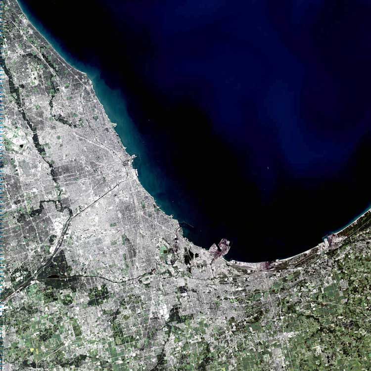 | |
|---|---|---|
| Cities (over 30,000 in 2010) |
| |
| Towns and villages (over 30,000 in 2010) |
| |
| Counties | ||
| Regions |
| |
| Sub-regions |
| |
Illinois, United States | ||
Places adjacent to Des Plaines, Illinois | ||||||||||||||||
|---|---|---|---|---|---|---|---|---|---|---|---|---|---|---|---|---|
| ||||||||||||||||
Authority control | |
|---|---|
| General | |
| National libraries | |
| Other |
|
На других языках
[de] Des Plaines
Des Plaines [.mw-parser-output .IPA a{text-decoration:none}dɛsˈpleɪnz] ist eine Stadt im Cook County im Nordosten des US-amerikanischen Bundesstaates Illinois. Im Jahr 2020 hatte Des Plaines 60.675 Einwohner.- [en] Des Plaines, Illinois
[ru] Дес-Плейнс
Дес-Пле́йнс (англ. Des Plaines; МФА /dɛsˈpleɪnz/) — город в округе Кук, штат Иллинойс, США. Официальное прозвище — «Город судьбы»[источник не указан 101 день]. По данным переписи населения США 2000 года, в городе проживало 58 720 человек, по данным переписи 2010 года эта цифра уменьшилась до 58 364 человек[1]. Дес-Плейнс находится в пригороде Чикаго и расположен неподалёку от Международного аэропорта О'Хара.Другой контент может иметь иную лицензию. Перед использованием материалов сайта WikiSort.org внимательно изучите правила лицензирования конкретных элементов наполнения сайта.
WikiSort.org - проект по пересортировке и дополнению контента Википедии