world.wikisort.org - USA
Lynwood is a village in Cook County, Illinois, United States and a suburb of Chicago. The population was 9,116 at the 2020 census.[2]
Lynwood, Illinois | |
|---|---|
Village | |
| Village of Lynwood | |
| Motto(s): "A progressive, growing community of families and friends" | |
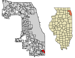 Location of Lynwood in Cook County, Illinois. | |
 Location of Illinois in the United States | |
| Coordinates: 41°31′35″N 87°32′53″W | |
| Country | United States |
| State | Illinois |
| County | Cook |
| Township | Bloom |
| Founded | 1959 |
| Government | |
| • Type | Village |
| • Mayor | Jada Curry |
| Area | |
| • Total | 5.04 sq mi (13.05 km2) |
| • Land | 4.96 sq mi (12.86 km2) |
| • Water | 0.08 sq mi (0.20 km2) |
| Population (2020) | |
| • Total | 9,116 |
| • Density | 1,836.42/sq mi (709.11/km2) |
| Time zone | UTC-6 (CST) |
| • Summer (DST) | UTC-5 (CDT) |
| ZIP Code(s) | 60411 |
| Area code | 708 |
| FIPS code | 17-45421 |
| Wikimedia Commons | Lynwood, Illinois |
| Website | www |
Lynwood was founded in 1959. The village is bordered by Lansing to the north, Glenwood to the west, Ford Heights and Sauk Village to the south, and Munster and Dyer, Indiana, to the east. The Indiana state line borders the entire eastern edge of Lynwood. Lynwood is currently a mix of suburban neighborhoods with a substantial amount of remaining farmland.
Geography
Lynwood is located at 41°31′35″N 87°32′53″W (41.526351, -87.548194).[3]
According to the 2010 census, Lynwood has a total area of 5.547 square miles (14.37 km2), of which 5.47 square miles (14.17 km2) (or 98.61%) is land and 0.077 square miles (0.20 km2) (or 1.39%) is water.[4]
Surrounding areas
- Lansing
- Glenwood


 Munster
 - Glenwood

 Munster / Dyer
 - Ford Heights


 Sauk Village
 - Sauk Village
Demographics
This section needs to be updated. (November 2022) |
| Historical population | |||
|---|---|---|---|
| Census | Pop. | %± | |
| 1960 | 255 | — | |
| 1970 | 1,042 | 308.6% | |
| 1980 | 4,195 | 302.6% | |
| 1990 | 6,535 | 55.8% | |
| 2000 | 7,377 | 12.9% | |
| 2010 | 9,007 | 22.1% | |
| 2020 | 9,116 | 1.2% | |
| U.S. Decennial Census[5] 2010[6] 2020[2] | |||
2020 census
| Race / Ethnicity | Pop 2010[6] | Pop 2020[2] | % 2010 | % 2020 |
|---|---|---|---|---|
| White (NH) | 2,265 | 1,187 | 25.15% | 13.02% |
| Black or African American (NH) | 5,886 | 6,869 | 65.35% | 75.35% |
| Native American or Alaska Native (NH) | 9 | 12 | 0.10% | 0.13% |
| Asian (NH) | 47 | 41 | 0.52% | 0.45% |
| Pacific Islander (NH) | 0 | 1 | 0.00% | 0.01% |
| Some Other Race (NH) | 10 | 25 | 0.11% | 0.27% |
| Mixed Race/Multi-Racial (NH) | 133 | 229 | 1.48% | 2.51% |
| Hispanic or Latino (any race) | 657 | 752 | 7.29% | 8.25% |
| Total | 9,007 | 9,116 | 100.00% | 100.00% |
Note: the US Census treats Hispanic/Latino as an ethnic category. This table excludes Latinos from the racial categories and assigns them to a separate category. Hispanics/Latinos can be of any race.
2010 census
At the 2010 census,[7] there were 7,377 people, 2,620 households and 1,985 families residing in the village. The population density was 1,497.8 per square mile (578.3/km2). There were 2,733 housing units at an average density of 554.9 per square mile (214.2/km2). The racial make-up of the village was 65.9% African American, 28.7% White, 0.29% Native American, 0.52% Asian, 2.4% from other races and 2.0% from two or more races. Hispanic or Latino of any race were 7.2% of the population.
There were 2,620 households, of which 40.4% had children under the age of 18 living with them, 53.8% were married couples living together, 17.6% had a female householder with no husband present, and 24.2% were non-families. 20.6% of all households were made up of individuals and 5.0% had someone living alone who was 65 years of age or older. The average household size was 2.82, and the average family size was 3.27.
29.8% ofthe population were under the age of 18, 8.4% from 18 to 24, 30.6% from 25 to 44, 23.8% from 45 to 64 and 7.5% were 65 years of age or older. The median age was 35 years. For every 100 females, there were 91.2 males. For every 100 females age 18 and over, there were 85.9 males.
The median household income was $59,954 and the median family income was $77,967. Males had a median income of $41,509 and females $36,458. The per capita income was $22,650. About 3.8% of families and 5.8% of the population were below the poverty line, including 7.8% of those under age 18 and none of those age 65 or over.
Government
Lynwood is in Illinois's 2nd congressional district and the village mayor is Jada Curry.[citation needed] The police chief is Dan Dempsy[citation needed] and the fire chief is Keenan Newton.[citation needed]
References
- "2020 U.S. Gazetteer Files". United States Census Bureau. Retrieved March 15, 2022.
- "P2 HISPANIC OR LATINO, AND NOT HISPANIC OR LATINO BY RACE - 2020: DEC Redistricting Data (PL 94-171) - Lynwood, Illinois". United States Census Bureau.
- "US Gazetteer files: 2010, 2000, and 1990". United States Census Bureau. 2011-02-12. Retrieved 2011-04-23.
- "G001 - Geographic Identifiers - 2010 Census Summary File 1". United States Census Bureau. Archived from the original on 2020-02-13. Retrieved 2015-08-04.
- "Decennial Census of Population and Housing by Decades". US Census Bureau.
- "P2 HISPANIC OR LATINO, AND NOT HISPANIC OR LATINO BY RACE - 2010: DEC Redistricting Data (PL 94-171) - Lynwood, Illinois". United States Census Bureau.
- "U.S. Census website". United States Census Bureau. Retrieved 2008-01-31.[dead link]
External links

Другой контент может иметь иную лицензию. Перед использованием материалов сайта WikiSort.org внимательно изучите правила лицензирования конкретных элементов наполнения сайта.
WikiSort.org - проект по пересортировке и дополнению контента Википедии