world.wikisort.org - India
Chittoor district (![]() pronunciation (help·info)) is one of the eight districts in the Rayalaseema region of the Indian state of Andhra Pradesh. The district headquarters is located at Chittoor. It has a population of 4,170,468 according to 2011 census of India.[4] It lies in the Poini River Valley of southernmost Andhra Pradesh along the Chennai–Bangalore section of Chennai-Mumbai highway. Chittoor district is a major market centre for mangoes, grains, sugarcane, and peanuts.
pronunciation (help·info)) is one of the eight districts in the Rayalaseema region of the Indian state of Andhra Pradesh. The district headquarters is located at Chittoor. It has a population of 4,170,468 according to 2011 census of India.[4] It lies in the Poini River Valley of southernmost Andhra Pradesh along the Chennai–Bangalore section of Chennai-Mumbai highway. Chittoor district is a major market centre for mangoes, grains, sugarcane, and peanuts.
Chittoor district | |
|---|---|
District of Andhra Pradesh | |
     Clockwise from top-left: Galigopuram of Vinayaka Temple, Kanipakam, Dravidian University in Kuppam, Road near Puthalapattu, Koundinya Wildlife Sanctuary, Buruzu near Sodam | |
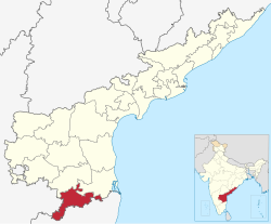 Location of Chittoor district in Andhra Pradesh | |
| Coordinates: 14°28′N 78°49′E | |
| Country | |
| State | |
| Region | Rayalaseema |
| Formed | 1 April 1911 |
| Headquarters | Chittoor |
| Largest City | Chittoor |
| Government | |
| • District collector | M. Harinarayan, Collector and District Magistrate |
| • Lok Sabha | Lok Sabha list |
| • Assembly | Assembly list |
| Area | |
| • Total | 6,855 km2 (2,647 sq mi) |
| Population (2011)[2] | |
| • Total | 1,872,951 |
| • Sex ratio | 985 (females per 1,000 males) |
| Languages | |
| • Official | Telugu demographics_type2 = Literacy |
| Time zone | UTC+5:30 (IST) |
| Postal Index Number | 517xxx |
| Area codes | +91–8572 |
| ISO 3166 code | IN-AP |
| Vehicle registration | AP-03 (former) AP–39 (from 30 January 2019)[3] |
| Website | chittoor |

Etymology
The district derived its name from its headquarters Chittoor.[5]
History
After the Indian independence in 1947, Chittoor became a part of the erstwhile Madras state. The modern Chittoor District was formerly Arcot District, which was established by the British in the 19th century had Chittoor as its headquarters. On 1 April 1911, district was split into Chittoor District and North Arcot Districts.
Chittoor District was formed on 1 April 1911,[6] taking Chittoor, Palamaneru, Tirupati, from the then North Arcot District of Madras State and Madanapalle, Vayalpadu from Kadapa and Pileru, Punganur, Sri Kalahasti, Karvetinagar from Zamindari tahsils of the Chittoor district to form united Chittoor district. In 1960, 319 villages in Chittoor district were added into Chingleput District now Kanchipuram district and Thiruvallur districts of Tamil Nadu and subsequently Sathyavedu and Kuppam of Chingleput District was transferred to Chittoor district on linguistic basis based on the Act called The Andhra Pradesh And Madras (Alteration Of Boundaries) Act, 1959.[7]
From 4 April 2022, Chittoor District is divided into 3 districts. The districts are Tirupati District, Annamayya District and Chittoor District.[citation needed]
Geography
Chittoor is a part of Rayalaseema region of Andhra Pradesh.[8] The district occupies an area of 6,855 square kilometres (2,647 sq mi).[9][10] The district is bounded by Annamayya district to the north, Krishnagiri District and Vellore District of Tamil Nadu state to the south, Tirupati District to the east, Chikballapur District and Kolar District of Karnataka state to the west. Chittoor District lies extreme south of the Andhra Pradesh state approximately between 12°37′ - 14°8′ north latitudes and 78°3′ - 79°55′ east longitudes. Thirty percent of the total land area is covered by forests in the district.[11] Mango and tamarind groves surround the city of Chittoor, and cattle are raised in the district. The soils in the district constitute red loamy 57%, red sandy 34% and the remaining 9% is covered by black clay black loamy, black sandy and red clay[11] Chittoor is 160 km from Chennai, 180 km from Bangalore and 590 km from Hyderabad.[citation needed]
Hydrology and climate
The important rivers in the district are Ponnai and Swarnamukhi rivers which originate in the Eastern Ghats. Other rivers include Kusasthali, Beema, Bahuda, Pincha, Kalyani, Araniyar and Pedderu. None of the rivers are perennial. Main rivers include Swarnamukhi, Kalangi, Papaghni, Koundinya, Pileru, Arani, Pinchcha, Cheyyeru, Neeva and Kusasthali. The district has a very short coastline, bordered by the Bay of Bengal. The temperature in the western parts of the district like Punganur, Madanapalle, Horsley Hills are relatively lower than the eastern parts of the Chittoor District. This is because of the higher altitude of the western parts compared to the eastern parts. The summer temperatures touches 44 °C in the eastern parts whereas in the western parts it ranges around 36° to 38 °C. Similarly the winter temperatures of the western parts are relatively low ranging around 12 °C to 14 °C and in eastern parts it is 16 °C to 18 °C. Most of a district has a Tropical wet and dry climate, with some north-western parts having Hot semi-arid climate.[12]
Chittoor district receives an annual rainfall of 918.1 mm. The South West Monsoon and North East Monsoon are the major sources of rainfall for the district. On average the district receives 438.0 mm of rainfall through the South West Monsoon (From June to September) and 396.0 mm from North East Monsoon (From October to December). The rainfall received by the district in the years 2002 and 2003 are 984.2 mm and 934 mm respectively.[13]
Demographics
According to the 2011 census, Chittoor district has a population of 4,174,064.[14][15][16] This gives it a ranking of 47th in India (out of a total of 640) and 6th in its state.[14] The district has a population density of 275 inhabitants per square kilometre (710/sq mi).[14] Its population growth rate over the decade 2001–2011 was 11.33%.[14] Chittoor has a sex ratio of 1002 females for every 1000 males, and a literacy rate of 72.36%.[14] After bifurcation, the district had a population of 18,72,951. Scheduled Castes and Scheduled Tribes made up 3,94,327 (21.05%) and 51,574 (2.75%) of the population respectively.[2]: 82–87
In 2007–2008 the International Institute for Population Sciences interviewed 1010 households in 38 villages across the district.[17] They found that 92.7% had access to electricity, 99.6% had drinking water, 33.3% toilet facilities, and 53.8% lived in a pucca (permanent) home.[17] 29.3% of girls wed before the legal age of 18[18] and 88.2% of interviewees carried a BPL card.[17]
At the time of the 2011 census, 73.23% of the population spoke Telugu, 16.75% Tamil and 8.72% Urdu as their first language.[20]
Telugu is the primary official language of the district along with English. Tamil is widely spoken in the border areas, especially in Kuppam.[21]
| Year | Pop. | ±% p.a. |
|---|---|---|
| 1901 | 1,118,706 | — |
| 1911 | 1,171,614 | +0.46% |
| 1921 | 1,203,748 | +0.27% |
| 1931 | 1,324,770 | +0.96% |
| 1941 | 1,490,095 | +1.18% |
| 1951 | 1,657,560 | +1.07% |
| 1961 | 1,905,344 | +1.40% |
| 1971 | 2,267,413 | +1.75% |
| 1981 | 2,737,316 | +1.90% |
| 1991 | 3,261,118 | +1.77% |
| 2001 | 3,745,875 | +1.40% |
| 2011 | 4,174,064 | +1.09% |
| source:[22] | ||
Administrative Divisions

The district is divided into 4 revenue divisions which are Nagari, Chittoor, Palamaneru and Kuppam.[23][24] Each revenue division is divided into mandals. The district has 31 mandals under these 4 revenue divisions.[25] There are 1 Municipal Corporations of Chittoor and 4municipalities of Kuppam, Punganur, Palamaner and Nagari in the district.[1]
| No | Chittoor Division | Kuppam division | Palamaner Division | Nagari Division |
|---|---|---|---|---|
| 1 | Chittoor | Kuppam | Palamaner | Nagari |
| 2 | Gudipala | Santhipuram | Gangavaram | Nindra |
| 3 | Gangadhara Nellore | Gudupalle | Peddapanjani | Vijayapuram |
| 4 | Yadamari | Ramakuppam | Somala | Karvetinagar |
| 5 | Irala | Chowdepalle | Palasamudram | |
| 6 | Puthalapattu | Punganur | ||
| 7 | Penumuru | Bangarupalyam | ||
| 8 | Thavanampalle | Sodam | ||
| 9 | Pulicherla | Baireddipalle | ||
| 10 | Rompicherla | Venkatagirikota | ||
| 11 | Srirangarajapuram | |||
| 12 | Vedurukuppam |
Before formation of Mandal System, Administration was done through Talukas System. Here are the Previous Talukas in the district.
| S.No. | Erstwhile Talukas | New talukas formed in 1978 | New Mandals formed in 1985 |
|---|---|---|---|
| 1 | Chittoor | Chittoor | Chittoor, Yadamarri, Gudipala, Gangadhara Nellore, Penumuru, Puthalapattu |
| 2 | Bangarupalem | Bangarupalem | Bangarupalem, Thavanampalle, Irala |
| 3 | Pileru | Pileru | Pileru, Yerravaripalem, Rompicherla, Chinnagottigallu,Sodam |
| 4 | Palamaner | Palamaner | Palamaneru, Venkatagirikota, Baireddipalle, Gangavaram, Ramakuppam [part] |
| 5 | Kuppam | Kuppam | Kuppam, Santhipuram, Gudupalle, Ramakuppam [part] |
| 6 | Punganur | Punganur | Punganur, Peddapanjani, Ramasamudhram, Somala, Chowdepalle, |
| 7 | Nagari [15] | Nagari, Nindra, Vijayapuram |
Politics
There are two Parliamentary & seven assembly constituencies located in this district.
The Parliamentary constituencies are Chittoor (Lok Sabha constituency), Rajampet Lok Sabha constituency.
The assembly constituency are:[26]
| Constituency number | Name | Reserved for (SC/ST/None) |
Parliament |
|---|---|---|---|
| 165 | Punganur | None | Rajampet Lok Sabha constituency |
| 170 | Nagari | None | Chittoor Lok Sabha constituency |
| 171 | Gangadhara Nellore | SC | Chittoor Lok Sabha constituency |
| 172 | Chittoor | None | Chittoor Lok Sabha constituency |
| 173 | Puthalapattu | SC | Chittoor Lok Sabha constituency |
| 174 | Palamaner | None | Chittoor Lok Sabha constituency |
| 175 | Kuppam | None | Chittoor Lok Sabha constituency |
Towns in district
Largest cities or towns in Chittoor District As per the 2011 Census | |||||||||
|---|---|---|---|---|---|---|---|---|---|
| Rank | Division | Pop. | |||||||
 Chittoor |
1 | Chittoor | Chittoor Division | 175,647 | |||||
| 2 | [[Nagari]] | Nagari Division | 96,152 | ||||||
| 3 | Punganur | Palamaner Division | 57,468 | ||||||
| 4 | Palamaneru | Palamaner Division | 54,035 | ||||||
| 5 | Kuppam | Kuppam Division | 39,000 | ||||||
| 6 | [[{{{city_6}}}]] | [[{{{div_6}}}]] | {{{pop_6}}} | ||||||
| 7 | [[{{{city_7}}}]] | [[{{{div_7}}}]] | {{{pop_7}}} | ||||||
| 8 | [[{{{city_8}}}]] | [[{{{div_8}}}]] | {{{pop_8}}} | ||||||
| 9 | [[{{{city_9}}}]] | [[{{{div_9}}}]] | {{{pop_9}}} | ||||||
| 10 | [[{{{city_10}}}]] | [[{{{div_10}}}]] | {{{pop_10}}} | ||||||
| S.No. | City / Town | Civic Status of Town | Municipality
Formation Year |
No. of
Wards |
2011 Census
Population |
2001 Census
Population |
1991 Census
Population |
1981 Census
Population |
1971 Census
Population |
1961 Census
Population |
1951 Census
Population |
|---|---|---|---|---|---|---|---|---|---|---|---|
| 1 | Chittoor | Municipal Corporation | 1917 | 50 | 175,647 | 152,654 | 133,462 | 86,230 | 63,035 | 47,876 | 38,894 |
| 2 | Nagari | Municipality Grade 3 | 2005 | 29 | 62,253 | 24,372 | 20,485 | 12,996 | 9,360 | 8,012 | 6,567 |
| 3 | Punganur | Municipality Grade 2 | 1985 | 31 | 57,468 | 44,314 | 33,882 | 25,562 | 18,207 | 13,806 | 11,280 |
| 4 | Palamaneru | Municipality Grade 3 | 2005 | 26 | 54,035 | 43,215 | 35,531 | 24,038 | 13,652 | 9,865 | 6,884 |
| 5 | Kuppam | Municipality Grade 3 | 2020 | 25 | 39,000 | 18,858 | 16,138 | 13,649 | 10,813 | 9,272 | 6,516 |
Source for Above Population
https://censusindia.gov.in/2011census/dchb/2823_PART_A_DCHB_CHITTOOR.pdf
Economy

The Gross District Domestic Product (GDDP) of the district is ₹34,742 crore (US$4.4 billion) and it contributes 6.6% to the Gross State Domestic Product (GSDP). For the FY 2013–14, the per capita income at current prices was ₹64,671 (US$810). The primary, secondary and tertiary sectors of the district contribute ₹8,226 crore (US$1.0 billion), and ₹18,849 crore (US$2.4 billion) respectively.[27] The major products contributing to the GVA of the district from agriculture and allied services are, sugarcane, groundnut, tomato, mango, milk, meat and fisheries. The GVA to the industrial and service sector is contributed from construction, electricity, manufacturing, education and ownership of dwellings.[27]
In 2006 the Indian government named Chittoor one of the country's 250 most backward districts (out of a total of 640).[28] It is one of the thirteen districts in Andhra Pradesh currently receiving funds from the Backward Regions Grant Fund Programme (BRGF).[28]
Notable people
- Mumtaz Ali, philosopher and educationist
- M. A. Ayyangar, first deputy speaker and second Speaker of Lok Sabha
- Bhuvaneswari (actress), film actress
- Jiddu Krishnamurti, philosopher
- Bindu Madhavi, film actress
- V. Nagayya, film actor
- D. K. Adikesavulu Naidu, Member of Parliament
- Gali Muddu Krishnama Naidu, politician
- N. Chandrababu Naidu, Chief Minister of United Andhra Pradesh (1995–2004), and first Chief Minister of Residual State Of Andhra Pradesh (2014–2019)
- Rama Prabha, actress
- Madhurantakam Rajaram, writer, Sahitya Akademi Award winner
- Shobha Raju, musician, devotional singer, writer and composer, an exponent of sankirtana of the gospel of the 15th-century saint-composer, Annamacharya
- Cattamanchi Ramalinga Reddy, educationist and political thinker, essayist and economist, poet and literary critic
- Sir C.R. Reddy, educationalist, founder and vice-chancellor of Andhra University
- P. Chinnamma Reddy, politician
- N. Kiran Kumar Reddy, former Chief Minister of Andhra Pradesh (2010–2014)
- Pratap C Reddy, founder of Apollo Hospitals
- Raj Reddy, Computer Scientist and winner of Turing Award
- Roja Selvamani, actress
- Saptagiri (actor), Telugu film actor
- Shafi (actor), film actor
Transport
The district has road connectivity by means of national and state highways. The main part of the National Highways runs through Chittoor City National Highway 69 and National Highway 40 that connects the main metro cities of South India from Bangalore to Chennai. NH 716 connecting Chennai in Tamil Nadu passes through the district.[29] The total road length of state highways in the district is 1,103 km (685 mi).[30]
Education
The primary and secondary school education is imparted by government, aided and private schools, under the School Education Department of the state.[31][32] As per the school information report for the academic year 2015–16, there are a total of 6,100 schools. They include, 45 government, 4,507 mandal and zilla parishads, 2 residential, 1,268 private, 17 model, 20 Kasturba Gandhi Balika Vidyalaya (KGBV), 158 municipal and 84 other types of schools.[33] The total number of students enrolled in primary, upper primary and high schools of the district are 562,504.[34] Chittoor district is home to the National Atmospheric Research Laboratory (NARL) of the Department of Space. The lab is involved in carrying out fundamental and applied research in Atmospheric and Space Sciences. It also has Dravidian University, Government Intermediate, Degree and Polytechnic Colleges.[citation needed]
Temples
There are forty-three temples under the management of Endowments Department[35]
See also
References
- "District Census Handbook – Chittoor" (PDF). Census of India. p. 19,21,58. Retrieved 29 January 2016.
- "District Census Hand Book - Chittoor" (PDF). Census of India. Registrar General and Census Commissioner of India.
- "New 'AP 39' code to register vehicles in Andhra Pradesh launched". The New Indian Express. Vijayawada. 31 January 2019. Archived from the original on 21 November 2020. Retrieved 9 June 2019.
- "Census of India 2011" (PDF). censusindia.gov.in.
- Biju, M.R., ed. (2009). Democratic political process. New Delhi, India: Mittal Publications. p. 235. ISBN 978-81-8324-237-0. Retrieved 17 November 2015.
- Umashanker, K. (2 April 2022). "Chittoor celebrates its last birthday in silence". The Hindu. ISSN 0971-751X. Retrieved 6 April 2022.
- "The Andhra Pradesh And Madras (Alteration Of Boundaries) Act, 1959". indiankanoon.org. Retrieved 23 December 2019.
- "The District Of Seven Hills – Tirumala". Archived from the original on 21 June 2012.
- Srivastava, Dayawanti; et al., eds. (2010). "States and Union Territories: Andhra Pradesh: Government". India 2010: A Reference Annual (54th ed.). New Delhi, India: Additional Director General, Publications Division, Ministry of Information and Broadcasting (India), Government of India. pp. 1111–1112. ISBN 978-81-230-1617-7.
- "Island Directory Tables: Islands by Land Area". United Nations Environment Program. 18 February 1998. Archived from the original on 8 February 2021. Retrieved 11 October 2011.
Nordaustlandet 14,467
- "National Informatics Center, Chittoor". Chittoor.nic.in. 28 June 2005. Archived from the original on 11 May 2012. Retrieved 4 November 2012.
- "Chittoor district". Atmachittoor.com. Archived from the original on 29 April 2012. Retrieved 4 November 2012.
- "Irrigation". Irrigation.cgg.gov.in. Archived from the original on 9 August 2008. Retrieved 4 November 2012.
- "District Census 2011". Census2011.co.in. 2011. Retrieved 30 September 2011.
- US Directorate of Intelligence. "Country Comparison:Population". Archived from the original on 13 June 2007. Retrieved 1 October 2011.
Lebanon 4,143,101 July 2011 est.
- "2010 Resident Population Data". U. S. Census Bureau. Archived from the original on 19 October 2013. Retrieved 30 September 2011.
Kentucky 4,339,367
- "District Level Household and Facility Survey (DLHS-3), 2007-08: India. Andhra Pradesh" (PDF). International Institute for Population Sciences and Ministry of Health and Family Welfare. 2010. Archived (PDF) from the original on 27 March 2021. Retrieved 3 October 2011.
- "How Do I? : Obtain Marriage Certificate". National Portal Content Management Team, National Informatics Centre. 2005. Retrieved 3 October 2011.
To be eligible for marriage, the minimum age limit is 21 for males and 18 for females.
- "Population by Religion - Andhra Pradesh". censusindia.gov.in. Office of the Registrar General & Census Commissioner, India. 2011.
- "Table C-16 Population by Mother Tongue: Andhra Pradesh". Census of India. Registrar General and Census Commissioner of India.
- Dr. Chigicherla Thirupal Reddy. "Multilingualism in Chittoor district of Andhra Pradesh". International Research journal of Management Sociology & Humanities.
- Decadal Variation In Population Since 1901
- "Industrial Profile – Chittoor District" (PDF). Commissionerate of Industries – Government of Andhra Pradesh. p. 4. Archived from the original (PDF) on 21 April 2015. Retrieved 15 June 2015.
- "New AP Map: Check Out Biggest and Smallest Districts in Andhra Pradesh". Sakshi Post. 3 April 2022. Retrieved 3 May 2022.
- "Mandals in Chittoor district". AP State Portal. Archived from the original on 24 December 2014. Retrieved 24 May 2014.
- "Delimitation of Parliamentary and Assembly Constituencies Order, 2008" (PDF). The Election Commission of India. p. 32.
- "Economy of Chittoor District". Andhra Pradesh Economic Development Board. Retrieved 25 April 2017.
- Ministry of Panchayati Raj (8 September 2009). "A Note on the Backward Regions Grant Fund Programme" (PDF). National Institute of Rural Development. Archived from the original (PDF) on 5 April 2012. Retrieved 27 September 2011.
- "List of National Highways passing through A.P. State". Roads and Buildings Department. Government of Andhra Pradesh. Archived from the original on 28 March 2016. Retrieved 11 February 2016.
- "Existing State Highways" (PDF). Andhra Pradesh Road Development Corporation. Government of Andhra Pradesh. p. 1. Archived from the original (PDF) on 20 September 2018. Retrieved 11 May 2019.
- "School Education Department" (PDF). School Education Department, Government of Andhra Pradesh. Archived from the original (PDF) on 27 December 2015. Retrieved 7 November 2016.
- "The Department of School Education – Official AP State Government Portal". www.ap.gov.in. Archived from the original on 7 November 2016. Retrieved 7 November 2016.
- "School Information Report". Commissionerate of School Education. Government of Andhra Pradesh. Archived from the original on 8 November 2016. Retrieved 8 November 2016.
- "Student Information Report". Commissionerate of School Education. Child info 2015–16, District School Education – Andhra Pradesh. Archived from the original on 22 May 2015. Retrieved 8 November 2016.
- "Trust Boards Abstract". AP Temples Portal, Government of Andhra Pradesh. Retrieved 24 July 2018.
External links
Places adjacent to Chittoor district | ||||||||||||||||
|---|---|---|---|---|---|---|---|---|---|---|---|---|---|---|---|---|
| ||||||||||||||||
Capital: Amaravati | |||
| Topics |
| ||
| Regions | |||
| Districts |
| ||
| Million-plus cities | |||
| Cities (population over 1 lakh) |
| ||
| Tourism |
| ||
| History |
| ||
| Related lists |
| ||
| |||
Authority control | |
|---|---|
| General |
|
| National libraries | |
На других языках
[de] Chittoor (Distrikt)
Der Distrikt Chittoor (Telugu: చిత్తూరు జిల్లా) ist einer von 13 Distrikten des indischen Bundesstaates Andhra Pradesh. Der Verwaltungssitz ist die Stadt Chittoor.- [en] Chittoor district
[ru] Читтур (округ)
Читтур (телугу చిత్తూరు జిల్లా; англ. Chittoor) — округ на юге индийского штата Андхра-Прадеш. Образован в 1911 году. Административный центр — город Читтур. Площадь округа — 15 151 км². По данным всеиндийской переписи 2001 года население округа составляло 3 745 875 человек. Уровень грамотности взрослого населения составлял 66,8 %, что выше среднеиндийского уровня (59,5 %). Доля городского населения составляла 21,7 %. На территории округа расположены популярные места паломничества индуизма Тирупати и Шрикалахасти.Другой контент может иметь иную лицензию. Перед использованием материалов сайта WikiSort.org внимательно изучите правила лицензирования конкретных элементов наполнения сайта.
WikiSort.org - проект по пересортировке и дополнению контента Википедии