world.wikisort.org - India
Vizianagaram district is one of the six districts in the Uttarandhra region of the Indian state of Andhra Pradesh with its headquarters located at Vizianagaram.[4][5] The district is bounded on the east by the district of Srikakulam, north by Parvathipuram Manyam southeast by Visakhapatnam, south by Anakapalli, southeast by the Bay of Bengal, and northwest by the state of Odisha. It was formed on 1 June 1979, with some parts carved from the neighbouring districts of Srikakulam and Visakhapatnam.[6] The district is named after the princely state of Vizianagaram (Vijaya means victory and Nagaram means city in Telugu). It is the least populous district in Andhra Pradesh.[7]

This article uses bare URLs, which are uninformative and vulnerable to link rot. (August 2022) |
Vizianagaram district | |
|---|---|
District of Andhra Pradesh | |
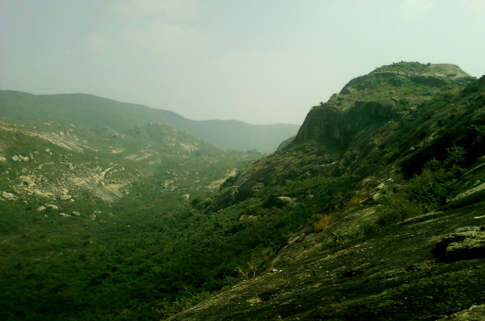
     Clockwise from top-left: Vizianagaram Fort gate, Jayathi Kalinga Temples, Bodhikonda Jain caves at Ramateertham, Eastern Ghats near Sontivanipalem village, Dibbeshwara Temple | |
 | |
| Country | |
| State | |
| Region | Uttarandhra |
| Headquarters | Vizianagaram |
| Mandals | 34[1] |
| Government | |
| • District collector | A. Surya Kumari |
| • Lok Sabha constituencies | Vizianagaram, Vishakapatnam |
| • Assembly constituencies | 07 |
| Area | |
| • Total | 4,122 km2 (1,592 sq mi) |
| Population (2011)[2] | |
| • Total | 1,930,811 |
| • Density | 470/km2 (1,200/sq mi) |
| • Urban | 20.94% |
| Demographics | |
| • Literacy | 59.49% |
| • Sex ratio | 1016 |
| Vehicle registration | AP-35 (former) AP–39 (from 30 January 2019)[3] |
| Major highways | NH-16 |
| Coordinates | 18°12′N 83°24′E |
| Website | vizianagaram |

Vizianagaram district was formed on 1 June 1979, as per G.O.Ms.No.700/Revenue (U) Department, dated 15 May 1979 with some parts carved from the neighbouring districts of Srikakulam and Visakhapatnam. The Taluks of Vizianagaram, Gajapathinagaram, Srungavarapukota and a portion of Bheemunipatnam Taluk were transferred from the Visakhapatnam District. The Salur, Bobbili, Parvathipuram and Cheepurupalli Taluks from Srikakulam district were transferred to the new district.
The district is a part of the Red Corridor.[8]
Geography

It is situated within the geographical co-ordinates of 17- 15’ and 19 – 15’ of the northern latitudes and 83 – 00’ and 83 – 45’ of the eastern longitudes. Vizianagaram district occupies an area of 4,122 square kilometres (1,592 sq mi).[9]
The principal rivers flowing in the district are River Nagavali, Suvarnamukhi, Vegavathi, River Champavathi, River Gosthani and Kandivalasa. There are no major irrigation projects in the district. The Denkada Anicut, Thatipudi Reservoir, Andra Reservoir Project, Vegavathi Anicut, Surapadu Anicut, Seethanagaram Anicut, Peda Ankalam Anicut, Vottigedda Reservoir Project, Paradi Anikut, Thotapalli Regulator and Vengala Raya Sagaram Project are the medium irrigation projects.[10] The total irrigated area under these projects and the other minor projects is about 285,077 acres (1,154 km2). Jhanjavati Project[11]
Climate
The climate of Vizianagaram district is characterised by high humidity nearly all-round the year with oppressive summer and good seasonal rainfall. The maximum temperature recorded during 2004 is 39.6O C during May and the minimum temperature is 17.1O C during December.I n 2020 the maximum is 40.1 °C the minimum is 19.11OnormalC
The normal rainfall of the district for the year is 1,131.0 MM as against the actual rainfall of 740.6 MM received during 2002–03. The district gets the benefit of both the South ?West and North- East monsoon.
The average maximum and minimum temperatures and average rainfall recorded in 2004 at Agricultural Research Station, Vizianagaram are given below:
| Climate data for Vizianagaram | |||||||||||||
|---|---|---|---|---|---|---|---|---|---|---|---|---|---|
| Month | Jan | Feb | Mar | Apr | May | Jun | Jul | Aug | Sep | Oct | Nov | Dec | Year |
| Average high °C (°F) | 38.7 (101.7) |
31.3 (88.3) |
36.2 (97.2) |
37.2 (99.0) |
39.0 (102.2) |
35.1 (95.2) |
32.9 (91.2) |
32.8 (91.0) |
33.3 (91.9) |
31.9 (89.4) |
30.2 (86.4) |
29.8 (85.6) |
34.0 (93.3) |
| Average low °C (°F) | 18.2 (64.8) |
19.1 (66.4) |
23.2 (73.8) |
26.1 (79.0) |
27.0 (80.6) |
26.8 (80.2) |
25.7 (78.3) |
26.3 (79.3) |
25.7 (78.3) |
22.8 (73.0) |
19.5 (67.1) |
17.1 (62.8) |
23.1 (73.6) |
| Average precipitation mm (inches) | 13.5 (0.53) |
1.2 (0.05) |
14.0 (0.55) |
27.1 (1.07) |
54.8 (2.16) |
183.2 (7.21) |
256.1 (10.08) |
105.2 (4.14) |
92.5 (3.64) |
141.8 (5.58) |
30.2 (1.19) |
0.0 (0.0) |
919.6 (36.2) |
| Source: [12] | |||||||||||||
Demographics
| Year | Pop. | ±% p.a. |
|---|---|---|
| 1901 | 929,913 | — |
| 1911 | 976,938 | +0.49% |
| 1921 | 987,532 | +0.11% |
| 1931 | 1,085,952 | +0.95% |
| 1941 | 1,198,241 | +0.99% |
| 1951 | 1,306,389 | +0.87% |
| 1961 | 1,411,055 | +0.77% |
| 1971 | 1,589,558 | +1.20% |
| 1981 | 1,804,196 | +1.27% |
| 1991 | 2,110,943 | +1.58% |
| 2001 | 2,249,254 | +0.64% |
| 2011 | 2,344,474 | +0.42% |
| source:[13] | ||
According to the 2011 census, Vizianagaram district has a population of 2,344,474.[14] This gives it a ranking of 193rd in India (out of a total of 640).[7] The district has a population density of 358 inhabitants per square kilometre (930/sq mi). Its population growth rate over the decade 2001–2011 was 4.16%. Vizianagaram has a sex ratio of 1016 females for every 1000 males, and a literacy rate of 59.49%.[7][15]
The district had a population of 9,58,778 in 1901. The total population of district increased to 22,49,254 as per 2001 census. They consists of 11,19,541 males and 11,29,713 females. There are 1009 females per 1000 males in the district. The total area is 6,539 square kilometres. The population density is 344 inhabitants per square kilometre (890/sq mi). The increase in population during the decennium from 1991 to 2001 is 6.55 percent for the district as against 14.6 percent for the Andhra Pradesh State. The Scheduled Caste population is 2,38,023 and Scheduled Tribe population is 2,14,839 which comes to 10.58% and 9.55% respectively to the total population of the district.
The rural population of the district is 18.37 lakhs which comes to 82% of the total population and the urban population is 4.12 lakhs which comes to 18% of the total population. Vizianagaram Town with a population of 1,95,801 is the only Class-I town in the district. There are twelve towns in the district; Vizianagaram, Cheepurupalli, Gajularega, Kanapaka, Bobbili, Parvathipuram, Salur, Sriramnagar, Nellimarla, Kothavalasa, Chintalavalasa, Jarjapupeta and Gajapathinagaram. All the towns are in plain areas of the district.
After bifurcation, the district had a population of 19,30,811. Scheduled Castes and Scheduled Tribes made up 2,07,333 (10.74%) and 46,884 (2.43%) of the population respectively.[2]: 83–88 Telugu was the predominant language, spoken by 98.76% of the population.[17]
Household indicators
In 2007–2008, the International Institute for Population Sciences interviewed 1232 households in 41 villages across the district.[18] They found that 78.7% had access to electricity, 84.1% had drinking water, 18.5% toilet facilities, and 33.9% lived in a pucca (permanent) home.[18] 28.6% of girls wed before the legal age of 18 and 87.3% of interviewees carried a BPL card.[18]
Economy
In 2006, the Indian government named Vizianagaram one of the country's 250 most backward districts (out of a total of 640).[19] It is one of the thirteen districts in Andhra Pradesh currently receiving funds from the Backward Regions Grant Fund Programme (BRGF).[19]
The Gross District Domestic Product (GDDP) of the district is ₹18,382 crore (US$2.3 billion) and it contributes 3.5% to the Gross State Domestic Product (GSDP). For the FY 2013–14, the per capita income at current prices was ₹61,157 (US$770). The primary, secondary and tertiary sectors of the district contribute ₹4,961 crore (US$620 million), ₹3,148 crore (US$390 million) and ₹10,272 crore (US$1.3 billion) respectively.[20] The major products contributing to the GVA of the district from agriculture and allied services are, sugarcane, paddy, mango, tomato, milk, meat and fisheries. The GVA to the industrial and service sector is contributed from construction, manufacturing, minor minerals, education and ownership of dwellings.[20]
Industry

Certain famous industries include
- The Ferro Alloys Corporation Limited[21] at Sriramnagar, Garividi
- Jindal Stainless Limited (Ferro Alloys Division), Kothavalasa.[22]
- Andhra Ferro Alloys Limited at Kothavalasa and Garbham[23]
Notable people
- Kodi Rammurthy Naidu, Indian bodybuilder
- P. Susheela, singer
- Maharajkumar of Vizianagram, Indian cricketer, cricket administrator and politician
- Pusapati Vijayarama Gajapati Raju, Indian parliamentarian and philanthropist
- Praveen Sattaru, film director
- Vidyasagar (composer), music director
Administrative divisions
Mandals
The below table categorises 27 mandals into their respective revenue divisions in the district:[24][25]
Parliament segment
Vizianagaram (Lok Sabha constituency), Visakhapatnam (Lok Sabha constituency)
Assembly segments
The Six Assembly segments of Vizianagaram Lok Sabha and One Assembly segment in Vizak Lok Sabha constituency are:[26]
| Constituency number | Name | Reserved for (SC/ST/None) | Parliament |
|---|---|---|---|
| 9 | Rajam | SC | Vizianagaram (Lok Sabha constituency) |
| 14 | Bobbili | None | Vizianagaram (Lok Sabha constituency) |
| 15 | Cheepurupalli | None | Vizianagaram (Lok Sabha constituency) |
| 16 | Gajapathinagaram | None | Vizianagaram (Lok Sabha constituency) |
| 17 | Nellimarla | None | Vizianagaram (Lok Sabha constituency) |
| 18 | Vizianagaram | None | Vizianagaram (Lok Sabha constituency) |
| 19 | Srungavarapukota | None | Visakhapatnam (Lok Sabha constituency) |
Politics
There are 7 assembly 2 parliamentary constituencies in Vizianagaram district. The parliamentary constituencies includes Visakhapatnam, Vizianagaram . The assembly constituencies[27] in Vizianagaram district are Bobbili, Cheepurupalli, Rajam, Srungavarapukota, Gajapathinagaram, Nellimarla and Vizianagaram. There are 3 revenue divisions, 26 Mandals, 935 Panchayats and 1,551 revenue villages in Vizianagaram district.[28] The revenue divisions are Parvathipuram and Vizianagaram. Vizianagaram parliamentary constituency is represented by the Former Union Civil Aviation Minister Pusapati Ashok Gajapathi Raju.
Towns in District
Largest cities or towns in Vizianagaram District As per the 2011 Census | |||||||||
|---|---|---|---|---|---|---|---|---|---|
| Rank | Division | Pop. | |||||||
 Vizianagaram  Bobbili |
1 | Vizianagaram | Vizianagaram Division | 2,28,720 |  Parvathipuram  Salur | ||||
| 2 | Bobbili | Parvathipuram Division | 56,819 | ||||||
| 3 | Parvathipuram | Parvathipuram Division | 53,844 | ||||||
| 4 | Salur | Parvathipuram Division | 49,500 | ||||||
| 5 | S.Kota | Vizianagaram Division | 28,304 | ||||||
| 6 | Nellimarla | Vizianagaram Division | 26,259 | ||||||
| 7 | Kottavalasa | Vizianagaram Division | 20,232 | ||||||
| 8 | Garividi | Vizianagaram Division | 18,893 | ||||||
| 9 | Cheepurupalle | Vizianagaram Division | 14,487 | ||||||
| 10 | Bhogapuram | Vizianagaram Division | 9,341 | ||||||
Municipalities in District[29][30][31]
| S.no. | City/Town | Civic Status
of Town |
No. of
Wards |
Municipality
Formation Year |
2011 Census
Population |
2001 Census
Population |
1991 Census
Population |
1981 Census
Population |
1971 Census
Population |
1961 Census
Population |
1951 Census
Population |
|---|---|---|---|---|---|---|---|---|---|---|---|
| 1 | Vizianagarm | Municipal Corporation | 50 | 1888 | 2,28,720 | 1,76,023 | 1,77,022 | 1,29,170 | 99,004 | 76,808 | 67,104 |
| 2 | Bobbili | Municipality Grade - 2 | 31 | 1956 | 56,819 | 50,096 | 43,249 | 36,239 | 30,649 | 25,592 | 23,102 |
| 3 | Nellimarla | Nagar Panchayat | 20 | 2013 | 26,259 | - | - | - | - | - | - |
Culture

The predominant religion is Hinduism. The major festivals are Sankranthi, Ugadi and Rama Navami, Maha Shivaratri, Deepavali, Vinayaka Chavithi, Dasara and Vijayadasami. The nine-day festival celebrations during Rama Navami and Ganesh Chaturthi are very popular in many towns and associated with many cultural events including Stage Dramas, Harikathas, Burra kathas etc. Festivals of Gramadevatha are held annually at Vizianagaram, Bobbili, Salur, Parvathipuram and Sambara with much fanfare. The most popular amongst them is Pydithalli Ammavari Jatra, celebrated at Vizianagaram on the next Tuesday of Vijayadasami day. And also Polamma Jatara, at Sambara in Sambara Village of Makkuva Mandal is a Very much state known famous festival being celebrated in every third week of January. This is a very renowned festival for north andhra people.
The cuisine is strikingly South Indian style with Rice as the staple food accompanied by Dals, Rasam or Sambar, Vegetable Curries, Pickles and Curd.
Transport

The total road length of state highways in the district is 777 km (483 mi).[32] Andhra Pradesh State Road Transport Corporation runs bus services to all the major cities and towns of the state from the district. Major railway stations in the district include Amudalavalasa, Srikakulam Road, Palasa etc. Railway network in the entire district comes under Waltair (Vishakapatnam) division of the South Coast Railway zone. Vizianagaram and Kothavalasa are the main railway junctions. There are 28 railway stations in the district.
National Highways 5 and 43 passes through the district and covers a distance of 200 kilometres. National Highway 43 (India) runs almost entirely in Vizianagaram district for a distance of 83 kilometres and passes through Odisha to Raipur in Chhattisgarh (total length of 551 kilometres). It passes through Vizianagaram, Gajapathinagaram, Ramabhadrapuram and Salur towns. National Highway 5 passes through coastal mandals of Bhogapuram and Pusapatirega. State Highways covers a distance of 122 kilometres, major district roads 852 kilometres and rural roads 781 kilometres.[33]
Tourism

Ramatheertham is a village panchayat in Nellimarla mandal of Vizianagaram district. It is located 12 km from Vizianagaram city.
Education
The primary and secondary school education is imparted by government, aided and private schools, under the School Education Department of the state.[34][35] As per the school information report for the academic year 2015–16, there are a total of 3,875 schools. They include, 85 government, 2,060 mandal and zilla parishads, 1 residential, 618 private, 16 model, 33 Kasturba Gandhi Balika Vidyalaya (KGBV), 112 municipal and 423 other types of schools.[36] The total number of students enrolled in primary, upper primary and high schools of the district are 307,298.[37]
Vizianagaram district has been comparatively backward in the field of education. The literacy rate is 51.82% as against the average of 61.55% for the entire Andhra Pradesh State.
There are 38 Branch Libraries in the district managed by Zilla Granthalaya Samstha. They are located 1–2 in each mandal. There are about 41 book depot centres in the district.
- University college of engineering, JNTU kakinada, vizianagaram. Vizianagaram.[38]
- Andhra University Vizianagaram Campus
- Avanthi Institute of Engineering and Technology, Cherukupalli, Bhogapuram.[39]
- Kodi Rama Murthy College of Physical Education, Bobbili.
- Maharajah's Government College of Music and Dance.
- Maharajah's Government Sanskrit College, Vizianagaram
- Maharaj Vijayaram Gajapath Raj College of Engineering, Vizianagaram.[40]
- St. Theressa Institute of Engineering and Technology, Garividi(Cheepurupalli).[41]
- Thandra Paparaya Institute of Science and Technology, Bobbili.[42]
- Maharajah's College
- Sainik School Korukondda
Temples
There are eleven temples under the management of Endowments Department.[43]
| S.no | Temple | Mandal | Village |
| 1 | Sri Yellaramma Ammavari Temple | Jami | Jami |
| 2 | Sri Ganapathi etc. Temples | Pusapatirega | Kumili |
| 3 | Sri Parammathalli Ammavari Temple | Pachipenta | Pachipenta |
| 4 | Sri Pydithalli Ammavari Temple | Bhoghapuram | Polipalle |
| 5 | Sri Venkateswara Swamy Temple | Salur | Salur |
| 6 | Sri Syamalamba Ammavari Temple | Salur | Salur |
| 7 | Sri Venu Gopala Swamy Temple | Salur | Salur |
| 8 | Sri Polamamba Ammavari Temple | Makkuva | Sambara |
| 9 | Sri Kotilingeswara Swamy Temple | Srungavarapukota | Srungavarapukota |
| 10 | Sri Mannar Rajagopala Swamy Temple | Vizianagaram | Vizianagaram |
| 11 | Sri Sanyaseswara Swamy Temple | Srungavarapukota | Dharmavaram |
| 12 | Sri Neelakanteswara Swamy Temple | Narayanapuram | Narayanapuram village, Balijipeta Mandal, Vizianagaram District |
See also
- List of villages in Vizianagaram district
References
- "District – Guntur". Andhra Pradesh Online Portal. Archived from the original on 28 April 2015. Retrieved 23 August 2014.
- "District Census Hand Book – Vizianagaram" (PDF). Census of India. Registrar General and Census Commissioner of India.
- "New 'AP 39' code to register vehicles in Andhra Pradesh launched". The New Indian Express. Vijayawada. 31 January 2019. Retrieved 9 June 2019.
- "Srikakulam | Andhra Pradesh | DISTRICTS OF INDIA". districts.nic.in. Retrieved 11 May 2019.
- "Population of AP districts(2011)" (PDF). ap.gov.in. p. 14. Archived from the original (PDF) on 12 November 2013. Retrieved 25 May 2014.
- Law, Gwillim (25 September 2011). "Districts of India". Statoids. Retrieved 11 October 2011.
- "District Census 2011". Census2011.co.in. 2011. Retrieved 30 September 2011.
- "83 districts under the Security Related Expenditure Scheme". IntelliBriefs. 11 December 2009. Retrieved 17 September 2011.
- Srivastava, Dayawanti et al. (ed.) (2010). "States and Union Territories: Andhra Pradesh: Government". India 2010: A Reference Annual (54th ed.). New Delhi, India: Additional Director General, Publications Division, Ministry of Information and Broadcasting (India), Government of India. pp. 1111–1112. ISBN 978-81-230-1617-7.
{{cite book}}:|last1=has generic name (help) - "Water Resources Information System". cgg.gov.in. Archived from the original on 28 September 2007. Retrieved 18 January 2007.
- "Rubber dam in focus at Arthur Cotton anniversary". The Hindu. 16 May 2006.
- Hand Book of Statistics, Vizianagaram district, 2004–2005, Compiled and Published by The Chief Planning Officer, Vizianagaram.
- Decadal Variation In Population Since 1901
- "Census 2011" (PDF). AP government portal. Archived from the original (PDF) on 14 July 2014. Retrieved 15 June 2014.
- "Census 2011". Official website of Viziznagaram district. Retrieved 12 May 2016.
- "Population by Religion - Andhra Pradesh". censusindia.gov.in. Office of the Registrar General & Census Commissioner, India. 2011.
- "Table C-16 Population by Mother Tongue: Andhra Pradesh". Census of India. Registrar General and Census Commissioner of India.
- "District Level Household and Facility Survey (DLHS-3), 2007-08: India. Andhra Pradesh" (PDF). International Institute for Population Sciences and Ministry of Health and Family Welfare. 2010. Retrieved 3 October 2011.
- Ministry of Panchayati Raj (8 September 2009). "A Note on the Backward Regions Grant Fund Programme" (PDF). National Institute of Rural Development. Archived from the original (PDF) on 5 April 2012. Retrieved 27 September 2011.
- "Economy of Vizianagaram District". Andhra Pradesh Economic Development Board. Retrieved 25 April 2017.
- "::.FACOR.::Ferro Alloys Corporation Ltd". facorgroup.in.
- http://www.jindalstainless.com/
- "Andhra Ferro Alloys Limited – Exporter of Ferro Alloy & Ferro Silico Manganese from Visakhapatnam". indiamart.com.
- "Divisions and Mandals | Vizianagaram District Website | India". Retrieved 21 April 2022.
- "New AP Map: Check Out Biggest and Smallest Districts in Andhra Pradesh". Sakshi Post. 3 April 2022. Retrieved 4 May 2022.
- "Delimitation of Parliamentary and Assembly Constituencies Order, 2008" (PDF). The Election Commission of India. 17 December 2018. p. 30. Archived from the original (PDF) on 3 October 2018. Retrieved 24 May 2019.
- District-wise Assembly constituencies in Andhra Pradesh
- "Mandals in Vizianagaram district". AP State Portal. Archived from the original on 3 March 2016. Retrieved 24 May 2014.
- "Municipal Corporations | Commissioner and Director of Municipal Administration". cdma.ap.gov.in. Retrieved 11 February 2022.
- "First Grade | Commissioner and Director of Municipal Administration". cdma.ap.gov.in. Retrieved 11 February 2022.
- "Nagarpanchayats | Commissioner and Director of Municipal Administration". cdma.ap.gov.in. Retrieved 11 February 2022.
- "Existing State Highways" (PDF). Andhra Pradesh Road Development Corporation. Government of Andhra Pradesh. p. 1. Archived from the original (PDF) on 20 September 2018. Retrieved 11 May 2019.
- A.P.Roads and Buildings Department
- "School Education Department" (PDF). School Education Department, Government of Andhra Pradesh. Archived from the original (PDF) on 27 December 2015. Retrieved 7 November 2016.
- "The Department of School Education – Official AP State Government Portal". www.ap.gov.in. Archived from the original on 7 November 2016. Retrieved 7 November 2016.
- "School Information Report". Commissionerate of School Education. Government of Andhra Pradesh. Archived from the original on 8 November 2016. Retrieved 8 November 2016.
- "Student Information Report". Commissionerate of School Education. Child info 2015–16, District School Education – Andhra Pradesh. Archived from the original on 22 May 2015. Retrieved 8 November 2016.
- http://jntukucev.ac.in/
- http://avanthienggcollege.ac.in/
- M.V.G.R.College of Engineering
- http://sttheressaengg.ac.in/ St. Theressa Institute of Engineering and Technology
- http://www.tpist.org/
- "Trust Boards Abstract". AP Temples Portal, Government of Andhra Pradesh. Retrieved 24 July 2018.
Further reading
- Handbook of Statistics-Vizianagaram district.2004-2005., Compiled and Published by The Chief Planning Officer, Vizianagaram.
External links
Places adjacent to Vizianagaram district | |
|---|---|
Capital: Amaravati | |||
| Topics |
| ||
| Regions | |||
| Districts |
| ||
| Million-plus cities | |||
| Cities (population over 1 lakh) |
| ||
| Tourism |
| ||
| History |
| ||
| Related lists |
| ||
| |||
| Rivers |
|      |
|---|---|---|
| Regions |
| |
| Hills |
| |
| Peaks | ||
| Waterfalls |
| |
| Parks & Reserves |
| |
| States | ||
Authority control | |
|---|---|
| General | |
| National libraries | |
На других языках
[de] Vizianagaram (Distrikt)
Vizianagaram, auch Vijayanagaram (Telugu: విజయనగరo జిల్లా) ist einer von 13 Distrikten des indischen Bundesstaats Andhra Pradesh. Der Verwaltungssitz ist die Stadt Vizianagaram.- [en] Vizianagaram district
[ru] Визианагарам (округ)
Визианагарам (телугу విజయనగరo జిల్లా; англ. Vizianagaram) или Виджаянагарам[источник не указан 1826 дней] (англ. Vijayanagaram) — округ на северо-востоке индийского штата Андхра-Прадеш. Образован 1 июня 1979 года из частей территорий округов Вишакхапатнам и Шрикакулам. Административный центр — город Визианагарам. Площадь округа — 6539 км². По данным всеиндийской переписи 2001 года население округа составляло 2 249 254 человека. Уровень грамотности взрослого населения составлял 51,1 %, что ниже среднеиндийского уровня (59,5 %). Доля городского населения составляла 18,3 %.Другой контент может иметь иную лицензию. Перед использованием материалов сайта WikiSort.org внимательно изучите правила лицензирования конкретных элементов наполнения сайта.
WikiSort.org - проект по пересортировке и дополнению контента Википедии