world.wikisort.org - India
Prakasam district is one of the thirteen districts in the coastal Andhra region of the Indian state of Andhra Pradesh. It was formed in 1970 and reorganised in 2022 on April 4. The headquarters of the district is Ongole. It is located on the western shore of Bay of Bengal and is bounded by Bapatla district and Palnadu districts on the north, Nandyal district on the west, Kadapa and Nellore districts on the south. A part of north west region also borders with Nagarkurnool district of Telangana.[4] It is the largest district in the state with an area of 14,322 km2 (5,530 sq mi) and had a population of 2,288,026 as per 2011 Census of India.[5]
Prakasam district | |
|---|---|
District of Andhra Pradesh | |
     Clockwise from top-left: Bhairavakona Cave temples, Chili drying in Dornapala, Amy Bowen Memorial Church in Donakonda, Beach in Pakala, Cumbum Lake | |
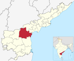 Location of Prakasam district in Andhra Pradesh | |
| Coordinates (Ongole): 15°20′N 79°33′E | |
| Country | |
| State | |
| Region | Coastal Andhra |
| Established | 1970 |
| Reorganized | 2022 |
| Named for | Tanguturi Prakasam |
| Headquarters | Ongole |
| Mandalas | 38 |
| Government | |
| • Collector | Sri.A S Dinesh Kumar, IAS[1] |
| • Superintendent of Police | Mallika Garg, ips |
| • Lok Sabha constituencies | Ongole,Bapatla |
| • Assembly constituencies | 08 |
| Area | |
| • Total | 14,322 km2 (5,530 sq mi) |
| Population (2011)[2] | |
| • Total | 2,288,026 |
| • Density | 160/km2 (410/sq mi) |
| • Urban | 19.44% |
| Demographics | |
| • Literacy | 63.53% |
| • Sex ratio | 981 |
| Vehicle registration | AP-27 (former) AP–39 (from 30 January 2019)[3] |
| Major highways | NH-16 |
| Website | prakasam |

Etymology
The district was named after the patriot and first Chief Minister of Andhra State Tanguturi Prakasam, also known as Andhra Kesari, who was born in the village of Vinodarayunipalem. It was accordingly renamed as Prakasam District in the year 1972.[6][citation needed]
History
Prakasam district was originally constituted on 2 February 1970, carved out of Guntur, Nellore and Kurnool districts of Andhra Pradesh.[7] It was carved out of three taluks of Guntur district, i.e. Addanki, Chirala, and Ongole, four taluks of Nellore district, i.e. Kandukur, Kanigiri, Darsi and Podili and three taluks of Kurnool district i.e. Markapur, Yarragondapalem and Giddaluru. It is one of the nine districts in the Coastal Andhra region of Andhra Pradesh.
Prakasam district used to be a part of the Red Corridor.[citation needed]
Geography
Prakasam district occupies an area of 17,626 square kilometres (6,805 sq mi),[5] comparatively equivalent to Indonesia's Seram Island.[8]
This district is bounded by Nagarkurnool district in Telangana state at North.And surrounded by South of SPSR Nellore district , West of Nandyal district ,East of Palnadu district and Bapatla district.And The Bay of Bengal held on Southeast of this district.[citation needed]
The only Municipal Corporation in Prakasam is Ongole. Some of the main towns in Prakasam district are Singarayakonda, Addanki, Inkollu, Markapur, Yerragondapalem, Podili, Darsi, Donakonda, Chirala, Kandukur, Pamuru, Parchur, Giddaluru, Dornala, Cumbum, Kanigiri, Chimakurthy and Martur. Markapur is India's main slate-manufacturing town and the home of the historic temple of Lord Chennakesava. Chimakurthi is known for its granite reserves. Dornala is also known as Diguva Srisailam, since it is very near the historic pilgrimage centre of Srisailam.[citation needed]
Cumbum lake also known as Gundalakamma lake built on Gundalakamma rivulet upon Nallamala hills is one of the oldest man made lakes of Asia. The anicut was built by the Vijayanagar princess Varadharaj Amma. The lake in its present form is about 7 km (4.3 mi) long and on average, about 3.5 km (2.2 mi) wide. As per the Imperial gazette of India at the turn of the 20th century, the height of the dam was 57 feet (17 m) and the drainage area was 1,100 km2 (420 sq mi). The direct irrigation land was about 10,300 acres (4,200 ha) in all. Cumbum lake is accessible both by the rail Guntur-Nandyal railway line and is situated about 108 km (67 mi) from Ongole. Although classified under the Coastal Andhra region, the district's western half has Rayalaseema like geography and climate, being somewhat arid.[citation needed]
Demographics
| Year | Pop. | ±% p.a. |
|---|---|---|
| 1901 | 975,037 | — |
| 1911 | 1,068,743 | +0.92% |
| 1921 | 1,117,701 | +0.45% |
| 1931 | 1,205,223 | +0.76% |
| 1941 | 1,343,883 | +1.09% |
| 1951 | 1,463,737 | +0.86% |
| 1961 | 1,671,726 | +1.34% |
| 1971 | 1,919,995 | +1.39% |
| 1981 | 2,329,571 | +1.95% |
| 1991 | 2,759,166 | +1.71% |
| 2001 | 3,059,423 | +1.04% |
| 2011 | 3,397,448 | +1.05% |
| source:[9] | ||
As of the 2011 census of India, the district had a population of 3,397,448 with a density of 193 persons per sq.km. The total population constitute, 17,14,764 males and 16,82,684 females –a ratio of 981 females per 1000 males. The total urban population is 664,582 (19.56%).[10]: 20 There are 19,04,435 literates with a literacy rate of 63.08%.[10]: 21 After bifurcation the district had a population of 22,88,026. Scheduled Castes and Scheduled Tribes make up 537,159 (23.48%) and 88,209 (3.86%) of the population respectively.[2]: 77–81
At the time of the 2011 census, 93.88% of the population spoke Telugu and 5.05% Urdu as their first language.[12]
Economy
The Gross District Domestic Product (GDDP) of the district is ₹35,962 crore (US$4.5 billion) and it contributes 6.9% to the Gross State Domestic Product (GSDP). For the FY 2013–14, the per capita income at current prices was ₹85,765 (US$1,100). The primary, secondary and tertiary sectors of the district contribute ₹12,875 crore (US$1.6 billion), ₹7,897 crore (US$990 million) and ₹15,190 crore (US$1.9 billion), respectively.[13] The major products contributing to the GVA of the district from agriculture and allied services are, tobacco, paddy, chillies, batavia, milk, meat and fisheries. The GVA to the industrial and service sector is contributed from construction, minor minerals, unorganised trade and ownership of dwellings.[13]
Industries
The district has many service industries such as industrial testing, electrical appliance repair, clinical laboratories, servicing of computer hardware, tourism, and hospitality. Major exports from the district include seafood, processed tobacco, granite blocks, granite monuments and yarn.[14] There are many industries of food and agriculture, mineral, chemical, leather, plastic and rubber, engineering, cotton and textiles, electronic products. All these industries deal with prawn and fish processing and canning, dairy products, the granite industry, pharmaceuticals, tanning, fishing nets, surgical cotton, etc. Forest-based industries produce Ayurvedic medicines, essential oil (Palm Rose Oil), wooden furniture, wooden toys, bamboo products, etc.[15]
Mining
This section needs additional citations for verification. (March 2021) |
The district leads in granite mining in the state with discovery of Galaxy Granite in the Chimakurthy area of the district. Good deposits of coloured granites are located occur around Uppumaguluru and Kodidena.[15] The minerals found in the district are Baryte, iron ore, quartz, and silica sand. In 2010-11, 4,300 tonnes of Baryte, 22,722 tonnes of quartz, 2,24,075 tonnes of silica sand and 400 tonnes of iron ore were produced.[15]
Granite barons in Prakasam district sold ahead of the Beijing Olympics in 2008 as the natural stone material was widely used in the construction of the sports village. The famous Black Galaxy granite, Black pearl, Steal Grey and English Grey processed in the SEZ make it to, among other countries, the U.S., Canada, Germany, Netherlands, Italy, Poland, Turkey, Saudi Arabia, and Algeria. Processing of granite was insignificant in the district before 2010. But now after the setting up of 13 export oriented units within the SEZ and five elsewhere in the district, at least 60% of the decorative stone material is processed here. Over 500 to 600 containers of the material are shipped from the SEZ every month to other countries, the U.S. alone accounting for 20%.
Tourism


The Bhairava Kona cave temples are 8th-century single rock-cut cave temples (similar to Mahabalipuram) for Lord Shiva.[16][17]
Cumbum Tank is one of the oldest man-made lakes in Asia. The anicut was built by the Vijayanagar Princess Varadharajamma (also known as Ruchidevi), wife of Sri Krishna Devaraya. The length of this tank is 7 km (4.3 mi) and width is 3 km (1.9 mi). It has received World Heritage Irrigation Structure (WHIS) tag in the year 2020 by UNESCO.[18]
Administrative divisions
The District comprises three Revenue divisions viz., Ongole, Kanigiri and Markapur.
38 Mandals. ‘1’ Municipal Corporation i.e., Ongole, ‘1’ Municipality i.e., Markapur and ‘5’ Nagarapanchayats Chimakurthy, Giddalur, Podili, Darsi and Kanigiri in the District.
Ongole division consists of ‘12’ mandals, Kanigiri division with ‘13’ mandals and Markapur division with ‘13’ mandals. Thus, a total of 38 mandals besides 1 Municipal Corporation, 1 Municipality, 5 Nagara Panchayats and 715 Gram Panchayats are existing in the district. ‘750’ Inhabited Revenue villages are existing in the district. They have been constituted into 734 Gram Panchayats.[10]
Mandals
The list of 38 mandals in Prakasam district under three revenue divisions are listed in the following table:[19]
Parliament segments
Ongole (Lok Sabha constituency), Bapatla (Lok Sabha constituency)
Assembly segments
Ongole and Bapatla Lok Sabha constituency presently comprises the following Legislative Assembly segments:[20]
| Constituency number | Name | Reserved for (SC/ST/None) |
Parliament |
|---|---|---|---|
| 107 | Santhanuthalapadu | SC | Bapatla Lok Sabha constituency |
| 102 | Yerragondapalem | SC | Ongole Lok Sabha constituency |
| 103 | Darsi | None | Ongole Lok Sabha constituency |
| 108 | Ongole | None | Ongole Lok Sabha constituency |
| 110 | Kondapi | SC | Ongole Lok Sabha constituency |
| 111 | Markapuram | None | Ongole Lok Sabha constituency |
| 112 | Giddalur | None | Ongole Lok Sabha constituency |
| 113 | Kanigiri | None | Ongole Lok Sabha constituency |
Erstwhile Talukas in Prakasam district
In 1978, the number of talukas in Prakasam was increased from 9 to 17. Later in 1985, 17 Talukas were divided into 56 mandals.[citation needed]
| S.No. | Separated from | Erstwhile talukas in newly formed
Prakasam district 1971 |
Newly formed Talukas in 1978 | Newly formed Mandals in 1985 |
|---|---|---|---|---|
| 1 | Guntur district | Ongole | Ongole | Ongole, Tangutur, Kothapatnam |
| Maddipadu | Maddipadu, Chimakurthy, Santhanuthalapadu | |||
| 2 | Chirala | Chirala | Chirala, Vetapalem, Chinganjam, Naguluppalapadu | |
| Parchur | Parchur, Karamchedu, Inkollu | |||
| 3 | Addanki | Addanki | Addanki, Korisapadu, Janakavaram Pungaluru | |
| Santhamaguluru | Santhamaguluru, Ballikuruva, Martur, Yeddanapudi | |||
| 4 | Kurnool District | Giddalur | Giddalur | Giddalur, Racherla, Komarolu |
| Bestavaripeta | Ardhaveedu, Cumbum, Bestavaripeta | |||
| 5 | Markapuram | Markapuram | Markapuram, Peda araveedu, Dornala | |
| Yerragondapalem | Yerragondapalem, Pullalacheruvu, Tripuranthakam | |||
| 6 | Nellore District | Podili | Podili | Podili, Marripudi, Konakanamitla [part] |
| Tarlupadu | Tarlupadu, Konakanamitla [part] | |||
| 7 | Darsi | Donakonda, Kurichedu, | ||
| Darsi | Darsi, Mundlamuru, Thallur | |||
| 8 | Kanigiri | Kanigiri | Kanigiri, Hanumanthunipadu, Veligandla, Pedacherlopalle [part] | |
| Pamuru | Pamuru, Chandrasekharapuram, Pedacherlopalle [part] | |||
| 9 | Kandukur | Kandukur | Kandukur, Ulavapadu, Gudluru, Lingasamudram, Voletivaripalem | |
| Kondapi | Kondapi, Zarugumilli, Singarayakonda, Ponnaluru |
Towns in Prakasam District
Largest cities or towns in Prakasam District As per the 2011 Census | |||||||||
|---|---|---|---|---|---|---|---|---|---|
| Rank | Division | Pop. | |||||||
 Ongole  Chirala |
1 | Ongole | Ongole Division | 2,08,344 |  Markapur | ||||
| 2 | Chirala | Ongole Division | 1,62,471 | ||||||
| 3 | Markapur | Markapur Division | 72,573 | ||||||
| 4 | Addanki | Ongole Division | 48,022 | ||||||
| 5 | Kanigiri | Kanigiri Division | 55,500 | ||||||
| 6 | Giddalur | Markapur Division | 35,150 | ||||||
| 7 | Darsi | Kanigiri Division | 33,418 | ||||||
| 8 | Podili | Kanigiri Division | 52,100 | ||||||
| 9 | Chimakurthy | Ongole Division | 30,279 | ||||||
| 10 | Tangutur | Ongole Division | 27,652 | ||||||
| S.No. | Towns | Civic status of Town | Municipality
Formation Year |
No. of
Wards |
2011 Census
Population |
2001 Census
Population |
1991 Census
Population |
1981 Census
Population |
1971 Census
Population |
1961 Census
Population |
1951 Census
Population |
|---|---|---|---|---|---|---|---|---|---|---|---|
| 1 | Ongole | Municipal Corporation | 1876 | 50 | 208,344 | 153,829 | 128,648 | 85,302 | 53,330 | 35,804 | 27,810 |
| 2 | Chirala | Municipality Grade - 1 | 1948 | 33 | 162,471 | 129,242 | 1,08,467 | 72,040 | 54,487 | 45,410 | 37,729 |
| 3 | Markapuram | Municipality Grade - 2 | 1964 | 35 | 72,573 | 58,462 | 45,563 | 34,381 | 22,263 | 16,665 | 11,794 |
| 4 | Addanki | Nagar Panchayat | 2011 | 20 | 48,022 | 35,019 | 24,0448 | 16,618 | 10,223 | 7,438 | 12,075 |
| 5 | Kanigiri | Nagar Panchayat | 2011 | 20 | 37,420 | 31,122 | 21,098 | 16,717 | 11,430 | 9,529 | 8,321 |
| 6 | Giddalur | Nagar Panchayat | 2011 | 20 | 35,150 | 26,977 | 23,707 | 19,188 | 14,830 | 12,084 | 8,074 |
| 7 | Darsi | Nagar Panchayat | 2020 | 20 | 33,418 | 25,907 | - | - | - | - | - |
| 8 | Poidili | Nagar Panchayat | 2020 | 20 | 31,145 | 26,665 | - | - | - | - | - |
| 9 | Chimkurthy | Nagar Panchayat | 2011 | 20 | 30,279 | 22,042 | - | - | - | - | - |
| S.No. | Erstwhile Talukas | Civic status of Town | 2011 Census
Population |
2001 Census
Population |
|---|---|---|---|---|
| 1 | Pamuru | Census Town | 20,000 | 15,245 |
| 2 | Yerragondapalem | Grama Panchayat | 19,398 | 15,269 |
| 3 | Parchur | Grama Panchayat | 13,375 | 13,379 |
| 4 | Santhamaguluru | Grama Panchayat | 9,687 | 7,916 |
| 5 | Bestavaripeta | Grama Panchayat | 7,606 | 6,526 |
| 6 | Maddipadu | Grama Panchayat | 6,480 | 4,713 |
| 7 | Tarlupadu | Grama Panchayat | 5,628 | 5,458 |
| 8 | Kondapi | Grama Panchayat | 4,928 | 4,393 |
| S.No. | Town | Civic status of town | 2011 Census
Population |
2001 Census
Population |
1991 Census
Population |
1981 Census
Population |
|---|---|---|---|---|---|---|
| 1 | Singarayakonda | Census Town | 19,400 | 16,686 | 13,909 | 10,204 |
| 2 | Cumbum | Census Town | 15,169 | - | - | - |
| 3 | Mulaguntapadu | Census Town | 7,145 | - | - | - |
- Vetapalem is included in Chirala town's population.
Transport
The total road length of state highways in the district is 1,184 km (736 mi).[21] The district is well connected by National highways, state highways and district roads as well. The NH 16 passes through Ongole which is the major highway connecting Howrah – Chennai, a part of Asian Highway Network AH45. APSRTC, a state government public bus transport operates services.
The district has a rail network of 406 km (252 mi). The entire rail network is under South Central Railway zone. Ongole is one of the main stations of this district and most of the stations are under Vijayawada railway division.
Minister of State for Civil Aviation, has granted site clearance for setting up of a Greenfield Airport at Ongole.[citation needed]
Notable personalities
There are many noted people from the district including Tanguturi Prakasam, a freedom fighter who was also the Chief Minister of Andhra State and Chief Minister of Madras Presidency. Mirza Ghouse Baig, M.A.LL.B Retired District Judge a second world war veteran who led the mutiny against the Britishers at Ambala Cantt. U. Aswathanarayana who was a Director of the Mahadevan International Centre for Water Resources Management in India. From the film industry personalities include Bhanumathi Ramakrishna was a film actress who was also a producer, director and singer. D. Ramanaidu, film producer; Tottempudi Krishna, film director and editor; Giri Babu, film actor; Raghu Babu, film actor and comedian in Telugu cinema; Dharmavarapu Subramanyam, comedian in Telugu cinema. Pullela Gopichand, an all-england champion and national badminton coach; Yarlagadda Nayudamma is a consultant paediatric surgeon. He is the only Indian surgeon to have successfully separated three sets of Conjoined Twins fused at three different locations – head, thorax-abdomen and pelvis; Former HRD Minister in the UPA 2 government Daggubati Purandeswari daughter of N. T. Rama Rao and is married to Daggubati Venkateswara Rao, GVL Narsimha Rao are nationally visible faces from the villages in the district. Artists family of Thimmiri Narasimharao,( Thimmiri naresh babu, (tollywood art director) thimmiri raveendra(secretary of srusti art academy) thimmiri bhanuchandar (artist), battula vani ( drawing teacher).
Education
The primary and secondary school education is imparted by government, aided and private schools, under the state's School Education Department.[22][23] As per the school information report for the academic year 2015–16, there are a total of 4,311 schools. They include, 33 government, 2,949 mandal and zilla parishads, 1 residential, 1079 private, 10 model, 37 Kasturba Gandhi Balika Vidyalaya (KGBV), 50 municipal and 152 other types of schools.[24] The total number of students enrolled in primary, upper primary and high schools of the district are 562,510.[25] The total number of students enrolled in primary, upper primary and high schools of the district are 461,065.[25]
References
- "Days after assuming office, Jagan rejigs administration in AP". Asian News International. 5 June 2019. Archived from the original on 1 February 2021. Retrieved 5 June 2019.
- "District Census Hand Book - Prakasam" (PDF). Census of India. Registrar General and Census Commissioner of India.
- "New 'AP 39' code to register vehicles in Andhra Pradesh launched". The New Indian Express. Vijayawada. 31 January 2019. Archived from the original on 21 November 2020. Retrieved 9 June 2019.
- "Mandals in Prakasam district". AP State Portal. Archived from the original on 6 June 2014. Retrieved 24 May 2014.
- "Prakasam dist". AP state portal. Archived from the original on 15 February 2016. Retrieved 16 June 2014.
- "District info" (PDF). apind.gov.in. Archived from the original (PDF) on 28 December 2013. Retrieved 16 June 2014.
- Law, Gwillim (25 September 2011). "Districts of India". Statoids. Archived from the original on 20 March 2021. Retrieved 11 October 2011.
- "Island Directory Tables: Islands by Land Area". United Nations Environment Program. 18 February 1998. Archived from the original on 8 February 2021. Retrieved 11 October 2011.
Seram 17,454
- Decadal Variation In Population Since 1901
- "District Census Handbook – Prakasam" (PDF). Census of India. pp. 16–17, 48. Retrieved 18 January 2016.
- "Population by Religion - Andhra Pradesh". censusindia.gov.in. Office of the Registrar General & Census Commissioner, India. 2011.
- "Table C-16 Population by Mother Tongue: Andhra Pradesh". Census of India. Registrar General and Census Commissioner of India.
- "Economy of Prakasam District". Andhra Pradesh Economic Development Board. Retrieved 25 April 2017.
- "Brief Industrial Profile of Prakasam District" (PDF). Ministry of Micro, Small & Medium Enterprises, Government of India. Development Commissioner (MSME). Archived from the original (PDF) on 23 August 2013. Retrieved 16 June 2014.
- "Geology and Mineral Resources of Prakasam District". Department of mines and geology, Andhra Pradesh. Archived from the original on 16 June 2014. Retrieved 16 June 2014.
- Subba Reddy, V. V. (2009). Temples of South India. google.com.sg. ISBN 9788121210225.
- Staff Reporter. "Devotees throng rock cut cave temples at Bhairavakona". The Hindu. Archived from the original on 29 November 2014.
- Chatterjee, Badri (1 December 2020). "Four sites in India get World Heritage Irrigation Structure tag". Hindustan Times. Archived from the original on 6 March 2021. Retrieved 26 March 2021.
- "New AP Map: Check Out Biggest and Smallest Districts in Andhra Pradesh". Sakshi Post. 3 April 2022. Retrieved 3 May 2022.
- "Delimitation of Parliamentary and Assembly Constituencies Order, 2008" (PDF). The Election Commission of India. p. 31.
- "Existing State Highways" (PDF). Andhra Pradesh Road Development Corporation. Government of Andhra Pradesh. p. 1. Archived from the original (PDF) on 20 September 2018. Retrieved 11 May 2019.
- "School Education Department" (PDF). School Education Department, Government of Andhra Pradesh. Archived from the original (PDF) on 27 December 2015. Retrieved 7 November 2016.
- "The Department of School Education – Official AP State Government Portal". www.ap.gov.in. Archived from the original on 13 April 2017. Retrieved 7 November 2016.
- "School Information Report". Commissionerate of School Education. Government of Andhra Pradesh. Archived from the original on 8 November 2016. Retrieved 8 November 2016.
- "Student Information Report". Commissionerate of School Education. Child info 2015–16, District School Education – Andhra Pradesh. Archived from the original on 22 May 2015. Retrieved 8 November 2016.
External links
Places adjacent to Prakasam district | ||||||||||||||||
|---|---|---|---|---|---|---|---|---|---|---|---|---|---|---|---|---|
| ||||||||||||||||
Capital: Amaravati | |||
| Topics |
| ||
| Regions | |||
| Districts |
| ||
| Million-plus cities | |||
| Cities (population over 1 lakh) |
| ||
| Tourism |
| ||
| History |
| ||
| Related lists |
| ||
| |||
Authority control | |
|---|---|
| General |
|
| National libraries | |
На других языках
[de] Prakasam (Distrikt)
Prakasam (Telugu: ప్రకాశం జిల్లా) ist einer von 13 Distrikten des indischen Bundesstaats Andhra Pradesh. Der Verwaltungssitz ist die Stadt Ongole.- [en] Prakasam district
[ru] Пракасам
Пракасам (телугу ప్రకాశం జిల్లా; англ. Prakasam) — округ на востоке индийского штата Андхра-Прадеш. Образован 2 февраля 1970 года из частей территорий округов Гунтур, Неллуру и Карнул. Административный центр — город Онголе. Площадь округа — 17 626 км². По данным всеиндийской переписи 2001 года население округа составляло 3 059 423 человека. Уровень грамотности взрослого населения составлял 57,4 %, что немного ниже среднеиндийского уровня (59,5 %). Доля городского населения составляла 15,3 %.Другой контент может иметь иную лицензию. Перед использованием материалов сайта WikiSort.org внимательно изучите правила лицензирования конкретных элементов наполнения сайта.
WikiSort.org - проект по пересортировке и дополнению контента Википедии