world.wikisort.org - India
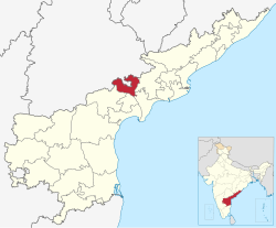
NTR district is a district in coastal Andhra Region in the Indian state of Andhra Pradesh. The administrative headquarters is located at Vijayawada. The district is named after former Chief Minister of Andhra Pradesh N. T. Rama Rao.
NTR district | |
|---|---|
District of Andhra Pradesh | |
     Clockwise from top-left: Kanaka Durga Temple in Vijayawada, Akkanna Madanna Caves, Kondapalli Fort, Krishna River at Prakasam Barrage, Bridges over Munneru River near Keesara | |
 | |
| Country | |
| State | |
| Region | Coastal Andhra |
| Formed | 4 April 2022 |
| Named for | N. T. Rama Rao |
| Headquarters | Vijayawada |
| Mandals | 20 |
| Government | |
| • District collector | Sri S Dilli Rao IAS Collector & District Magistrate |
| • Lok Sabha constituencies | Vijayawada |
| • MP | Kesineni Srinivas |
| • Assembly constituencies | 07 |
| Area | |
| • Total | 3,316 km2 (1,280 sq mi) |
| Population (2011) | |
| • Total | 2,218,591 |
| • Density | 670/km2 (1,700/sq mi) |
| Time zone | UTC+05:30 (IST) |
| Website | ntr |

History
Named after former Chief Minister of Andhra Pradesh N. T. Rama Rao,[1] NTR district was proposed on 26 January 2022 and became one of the twenty-six districts in the state after the gazette notification was issued by the Government of Andhra Pradesh on 3 April 2022. The gazette notification came into force on 4 April 2022. The district was carved out of Krishna district, and consists of the existing Vijayawada revenue division along with Nandigama and Tiruvuru revenue divisions, which were formed along with the district.[2][3][4][5][6]
Geography
NTR district is bordered with Krishna district and Eluru districts on the East, Palnadu district and Guntur districts on the South, Suryapet district of Telangana state on the West and Khammam district of Telangana state on the North.
The River Krishna flows towards East and acts as border between NTR and Palnadu district as well as Guntur districts.
Education
Primary and secondary school education in the district is imparted by government, aided and private schools, under the School Education Department of the state.
NTR University of Health Sciences and School of Planning and Architecture, South Indian Chapter are located in Vijayawada. The district also has numerous engineering colleges, including Lakireddy Bali Reddy Engineering College, Loyola Engineering College and Potti Sri Ramulu College, and degree colleges including SRR & CVR Govt, Andhra Loyola College, P.B Siddarth, Maris Stella, K.B.N, KVR College in Nandigama, and SGS College in Jaggayyapeta, etc. Govt Polytechnic Vijayawada is one of the oldest polytechnic colleges in India.[citation needed]
Transportation
Road
APSRTC state headquarters are located at Vijayawada. APSRTC operates bus services from Vijayawada to Machillipatnam, Eluru, Hanuman Junction, Gudivada, Avanigadda, Hyderabad, Kakinada, Narsapuram, Bhimavaram, Visakhapatnam, Srikakulam, Tirupati, Nandigama and Rajahmundry.
Railway
The district is well connected to railways. Vijayawada is headquarters for Vijayawada railway division and Vijayawada Junction is one of the busiest railway stations in India.
Other railway stations in the district (all in Vijayawada) are:
Cities and towns
Largest cities or towns in Nandamuri Taraka Rama Rao District As per the 2011 Census | |||||||||
|---|---|---|---|---|---|---|---|---|---|
| Rank | Division | Pop. | Rank | Division | Pop. | ||||
| 1 | Vijayawada | Vijayawada | 10,21,806 | 11 | Nadim Tiruvuru | Tiruvuru | 18,567 | ||
| 2 | Jaggayyapeta | Nandigama | 53,530 | 12 | Penuganchiprolu | Nandigama | 14,374 | ||
| 3 | Nandigama | Nandigama | 44,359 | 13 | Nunna | Vijayawada | 14,176 | ||
| 4 | Gollapudi, Vijayawada | Vijayawada | 37,349 | 14 | Prasadampadu | Vijayawada | 13,941 | ||
| 5 | Tiruvuru | Tiruvuru | 34,173 | 15 | Guntupalli | Vijayawada | 11,187 | ||
| 6 | Kondapalli | Vijayawada | 33,373 | 16 | Chandarlapadu | Nandigama | 10,958 | ||
| 7 | Ibrahimpatnam, NTR district | Vijayawada | 29,432 | 17 | Reddigudem | Tiruvuru | 9,873 | ||
| 8 | Kanchikacherla | Nandigama | 22,756 | 18 | Gampalagudem | Tiruvuru | 8,256 | ||
| 9 | Ramavarappadu | Vijayawada | 22,222 | ||||||
| 10 | Mylavaram | Vijayawada | 21,763 | ||||||
| Municipal body | Civic status | Formation year | No. of
wards |
2011 Census
population |
|---|---|---|---|---|
| Vijayawada | Municipal Corporation | 1981 | 50 | 10,39,518 |
| Jaggayyapeta | Municipality Grade 2 | 31 | 53,530 | |
| Kondapalli | Municipality Grade 3 | 29 | 33,373 |
Note -
** Vijayawada Population shown here is only, Municipal Corporation Population.
** Vijayawada Urban Agglomeration Population is 14,76,931
| Town | Mandal HQ | Civic status | 2011 Census
population |
2001 Census
population |
1991 Census
population |
1981 Census
population |
|---|---|---|---|---|---|---|
| Ibrahimpatnam | Ibrahimpatnam | Census Town | 29,432 | 22,020 | -- | -- |
| Ramavarappadu | Vijayawada Rural | Census Town | 22,222 | -- | -- | -- |
| Nadim Tiruvuru | Tiruvuru | Census Town | 18,567 | -- | -- | -- |
| Prasadampadu | Vijayawada Rural | Census Town | 13,941 | -- | -- | -- |
| Guntupalli | Ibrahimpatnam | Census Town | 11,187 | 12,011 | -- | -- |
Administrative divisions
The district has three revenue divisions, namely Tiruvuru, Nandigama and Vijayawada, each headed by a sub collector or RDO. These revenue divisions are divided into 20 mandals. The district consists of one municipal corporation, Vijayawada.[7]
Mandals
There are 5 mandals in Tiruvuru division, 7 mandals in Nandigama and 8 in Vijayawada division. The 20 mandals under their revenue divisions are listed below:[7]
Demographics
At the time of the 2011 census, NTR district has a population of 22,18,591. Scheduled Castes and Scheduled Tribes made up 4,06,350 (18.32%) and 82,101 (3.70%) of the population respectively.[8]: 79–83
At the time of the 2011 census, 90.12% of the population spoke Telugu, 6.90% Urdu and 1.43% Lambadi as their first language.[10]
Tourism
Kondapalli Fort, Bhavani Island, and temples like Kanaka Durga Temple, Sri Tirupatamma Gopayya Swamivarla Devasthanam, Vedadri Lakshmi Narasimha Swamy Devasthanam, Srikakulandhra Mahavishnu Devasthanam, Ghantasala Jaladheeswara Temple, Mopidevi Subhramanyeswara Swamy Temple are some of the major attractions.[citation needed]
Politics
There are one parliamentary, Vijayawada (Lok Sabha constituency), and seven assembly constituencies in the district.
The assembly constituencies are[11]
| Constituency number | Name | Reserved for
|
Parliament |
|---|---|---|---|
| 69 | Tiruvuru | SC | Vijayawada (Lok Sabha constituency) |
| 79 | Vijayawada West | None | Vijayawada (Lok Sabha constituency) |
| 80 | Vijayawada Central | None | Vijayawada (Lok Sabha constituency) |
| 81 | Vijayawada East | None | Vijayawada (Lok Sabha constituency) |
| 82 | Mylavaram | None | Vijayawada (Lok Sabha constituency) |
| 83 | Nandigama | SC | Vijayawada (Lok Sabha constituency) |
| 84 | Jaggayyapeta | None | Vijayawada (Lok Sabha constituency) |
References
- Sharma, Ravi (26 January 2022). "Andhra Pradesh Cabinet clears the formation of 13 new districts". Frontline. Archived from the original on 31 January 2022. Retrieved 31 January 2022.
- Raghavendra, V. (26 January 2022). "With creation of 13 new districts, AP now has 26 districts". The Hindu. ISSN 0971-751X. Archived from the original on 26 January 2022. Retrieved 26 January 2022.
- "Andhra Pradesh approves creation of 13 new districts". Telangana Today. 26 January 2022. Archived from the original on 26 January 2022. Retrieved 26 January 2022.
- "AP issues draft gazette notification on 26 districts". Deccan Chronicle. 26 January 2022. Archived from the original on 29 January 2022. Retrieved 31 January 2022.
- Staff Reporter (30 March 2022). "New districts to come into force on April 4". The Hindu. Archived from the original on 22 September 2022. Retrieved 31 March 2022.
- "కొత్త జిల్లా తాజా స్వరూపం". Eenadu.net (in Telugu). 31 March 2022. Archived from the original on 17 September 2022. Retrieved 31 March 2022.
- Boda, Tharun (3 April 2022). "Andhra Pradesh: Govt. notifies NTR, Krishna districts". The Hindu. ISSN 0971-751X. Retrieved 5 April 2022.
- "District Census Hand Book – Krishna" (PDF). Census of India. Registrar General and Census Commissioner of India.
- "Population by Religion – Andhra Pradesh". censusindia.gov.in. Office of the Registrar General & Census Commissioner, India. 2011.
- "Table C-16 Population by Mother Tongue: Andhra Pradesh". Census of India. Registrar General and Census Commissioner of India.
- "District-wise Assembly-Constituencies". ceoandhra.nic.in.
External links
Другой контент может иметь иную лицензию. Перед использованием материалов сайта WikiSort.org внимательно изучите правила лицензирования конкретных элементов наполнения сайта.
WikiSort.org - проект по пересортировке и дополнению контента Википедии