world.wikisort.org - India
Uttarandhra (North costal Andhra), also known as Kalinga Andhra[1][2] is a region consisting of six northern districts of the Indian state of Andhra Pradesh. It comprises the districts of Srikakulam, Parvathipuram Manyam, Vizianagaram, Visakhapatnam, Alluri Sitharama Raju and Anakapalli.[3] As of 2011 census of India, the region with six districts has a population of 9,338,177.[4]
This article needs to be updated. (April 2022) |
Uttarandhra
Kalinga Andhra,North Coast | |
|---|---|
Region of Andhra Pradesh | |
 Srimukhalingam | |
 Uttarandhra region with districts | |
| Country | |
| State | |
| Districts | |
| Area | |
| • Total | 23,537 km2 (9,088 sq mi) |
| Population | |
| • Total | 9,338,177 |
| Languages | |
| • Official | Telugu |
| Time zone | UTC+05:30 (IST) |
| Largest city | Visakhapatnam |


The region is in the extreme Northeast of Indian state of Andhra Pradesh. The region is skirted to a distance by Kandivalasagedda, Vamsadhara and Bahuda at certain stretches of their courses white a line of heights of the great Eastern Ghats run from North East. Kakinada and East Godavari Districts flanks in the southwest while Odisha bounds it on the north and Bay of Bengal on the South and the East. Visakhapatnam is the largest city of the region in terms of population and area. However Uttarandhra is a part of Coastal Andhra region.[citation needed]


History
The present north coastal districts of Andhra Pradesh were once part of the Kalinga region. Kalinga is a historical region of India. It is generally defined as the eastern coastal region between the Mahanadi and the Godavari rivers, although its boundaries have fluctuated with the territory of its rulers. The core territory of Kalinga now encompasses a large part of Odisha and northern part of Andhra Pradesh.[citation needed]
Early and Medieval history
The Kalingas have been mentioned as a major tribe in the legendary text Mahabharata. In the 3rd century BCE, the region came under Mauryan control as a result of the Kalinga War. Ashoka annexed the kingdom after the final battle near the Dhauli hills, the capital Sisupalgarh fell to the Mauryas. After the war, Buddhism prospered in Kalinga and spread to other south eastern regions through maritime trade routes. After the decline of the Mauryan Empire, the region came under the control of the Mahameghavahana family, whose king Kharavela described himself as the "supreme Lord of Kalinga".[5]
After several wars with Satavahanas and other kingdoms, the Kalinga dynasty crumbled and divided into small independent kingdoms. The Gupta ruler Samudragupta sensed an opportunity and invaded the kingdom. Kalinga came under Gupta suzerainty in the 4th century CE after his invasion, the kingdom got united and reclaimed its glory. They ruled the region from Mukhalinga and Dantapura of Northern Andhra. After the Gupta withdrawal, it was ruled by several minor dynasties. These included the Vasishthas, the Matharas, and the Pitrbhaktas.[6]
The last Eastern Ganga ruler Bhanudeva IV was dethroned by Kapilendra Deva in 1435. This event marked the foundation of the Gajapati Empire that ruled over the regions of Utkala (North Odisha) and Kalinga (South Odisha, North Andhra Pradesh). Prataparudra Deva was the last great king of the Suryavamsi Gajapatis and soon after his death his minister Govinda Vidyadhara usurped the throne by murdering the last two Gajapati scions. The fall of the Gajapati Empire meant the independence of their many tributary and feudal states.[citation needed]
Evidently, a tributary kingdom called Nandapur ruled by the Suryavamsa dynasty that arrived in the region in 13th century from Kashmir.[7] The king of this little kingdom was Vishwanatha Deva Gajapati who began expanding his kingdom in the southern region of Odisha and northern region of Andhra. In 1545, he sent his military commander and the chief of Kasimkota, Mukunda Harichandana to conquer the northern plains of Odisha which were under control of the weak Bhoi dynasty of Govinda Vidyadhara.[8]
Govinda Vidyadhara signed a truce with Vishwanatha Deba and was granted the status of a tributary state. Mukunda Harichandana was appointed as the minister in order to seek full control over the region, however, he later assassinated the last two Bhoi heirs and declared himself as the new king of Utkala. Nevertheless, Kalinga was still ruled by the Suryavamsi kings until they were defeated and became a Vassal of the Golconda Qutb Shahi during the reign of Balarama Deva, who failed to control the vast dominion of his predecessor, Vishwanatha Gajapati.[9] His successors ruled over the region as 'Maharajah of Kalinga' until the feud of Ramachandra Deva I and Balarama Deva III which marked the end of their domination over Kalinga.[10] They came to be known as Jeypore Samasthanam.[citation needed]
Modern history
In 1674, Vishwambhar Dev of Jeypore kingdom defeated the Faujdar of Chicacole (Srikakulam), appointed by the Qutb Shahi Sultans and claimed an independent semi-monarchy over the Circars.[11] Aurangzeb conquered Golconda in 1687 and the Circars along with the Qutb Shahi Sultanate were annexed to the extensive empire of Aurangzeb. However, the first two Faujdars appointed by the Mughals were defeated and slain in the battlefield by the Maharaja of Jeypore, Raghunath Krishna Dev, who continued to rule claiming independent control over the region until his death in 1708.[12] The successor of Raghunath Krishna proved to be an inefficient ruler and as a result lost a vast territory of the Circars. However, the kings of Jeypore continued to rule their decreased kingdom independently until the advent of the British in 1777. The British destroyed the fort of Jeypore and granted them a demoted status of a Zamindari.[citation needed]
In 1724, Mir Qamar-ud-din Khan was appointed the governor of Hyderabad, with the title Nizam al Mulk. He came to be known as the Nizam of Hyderabad, its de facto ruler. The fourth Nizam Salabat Jang, a son of the Nizam al Mulk, who was indebted for his elevation to the throne to the French East India Company, granted the circars to the French in return for their services. In 1759, through the conquest of the fortress of Masulipatnam, the maritime provinces from the river Gundlakamma to the Chilka Lake were transferred from the French to the British. But the British left them under the administration of the Nizam, with the exception of Masulipatnam, a valuable port, which was retained by the British.[citation needed]
In 1765 Lord Robert Clive obtained from the Mughal emperor Shah Alam II a grant of the five Circars. The fort of Kondapalli was seized by the British as an opening move. On 12 November 1766 a treaty of alliance was signed with Nizam Ali Khan by which the British undertook to maintain troops for the Nizam's assistance. By a second treaty, often referred to as the Treaty of Masulipatnam, signed on 1 March 1768, the Nizam acknowledged the validity of Shah Alam's grant and resigned the Circars to the British East India Company, receiving as a mark of friendship an annuity of £50,000. Finally, in 1823, the claims of the Nizam over the Northern Circars were bought outright by the Company, and they became a British possession.[13] The Northern Circars were governed as part of Madras Presidency until India's independence in 1947, after which the presidency became India's Madras State.[citation needed]
Post independence
In an effort to gain an independent state based on linguistic identity, and to protect the interests of the Telugu-speaking people of Madras State, Potti Sreeramulu fasted to death in 1952. As Madras became a bone of contention, in 1949 a JVP committee report stated: "Andhra Province could be formed provided the Andhras give up their claim on the city of Madras [now Chennai]". After Potti Sreeramulu's death, the Telugu-speaking area of Andhra State was carved out of Madras State on 1 October 1953, with Kurnool as its capital city.[14] On the basis of the gentlemen's agreement of 1 November 1956, the States Reorganisation Act formed combined Andhra Pradesh by merging Andhra State with the Telugu-speaking areas of the already existing Hyderabad State.[15] Hyderabad was made the capital of the new state.[citation needed]
In February 2014, the Andhra Pradesh Reorganisation Act, 2014 bill was passed by the Parliament of India for the formation of the Telangana state comprising ten districts. Hyderabad will remain as a joint capital for not exceeding ten years.[16] The new state of Telangana came into existence on 2 June 2014 after approval from the President of India.[17] Number of petitions questioning the validity of Andhra Pradesh Reorganisation Act, 2014 is long pending for the verdict since April 2014 before the Supreme Court constitutional bench.[18]
In 2017, Andhra Pradesh Government began operating from the newly planned capital city Amaravati.[19][20] In August 2020, Andhra Pradesh Legislative Assembly passed Andhra Pradesh Decentralisation and Inclusive Development of All Regions Act, 2020. According to its provisions, Visakhapatnam is the executive capital while Amaravati and Kurnool serve as legislative and judicial capitals, respectively.[21] The decision resulted in widespread protests by the farmers of Amaravati.[22] The act has been challenged in Andhra Pradesh High Court, which ordered to maintain status quo until the court completes its hearing.[citation needed]
Geography
Nagavali River rises in the eastern slopes of the Eastern Ghats near Lakhbahal in the Kalahandi district of Odisha at an elevation of about 1,300 metres. The total length of the river is about 256 km, of which 161 km are in Odisha and the rest in Andhra Pradesh.[citation needed] The catchment area of the basin is 9,510 square km. Nagavali is an interstate river with 4462 km2 and 5048 km2 river basin area located in Odisha and Andhra Pradesh respectively. The river basin receives 1000 mm average rain fall annually. The uplands of the river basin are hilly areas with predominantly tribal populated.[citation needed] It drains parts of the Kalahandi, Rayagada and Koraput districts of Odisha and Srikakulam, Vizianagaram and Visakhapatnam districts of Andhra Pradesh.[23] Vamsadhara River originates in the border of Thuamul Rampur in the Kalahandi district and Kalyansinghpur in Rayagada district of Odisha and runs for a distance of about 254 kilometers, where it joins the Bay of Bengal at Kalingapatnam, Andhra Pradesh. The total catchment area of the river basin is about 10,830 square kilometers.[24]
Climate
South West Monsoon : 1000–1100 mm. Temperatures range from Max. 33-36 °C & Min. 26-27 °C. Red soils and Black soils with clay base, Pockets of acidic soils, laterite soils, Soils with PH 4-5.[25]
Economy
Agriculture
Major crops grown in this region are rice, black gram, green gram, groundnut, sugarcane, sesame, pearl millet, mesta, finger millets, and horse gram.[26] This region is home to many co-operative sugar factories, jute mills, cashew processing industries.[citation needed]
Visakha Dairy is second biggest co-operative dairy in India.[citation needed]
Industries
Visakhapatnam is the biggest city of the region and is placed 10th among the top 15 cities contributing to India's overall Gross domestic product.[27] The industrial city, Visakhapatnam has contributed a GDP of $26 billion. The city has state owned heavy industries and a steel plant.[citation needed]
- Visakhapatnam Steel Plant a leading Central PSU under the Ministry of Steel is the first shore based Integrated Steel Plant in the country.[citation needed]
- Visakhapatnam Port is one of the major port in India.[citation needed]
- Hindustan Petroleum Corporation Limited is one of the two oil refineries of HPCL in India[28]
- Hindustan Shipyard Limited (HSL) is a shipyard located in Visakhapatnam on the east coast of India.[29]
- Naval Dockyard (Visakhapatnam)[citation needed]
- Bharat Heavy Electricals Limited[citation needed]
- Gangavaram Port[citation needed]
- Simhadri Super Thermal Power Station[citation needed]

Palasa-Kasibugga is the center of cashew industries in the Srikakulam district.[citation needed]
Ponduru hand-loom where the finest khadi is woven. Jute mills and dairy products industry like Visakha Dairy contribute to the economy of the region[30]
Politics
This section does not cite any sources. (September 2022) |
The parliament constituencies of Uttarandhra are
- Araku
- Srikakulam
- Vizianagaram
- Visakhapatnam
- Anakapalli
Education
This section does not cite any sources. (September 2022) |
Central Universities
- Central Tribal University of Andhra Pradesh, Vizianagaram
Universities

- Andhra University, Visakhapatnam
- Jawaharlal Nehru Technological University - Gurajada, Vizianagaram
- Dr. B. R. Ambedkar University, Srikakulam
- GITAM University, Visakhapatnam
Medical colleges
- Andhra Medical College, Visakhapatnam
- Government Medical College, Srikakulam.
- Gitam Institute of Medical Science and Research, Visakhapatnam
- Maharaja Institute of Medical Sciences, Vizianagaram
- NRI Institute of Medical Sciences, Visakhapatnam
- Great Eastern Medical School and Hospital, Srikakulam.
Central Institutions
- Indian Institute of Management Visakhapatnam
- Indian Institute of Petroleum and Energy
- Damodaram Sanjivayya National Law University
- Indian Maritime University
- Kalam Institute of Health Technology, Visakhapatnam
Culture
People from Uttarandhra
- Alluri Sitarama Raju (Freedom fighter)
- Chowdary Satyanarayana (Freedom fighter, Politician, Rights Activist)
- Tenneti Viswanadham (Freedom fighter and politician)
- Kandala Subrahmanya Tilak (Indian lawyer, Socialist leader, Indian freedom activist and Parliamentarian)
- Gouthu Latchanna (veteran freedom fighter)
- Gurazada Apparao (Social reformer)
- Dwaram Venkataswamy Naidu (violinist)
- Gidugu Venkata Ramamurthy (doyen of Spoken Telugu movement)
- Srirangam Srinivasarao (poet)
- Aarudhra (poet, lyricist, songwriter, translator and writer)
- Ajjada Adibhatla Narayana Dasu (poet, musician, dancer, linguist and philosopher)
- Rachakonda Viswanatha Sastry (writer)
- Lanka Sundaram (Indian parliamentarian and an expert in international law)
- Venugopal Rao(cricketer)
- P. Susheela (singer)
- Gollapudi Maruti Rao
- Sirivennela Sitaramasastri (lyricist)[31]
- Sarath Babu (Tollywood movie actor)
- Puri Jagannadh (movie director)
- Parasuram (movie director)
- Ramana Gogula
- Grandhi Mallikarjuna Rao (founder chairman of GMR Group)
- Kodi Rammurthy Naidu (Indian bodybuilder)
- Karnam Malleswari (Indian weightlifter, Olympic medalist)
- Chaganti Somayajulu (Telugu story writers)
- Vulimiri Ramalingaswami (pathologist and ex-Director AIIMS New Delhi and ICMR)
- Hilda Mary Lazarus (Christian missionary, gynecologist and obstetrician)
- Vaddadi Papaiah (artist)
- Kotcherlakota Rangadhama Rao (physicist))
- John Louis Nayar (freedom-fighter, physician, singer, dancer and humorist),[32][33]
- Pingali Nagendrarao (script writer, playwright and lyricist)
- Raja Abel (Tollywood actor)
- Rashmi Gautam (Tollywood actress)
- Anisha Ambrose (Tollywood actress)
- Ipsita Pati (actress)
- Zarina Wahab (actress)
- Devika Rani (Indian film actress)
- Mallikarjuna Rao (Tollywood actor)
- G.Anand (playback singer and music director)
- J.V. Somayajulu (Indian theatre and film actor)
- E. L. Quirk (founder of Quirk Memorial Baptist Church)
- S. Rajeswara Rao (composer)
Anglo-Indians Born in Uttarandhra
- Edward Hay Mackenzie Elliot (Governor of New Zealand)
- Arthur Luard (English cricketer)
- George William Forbes Playfair (British businessman and member of the Legislative Council of Hong Kong)
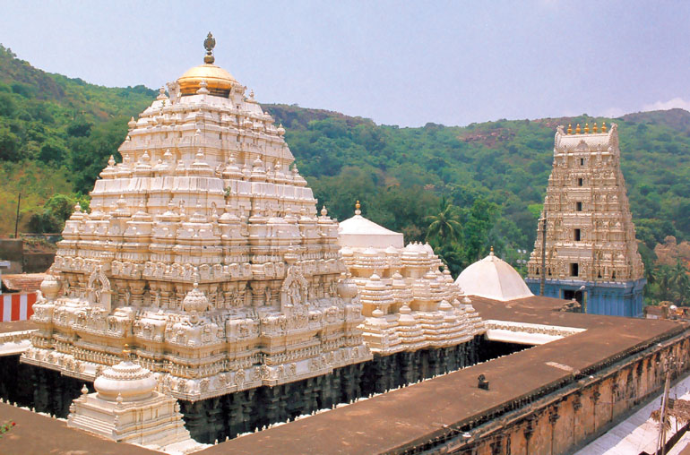
Religious Destinations
- Simhachalam Temple
- Nookambika Temple, Anakapalli
- Arasavalli Sun Temple
- Kurmanathaswamy temple, Srikurmam
- Sri Kanaka Maha Lakshmi Temple
- Ramateertham
- Mukhalingam
- Pydithallamma Temple, Vizianagaram
- Upamaka Venkateshwara Swamy Temple
Transport
NH16 and NH 26 passes through most of the Uttarandhra towns.[34] The East Coast Railway serves Srikakulam, Vizianagaram District, and part of Visakhapatnam district including Visakhapatnam City and remaining under South Central Railway zone. Visakhapatnam Airport is a customs airport situated in the region. Visakhapatnam Port, Gangavaram Port are the major seaports. Some minor ports are at Bhavanapadu, Kalingapatnam, Bheemunipatnam.[35]
See also
References
- Chalam, K. S. (24 November 2016). Social Economy of Development in India. SAGE Publications India. p. 165. ISBN 9789385985126.
- Subrahmanyam, Velcheti (20 October 2016). "Indefatigable talent". The Hindu. ISSN 0971-751X. Retrieved 6 June 2019.
- "Uttarandhra in a State of Plenty, Penury". The New Indian Express. Retrieved 8 May 2016.
- "Statistical Abstract Andhra Pradesh, 2018" (PDF). CORE Dashboard. Gollapudi, Vijayawada: Directorate of Economics and Statistics, Government of Andhra Pradesh. p. 10. Retrieved 6 June 2019.
- Dineschandra Sircar 1971, p. 167.
- Snigdha Tripathy 1997, p. 219.
- Mohanty 2013.
- KBS Singh 1939, p. 26.
- Dutt 2009, p. 43.
- Dutt 2009, p. 44.
- Senapati, N. (1966). "Orissa district gazetteers : Koraput". INDIAN CULTURE. p. 66 - 69. Retrieved 3 June 2021.
{{cite web}}: CS1 maint: url-status (link) - Deo Kumar Bidyadhar Singh (1961). Nandapur A Forsaken Kingdom Part-i (Second ed.). p. 69.
- The History of Vizag
- "Post-Independence Era, then and now". aponline.gov.in. Archived from the original on 20 December 2013. Retrieved 3 August 2013.
- "Know Hyderabad: History". Pan India Network. 2010. Archived from the original on 21 September 2010. Retrieved 5 October 2010.
- "The Andhra Pradesh Reorganisation Act, 2014" (PDF). India Code Legislative Department. Ministry of Law and Justice. 1 March 2014. p. 2. Archived from the original (PDF) on 24 September 2015. Retrieved 14 July 2015.
- "Telangana state formation gazette". The New Indian Express. Archived from the original on 6 July 2014. Retrieved 14 May 2014.
- "Supreme court refers Telangana petitions to constitution bench". NDTV. Archived from the original on 29 November 2014. Retrieved 17 February 2016.
- "Andhra Pradesh To Get New Capital Amaravati Today, PM Modi To Inaugurate". NDTV. 22 October 2015. Retrieved 9 March 2021.
- P, Ashish (2 March 2017). "Chief Minister Chandrababu Naidu inaugurates new Andhra Pradesh Assembly". India Today. Retrieved 9 March 2021.
- "YS Jaganmohan Reddy's three-capital plan on track as Andhra Pradesh governor gives nod to two bills".
- Sudhir, Uma (13 January 2020). "Won't Celebrate Harvest Festival, Say Amaravati Farmers Amid Protests". NDTV. Retrieved 28 February 2021.
- Nagavali River
- Vamsadhara River
- "GOVERNMENT OF ANDHRA PRADESH State Horticulture Mission". Archived from the original on 15 September 2013. Retrieved 8 December 2013.
- "Agro Climatic Regions in Andhra Pradesh".
- Sat 3 Nov 2012, 8:24 PM IST – India Markets closed (28 September 2012). "India's top 15 cities with the highest GDP Photos | Pictures – Yahoo! India Finance". In.finance.yahoo.com. Retrieved 3 November 2012.
- Visakhapatnam Refinery
- Hindustan Shipyard
- "Visakhadairy-Home Page".
- "Telugu Cinema Etc – Idlebrain.com".
- "A versatile personality". The Hindu. Archived from the original on 21 August 2003.
- "Vizagites 'dil toot gaya' - Bay News – Vizag News Online".
- National Highway 43 (India)
- "For Andhra Pradesh Department of Ports".
Capital: Amaravati | |||
| Topics |
| ||
| Regions | |||
| Districts |
| ||
| Million-plus cities | |||
| Cities (population over 1 lakh) |
| ||
| Tourism |
| ||
| History |
| ||
| Related lists |
| ||
| |||
External Links
 Media related to Uttarandhra at Wikimedia Commons
Другой контент может иметь иную лицензию. Перед использованием материалов сайта WikiSort.org внимательно изучите правила лицензирования конкретных элементов наполнения сайта.
WikiSort.org - проект по пересортировке и дополнению контента Википедии