world.wikisort.org - India
Rayagada district is a district in southern Odisha, a state in India, which became a separate district in October 1992. Its population consists mainly of tribes, primarily the Khonds and the Soras. In addition to Odia, Kui and Sora are spoken by the district's indigenous population. It was founded by Maharajah Biswanatha Deba Gajapati of the Surjyabansha dynasty of Jeypore.[1][2][3][4]
Rayagada district | |
|---|---|
District of Odisha | |
  | |
 Location in Odisha | |
| Coordinates: 19.166°N 83.416°E | |
| Country | |
| State | |
| Headquarters | Rayagada |
| Government | |
| • Collector & District Magistrate | Swadha Dev Singh, IAS |
| • Superintendent of Police | Vivekanand Sharma, IPS |
| • Divisional Forest Officer, Rayagada Forest Division | Aswini Kumar Kar, OFS |
| Area | |
| • Total | 7,584.7 km2 (2,928.5 sq mi) |
| Population (2011) | |
| • Total | 967,911 |
| • Density | 116/km2 (300/sq mi) |
| Languages | |
| • Official | Odia, English |
| • Other Local Language | Kui, Sora, Kuvi |
| Time zone | UTC+5:30 (IST) |
| PIN | 765 xxx |
| Vehicle registration | OD-18 |
| Sex ratio | 0.972 ♂/♀ |
| Literacy | 49.76% |
| Lok Sabha constituency | Koraput(ST) |
| Vidhan Sabha constituency |
|
| Municipality | |
| Notified Area Council (NAC) | Gudari NAC |
| Website | www |
| This article is part of a series on |
| Odisha |
|---|
 |
| Governance |
|
| Topics |
|
|
Districts Divisions |
| GI Products |
|
|
|

Rayagada covers an area of 7,584.7 square kilometres (2,928.5 sq mi), and is divided into eleven blocks. Agriculture is the chief source of income, and paddy, wheat, ragi, green and black gram, groundnut, sweet potato and maize are the district's major crops.
Administrative setup
The 11 Blocks and Tahasils in Rayagada district under two administrative Sub-Divisions are listed in the following table.
| # | Rayagada Sub-Division | Gunupur Sub-Division |
|---|---|---|
| 1 | Rayagada | Gunupur |
| 2 | Kashipur | Gudari |
| 3 | Kalyansingpur | Padmapur |
| 4 | Kolnara | Ramanaguda |
| 5 | Bissam Cuttack | |
| 6 | Muniguda | |
| 7 | Chandrapur |
There are 17 Police Stations under the three Police Sub-Divisions in Rayagada district are listed in the following table.
| # | Rayagada Police Sub-Division | Gunupur Police Sub-Division | Bissam Cuttack Police Sub-Division |
|---|---|---|---|
| 1 | Rayagada P.S. | Gunupur P.S. | Bissam Cuttack P.S. |
| 2 | Seskhal P.S. | Gudari P.S. | Muniguda P.S. |
| 3 | Tikiri P.S. | Padmapur P.S. | Ambadola P.S. |
| 4 | Doraguda P.S. | Puttasing P.S. | Chandrapur P.S. |
| 5 | Andirakanch P.S. | ||
| 6 | Kashipur P.S. | ||
| 7 | Chandili P.S., Jaykaypur | ||
| 8 | Kalyansingpur P.S. | ||
| 9 | Energy P.S., Rayagada |
History
In the third century BC, during the reign of Ashoka, Odisha was part of the Kalinga empire. The hilly track between the Vamshadhara and Nagavali Rivers was known for its spices.[5][full citation needed] The Rastriks were defeated by Kharvela, the emperor of Kalinga, during the battle of Chawpagada.[6]
Vishwanath Dev Gajapati (1527 - 1571 CE), the suryavanshi king of Nandapur (later Jeypore) established his capital on the bank of Nagavali and named it Rayagada or Rai-gadh. Under his rule the place flourished economically which proved beneficial to the vast kingdom that stretched from the confines of Jharkhand and West Bengal to River Godavari in south. During his reign he fought a war with Quli Qutb Mulk, the first Qutb Shahi Sultan of Golconda and successfully stopped his advance towards his kingdom. However, he had to surrender the rich fertile land located in the middle of Godavari-Krishna Delta to execute a peace treaty which made Godavari the border of the two kingdoms. Rayagada remained under the Kingdom of Jeypore until the dissolution act of 1947.[1][2][3][4]
During the British Raj, Rayagada was under the then-newly demoted Jeypore Samasthanam and was part of Koraput district; it was carved from the district on 2 October 1992 as part of Odisha's district-expansion plan.
Economy
The district is reportedly rich in bauxite and silicon.[citation needed] In 2006, the Ministry of Panchayati Raj named Rayagada one of the country's 250 most backward districts (out of a total of 640).[7] It is one of the 19 districts in Odisha receiving aid from the Backward Regions Grant Fund (BRGF).[7]
Constituencies
The district has three Odisha Legislative Assembly (Vidhan sabha) constituencies.[8][9]
| No. | Constituency | Reservation | Blocks | Member | Party |
|---|---|---|---|---|---|
| 138 | Gunupur | ST | Gunupur, Gudari (NAC), Gunupur, Gudari, Ramanaguda, Padampur | Raghunath Gomango | BJD |
| 139 | Bissam Cuttack | ST | Bissam Cuttack, Muniguda, Chandrapur | Jagannath Saraka | BJD |
| 140 | Rayagada | ST | Rayagada, Kashipur, Kolnara, Kalyansinghpur | Makaranda Muduli | Independent |
Rayagada district is part of the Koraput Lok Sabha constituency.[10]
Rail transport
This section does not cite any sources. (September 2019) |
Rayagada railway station has direct service to Chennai, Kolkata, Hyderabad, Bhubaneswar, Raipur, Bengaluru, Ahmedabad, Mumbai, Jamshedpur, Jodhpur and New Delhi. Gunupur is also an important railway station; via Parlakhemundi, it is connected to Naupada on the main east-coast railway line from Kolkata to Chennai by a 90-kilometre (56 mi) 1,676 mm (5 ft 6 in) broad-gauge line which was converted from 762 mm (2 ft 6 in) narrow gauge in 2011. The 40-kilometre (25 mi) narrow-gauge line (the Paralakhemedi Light Railway, or PLR) was established by Gajpatirajas of Paralakhemundi, the former raja of Paralakhemedi, to connect his capital with Naupada. The government authorized construction in 1898, and the line was opened to traffic two years later at a cost of ₹700,000.
The East Coast Railway began in 1893 with construction of the 96-kilometre (60 mi) Cuttack-Khurda Road-Puri line, and its subsequent 1,280-kilometre (800 mi) link along the East Coast to Vijayawada (the junction of Southern Maratha Railway and Nizam's Guaranteed State Railway) was opened for traffic between 1893 and 1896. The railway brought service to Naupada in 1894.
Due to a policy change by the British government, the Bengal Nagpur Railway took over East Coast Railway's northern section from Vizianagaram to Cuttack, including the Puri branch line, by 23 January 1902. The PLR was also taken over by the Bengal Nagpur Railway that year. In its first few years, the PLR had incurred losses; after 1910 it began making a profit, which increased after 1924–25. This motivated the raja to extend the line to Gunupur in two phases in 1929 and 1931. There were now ten stations between Naupada and Gunupur: Tekkali, Paddasan, Temburu, Ganguvada, Patapatnam, Paralakhemedi, Kashinagar, Lihuri, Bansidhara and Palasingi. The standard PLR locomotive was a 20-ton 0-6-4 tank engine with 27-inch-diameter (69 cm) coupled wheels and a 4.75-ton axle load.
Management of the BNR was taken over by the government of India in October 1944. On 14 April 1952, when Indian Railways was regrouped, it became part of the Eastern Railway. The merger was short-lived, however, and on 1 August 1955 it was merged with the new South Eastern Railway. A set of four postage stamps was released during the 1987 BNR centennial, one stamp featuring the PL 691 locomotive.
The foundation stone was laid for the Naupada-Gunupur gauge conversion at Naupada on 27 September 2002. On 1 April 2003, PLR became a part of the East Coast Railway. The line was closed for gauge conversion on 9 June 2004. Although the 290-kilometre (180 mi) Khurda-Bolangir broad-gauge line was approved in 1995, only about half the work has been completed.
Demographics
| Year | Pop. | ±% p.a. |
|---|---|---|
| 1901 | 186,480 | — |
| 1911 | 224,190 | +1.86% |
| 1921 | 217,200 | −0.32% |
| 1931 | 256,152 | +1.66% |
| 1941 | 303,663 | +1.72% |
| 1951 | 341,241 | +1.17% |
| 1961 | 403,471 | +1.69% |
| 1971 | 511,333 | +2.40% |
| 1981 | 608,751 | +1.76% |
| 1991 | 713,984 | +1.61% |
| 2001 | 831,109 | +1.53% |
| 2011 | 967,911 | +1.54% |
| source:Governament if India[11] | ||
Rayagada district had a population of 967,911 in the 2011 Census of India, roughly equal to that of Fiji or the US state of Montana. The district ranked 454th of India's 640 districts, and had a population density of 136 inhabitants per square kilometre (350/sq mi).[12] Its population growth rate from 2001 to2011 was 15.74 percent.[12] Rayagada has a sex ratio of 1,048 females to 1,000 males,[12] and a literacy rate of 50.88 percent. Scheduled Castes and Scheduled Tribes make up 14.41% and 55.99% of the population respectively.[13]
At the time of the 2011 Census of India, 41.64% of the population in the district spoke Odia, 33.36% Kui, 10.43% Telugu, 8.37% Sora, 3.27% Kuvi and 0.66% Hindi as their first language.[15]
The district's tribal population is 57.52 percent of the total. Its 11 blocks have been covered by a tribal sub-plan, with three micro-projects in operation for pre-literate indigenous tribal communities. Rayagada's topography helps the tribal communities maintain their cultural identity; 4,785.36 square kilometres (1,847.64 sq mi) is forested, 777.27 square kilometres (300.11 sq mi) of which is reserved forest. Its predominant tribes are the Khonds and the Soras.
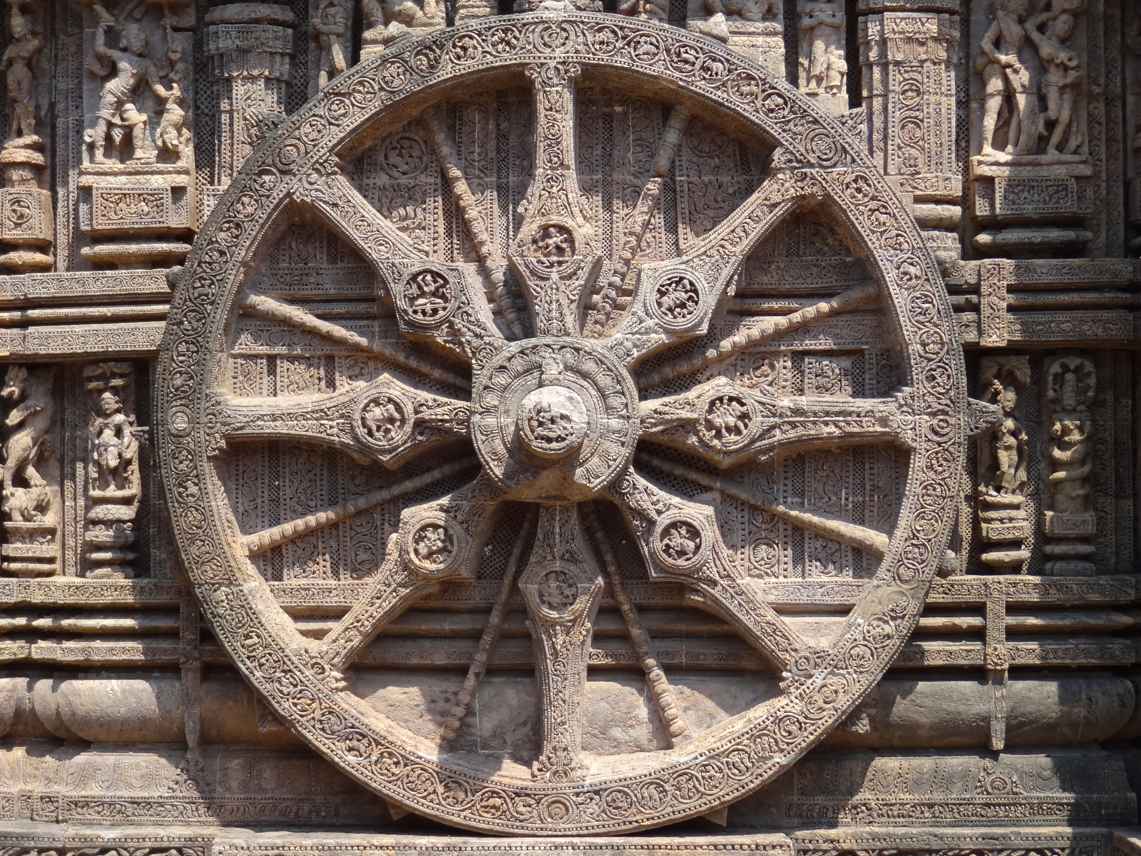
Points of interest

- Majhighariani Temple in Rayagada
- Jagannath Temple, at the market on the south side of Rayagada, is near Majhighariani Temple.
- Laxminarayan temple was built by Indian Metals and Ferro Alloys in Therubali.
- Paikapada, near Therubali, is known for its Pataleshwar Shiva temple.
- Chatikona, a small village 48 kilometres (30 mi) from Rayagada, is known for its Shiva temple and waterfalls.
- Maa Markama Temple at Bissamcuttack is the only shrine (Shakti Peethas) of Devi Maa Markama and Maa karkama in the Indian state of Odisha and known for its history and also mentioned in Saraladas's Chandi Purana.
- Minajhola, a village near Gudari, is known for its Shiva temple at the confluence of three rivers: the Vamsadhara, the Chauladhua and the Phalaphalia.
- The Devagiri hill, 50 kilometres (31 mi) from Rayagada, near Kalyan Singhpur, is 120 metres (390 ft) and has 476 steps.
- Kumudabali, a small village, is known for its Balunkeswar Shiva temple on the Vamsadhara River. The nearest railway station is in Muniguda, 60 kilometres (37 mi) from Rayagada.
- Padmapur, 90 kilometres (56 mi) from Rayagada, is known for the Nilakantheswar Temple. According to historian Satyanarayana Rajguru, the temple housed the 6th- or 7th-century Buddhist philosopher Dharmakirti.
- The Hanging Bridge at Chekaguda, over the Nagavali River, is Odisha's second simple suspension bridge.
- The Bhimasankar temple in Bhimpur, 100 kilometres (62 mi) from Rayagada and 30 kilometres (19 mi) from Gunupur, is one of India's 12 Jyotirlingas.
- The three-day Chaiti Festival, from 27 to 29 December in Rayagada, celebrates tribal art and culture.
- Parsali, a habitat of Dangariya Kandha, a PVTG tribe. One has to take a diversion from Chatikona, before Bissam Cuttack. For serene and picturesque greenery Niyamagiri Hills.
Education
This section does not cite any sources. (September 2019) |
Govind Chandra Dev (Zilla) High School, founded in 1938, is one of the district's oldest high schools. Government Girls' High School, in Rayagada, was founded in 1964. Other schools in Rayagada are Kendriya Vidyalaya, Sacred Heart School, Deepti Convent School, Maharshi Vidya Mandir, St. Xavier's High School and N.V.R Educational Institution. A primary school was founded at the Thakkar Bapa Ashram in 1958 for tribal students. The Jawahar Navodaya Vidyalaya of Rayagada is a central government boarding school in Therubali (earlier in Bissam Cuttack.
Rayagada Autonomous College is affiliated with Berhampur University. The Utkal Gourav Madhusudan Institute of Technology is an engineering school. The Gandhi Institute of Engineering and Technology is in Gunupur. College of Nursing www.chbmck.org affiliated with Berhampur University, managed by the Christian Hospital, Bissam Cuttack offers B.Sc. Nursing program.
References
- B Schnepel 1995, p. 147.
- KBS Singh 1939, p. 19.
- Mohanty 2013.
- Sarma, G. v Prasada (24 May 2017). "Shedding light on tribal history and culture". The Hindu.
- Andhra Historical Journal, XXVII edition, p. 46.
- The rock inscription of Allahbad, inscribed by Mahamantri Harisena, provides evidence to this effect.
- Ministry of Panchayati Raj (8 September 2009). "A Note on the Backward Regions Grant Fund Programme" (PDF). National Institute of Rural Development. Archived from the original (PDF) on 5 April 2012. Retrieved 27 September 2011.
- Assembly Constituencies and their EXtent
- "List of Member in Fourteenth Assembly". ws.ori.nic.in. Archived from the original on 2 May 2007. Retrieved 19 February 2013.
MEMBER NAME
- "Assembly Constituencies - Corresponding Districts and Parliamentary Constituencies of Orissa" (PDF). Election Commission of India. Archived from the original (PDF) on 8 November 2005. Retrieved 18 September 2008.
- "Decadal Variation In Population Since 1901". Archived from the original on 8 August 2019. Retrieved 18 September 2019.
- "District Census Handbook 2011 - Rayagada" (PDF). Census of India. Registrar General and Census Commissioner of India.
- Rayagada District (PDF). Orissa Review(Census Special). December 2010. pp. 175–178. Retrieved 24 June 2015.
- "Table C-01 Population by Religious Community: Odisha". Census of India, 2011. Registrar General and Census Commissioner of India.
- "Table C-16 Population by Mother Tongue: Odisha". Census of India 2011. Registrar General and Census Commissioner of India.
- Burkhard Schnepel (1995). Durga and the King: Ethno-historical Aspects of Politico-Ritual Life in a South Orissan Kingdom. Royal Anthropological Institute of Great Britain and Ireland. ISBN 978-81-86772-17-1. JSTOR 3034233.
- Indrajit Mohanty (2013). Jeypore - A Historical Perspective (PDF). Government of Odisha State. ISBN 978-81-86772-17-1.
- KBS Singh (1939). Nandapur A Forsaken Kingdom. Utkal Sahitya Press. ISBN 978-81-86772-17-1.
{{cite book}}: CS1 maint: ref duplicates default (link)
External links
Places adjacent to Rayagada district | |
|---|---|
Hindu temples in Odisha | |||||||||||||||||
|---|---|---|---|---|---|---|---|---|---|---|---|---|---|---|---|---|---|
| |||||||||||||||||
| |||||||||||||||||
| |||||||||||||||||
| |||||||||||||||||
| |||||||||||||||||
| |||||||||||||||||
| |||||||||||||||||
Capital: Bhubaneswar | |||||||
| State symbols |
|  | |||||
| Governance |
| ||||||
| History |
| ||||||
| Geography |
| ||||||
| Districts by division |
| ||||||
| Cities | |||||||
| GI products |
| ||||||
| Topics | |||||||
Authority control | |
|---|---|
| General |
|
| National libraries | |
На других языках
[de] Rayagada (Distrikt)
Der Distrikt Rayagada (Oriya ରାୟଗଡ଼ା ଜିଲ୍ଲା .mw-parser-output .Latn{font-family:"Akzidenz Grotesk","Arial","Avant Garde Gothic","Calibri","Futura","Geneva","Gill Sans","Helvetica","Lucida Grande","Lucida Sans Unicode","Lucida Grande","Stone Sans","Tahoma","Trebuchet","Univers","Verdana"}Rāẏagaṛā Jillā) ist ein Distrikt im ostindischen Bundesstaat Odisha.- [en] Rayagada district
[ru] Раягада (округ)
Раягада (англ. Rayagada) — округ в индийском штате Орисса. Вместе с округами Малкангири и Набарангпур выделен из округа Корапут 2 октября 1992 года. Административный центр — город Раягада. Площадь округа — 7585 км². По данным всеиндийской переписи 2001 года население округа составляло 831 109 человек. Уровень грамотности взрослого населения составлял 36,1 %, что значительно ниже среднеиндийского уровня (59,5 %). Доля городского населения составляла 13,9 %.Другой контент может иметь иную лицензию. Перед использованием материалов сайта WikiSort.org внимательно изучите правила лицензирования конкретных элементов наполнения сайта.
WikiSort.org - проект по пересортировке и дополнению контента Википедии