world.wikisort.org - India
Nayagarh district is one of the 30 districts of Odisha state in eastern India. It was created in 1st April 1993[2][citation needed] when the erstwhile Puri District was split into three distinct districts, namely Khordha, Nayagarh and Puri.
This article possibly contains original research. (May 2021) |
Nayagarh district | |
|---|---|
District of Odisha | |
  | |
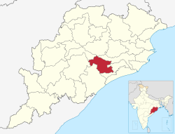 Location in Odisha | |
 Nayagarh district | |
| Coordinates: 20.116°N 85.01°E | |
| Country | |
| State | |
| Headquarters | Nayagarh |
| Government | |
| • Collector & District Magistrate | Rabindra Nath Sahu , IAS ( SCS - 2009) |
| • Member of Lok Sabha | Pinaki Misra |
| Area | |
| • Total | 3,890 km2 (1,500 sq mi) |
| Population (2011)[1] | |
| • Total | 962,789 |
| • Density | 250/km2 (640/sq mi) |
| Languages | |
| • Official | Odia, English |
| Time zone | UTC+5:30 (IST) |
| PIN | 752069 |
| Vehicle registration | OD-25 |
| Sex ratio | 0.994 ♂/♀ |
| Lok Sabha constituency | Puri |
| Climate | Aw (Köppen) |
| Precipitation | 1,449.1 millimetres (57.05 in) |
| Website | www |
| This article is part of a series on |
| Odisha |
|---|
 |
| Governance |
|
| Topics |
|
|
Districts Divisions |
| GI Products |
|
|
|
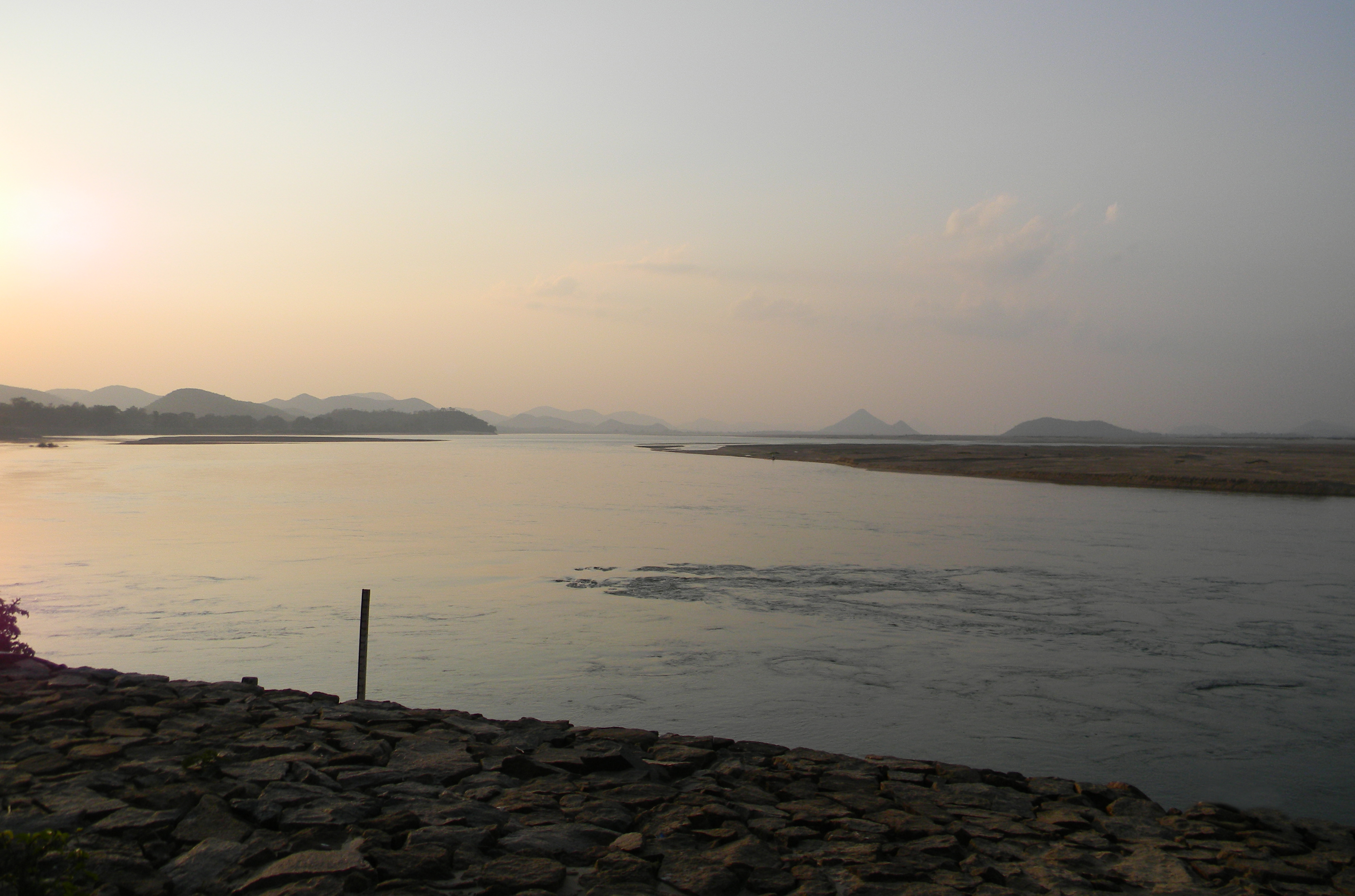
The district is bordered by Khordha district to the south and east, Cuttack district to the east and north, Angul district to the north, Boudh district to the northwest, Kandhamal district to the west and Ganjam district to the southwest.
Blocks
- Bhapur
- Daspalla
- Gania
- Khandapada
- Nayagarh
- Nuagan
- Odagaon
- Ranapur
Demographics
| Year | Pop. | ±% p.a. |
|---|---|---|
| 1901 | 331,061 | — |
| 1911 | 337,561 | +0.19% |
| 1921 | 303,665 | −1.05% |
| 1931 | 336,493 | +1.03% |
| 1941 | 363,652 | +0.78% |
| 1951 | 392,506 | +0.77% |
| 1961 | 470,878 | +1.84% |
| 1971 | 578,498 | +2.08% |
| 1981 | 683,392 | +1.68% |
| 1991 | 782,647 | +1.37% |
| 2001 | 864,516 | +1.00% |
| 2011 | 962,789 | +1.08% |
| source:[4] | ||
According to the 2011 census, Nayagarh district has a population of 962,789,[1] roughly equal to the nation of Fiji[5] or the US state of Montana.[6] This gives it a ranking of 453rd in India (out of a total of 640).[1] The district has a population density of 247 inhabitants per square kilometre (640/sq mi) .[1] Its population growth rate over the decade 2001-2011 was 11.3%.[1] Nayagarh has a sex ratio of 916 females for every 1000 males,[1] and a literacy rate of 79.17%. Scheduled Castes and Scheduled Tribes make up 14.17% and 6.10% of the population respectively.[1]
Odia is the predominant language, spoken by 99.09% of the population. Kui is spoken by a small minority (0.60%).[7]
Vidhan sabha constituencies
The following is the 4 Vidhan sabha constituencies[8][9] of Nayagarh district and the elected members[10] of that area
| No. | Constituency | Reservation | Extent of the Assembly Constituency (Blocks) | Member of 15th Assembly | Party |
|---|---|---|---|---|---|
| 119 | Ranpur | None | Ranpur, Odagaon (part) | Rabinarayan Mohapatra | BJD |
| 120 | Khandapada | None | Khandapada (NAC), Khandapada, Bhapur | Soumya Ranjan Patnaik | BJD |
| 121 | Daspalla | SC | Daspalla, Gania, Nuagaon | Ramesh Chandra Behera | BJD |
| 122 | Nayagarh | None | Nayagarh (NAC), Nayagarh, Odagaon (part) | Arun Kumar Sahu | BJD |
See also
- Nayagarh State – Princely state existed in the Nayagarh district, Odisha, India.
References
- "District Census Handbook 2011 - Nayagarh" (PDF). Census of India. Registrar General and Census Commissioner of India.
- "About District | Nayagarh District Government of Odisha | India".
- "Table C-01 Population by Religious Community: Odisha". Census of India, 2011. Registrar General and Census Commissioner of India.
- Decadal Variation In Population Since 1901
- US Directorate of Intelligence. "Country Comparison:Population". Archived from the original on June 13, 2007. Retrieved 2011-10-01.
Fiji 883,125 July 2011 est.
- "2010 Resident Population Data". U. S. Census Bureau. Archived from the original on 2013-10-19. Retrieved 2011-09-30.
Montana 989,415
- "Table C-16 Population by Mother Tongue: Odisha". Census of India 2011. Registrar General and Census Commissioner of India.
- Assembly Constituencies and their EXtent
- Seats of Odisha
- "List of Member in Fourteenth Assembly". ws.ori.nic.in. Archived from the original on 2 May 2007. Retrieved 19 February 2013.
External links
Places adjacent to Nayagarh district | ||||||||||||||||
|---|---|---|---|---|---|---|---|---|---|---|---|---|---|---|---|---|
| ||||||||||||||||
Capital: Bhubaneswar | |||||||
| State symbols |
|  | |||||
| Governance |
| ||||||
| History |
| ||||||
| Geography |
| ||||||
| Districts by division |
| ||||||
| Cities | |||||||
| GI products |
| ||||||
| Topics | |||||||
Authority control | |
|---|---|
| General |
|
| National libraries | |
На других языках
[de] Nayagarh (Distrikt)
Der Distrikt Nayagarh (Oriya ନୟାଗଡ଼ ଜିଲ୍ଲା .mw-parser-output .Latn{font-family:"Akzidenz Grotesk","Arial","Avant Garde Gothic","Calibri","Futura","Geneva","Gill Sans","Helvetica","Lucida Grande","Lucida Sans Unicode","Lucida Grande","Stone Sans","Tahoma","Trebuchet","Univers","Verdana"}Naẏāgaṛa Jillā) befindet sich im indischen Bundesstaat Odisha. Verwaltungssitz ist die namensgebende Stadt Nayagarh.- [en] Nayagarh district
[ru] Наягарх (округ)
Наягарх (англ. Nayagarh) — округ в индийском штате Орисса. Образован в 1995 году из части территории округа Пури. Административный центр — город Наягарх. Площадь округа — 3890 км². По данным всеиндийской переписи 2001 года население округа составляло 864 506 человек. Уровень грамотности взрослого населения составлял 70,5 %, что выше среднеиндийского уровня (59,5 %). Доля городского населения составляла 4,3 %.Другой контент может иметь иную лицензию. Перед использованием материалов сайта WikiSort.org внимательно изучите правила лицензирования конкретных элементов наполнения сайта.
WikiSort.org - проект по пересортировке и дополнению контента Википедии