world.wikisort.org - USA
Kanabec County (/kəˈneɪbɪk/ kə-NAY-bik) is a county in the East Central part of U.S. state of Minnesota. As of the 2020 census, the population was 16,032.[1] Its county seat is Mora.[2]
Kanabec County | |
|---|---|
U.S. county | |
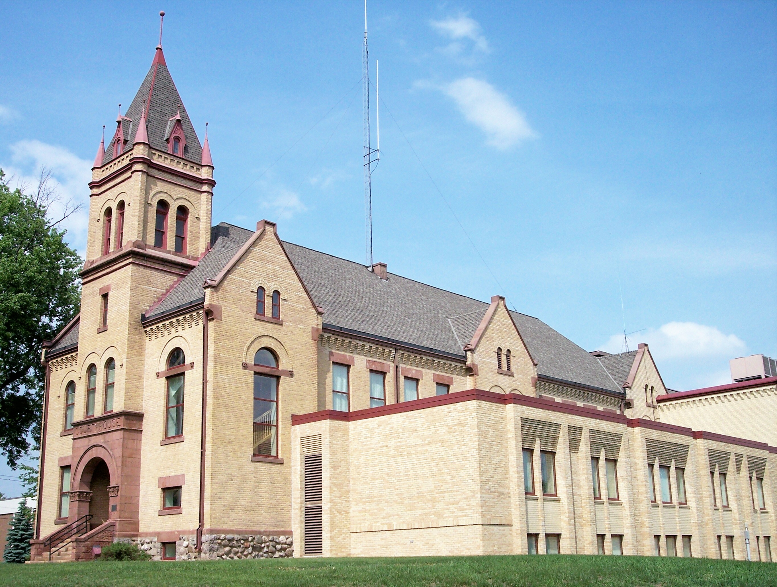 Kanabec County Courthouse in Mora (2007) | |
 Location within the U.S. state of Minnesota | |
 Minnesota's location within the U.S. | |
| Coordinates: 45°57′N 93°18′W | |
| Country | |
| State | |
| Founded | March 13, 1858 (created) 1882 (fully organized) |
| Named for | Snake River |
| Seat | Mora |
| Largest city | Mora |
| Area | |
| • Total | 534 sq mi (1,380 km2) |
| • Land | 522 sq mi (1,350 km2) |
| • Water | 12 sq mi (30 km2) 2.3%% |
| Population (2020) | |
| • Total | 16,032 |
| • Estimate (2021) | 16,159 |
| • Density | 30.7/sq mi (11.9/km2) |
| Time zone | UTC−6 (Central) |
| • Summer (DST) | UTC−5 (CDT) |
| Congressional district | 8th |
| Website | www |
History
The Minnesota legislature authorized creation of Kanabec County on March 13, 1858,[3] with territory partitioned from Pine County. No county seat was designated at that time, and the county organization was not effected at that time. The county name came from the Ojibwe term ginebig, meaning "snake," after the Snake River — Kanabecosippi (Ginebigo-ziibi in the modern spelling) — which flows through the county.[4]
The area of Kanabec County was attached to Chisago County for administrative and judicial purposes. What county business was handled locally was performed by part-time County Auditor and County Treasurer, in a single room in a stopping place operated by lumber-trader George Staples at Millet Rapids.
In 1871 the county was detached from Chisago, and assigned to Pine County. This assignment lasted through 1881.
The 1870 United States census listed 53 occupants of the Kanabec County area. However, an influx of settlers into its southern areas occurred in the early 1870s, and by 1876 an official county building was needed. A one-room wood building was erected at Millet Rapids, put into use in 1876. In 1881 the county was detached from Pine, and the government structure was finalized, with the county seat being designated at Brunswick. Only one court term was held at Brunswick; in the 1882 general election, a nearly-unanimous vote designated Mora as the county seat. The old courthouse building was sold to a local farmer, who moved it to his property to use as a home. The wood courthouse erected at Mora was used until 1894, when it burned and was replaced by a more fireproof building.[5]
Geography

The Snake River flows south-southeasterly through the central part of the county, fed by Groundhouse River (flowing northeasterly from the county's SW corner) and Red Creek and Mud Creek. The Snake continues easterly into Pine County. The county terrain consists of partly-wooded rolling hills, etched by drainages. It is largely devoted to agriculture.[6] The terrain slopes to the south and east, with its highest point near the NW corner, at 1,309' (399m) ASL.[7] The county has a total area of 534 square miles (1,380 km2), of which 522 square miles (1,350 km2) is land and 12 square miles (31 km2) (2.3%) is water.[8]

Lakes[6]
- Ann Lake
- Bachman Dam
- Bass Lake (part)
- Beauty Lake
- Featherbed Lake
- Fish Lake
- Knife Lake
- Lake Eleven
- Lake Five
- Lake Full of Fish
- Lewis Lake
- Long Lake
- Pennington Lake
- Pomroy Lake
- Rice Lake
- Thirteen Lake
- White Lily Lake
Major highways
 Minnesota State Highway 23
 Minnesota State Highway 27
 Minnesota State Highway 47
 Minnesota State Highway 65
 Minnesota State Highway 70
 Minnesota State Highway 107
- List of county roads
Adjacent counties
- Aitkin County - north
- Pine County - east
- Chisago County - southeast
- Isanti County - south
- Mille Lacs County - west
Protected areas[6]
- Ann Lake State Wildlife Management Area
- Bean Dam State Wildlife Management Area
- Hay-Snake State Wildlife Management Area
- Rice Creek State Wildlife Management Area
- Rum River State Forest (part)
- Tosher Creek State Wildlife Management Area
- Whited State Wildlife Management Area
Demographics
| Historical population | |||
|---|---|---|---|
| Census | Pop. | %± | |
| 1860 | 30 | — | |
| 1870 | 93 | 210.0% | |
| 1880 | 505 | 443.0% | |
| 1890 | 1,579 | 212.7% | |
| 1900 | 4,614 | 192.2% | |
| 1910 | 6,461 | 40.0% | |
| 1920 | 9,086 | 40.6% | |
| 1930 | 8,558 | −5.8% | |
| 1940 | 9,651 | 12.8% | |
| 1950 | 9,192 | −4.8% | |
| 1960 | 9,007 | −2.0% | |
| 1970 | 9,775 | 8.5% | |
| 1980 | 12,161 | 24.4% | |
| 1990 | 12,802 | 5.3% | |
| 2000 | 14,996 | 17.1% | |
| 2010 | 16,239 | 8.3% | |
| 2020 | 16,032 | −1.3% | |
| 2021 (est.) | 16,159 | [9] | 0.8% |
| U.S. Decennial Census[10] 1790-1960[11] 1900-1990[12] 1990-2000[13] 2010-2020[1] | |||

2010 census
As of the 2010 census,[14] there were 16,239 people and 6,277 households in the county. The population density was 31.1/sqmi (12.0/km2). There were 7,808 housing units (2014 estimate). The racial makeup of the county was 96.6% White, 0.6% Black or African American, 0.8% Native American or Alaska Native, 0.4% Asian, <0.1% Pacific Islander or Native Hawaiian, and 1.6% from other races or two or more races. 1.7% of the population were Hispanic or Latino of any race. As of the 2000 census, 30.2% were of German, 18.1% Swedish, 13.1% Norwegian, 5.5% American and 5.4% Irish ancestry.
In the census of 2000, there were 5,759 households, out of which 34.10% had children under the age of 18 living with them, 58.80% were married couples living together, 8.40% had a female householder with no husband present, and 28.00% were non-families. 23.80% of all households were made up of individuals, and 10.30% had someone living alone who was 65 years of age or older. The average household size was 2.58 and the average family size was 3.03.
The county population contained 24.0% under the age of 18 and 16.4% who were 65 years of age or older. For every 100 females there were 101.2 males.
The median income for a household in the county was $47,068. The per capita income for the county was $22,291. About 14.2% of the population were below the poverty line.
2020 Census
| Race | Num. | Perc. |
|---|---|---|
| White (NH) | 14,954 | 93.3% |
| Black or African American (NH) | 65 | 0.4% |
| Native American (NH) | 113 | 0.7% |
| Asian (NH) | 80 | 0.5% |
| Pacific Islander (NH) | 0 | 0% |
| Other/Mixed (NH) | 582 | 3.63% |
| Hispanic or Latino | 238 | 1.5% |
Communities
Cities
Unincorporated communities
Townships
Politics
Kanabec County voters have moved toward the Republican Party in the past few decades; since 1980 the county has selected the Republican Party candidate in 67% of national elections (as of 2020).
| Year | Republican | Democratic | Third party | |||
|---|---|---|---|---|---|---|
| No. | % | No. | % | No. | % | |
| 2020 | 6,278 | 67.93% | 2,774 | 30.02% | 190 | 2.06% |
| 2016 | 5,230 | 63.96% | 2,327 | 28.46% | 620 | 7.58% |
| 2012 | 4,328 | 53.10% | 3,593 | 44.09% | 229 | 2.81% |
| 2008 | 4,479 | 52.70% | 3,743 | 44.04% | 277 | 3.26% |
| 2004 | 4,527 | 54.89% | 3,592 | 43.55% | 129 | 1.56% |
| 2000 | 3,480 | 51.09% | 2,831 | 41.57% | 500 | 7.34% |
| 1996 | 1,924 | 32.35% | 2,927 | 49.21% | 1,097 | 18.44% |
| 1992 | 1,876 | 29.83% | 2,532 | 40.27% | 1,880 | 29.90% |
| 1988 | 2,571 | 45.93% | 2,970 | 53.05% | 57 | 1.02% |
| 1984 | 3,027 | 52.88% | 2,660 | 46.47% | 37 | 0.65% |
| 1980 | 2,500 | 45.39% | 2,654 | 48.18% | 354 | 6.43% |
| 1976 | 1,943 | 36.58% | 3,188 | 60.03% | 180 | 3.39% |
| 1972 | 2,395 | 51.71% | 1,969 | 42.51% | 268 | 5.79% |
| 1968 | 1,847 | 43.48% | 2,154 | 50.71% | 247 | 5.81% |
| 1964 | 1,348 | 33.50% | 2,666 | 66.25% | 10 | 0.25% |
| 1960 | 2,278 | 54.33% | 1,890 | 45.08% | 25 | 0.60% |
| 1956 | 1,950 | 52.80% | 1,736 | 47.01% | 7 | 0.19% |
| 1952 | 2,205 | 55.85% | 1,714 | 43.41% | 29 | 0.73% |
| 1948 | 1,531 | 38.56% | 2,305 | 58.06% | 134 | 3.38% |
| 1944 | 1,913 | 51.52% | 1,776 | 47.83% | 24 | 0.65% |
| 1940 | 2,311 | 50.85% | 2,185 | 48.07% | 49 | 1.08% |
| 1936 | 1,350 | 33.02% | 2,579 | 63.09% | 159 | 3.89% |
| 1932 | 1,268 | 35.17% | 2,106 | 58.42% | 231 | 6.41% |
| 1928 | 2,380 | 68.35% | 1,040 | 29.87% | 62 | 1.78% |
| 1924 | 1,507 | 47.57% | 128 | 4.04% | 1,533 | 48.39% |
| 1920 | 2,436 | 75.68% | 332 | 10.31% | 451 | 14.01% |
| 1916 | 776 | 49.02% | 608 | 38.41% | 199 | 12.57% |
| 1912 | 218 | 16.99% | 270 | 21.04% | 795 | 61.96% |
| 1908 | 803 | 69.52% | 242 | 20.95% | 110 | 9.52% |
| 1904 | 872 | 86.08% | 106 | 10.46% | 35 | 3.46% |
| 1900 | 658 | 73.44% | 210 | 23.44% | 28 | 3.13% |
| 1896 | 484 | 64.11% | 256 | 33.91% | 15 | 1.99% |
| 1892 | 182 | 53.53% | 38 | 11.18% | 120 | 35.29% |
| 1888 | 162 | 45.25% | 82 | 22.91% | 114 | 31.84% |
| 1884 | 280 | 87.50% | 40 | 12.50% | 0 | 0.00% |
| 1880 | 101 | 67.79% | 48 | 32.21% | 0 | 0.00% |
| 1876 | 109 | 78.99% | 29 | 21.01% | 0 | 0.00% |
| 1872 | 22 | 62.86% | 13 | 37.14% | 0 | 0.00% |
| 1868 | 8 | 88.89% | 1 | 11.11% | 0 | 0.00% |
| 1860 | 15 | 100.00% | 0 | 0.00% | 0 | 0.00% |
See also
- National Register of Historic Places listings in Kanabec County, Minnesota
References
- "U.S. Census Bureau QuickFacts: Kanabec County, Minnesota". www.census.gov. United States Census Bureau. Retrieved April 3, 2022.
- "Find a County". National Association of Counties. Archived from the original on May 31, 2011. Retrieved June 7, 2011.
- Minnesota State Government Series - State Counties
- Gannett, Henry (1905). The Origin of Certain Place Names in the United States. Govt. Print. Off. p. 172.
- About Us. Kanabec County website (accessed March 13, 2019)
- https://www.google.com/maps/place/Kanabec+County,+MN/@45.745944,-93.5605564,11.75z/data=!4m5!3m4!1s0x52b3cdf8a56ed3e3:0x10d2ebe8b70f25a0!8m2!3d45.9329034!4d-93.2883531 Kanabec County MN Google Maps (accessed March 13, 2019)]
- ""Find an Altitude/Kanabec County MN" Google Maps (accessed March 13, 2019)". Archived from the original on May 21, 2019. Retrieved March 13, 2019.
- "2010 Census Gazetteer Files". United States Census Bureau. August 22, 2012. Archived from the original on September 21, 2013. Retrieved October 18, 2014.
- "Annual Estimates of the Resident Population for Counties: April 1, 2020 to July 1, 2021". Retrieved April 3, 2022.
- "U.S. Decennial Census". United States Census Bureau. Archived from the original on April 26, 2015. Retrieved October 18, 2014.
- "Historical Census Browser". University of Virginia Library. Retrieved October 18, 2014.
- "Population of Counties by Decennial Census: 1900 to 1990". United States Census Bureau. Retrieved October 18, 2014.
- "Census 2000 PHC-T-4. Ranking Tables for Counties: 1990 and 2000" (PDF). United States Census Bureau. Retrieved October 18, 2014.
- "State & County QuickFacts". United States Census Bureau. Archived from the original on June 7, 2011. Retrieved November 12, 2015.
- "P2 HISPANIC OR LATINO, AND NOT HISPANIC OR LATINO BY RACE – 2020: DEC Redistricting Data (PL 94-171) – Kanabec County, Minnesota".
- Leip, David. "Atlas of US Presidential Elections". uselectionatlas.org. Retrieved September 19, 2018.
Further reading
- Ziegler, Frank and Robert H Beck (1981). Ken-ā-big : the story of Kanabec County: an illustrated history of Kanabec County, its early years. Mora, MN: B & W Printers. ISBN 978-1-199-49133-6. ISBN 1-199-49133-0.
External links
Places adjacent to Kanabec County, Minnesota | ||||||||||||||||
|---|---|---|---|---|---|---|---|---|---|---|---|---|---|---|---|---|
| ||||||||||||||||
Municipalities and communities of Kanabec County, Minnesota, United States | ||
|---|---|---|
County seat: Mora | ||
| Cities | 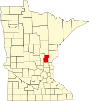 | |
| Townships | ||
| Unincorporated communities | ||
| Indian reservation |
| |
| Footnotes | ‡This populated place also has portions in an adjacent county or counties | |
| ||
Authority control | |
|---|---|
| General | |
| National libraries | |
На других языках
[de] Kanabec County
Das Kanabec County[3] ist ein County im US-amerikanischen Bundesstaat Minnesota. Im Jahr 2010 hatte das County 16.239 Einwohner und eine Bevölkerungsdichte von 11,9 Einwohnern pro Quadratkilometer.[4] Der Verwaltungssitz (County Seat) ist Mora.[5]- [en] Kanabec County, Minnesota
[ru] Канейбик
Канейбик (англ. Kanabec County) — округ в штате Миннесота, США. Столица и крупнейший город — Мора. По переписи 2000 года в округе проживают 14 996 человек. Площадь — 1381 км², из которых 1359,2 км² — суша, а 21,8 км² — вода. Плотность населения составляет 11 чел./км².Другой контент может иметь иную лицензию. Перед использованием материалов сайта WikiSort.org внимательно изучите правила лицензирования конкретных элементов наполнения сайта.
WikiSort.org - проект по пересортировке и дополнению контента Википедии