world.wikisort.org - Thailand
Saraburi (Thai: สระบุรี) is one of the central provinces (changwat) of Thailand. Neighboring provinces are (from north clockwise) Lopburi, Nakhon Ratchasima, Nakhon Nayok, Pathum Thani, and Ayutthaya. It is believed to have been constructed in the year 1548 during the reign of King Maha Chakkraphat of Ayutthaya as a centre for recruiting troops.
Saraburi
สระบุรี | |
|---|---|
Province | |
      (Clockwise from top left) Wat Phra Phutthabat, the provincial symbol, Kaeng Khoi Junction railway station, the main railway station of the province, Curry puffs, good stuff of province, Mittraphap Road in the area of Muak Lek, Muak Lek old town zone, Chet Sao Noi Waterfall | |
 Flag  Seal | |
 Map of Thailand highlighting Saraburi province | |
| Country | Thailand |
| Capital | Saraburi |
| Government | |
| • Governor | Manrat Rattanasukhon (since October 2018) |
| Area | |
| • Total | 3,499 km2 (1,351 sq mi) |
| • Rank | Ranked 56th |
| Population (2018)[2] | |
| • Total | 645,024 |
| • Rank | Ranked 40th |
| • Density | 180.4/km2 (467/sq mi) |
| • Rank | Ranked 17th |
| Human Achievement Index | |
| • HAI (2017) | 0.6341 "high" Ranked 13th |
| Time zone | UTC+7 (ICT) |
| Postal code | 18xxx |
| Calling code | 036 |
| ISO 3166 code | TH-19 |
Geography

Saraburi is on the east side of the Chao Phraya River valley. The eastern part of the province is covered by high plains and plateaus, while the western part is mostly low flat plains.[citation needed] Saraburi province has 848 km2 (327 sq mi) of forest or 24.2 percent of provincial area.[1] Two national parks are in the province. Namtok Chet Sao Noi protects 28 km2 (11 sq mi) around a scenic waterfall. Phra Puttachai protects the Khao Sam Lan Forest, which consists of hilly landscape and is the source to several rivers and waterfalls. The highest elevation is the Khao Khrok at 329 m. The 45 km2 (17 sq mi) area was declared a national park in 1981.
The town, as a gateway to the northeastern region, is 108 km from Bangkok. It occupies an area of 3,577 square kilometres.
History
Saraburi has been an important city since ancient times.[citation needed] It is assumed to have been established about 1549 during the reign of King Maha Chakkraphat of the Kingdom of Ayutthaya. It may also be assumed that the area in Saraburi province has existed since Dvaravati period.
Ayutthaya period
Saraburi began to appear in the middle of the Ayutthaya period in 1569 during the reign of Mahinthrathirat. When the king of Hanthawaddy came to surround Ayutthaya, Mahinthrathirat has asked Setthathirath to bring the army to help, but the Lao army was ambushed by the Burmese army in Saraburi, until the Lao army fell back to Vientiane.
In the Ayutthaya period, assumed that Saraburi was located in the area of Bueng Ngong. Until 1890, has changed the new governor then moved the political office to Ban Phai Lom Noi.
Rattanakosin period
The new governor appointed by the county to rule Saraburi is Phraya Phichai Ronarongsongkram (Dist). In 1896, King Rama V ordered to built a railway line northeast up to Saraburi, Phraya Phichai Ronarongsongkram saw that the old town at Sao Hai far from the railway, the terrain was not suitable for the current conditions at that time and difficult to expand the city in the future. Therefore, a new town hall was built at Tambon Pak Phriao, construction has been ongoing and successful, able to move government officials to work on the city hall.
When the railway is finished. Later, many roads were built in Saraburi, such as Nong Don – Phra Phutthabat Road and Pichai Ronarongsongkram Road from Saraburi City to Sao Hai District built in 1928 – 1933. For other roads, in 1937 – 1939, Phahonyothin Road was built from Bangkok to Saraburi. In 1955 – 1958, Mittraphap Road was built from Saraburi to Nong Khai.
In 1827, The Thai army attacked Vientiane and led the Lao Vientiane, Lao Puan came to settled in Lopburi and Saraburi. As a result, Saraburi has Laotian came to settled, making Saraburi's population increase.
The Laotian who settled are divided into 4 groups:
1. Lao Wiang – Laotian from Vientiane, lives a lot in Kaeng Khoi district, Nong Khae district, Nong Saeng district, Wihan Daeng district, Sao Hai district and in Ban Mo district.
2. Phuan – Laotian from Muang Phuan came to settled in Nong Don district and in Don Phut district
3. Ngaew – Laotian from rural suburbs of Vientiane came to settled in Phra Phutthabat district.
4. Nyaw – Laotian from Khamkeut district came to settled in Kaeng Khoi district
In addition to the Laotian, there are also Chiang Saen people who came to settled in Saraburi in 1804, call themselves as "Yuan" currently live in every district in Saraburi except in Nong Don district and in Don Phut district.
Climate
Saraburi has a tropical savanna climate, Aw (Climate Classification system of Koppen) The climate is arid with little rain in winter, relatively high temperatures in summer, cool in winter, and rain from May to October, about 70–90 days
The average annual temperature is 28-29 degrees Celsius. Maximum temperatures average 33-34 degrees Celsius and minimum temperature averages 23–24 degrees Celsius. April is the hottest month of the year, while winters are cool in January.
Air quality
Saraburi has poor air quality resulting from cement production, chiefly stone crushing. In the area of Na Pra Lan Sub-district there are 133 plants, 17 mining sites, 32 stone mill plants, and 22 stone dressing plants. Air quality in the province frequently exceeds recommended limits for particulates.[4][5]
Education
There are 366 schools. There are a total of 125,255 students at all levels.[citation needed]
Economy
In 2007 Saraburi's population had an average income per capita 214,537 baht per year, making it tenth highest in the country, second in the central provinces. Annual GDP was 129,275 million baht.[citation needed]
Religion and culture
In 2007, Saraburi's population was 89.34 percent Buddhist, 597,138 people. There are 499 temples. There are total of 3,443 monks and 274 neophytes. Muslims number 953 (0.32 percent). There are five Christian churches.[citation needed]
Symbols
The provincial seal shows the temple Wat Phra Buddha Baat. In the 17th century a hunter found a puddle of water which looked like a large footprint. It was declared a footprint of Buddha, and a temple was built around it. Phra Phutthabat means footprint of Buddha.
The provincial tree is Lagerstroemia floribunda and the provincial flower is the yellow cotton tree (Cochlospermum regium). The endemic crab, Larnaudia larnaudii is the provincial aquatic animal.[6]
Administrative divisions
Provincial government
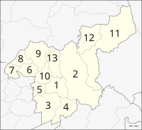
The province is divided into 13 districts (amphoe). The districts are further divided into 111 subdistricts (tambon) and 965 villages (muban).
- Mueang Saraburi
- Kaeng Khoi
- Nong Khae
- Wihan Daeng
- Nong Saeng
- Ban Mo
- Don Phut
- Nong Don
- Phra Phutthabat
- Sao Hai
- Muak Lek
- Wang Muang
- Chaloem Phra Kiat
Local government
As of 26 November 2019 there are:[7] one Saraburi Provincial Administrative Organization - PAO (ongkan borihan suan changwat) and 38 municipal (thesaban) areas in the province. Saraburi, Kaeng Khoi, Phra Phutthabat and Thap Kwang have town (thesaban mueang) status. Further 34 subdistrict municipalities (thesaban tambon).[2] The non-municipal areas are administered by 70 Subdistrict Administrative Organizations - SAO (ongkan borihan suan tambon).
Transport
Rail
Saraburi's main station is Saraburi Railway Station. There is a major rail junction at Kaeng Khoi Junction.
Road
Saraburi can be reached on Phahonyothin Road (Thailand Route 1). Mittraphap Road (Thailand Route 2) is a main road in the northeastern region. It has a beginning here which is a route that separates from the right side of Phahonyothin Road.[8]
Health
The main hospital of Saraburi is Saraburi Hospital, operated by the Ministry of Public Health.
Human achievement index 2017
| Health | Education | Employment | Income |
| 26 | 25 | 24 | 11 |
| Housing | Family | Transport | Participation |
 |
 |
||
| 53 | 39 | 17 | 32 |
| Province Saraburi, with an HAI 2017 value of 0.6341 is "high", occupies place 13 in the ranking. | |||
Since 2003, United Nations Development Programme (UNDP) in Thailand has tracked progress on human development at sub-national level using the Human achievement index (HAI), a composite index covering all the eight key areas of human development. National Economic and Social Development Board (NESDB) has taken over this task since 2017.[3]
| Rank | Classification |
| 1 - 15 | "high" |
| 16 - 30 | "somewhat high" |
| 31 - 45 | "average" |
| 45 - 60 | "somewhat low" |
| 61 - 77 | "low" |
| Map with provinces and HAI 2017 rankings |
 |
Notable people
- Arthit Tanusorn (born 1975), retired footballer
References
- "ตารางที่ 2 พี้นที่ป่าไม้ แยกรายจังหวัด พ.ศ.2562" [Table 2 Forest area Separate province year 2019]. Royal Forest Department (in Thai). 2019. Retrieved 6 April 2021, information, Forest statistics Year 2019
{{cite web}}: CS1 maint: postscript (link) - "ร่ยงานสถิติจำนวนประชากรและบ้านประจำปี พ.ศ.2561" [Statistics, population and house statistics for the year 2018]. Registration Office Department of the Interior, Ministry of the Interior. stat.bora.dopa.go.th (in Thai). 31 December 2018. Retrieved 20 June 2019.
- Human achievement index 2017 by National Economic and Social Development Board (NESDB), pages 1-40, maps 1-9, retrieved 14 September 2019, ISBN 978-974-9769-33-1
- Wipatayotin, Apinya (2019-01-27). "Grappling with pollution". Bangkok Post. Retrieved 2019-01-27.
- Wipatayotin, Apinya (13 January 2018). "Saraburi area hits No.1 for worst air quality". Bangkok Post. Retrieved 26 July 2018.
- "สัตว์น้ำจืดประจำจังหวัดสระบุรี (ปูน้ำตกสระบุรี)" [Saraburi provincial freshwater animal (Waterfall crab)]. 4.fisheries.go.th (in Thai). 2017-01-06. Retrieved 2020-04-22.
- "Number of local government organizations by province". dla.go.th. Department of Local Administration (DLA). 26 November 2019. Retrieved 10 December 2019.
62 Saraburi: 1 PAO, 4 Town mun., 34 Subdistrict mun., 70 SAO.
- ""สุดบรรทัด-เจนจบทิศ" สู่ "ถนนมิตรภาพ" ช่วยย่นเวลาเดินทางกทม.-โคราชจาก 10 เหลือ 3 ชม" ["Sudbanthat-Jenjopthit" to "Mittraphap Road" help shorten the travel time from Bangkok - Khorat from 10 to 3 hrs.]. Silpa Wattanatham (in Thai). 2019-12-27. Retrieved 2020-04-22.
External links
 Saraburi travel guide from Wikivoyage
- Provincial page, Tourist Authority of Thailand
- Khao Yai National Park
- Saraburi history in Thai language Archived April 9, 2008, at the Wayback Machine
Places adjacent to Saraburi province | ||||||||||||||||
|---|---|---|---|---|---|---|---|---|---|---|---|---|---|---|---|---|
| ||||||||||||||||
Authority control | |
|---|---|
| General | |
| National libraries | |
| Other |
|
На других языках
[de] Saraburi (Provinz)
Saraburi (Thai: จังหวัดสระบุร) ist eine Provinz (Changwat) in Zentralthailand. Die Provinzhauptstadt Saraburi liegt etwa 110 km nördlich von der Landeshauptstadt Bangkok.- [en] Saraburi province
[ru] Сарабури (провинция)
Сара́бури[1][2] (тайск. สระบุรี) — провинция в центральной части Таиланда. Расположена на восточной стороне долины река Чаупхрая. Восточная часть провинции занята высокими равнинами и плато, западная — низменными равнинами. Площадь — 3 576,5 км², население — 715 404 человек (2010). Средняя плотность населения составляет 200,00 чел./км². Административный центр провинции — город Сарабури, расположен в 108 км от Бангкока. В Сарабури расположены 2 национальных парка.Другой контент может иметь иную лицензию. Перед использованием материалов сайта WikiSort.org внимательно изучите правила лицензирования конкретных элементов наполнения сайта.
WikiSort.org - проект по пересортировке и дополнению контента Википедии