world.wikisort.org - Thailand
Wang Muang (Thai: วังม่วง, pronounced [wāŋ mûa̯ŋ]) is a district (amphoe) in the northern part of Saraburi province, central Thailand.
Wang Muang
วังม่วง | |
|---|---|
District | |
 The pass on highway 2089 | |
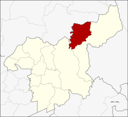 District location in Saraburi province | |
| Coordinates: 14°50′44″N 101°8′4″E | |
| Country | Thailand |
| Province | Saraburi |
| Seat | Wang Muang |
| Area | |
| • Total | 338.0 km2 (130.5 sq mi) |
| Population (2005) | |
| • Total | 17,536 |
| • Density | 52/km2 (130/sq mi) |
| Time zone | UTC+7 (ICT) |
| Postal code | 18220 |
| Geocode | 1912 |
History
The district was created as a minor district (king amphoe) on 1 April 1990, with three tambons taken from Muak Lek district.[1] It was upgraded to full district status on 7 September 1995.[2]
Geography
Neighboring districts are (from the north clockwise) Phatthana Nikhom of Lopburi province and Muak Lek and Kaeng Khoi of Saraburi Province.
Administration
The district is divided into three sub-districts (tambons), which are further subdivided into 31 villages (mubans). Wang Muang is the only township (thesaban tambon), covering parts of tambons Wang Muang and Kham Phran. There are three tambon administrative organizations (TAO).
| No. | Name | Thai name | Villages | Pop. |
|---|---|---|---|---|
| 1. | Salaeng Phan | แสลงพัน | 5 | 2,616 |
| 2. | Kham Phran | คำพราน | 9 | 6,511 |
| 3. | Wang Muang | วังม่วง | 17 | 8,409 |
References
- ประกาศกระทรวงมหาดไทย เรื่อง แบ่งเขตท้องที่อำเภอมวกเหล็ก จังหวัดสระบุรี ตั้งเป็นกิ่งอำเภอวังม่วง (PDF). Royal Gazette (in Thai). 107 (25 ง): 1359. February 13, 1990.
- พระราชกฤษฎีกาตั้งอำเภอด่านมะขามเตี้ย อำเภอแก่งหางแมว อำเภอภักดีชุมพล อำเภอเวียงแก่น อำเภอแม่วาง อำเภอถ้ำพรรณรา อำเภอบ่อเกลือ อำเภอโนนสุวรรณ อำเภอห้วยราช อำเภอแม่ลาน อำเภอบางแก้ว อำเภอป่าพะยอม อำเภอหนองม่วงไข่ อำเภอยางสีสุราช อำเภอจังหาร อำเภอบ้านธิ อำเภอภูสิงห์ อำเภอบางกล่ำ อำเภอวังม่วง และอำเภอนายูง พ.ศ. ๒๕๓๘ (PDF). Royal Gazette (in Thai). 112 (32 ก): 1–3. August 8, 1995.
External links
This Saraburi Province location article is a stub. You can help Wikipedia by expanding it. |
Другой контент может иметь иную лицензию. Перед использованием материалов сайта WikiSort.org внимательно изучите правила лицензирования конкретных элементов наполнения сайта.
WikiSort.org - проект по пересортировке и дополнению контента Википедии