world.wikisort.org - Thailand
Ban Mo (Thai: บ้านหมอ, pronounced [bâːn mɔ̌ː]) is a district (amphoe) in the northwestern part of Saraburi province, central Thailand.
This article needs additional citations for verification. (January 2021) |
Ban Mo
บ้านหมอ | |
|---|---|
District | |
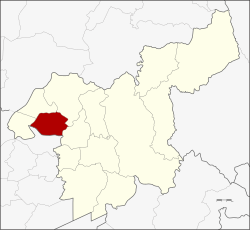 District location in Saraburi province | |
| Coordinates: 14°36′56″N 100°43′38″E | |
| Country | Thailand |
| Province | Saraburi |
| Area | |
| • Total | 203.6 km2 (78.6 sq mi) |
| Population (2000) | |
| • Total | 39,489 |
| • Density | 190/km2 (500/sq mi) |
| Time zone | UTC+7 (ICT) |
| Postal code | 18130 |
| Geocode | 1906 |
History
After the Buddha footprint near Saraburi was found and a temple was built, King Songtham hired Dutch engineers to build a road from Tha Ruea to Wat Phra Phutthabat to make the pilgrimage there easier. Elephants did the heavy lifting. When the elephants got sick, they were cured at Wat Khok (later called Wat Khok Ban Mo and Wat Ban Mo finally), which thus gave the district its name.
Geography
Neighboring districts are (from the west clockwise) Don Phut, Nong Don, Phra Phutthabat, Sao Hai of Saraburi Province, and Tha Ruea of Ayutthaya province.
Administration
The district is divided into nine sub-districts (tambons).[1]
| No. | Name | Thai |
|---|---|---|
| 1. | Ban Mo | บ้านหมอ |
| 2. | Bang Khamot | บางโขมด |
| 3. | Sang Sok | สร่างโศก |
| 4. | Talat Noi | ตลาดน้อย |
| 5. | Horathep | หรเทพ |
| 6. | Khok Yai | โคกใหญ่ |
| 7. | Phai Khwang | ไผ่ขวาง |
| 8. | Ban Khrua | บ้านครัว |
| 9. | Nong Bua | หนองบัว |
Transportation
Ban Mo accessible by Northern Railway, Ban Mo Railway Station is the only station of the district, it is middle between Tha Ruea (Ayutthaya) and Nong Don (Saraburi) Railway Stations.
Economy
Ban Mo can be considered as the area that has grown the most Melientha suavis in the country, with a total area of more than 1,000 rai (395 acres). Taro is another important food crop.[2]
References
- J Pongpat; M Panya; Suneeporn Suwanmaneepong (February 2016). "Financial Cost and Benefit Analysis of Pak-wan Pa (Melientha sauvis Pierre) Farming in Ban Mo District". pp. 1845–1856.
- "ปลูกผักหวานป่าที่สระบุรี" [Planting Melienta in Saraburi]. Phtnet.org (in Thai). 2011-01-12. Retrieved 2020-03-04.
This Saraburi Province location article is a stub. You can help Wikipedia by expanding it. |
Другой контент может иметь иную лицензию. Перед использованием материалов сайта WikiSort.org внимательно изучите правила лицензирования конкретных элементов наполнения сайта.
WikiSort.org - проект по пересортировке и дополнению контента Википедии