world.wikisort.org - Thailand
Lampang (Thai: ลำปาง, pronounced [lām.pāːŋ]; Northern Thai: ᩃᩣᩴᨻᩣ᩠ᨦ) is one of Thailand's seventy-six provinces (changwat), lies in upper northern Thailand. The old name of Lampang was Khelang Nakhon.
| Lampang province | |
|---|---|
 | |
| Thai name | |
| Thai | ลำปาง |
| RTGS | Lampang |
| Northern Thai name | |
| Northern Thai | ᩃᩣᩴᨻᩣ᩠ᨦ (Lam phuang) |
Lampang
ลำปาง ᩃᩣᩴᨻᩣ᩠ᨦ | |
|---|---|
Province | |
| จังหวัดลำปาง · ᨧᩢ᩠ᨦᩉ᩠ᩅᩢᨯᩃᩣᩴᨻᩣ᩠ᨦ | |
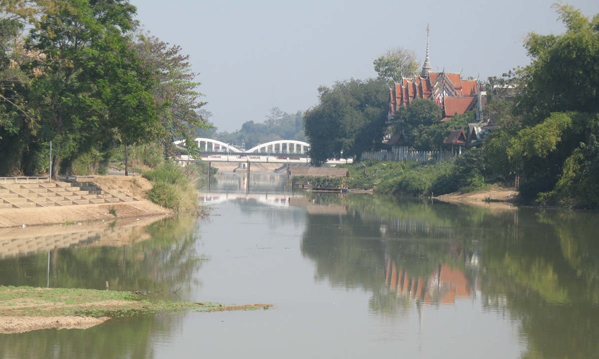
From left to right, top to bottom : Wat Phra That Lampang Luang, Chae Son National Park, Wat Sri Chum, Wat Phra Kaeo Don Tao, Wang River, The Thai Elephant Conservation Center | |
 Flag  Seal | |
| Nickname(s): Khelang Nakhon Kukuta Nakhon (white rooster city) Mueang Rot Ma (horse carriage city) | |
 Map of Thailand highlighting Lampang province | |
| Country | Thailand |
| Capital | Lampang |
| Government | |
| • Governor | Sithichai Jindaluang (since October 2021) |
| Area | |
| • Total | 12,488 km2 (4,822 sq mi) |
| • Rank | Ranked 9th |
| Population (2019)[2] | |
| • Total | 738,316 |
| • Rank | Ranked 33rd |
| • Density | 59/km2 (150/sq mi) |
| • Rank | Ranked 70th |
| Human Achievement Index | |
| • HAI (2017) | 0.6450 "high" Ranked 9th |
| Time zone | UTC+7 (ICT) |
| Postal code | 52xxx |
| Calling code | 054 |
| ISO 3166 code | TH-52 |
| Vehicle registration | ลำปาง |
| Website | www |


Geography
Lampang is in the broad river valley of the Wang River, surrounded by mountains. In Mae Mo district lignite is found and mined in open pits. To the north of the province is the 1,697-metre (5,568 ft) high Doi Luang.
Within the province are Chae Son and Doi Khun Tan National Parks in the Khun Tan Range, as well as Tham Pha Thai, Doi Luang National Park, and the Huai Tak Teak Biosphere Reserve in the Phi Pan Nam Range.[4] The total forest area is 8,747 km2 (3,377 sq mi) or 70 percent of provincial area.[1]
History
Lampang is an ancient city of more than 1,300 years. It is mentioned in various legends in 11 different names; namely Kukkudnakhon, Lampakappanakhon, Srinakhonchai, Nakhon Vieng Kok Wua, Vieng Din, Kelang Nakhon, Nakhon Lampang Kam Kelang, Arlampang, Muang Lakorn, and Muang Nakhon Lampang.
Lampang was built in 680. According in Yonok historical record, a hermit named Suphrom Ruesi built a town for Prince Anantayot, son of Queen Jamadevi of Haripunchai’s Lamphun. The town was first named Kelang Nakhon and then changed into Nakhon Lampang.
In Yonok Chiang Saen period, Nakhon Lampang was governed by Khmer. It was later colonized by Burma and Chiang Mai in the period of King Thonburi about 250 years ago. Later, Lord Thipchang of Lampang has fought for Lamapng independence and established himself as Phraya Sulavalue Chaisongkram, King of Lampang in 1732.
In 1764 Prince Kaewfa, son of Lord Thipchang governed Lampang and was the first ancestor of Na Lampang, Na Lamphun and Na Chiang Mai family. Prince Boonyawat Vongmanit was the last ruler of Lampang.
Lampang was announced as a province in Thailand in 1892 in the reign of King Rama V.
Transport
The city is an important highway hub, with a four lane highway link to Chiang Mai and Chiang Rai, as well as a major highway to Phrae and the eastern Lanna provinces. Lampang is roughly a 1.5 hour bus ride to Chiang Mai. Lampang is a stop for the Chiang Mai-bound train, approximately 10 hours from Bangkok.
Lampang Airport is served by Bangkok Airways (three flights daily to Suvarnabhumi Airport) and Nok air (four flights daily to Don Mueang) (Oct 2015).
Health
The main hospital of Lampang is Lampang Hospital, operated by the Ministry of Public Health.
Tourism
Lampang province is not visited by many tourists, only about 900,000 per year, most of them passing through. In early 2019, the provincial governor rolled out a program called "Lampang: Dream Destination" to raise the number of visitors to two million within two years.[5]
Economy

Lampang is known for the production of ceramic goods and its mining operations. A great deal of ball clay, china stone, and lignite are extracted from the surrounding mountains. There are more than 200 ceramic factories in and around Mueang Lampang District. Most are small- to medium-sized operations producing novelties (plant pots, dolls), tableware, and building materials (tiles, railings). The largest coal fired power plant in Southeast Asia[6] is in Mae Mo District near the lignite mining area. The plant uses lignite as fuel. The largest concrete plant is also north of Mueang Lampang. This is also powered by lignite. Limestone is another abundant rock mined in Lampang. Agriculturally, the province produces rice and pineapples.
Symbols
The provincial seal shows a white rooster inside the entrance to the Phra That Lampang Luang Temple. According to local legend, Buddha visited the province. The god Indra worried that the people would not wake up by themselves to show respect to Buddha, and therefore woke them by transforming himself into a white rooster.
The provincial flower is the Heliconia (Heliconia sp.), and the provincial tree is the Indian Elm (Holoptelea integrifolia). According to the legend, this tree was planted in the temple during Buddha's visit.
Administrative divisions

Provincial government
The province is divided into 13 districts (amphoes). These are further divided into 100 subdistricts (tambons) and 855 villages (mubans).
|
Local government
As of 26 November 2019 there are:[7] one Lampang Provincial Administration Organisation (ongkan borihan suan changwat) and 42 municipal (thesaban) areas in the province. Lampang has city (thesaban nakhon) status. Khelang Nakhon, Lom Raet and Phichai have town (thesaban mueang) status. Further 38 subdistrict municipalities (thesaban tambon). The non-municipal areas are administered by 60 Subdistrict Administrative Organisations - SAO (ongkan borihan suan tambon).[2]
Human achievement index 2017
| Health | Education | Employment | Income |
| 69 | 13 | 35 | 48 |
| Housing | Family | Transport | Participation |
 |
 |
||
| 33 | 27 | 22 | 4 |
| Province Lampang, with an HAI 2017 value of 0.6450 is "high", occupies place 9 in the ranking. | |||
Since 2003, United Nations Development Programme (UNDP) in Thailand has tracked progress on human development at sub-national level using the Human achievement index (HAI), a composite index covering all the eight key areas of human development. National Economic and Social Development Board (NESDB) has taken over this task since 2017.[3]
| Rank | Classification |
| 1 - 15 | "high" |
| 16 - 30 | "somewhat high" |
| 31 - 45 | "average" |
| 45 - 60 | "somewhat low" |
| 61 - 77 | "low" |
| Map with provinces and HAI 2017 rankings |
 |
Gallery
 Wat Phra That Lampang Luang
 Singha Lanna
 Wang River
 Phra That Lampang Luang
 Burmese-style Wat Srichum
 Chae Son National Park
 Hot springs at Chae Son National Park


References
- "ตารางที่ 2 พี้นที่ป่าไม้ แยกรายจังหวัด พ.ศ.2562" [Table 2 Forest area Separate province year 2019]. Royal Forest Department (in Thai). 2019. Retrieved 6 April 2021, information, Forest statistics Year 2019, Thailand boundary from Department of Provincial Administration in 2013
{{cite web}}: CS1 maint: postscript (link) - รายงานสถิติจำนวนประชากรและบ้านประจำปี พ.ส.2562 [Statistics, population and house statistics for the year 2019]. Registration Office Department of the Interior, Ministry of the Interior. stat.bora.dopa.go.th (in Thai). 31 December 2019. Retrieved 26 February 2020.
- Human achievement index 2017 by National Economic and Social Development Board (NESDB), pages 1-40, maps 1-9, retrieved 14 September 2019, ISBN 978-974-9769-33-1
- UNESCO - MAB Biosphere Reserves Directory - Huai Tak Teak Biosphere Reserve
- Svasti, Pichaya (24 January 2019). "Northern Star Rising". Bangkok Post. Retrieved 24 January 2019.
- Kongrut, Anchalee (21 October 2015). "Sustaining environmental activism". Bangkok Post. Retrieved 21 October 2015.
- "Number of local government organizations by province". dla.go.th. Department of Local Administration (DLA). 26 November 2019. Retrieved 10 December 2019.
52 Lampang: 1 PAO, 1 City mun., 3 Town mun., 38 Subdistrict mun., 60 SAO.
External links
 Lampang travel guide from Wikivoyage
- Province page from the Tourist Authority of Thailand
- Golden Jubilee Network province guide
- Lampang provincial map, coat of arms and postal stamp
Places adjacent to Lampang province | ||||||||||||||||
|---|---|---|---|---|---|---|---|---|---|---|---|---|---|---|---|---|
| ||||||||||||||||
Authority control | |
|---|---|
| General | |
| National libraries | |
На других языках
[de] Lampang (Provinz)
Lampang (Thai: ลำปาง, [.mw-parser-output .IPA a{text-decoration:none}lām.pāːŋ]) ist eine Provinz (Changwat) in der Nordregion von Thailand. Die Hauptstadt der Provinz Lampang heißt ebenfalls Lampang.- [en] Lampang province
Другой контент может иметь иную лицензию. Перед использованием материалов сайта WikiSort.org внимательно изучите правила лицензирования конкретных элементов наполнения сайта.
WikiSort.org - проект по пересортировке и дополнению контента Википедии