world.wikisort.org - Australia
The Shire of Wyalkatchem is a local government area located in the Wheatbelt region of Western Australia. Its seat of government is the town of Wyalkatchem, about 190 kilometres (118 mi) northeast of Perth, the state capital.
| Shire of Wyalkatchem Western Australia | |||||||||||||||
|---|---|---|---|---|---|---|---|---|---|---|---|---|---|---|---|
 The Wyalkatchem Shire offices.jpg | |||||||||||||||
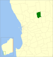 Location in Western Australia | |||||||||||||||
 | |||||||||||||||
| Population | 470 (LGA 2021)[1] | ||||||||||||||
| Established | 1920 | ||||||||||||||
| Area | 1,595.4 km2 (616.0 sq mi) | ||||||||||||||
| Shire President | Quentin Davies | ||||||||||||||
| Council seat | Wyalkatchem | ||||||||||||||
| Region | Wheatbelt | ||||||||||||||
| State electorate(s) | Central Wheatbelt | ||||||||||||||
| Federal division(s) | Durack | ||||||||||||||
| Website | Shire of Wyalkatchem | ||||||||||||||
| |||||||||||||||
History
On 18 June 1920, the Wyalkatchem Road District was created out of land previously administered by the Ninghan and Dowerin Road Boards. On 1 July 1961, it became the Shire of Wyalkatchem under the Local Government Act 1960, which reformed all remaining road districts into shires.[2]
Wards
The shire has no wards, and seven councillors. The shire president is elected from amongst the councillors.
Towns and localities
- Wyalkatchem
- Benjaberring
- Cowcowing
- Korrelocking
- Nembudding
Population
|
|
Heritage-listed places
As of 2021, 133 places are heritage-listed in the Shire of Wyalkatchem,[3] of which ten are on the State Register of Heritage Places.[4]
References
- Australian Bureau of Statistics (28 June 2022). "Wyalkatchem (Local Government Area)". Australian Census 2021 QuickStats. Retrieved 28 June 2022.
- "Municipality Boundary Amendments Register" (PDF). Western Australian Electoral Distribution Commission. Retrieved 11 January 2020.
- "Shire of Wyalkatchem Heritage Places". inherit.stateheritage.wa.gov.au. Heritage Council of Western Australia. Retrieved 27 March 2021.
- "Shire of Wyalkatchem State Register of Heritage Places". inherit.stateheritage.wa.gov.au. Heritage Council of Western Australia. Retrieved 27 March 2021.
External links
![]() Media related to Shire of Wyalkatchem at Wikimedia Commons
Media related to Shire of Wyalkatchem at Wikimedia Commons
| Authority control |
|
|---|
На других языках
[de] Wyalkatchem Shire
-31.166666666667117.38333333333 Das Shire of Wyalkatchem ist ein lokales Verwaltungsgebiet (LGA) im australischen Bundesstaat Western Australia. Das Gebiet ist 1595 km² groß und hat etwa 500 Einwohner ("016).- [en] Shire of Wyalkatchem
Другой контент может иметь иную лицензию. Перед использованием материалов сайта WikiSort.org внимательно изучите правила лицензирования конкретных элементов наполнения сайта.
WikiSort.org - проект по пересортировке и дополнению контента Википедии