world.wikisort.org - Australia
The Shire of Mingenew is a local government area in the Mid West region of Western Australia, about 110 kilometres (68 mi) southeast of the city of Geraldton and about 370 kilometres (230 mi) north of the state capital, Perth. The Shire covers an area of 1,939 square kilometres (749 sq mi), and its seat of government is the town of Mingenew.
| Shire of Mingenew Western Australia | |||||||||||||||
|---|---|---|---|---|---|---|---|---|---|---|---|---|---|---|---|
 Mingenew Town Hall, 2018 | |||||||||||||||
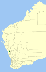 Location in Western Australia | |||||||||||||||
 | |||||||||||||||
| Population | 407 (LGA 2021)[1] | ||||||||||||||
| Area | 1,939.4 km2 (748.8 sq mi) | ||||||||||||||
| Shire President | Gary Cosgrove | ||||||||||||||
| Council seat | Mingenew | ||||||||||||||
| Region | Mid West | ||||||||||||||
| State electorate(s) | Moore | ||||||||||||||
| Federal division(s) | Durack | ||||||||||||||
| Website | Shire of Mingenew | ||||||||||||||
| |||||||||||||||
History
The Shire of Mingenew was initially constituted as the Upper Irwin Road District on 25 October 1901, over a much larger area. On 12 December 1919, it was renamed the Mingenew Road District.[2] Between 1923 and 1928, it lost 80% of its land area to the neighboring Perenjori-Morawa Road District and the new districts of Carnamah and Three Springs. By 1930, it had adopted roughly its present boundaries.
On 1 July 1961, it became a shire following the passage of the Local Government Act 1960, which reformed all remaining road districts into shires.[2]
On 18 September 2009, the Shires of Mingenew, Three Springs, Morawa and Perenjori announced their intention to amalgamate. A formal agreement was signed five days later, and the name Billeranga was later chosen.[3] However, by February 2011, community pressure had led to the negotiations stalling, and on 16 April 2011, voters from the Shire of Perenjori defeated the proposal at a referendum.[4][5]
Wards
Since 2005 the Shire has been divided into two wards. Prior to this, a five-ward system was in place with the Town Ward having three councillors and the remaining wards one each.
- Rural Ward (three councillors)
- Town Ward (four councillors)
Towns and localities
- Mingenew
- Holmwood
- Ikewa
- Mooriary
- Mount Budd
- Nangetty
- Yandanooka
- Yarragadee
Population
|
|
Heritage-listed places
As of 2021, 62 places are heritage-listed in the Shire of Mingenew,[6] of which three are on the State Register of Heritage Places.[7]
References
- Australian Bureau of Statistics (28 June 2022). "Mingenew (Local Government Area)". Australian Census 2021 QuickStats. Retrieved 28 June 2022.
- "Municipality Boundary Amendments Register" (PDF). Western Australian Electoral Distribution Commission. Retrieved 11 January 2020.
- "Mid-West councils to amalgamate". ABC Online. 18 September 2009.
- Kennedy, Jane (25 February 2011). "Shire merges hit stalling point". ABC Midwest. Retrieved 26 May 2012.
- "Perenjori amalgamation not to proceed". Mid West News. 18 April 2011. Retrieved 26 May 2012.
- "Shire of Mingenew Heritage Places". inherit.stateheritage.wa.gov.au. Heritage Council of Western Australia. Retrieved 13 March 2021.
- "Shire of Mingenew State Register of Heritage Places". inherit.stateheritage.wa.gov.au. Heritage Council of Western Australia. Retrieved 13 March 2021.
External links
| Authority control |
|
|---|
Другой контент может иметь иную лицензию. Перед использованием материалов сайта WikiSort.org внимательно изучите правила лицензирования конкретных элементов наполнения сайта.
WikiSort.org - проект по пересортировке и дополнению контента Википедии