world.wikisort.org - Australia
The Shire of Waroona is a local government area in the Peel region of Western Australia between Mandurah and Harvey and about 110 kilometres (68 mi) south of Perth, the state capital. The Shire covers an area of about 835 km² (322 mi²) and its seat of government is the town of Waroona.
| Shire of Waroona Western Australia | |||||||||||||||
|---|---|---|---|---|---|---|---|---|---|---|---|---|---|---|---|
 The Waroona shire offices in October 2021 | |||||||||||||||
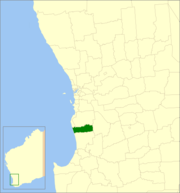 Location in Western Australia | |||||||||||||||
 | |||||||||||||||
| Population | 4,234 (LGA 2021)[1] | ||||||||||||||
| Established | 1898 | ||||||||||||||
| Area | 832.2 km2 (321.3 sq mi) | ||||||||||||||
| Shire President | Mike Walmsley | ||||||||||||||
| Council seat | Waroona | ||||||||||||||
| Region | Peel | ||||||||||||||
| State electorate(s) | Murray-Wellington | ||||||||||||||
| Federal division(s) | Canning | ||||||||||||||
| Website | Shire of Waroona | ||||||||||||||
| |||||||||||||||
History
The Drakesbrook Road District was established on 29 April 1898, seceding from the larger Murray Road District. The road district maintained the Drakesbrook name for some years after the town itself was renamed, but on 1 July 1961 it was declared a shire as the Shire of Waroona following the passage of the Local Government Act 1960, which reformed all remaining road districts into shires.[2]
Wards
The shire no longer has wards, it is made up of eight councillors who represent the whole of the Shire.
Towns
The Shire of Waroona contains the following towns and localities:
- Hamel
- Lake Clifton
- Nanga Brook
- Preston Beach
- Wagerup
- Waroona
- Yalup Brook (former)
National parks and state forests based around both the Yalgorup lakes and the Darling Scarp jarrah forests occupy approximately half the land area of the Shire.
Population
|
|
Heritage-listed places
As of 2020, 37 places are heritage-listed in the Shire of Waroona,[3] of which four are on the State Register of Heritage Places.[4]
References
- Australian Bureau of Statistics (28 June 2022). "Waroona (Local Government Area)". Australian Census 2021 QuickStats. Retrieved 28 June 2022.
- "Municipality Boundary Amendments Register" (PDF). Western Australian Electoral Distribution Commission. Retrieved 11 January 2020.
- "Shire of Waroona Heritage Places". inherit.stateheritage.wa.gov.au. Heritage Council of Western Australia. Retrieved 19 February 2020.
- "Shire of Waroona State Register of Heritage Places". inherit.stateheritage.wa.gov.au. Heritage Council of Western Australia. Retrieved 19 February 2020.
External links
| Authority control |
|
|---|
На других языках
[de] Waroona Shire
-32.833333333333115.91666666667 Das Shire of Waroona ist ein lokales Verwaltungsgebiet (LGA) im australischen Bundesstaat Western Australia. Das Gebiet ist 832 km² groß und hat etwa 4000 Einwohner (2016).- [en] Shire of Waroona
Другой контент может иметь иную лицензию. Перед использованием материалов сайта WikiSort.org внимательно изучите правила лицензирования конкретных элементов наполнения сайта.
WikiSort.org - проект по пересортировке и дополнению контента Википедии