world.wikisort.org - Australia
The Shire of Donnybrook Balingup is a local government area in the South West region of Western Australia, about 35 kilometres (22 mi) southeast of Bunbury and about 220 kilometres (137 mi) south of the state capital, Perth. The Shire covers an area of about 1,560 square kilometres (602 sq mi), and its seat of government is the town of Donnybrook.
| Shire of Donnybrook Balingup Western Australia | |||||||||||||||
|---|---|---|---|---|---|---|---|---|---|---|---|---|---|---|---|
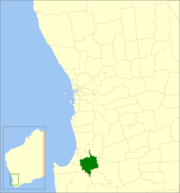 Location in Western Australia | |||||||||||||||
 | |||||||||||||||
| Population | 6,155 (LGA 2021)[1] | ||||||||||||||
| Established | 1970 | ||||||||||||||
| Area | 1,560.3 km2 (602.4 sq mi) | ||||||||||||||
| Shire President | Leanne Wringe | ||||||||||||||
| Council seat | Donnybrook | ||||||||||||||
| Region | South West | ||||||||||||||
| State electorate(s) | Collie-Preston | ||||||||||||||
| Federal division(s) | Forrest | ||||||||||||||
| Website | Shire of Donnybrook Balingup | ||||||||||||||
| |||||||||||||||
History
The Shire of Donnybrook–Balingup was established on 26 March 1970 with the amalgamation of the Shire of Donnybrook and the Shire of Balingup. The merged shire initially retained the Donnybrook name, but adopted the Donnybrook-Balingup name on 17 July 1970.[2] The new council was administered from Donnybrook.
The Shire of Donnybrook–Balingup is also home to a number of heritage-listed historic properties including Ferndale Homestead and Southampton homestead.
Wards
In 2001 the Shire abolished wards and all nine councillors represent the entire shire.
Prior to this, four wards made up the council:
- Donnybrook (including Argyle, Irishtown and Beelerup)
- Preston (area east of Donnybrook including Lowden, Mumballup and Noggerup)
- Central (including Kirup, Upper Capel, Brazier, Newlands, Brookhampton and Thompsons Brook)
- Balingup (including Mullalyup, Grimwade, Upper Balingup, Southampton and Ferndale[Lower Balingup])
Towns and localities
- Donnybrook
- Argyle
- Balingup
- Beelerup
- Brazier
- Brookhampton
- Charlie Creek
- Glen Mervyn
- Grimwade
- Kirup
- Lowden
- Mullalyup
- Mumballup
- Newlands
- Noggerup
- Paynedale
- Queenwood
- Southampton
- Thomson Brook
- Upper Capel
- Wilga West
- Yabberup
Heritage-listed places
As of 2021, 113 places are heritage-listed in the Shire of Donnybrook–Balingup,[3] of which twelve are on the State Register of Heritage Places, among them the Southampton homestead.[4]
References
- Australian Bureau of Statistics (28 June 2022). "Donnybrook-Balingup (Local Government Area)". Australian Census 2021 QuickStats. Retrieved 28 June 2022.
- "Municipality Boundary Amendments Register" (PDF). Western Australian Electoral Distribution Commission. Retrieved 11 January 2020.
- "Shire of Donnybrook-Balingup Heritage Places". inherit.stateheritage.wa.gov.au. Heritage Council of Western Australia. Retrieved 21 March 2021.
- "Shire of Donnybrook-Balingup State Register of Heritage Places". inherit.stateheritage.wa.gov.au. Heritage Council of Western Australia. Retrieved 21 March 2021.
External links
| Authority control |
|
|---|
Другой контент может иметь иную лицензию. Перед использованием материалов сайта WikiSort.org внимательно изучите правила лицензирования конкретных элементов наполнения сайта.
WikiSort.org - проект по пересортировке и дополнению контента Википедии