world.wikisort.org - Australia
The Shire of Narembeen is a local government area in the eastern Wheatbelt region of Western Australia, about 300 kilometres (186 mi) east of the state capital, Perth, and between the shires of Merredin to the north, and Kondinin to the south. The Shire has a land area of 3,833 square kilometres (1,480 sq mi) and its seat of government is the town of Narembeen.
| Shire of Narembeen Western Australia | |||||||||||||||
|---|---|---|---|---|---|---|---|---|---|---|---|---|---|---|---|
 The state heritage listed Narembeen Public Hall, 2014 | |||||||||||||||
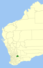 Location in Western Australia | |||||||||||||||
 | |||||||||||||||
| Population | 787 (LGA 2021)[1] | ||||||||||||||
| Area | 3,832.9 km2 (1,479.9 sq mi) | ||||||||||||||
| Shire President | Kellie Mortimore | ||||||||||||||
| Council seat | Narembeen | ||||||||||||||
| Region | Wheatbelt | ||||||||||||||
| State electorate(s) | Central Wheatbelt) | ||||||||||||||
| Federal division(s) | Durack(2021 Redistribution will return Narembeen to O'Connor | ||||||||||||||
 | |||||||||||||||
| Website | Shire of Narembeen | ||||||||||||||
| |||||||||||||||
History
The Narembeen Road District was gazetted on 6 June 1924. On 1 July 1961, it became a shire following the passage of the Local Government Act 1960, which reformed all remaining road districts into shires.[2]
Towns and localities
- Narembeen
- Cramphorne
- Emu Hill
- Mount Walker
- Wadderin
- South Kumminin
- Wogarl
Heritage-listed places
As of 2021, 172 places are heritage-listed in the Shire of Narembeen,[3] of which five are on the State Register of Heritage Places.[4]
References
- Australian Bureau of Statistics (28 June 2022). "Narembeen (Local Government Area)". Australian Census 2021 QuickStats. Retrieved 28 June 2022.
- "Municipality Boundary Amendments Register" (PDF). Western Australian Electoral Distribution Commission. Retrieved 11 January 2020.
- "Shire of Narembeen Heritage Places". inherit.stateheritage.wa.gov.au. Heritage Council of Western Australia. Retrieved 27 March 2021.
- "Shire of Narembeen State Register of Heritage Places". inherit.stateheritage.wa.gov.au. Heritage Council of Western Australia. Retrieved 27 March 2021.
External links
![]() Media related to Shire of Narembeen at Wikimedia Commons
Media related to Shire of Narembeen at Wikimedia Commons
| Authority control |
|
|---|
На других языках
[de] Narembeen Shire
-32.1118.18333333333 Das Shire of Narembeen ist ein lokales Verwaltungsgebiet (LGA) im australischen Bundesstaat Western Australia. Das Gebiet ist 3833 km² groß und hat etwa 800 Einwohner (2016).- [en] Shire of Narembeen
Другой контент может иметь иную лицензию. Перед использованием материалов сайта WikiSort.org внимательно изучите правила лицензирования конкретных элементов наполнения сайта.
WikiSort.org - проект по пересортировке и дополнению контента Википедии