world.wikisort.org - Australia
The Shire of Cranbrook is a local government area in the Great Southern region of Western Australia, about 92 kilometres (57 mi) north of Albany and about 320 kilometres (200 mi) south-southeast of the state capital, Perth. The Shire covers an area of 3,277 square kilometres (1,265 sq mi), and its seat of government is the town of Cranbrook.
| Shire of Cranbrook Western Australia | |||||||||||||||
|---|---|---|---|---|---|---|---|---|---|---|---|---|---|---|---|
 Cranbrook shire offices, 2018 | |||||||||||||||
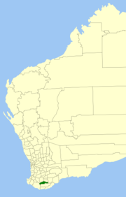 Location in Western Australia | |||||||||||||||
 | |||||||||||||||
| Population | 1,100 (LGA 2021)[1] | ||||||||||||||
| Established | 1926 | ||||||||||||||
| Area | 3,276.8 km2 (1,265.2 sq mi) | ||||||||||||||
| Shire President | Phil Horrocks | ||||||||||||||
| Council seat | Cranbrook | ||||||||||||||
| Region | Great Southern | ||||||||||||||
| State electorate(s) | Roe | ||||||||||||||
| Federal division(s) | O'Connor | ||||||||||||||
| Website | Shire of Cranbrook | ||||||||||||||
| |||||||||||||||
History
The Cranbrook Road District was gazetted on 14 May 1926 out of parts of the Plantagenet and Tambellup road districts. On 1 July 1961, it became a Shire following changes to the Local Government Act, which reformed all remaining road boards into shires.[2]
Wards
The shire is divided into 3 wards, each with 3 councillors:
- East Ward
- Central Ward
- West Ward
Towns and localities
Heritage-listed places
As of 2021, 35 places are heritage-listed in the Shire of Cranbrook,[3] of which one is on the State Register of Heritage Places, the Tenterden Agricultural Hall, a building destroyed by bush fire on 27 December 2003.[4]
References
- Australian Bureau of Statistics (28 June 2022). "Cranbrook (Local Government Area)". Australian Census 2021 QuickStats. Retrieved 28 June 2022.
- "Municipality Boundary Amendments Register" (PDF). Western Australian Electoral Distribution Commission. Retrieved 11 January 2020.
- "Shire of Cranbrook Heritage Places". inherit.stateheritage.wa.gov.au. Heritage Council of Western Australia. Retrieved 9 February 2021.
- "Shire of Cranbrook State Register of Heritage Places". inherit.stateheritage.wa.gov.au. Heritage Council of Western Australia. Retrieved 9 February 2021.
External links
Authority control | |
|---|---|
| General | |
| National libraries | |
Другой контент может иметь иную лицензию. Перед использованием материалов сайта WikiSort.org внимательно изучите правила лицензирования конкретных элементов наполнения сайта.
WikiSort.org - проект по пересортировке и дополнению контента Википедии