world.wikisort.org - Australia
The Shire of Chapman Valley is a local government area located in the Mid West region of Western Australia, immediately northeast of the City of Geraldton and about 440 kilometres (273 mi) north of Perth, the state capital. The Shire covers an area of 3,965 square kilometres (1,531 sq mi) and its seat of government is the small town of Nabawa.
| Shire of Chapman Valley Western Australia | |||||||||||||||
|---|---|---|---|---|---|---|---|---|---|---|---|---|---|---|---|
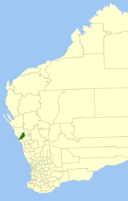 Location in Western Australia | |||||||||||||||
 | |||||||||||||||
| Population | 1,556 (LGA 2021)[1] | ||||||||||||||
| Established | 1901 | ||||||||||||||
| Area | 3,964.7 km2 (1,530.8 sq mi) | ||||||||||||||
| Shire President | Kirrilee Warr | ||||||||||||||
| Council seat | Nabawa | ||||||||||||||
| Region | Mid West | ||||||||||||||
| State electorate(s) | Moore | ||||||||||||||
| Federal division(s) | Durack | ||||||||||||||
| Website | Shire of Chapman Valley | ||||||||||||||
| |||||||||||||||
History
The Upper Chapman Road District was established on 25 January 1901. On 28 March 1958, it was renamed to Chapman Valley Road District and on 1 July 1961, it became a Shire under the Local Government Act 1960, which reformed all remaining road districts into shires.[2]
Wards
The Shire no longer has wards - represented by 8 councillors
Towns
- Nabawa
- Howatharra
- Mount Erin
- Nanson
- Naraling
- Narra Tarra
- Oakajee
- Protheroe
- Rockwell
- Whelarra
- Yetna
- Yuna
Population
|
|
Heritage-listed places
As of 2021, 95 places are heritage-listed in the Shire of Chapman Valley,[3] of which seven are on the State Register of Heritage Places.[4]
References
- Australian Bureau of Statistics (28 June 2022). "Chapman Valley (Local Government Area)". Australian Census 2021 QuickStats. Retrieved 28 June 2022.
- "Municipality Boundary Amendments Register" (PDF). Western Australian Electoral Distribution Commission. Retrieved 11 January 2020.
- "Shire of Chapman Valley Heritage Places". inherit.stateheritage.wa.gov.au. Heritage Council of Western Australia. Retrieved 13 March 2021.
- "Shire of Chapman Valley State Register of Heritage Places". inherit.stateheritage.wa.gov.au. Heritage Council of Western Australia. Retrieved 13 March 2021.
External links
На других языках
[de] Chapman Valley Shire
-28.5114.78333333333 Das Shire of Chapman Valley ist ein lokales Verwaltungsgebiet (LGA) im australischen Bundesstaat Western Australia. Das Gebiet ist 3965 km² groß und hat etwa 1400 Einwohner (2016).- [en] Shire of Chapman Valley
Другой контент может иметь иную лицензию. Перед использованием материалов сайта WikiSort.org внимательно изучите правила лицензирования конкретных элементов наполнения сайта.
WikiSort.org - проект по пересортировке и дополнению контента Википедии