world.wikisort.org - Australia
The Shire of Halls Creek is one of the four local government areas in the Kimberley region of northern Western Australia, covering an area of 143,030 square kilometres (55,224 sq mi), most of which is sparsely populated. The Shire's seat of government is the town of Halls Creek. Many Aboriginal communities are located within the shire.
| Shire of Halls Creek Western Australia | |||||||||||||||
|---|---|---|---|---|---|---|---|---|---|---|---|---|---|---|---|
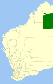 Location in Western Australia | |||||||||||||||
 | |||||||||||||||
| Population | 3,574 (LGA 2021)[1] | ||||||||||||||
| Established | 1887 | ||||||||||||||
| Area | 143,030 km2 (55,224.2 sq mi) | ||||||||||||||
| President | Malcolm Edwards | ||||||||||||||
| Council seat | Halls Creek | ||||||||||||||
| Region | Kimberley | ||||||||||||||
| State electorate(s) | Kimberley | ||||||||||||||
| Federal division(s) | Durack | ||||||||||||||
| Website | Shire of Halls Creek | ||||||||||||||
| |||||||||||||||
The Purnululu National Park, home to part of the Bungle Bungle Range, and Gregory Lake are within the Shire, as is the Wolfe Creek Meteorite Crater National Park.
History
The Shire of Halls Creek originated as the Kimberley Goldfields Road District on 10 February 1887. It was renamed the Halls Creek Road District on 8 January 1915. On 1 July 1961, it became a shire following the passage of the Local Government Act 1960, which reformed all remaining road districts into shires.[2]
Stations
The area is home to many large cattle stations including Bedford Downs Station, which was established some time prior to 1906 by the Buchanan and Gordon brothers. Other properties in the area include Alice Downs, Louisa Downs, Moola Bulla, Springvale and Ruby Plains Station.
Elected council
Councillors are elected at-large to represent the whole shire.
Previously the council consisted of three wards. A review of wards and representation was carried out in late 2008 and, at its December 2008 meeting, the council resolved to recommend to the Local Government Advisory Board that the wards be abolished.[3]
| Ward | Councillor | Position | ||
|---|---|---|---|---|
| Unsubdivided | Malcolm Edwards | President | [4] | |
| Chris Loessl | Deputy president | |||
| Rosemary Stretch | ||||
| Virginia O'Neil | ||||
| Bonnie Edwards | ||||
| Trish McKay | ||||
| (Vacant) | ||||
Towns and communities
- Balgo
- Billiluna (Mindibungu)
- Halls Creek
- Mulan
- Kundat Djaru (Ringer Soak)
- Warmun (Turkey Creek)
- Yiyili
Heritage-listed places
As of 2021, 27 places are heritage-listed in the Shire of Halls Creek,[5] of which five are on the State Register of Heritage Places.[6]
References
- Australian Bureau of Statistics (28 June 2022). "Halls Creek (Local Government Area)". Australian Census 2021 QuickStats. Retrieved 28 June 2022.
- "Municipality Boundary Amendments Register" (PDF). Western Australian Electoral Distribution Commission. Retrieved 11 January 2020.
- "Local Government Advisory Board Annual Report" (PDF).
{{cite web}}: CS1 maint: url-status (link) - "Councillors - Shire of Halls Creek". www.hallscreek.wa.gov.au. Retrieved 19 June 2021.
- "Shire of Halls Creek Heritage Places". inherit.stateheritage.wa.gov.au. Heritage Council of Western Australia. Retrieved 15 March 2021.
- "Shire of Halls Creek State Register of Heritage Places". inherit.stateheritage.wa.gov.au. Heritage Council of Western Australia. Retrieved 15 March 2021.
External links
На других языках
[de] Halls Creek Shire
-18.216666666667127.66666666667 Das Shire of Halls Creek ist ein lokales Verwaltungsgebiet (LGA) im australischen Bundesstaat Western Australia. Das Gebiet ist 143.030 km² groß und hat etwa 3250 Einwohner (2016).- [en] Shire of Halls Creek
Другой контент может иметь иную лицензию. Перед использованием материалов сайта WikiSort.org внимательно изучите правила лицензирования конкретных элементов наполнения сайта.
WikiSort.org - проект по пересортировке и дополнению контента Википедии