world.wikisort.org - Australia
The Shire of Leonora is a local government area in the Goldfields-Esperance region of Western Australia, about 240 kilometres (149 mi) north of the city of Kalgoorlie and about 830 kilometres (516 mi) northeast of the state capital, Perth. The Shire covers an area of 32,189 square kilometres (12,428 sq mi), and its seat of government is the town of Leonora.
| Shire of Leonora Western Australia | |||||||||||||||
|---|---|---|---|---|---|---|---|---|---|---|---|---|---|---|---|
 Leonora shire offices, 2018 | |||||||||||||||
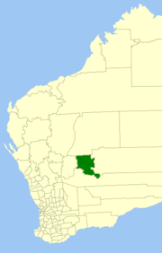 Location in Western Australia | |||||||||||||||
 | |||||||||||||||
| Population | 1,588 (LGA 2021)[1] | ||||||||||||||
| Area | 32,189.3 km2 (12,428.4 sq mi) | ||||||||||||||
| Shire President | Peter Craig | ||||||||||||||
| Council seat | Leonora | ||||||||||||||
| Region | Goldfields-Esperance | ||||||||||||||
| State electorate(s) | Kalgoorlie | ||||||||||||||
| Federal division(s) | O'Connor | ||||||||||||||
 | |||||||||||||||
| Website | Shire of Leonora | ||||||||||||||
| |||||||||||||||
History
Leonora was originally part of the North Coolgardie Road District when that entity was gazetted in 1898. The town of Leonora was gazetted as the Municipality of Leonora with its own mayor in 1900.
The Shire of Leonora originated from the Mount Malcolm Road District, which was established on 31 May 1912, when the North Coolgardie Road District was abolished and broken up into three separate road districts: Mount Malcolm, Kookynie and Menzies. (The North Coolgardie Road District had absorbed three municipalities in March 1912, including the Municipality of Malcolm; however, the amalgamation had not been successful.)[2]
Mount Malcolm absorbed the Municipality of Leonora on 1 July 1917 and became the Leonora-Mount Malcolm Road District.[3]
On 16 August 1929, a neighbouring district, the Lawlers Road District, was dissolved and split between Mount Margaret (later Laverton) and Leonora-Mount Malcolm. The Leonora-Mt-Malcolm Road District was renamed the Leonora Road District on 20 June 1930.[2]
On 1 July 1961, it became the Shire of Leonora under the Local Government Act 1960, which reformed all remaining road districts into shires.[2]
Wards
As of the 2003 election, the Shire is divided into two wards:
- North Ward (four councillors)
- South Ward (five councillors)
From 1979 until 2003, the Shire was divided into Leonora (3), Leinster (4) and Country (2) wards.
Towns and localities
- Leonora
- Agnew
- Eulaminna
- Gwalia
- Kathleen
- Kurrajong
- Lake Darlot
- Lawlers
- Leinster
- Malcolm
- Mertondale
- Murrin Murrin
- Sir Samuel
- Vivien
- Woodarra
- Yundamindera (known as "The Granites")
Heritage-listed places
As of 2021, 95 places are heritage-listed in the Shire of Leonora,[4] of which 47 are on the State Register of Heritage Places, the majority of those around the former mining town of Gwalia.[5]
References
- Australian Bureau of Statistics (28 June 2022). "Leonora (Local Government Area)". Australian Census 2021 QuickStats. Retrieved 28 June 2022.
- "Municipality Boundary Amendments Register" (PDF). Western Australian Electoral Distribution Commission. Retrieved 11 January 2020.
- "Municipal Corporations Act 1906 and Roads Act 1911. Merging of Leonora Municipality into Mount Malcolm Road District, and renaming Leonora-Malcolm Road District. Order in Council (per PW 1461/17)". Western Australia Government Gazette. 23 May 1917. p. 1917:851. Effective 1 July 1917.
- "Shire of Leonora Heritage Places". inherit.stateheritage.wa.gov.au. Heritage Council of Western Australia. Retrieved 9 February 2021.
- "Shire of Leonora State Register of Heritage Places". inherit.stateheritage.wa.gov.au. Heritage Council of Western Australia. Retrieved 9 February 2021.
External links
| Authority control |
|
|---|
На других языках
[de] Leonora Shire
-28.883333333333121.31666666667 Das Shire of Leonora ist ein lokales Verwaltungsgebiet (LGA) im australischen Bundesstaat Western Australia. Das Gebiet ist 32.189 km² groß und hat etwa 1400 Einwohner (2016).- [en] Shire of Leonora
Другой контент может иметь иную лицензию. Перед использованием материалов сайта WikiSort.org внимательно изучите правила лицензирования конкретных элементов наполнения сайта.
WikiSort.org - проект по пересортировке и дополнению контента Википедии