world.wikisort.org - Australia
The Shire of Cuballing is a local government area in the Wheatbelt region of Western Australia. Cuballing is located 15.1 kilometres (9 mi) north of the town of Narrogin and 192 kilometres (119 mi) southeast of the capital, Perth. The Shire covers an area of 1,195 square kilometres (461 sq mi) and its seat of government is the small town of Cuballing.
| Shire of Cuballing Western Australia | |||||||||||||||
|---|---|---|---|---|---|---|---|---|---|---|---|---|---|---|---|
 Cuballing shire offices, 2014 | |||||||||||||||
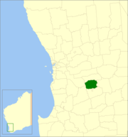 Location in Western Australia | |||||||||||||||
 | |||||||||||||||
| Population | 902 (LGA 2021)[1] | ||||||||||||||
| Established | 1902 | ||||||||||||||
| Area | 1,195.4 km2 (461.5 sq mi) | ||||||||||||||
| Shire President | Eliza Dowling | ||||||||||||||
| Council seat | Cuballing | ||||||||||||||
| Region | Wheatbelt | ||||||||||||||
| State electorate(s) | Central Wheatbelt | ||||||||||||||
| Federal division(s) | O'Connor | ||||||||||||||
| Website | Shire of Cuballing | ||||||||||||||
| |||||||||||||||
Over 10% of its area contains native dryandra forests. The economy, worth approximately $20 million per year to the state economy, is based on agriculture, with cereal grains, sheep and pig farming being the main activities.[2]
History
On 31 October 1902, the Cuballing Road District was created. On 1 July 1961, it became a shire following the enactment of the Local Government Act 1960.[3]
Wards
On 3 May 2003, the shire was divided into two wards.[3]
- North Ward (three councillors)
- South Ward (four councillors)
Between 1912 and 2003, the ward names were as follows:[4]
- Cuballing Ward
- North West Ward
- North East Ward
- Central West Ward
- Central East Ward
- South West Ward
- South East Ward
Towns and localities
- Cuballing
- Contine
- Popanyinning
- Yornaning
Population
|
|
Heritage-listed places
As of 2021, 28 places are heritage-listed in the Shire of Cuballing,[5] of which three are on the State Register of Heritage Places.[6]
References
- Australian Bureau of Statistics (28 June 2022). "Cuballing (Local Government Area)". Australian Census 2021 QuickStats. Retrieved 28 June 2022.
- Agriculture WA (July 2000). "Agriculture Statistical Overview 96/97 - Shire of Cuballing" (PDF). Archived from the original (PDF) on 17 September 2006. Retrieved 15 November 2006.
- WA Electoral Commission, Municipality Boundary Amendments Register (release 3.0), 31 July 2007.
- "Local Government Act 1960 - Shire of Cuballing (Ward Boundaries) Order No.1 1987". Western Australia Government Gazette. 11 December 1987. p. 1987:4406.
- "Shire of Cuballing Heritage Places". inherit.stateheritage.wa.gov.au. Heritage Council of Western Australia. Retrieved 25 March 2021.
- "Shire of Cuballing State Register of Heritage Places". inherit.stateheritage.wa.gov.au. Heritage Council of Western Australia. Retrieved 25 March 2021.
External links
На других языках
[de] Cuballing Shire
-32.816666666667117.18333333333 Das Shire of Cuballing ist ein lokales Verwaltungsgebiet (LGA) im australischen Bundesstaat Western Australia. Das Gebiet ist 1195 km² groß und hat etwa 860 Einwohner (2016).- [en] Shire of Cuballing
Другой контент может иметь иную лицензию. Перед использованием материалов сайта WikiSort.org внимательно изучите правила лицензирования конкретных элементов наполнения сайта.
WikiSort.org - проект по пересортировке и дополнению контента Википедии