world.wikisort.org - Australia
The Shire of Plantagenet is a local government area in the Great Southern region of Western Australia, managed from the town of Mount Barker, 360 kilometres (224 mi) south of Perth and 50 kilometres (31 mi) north of Albany. The shire covers an area of 4,792 square kilometres (1,850 sq mi)[2] and includes the communities of Narrikup, Rocky Gully, Kendenup and Porongurup.
| Shire of Plantagenet Western Australia | |||||||||||||||
|---|---|---|---|---|---|---|---|---|---|---|---|---|---|---|---|
 Plantagenet shire offices, 2018 | |||||||||||||||
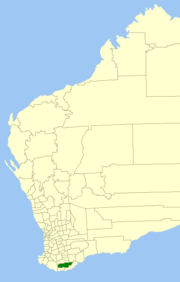 Location in Western Australia | |||||||||||||||
 | |||||||||||||||
| Population | 5,388 (LGA 2021)[1] | ||||||||||||||
| Established | 1871 | ||||||||||||||
| Area | 4,792 km2 (1,850.2 sq mi) | ||||||||||||||
| Shire President | Chris Pavlovich | ||||||||||||||
| Council seat | Mount Barker | ||||||||||||||
| Region | Great Southern | ||||||||||||||
| State electorate(s) | Blackwood-Stirling | ||||||||||||||
| Federal division(s) | O'Connor | ||||||||||||||
| Website | Shire of Plantagenet | ||||||||||||||
| |||||||||||||||
The region is noted for agriculture, principally wheat, sheep (wool and meat), beef cattle, wine, canola and olives. Silviculture, especially plantations of Tasmanian blue gums (Eucalyptus globulus), was a major industry in the shire although some recent silviculture enterprises (Great Southern Plantations and Timbercorp)[3] have gone into receivership. Local tourist attractions include the Porongurup Range and Stirling Range, a museum based within the original police station, as well as other pioneer structures such as St Werburgh's Chapel.
History
The Plantagenet Road District was gazetted on 24 January 1871 as one of 18 elected boards to manage roads and services in Western Australia, and initially included a reasonably large section of the Great Southern region. On 1 July 1961, it became the Shire of Plantagenet following the enactment of the Local Government Act 1960, which reformed all remaining road districts into shires.[4]
Wards
The Shire was redivided into five wards in 2001. The shire president is elected from amongst the councillors.
- East Ward (two councillors)
- Kendenup Ward (one councillor)
- Rocky Gully/West Ward (two councillors)
- South Ward (one councillor)
- Town Ward (three councillors)
Towns and localities
- Mount Barker
- Denbarker
- Forest Hill
- Kendenup
- Narrikup
- Perillup
- Porongurup
- Rocky Gully
- Takalarup
- Woogenellup
Infrastructure
The shire has ownership and responsibility of the Great Southern Saleyards, a state-of-the-art facility that was built following the closure of the Mount Barker Saleyards and the Albany Town Saleyards, and joint development by both councils around 2002.[5] Due to cost issues, the City of Albany sought to dispose of its share of the facility, and an agreement was made to transfer full ownership and responsibility to the Shire of Plantagenet.[6]
The Mount Barker Power Company Pty Ltd has constructed slightly to the north of the township a three Enercon turbine 73m high windfarm costing $8.3 million.[7] The turbines are on private land and this development is a private energy generation selling power into the state grid. The windfarm is one of the very few to have been completed to service a local community's power needs since the government of Western Australia set a renewable energy target. The site is on private property and is projected to generate about 8,400 megawatt hours of electricity each year from three 800 kilowatt turbines.[8][9]
Services
The Shire of Plantagenet provides the usual services that Western Australian local governments would supply. Rubbish collection is provided by Warren Blackwood Waste. A rubbish tip is located on O'Neill Road south of Mount Barker and transfer stations are at Kendenup, Porongurup and Narrikup.
Ranger Services and a Community Emergency Services Manager (CESM) are based in the Shire Office in Mount Barker. The CESM assists the local bushfire brigades and State Emergency Service unit. The bushfire brigades are located at Porongurup, Porongurup South, Narrikup, Narpyn, Kendenup, Woogenellup, Rocky Gully, Perrilup, Denbarker, Forest Hill and Middle Ward. South Stirling's brigade works closely with the Plantagenet Shire but is registered with Albany City Council.
A Local Emergency Management Committee and a Roadwise Committee are just two examples of how the Shire engages with the community.
Heritage-listed places
As of 2021, 74 places are heritage-listed in the Shire of Plantagenet,[10] of which six are on the State Register of Heritage Places.[11]
See also
- Electoral district of Plantagenet
References
Notes
- Australian Bureau of Statistics (28 June 2022). "Plantagenet (Local Government Area)". Australian Census 2021 QuickStats. Retrieved 28 June 2022.
- "Home » Shire of Plantagenet". Plantagenet.wa.gov.au. Retrieved 25 January 2022.
- "Timbercorp - Home". Archived from the original on 28 July 2011. Retrieved 24 July 2011. Timbercorp
- "Municipality Boundary Amendments Register" (PDF). Western Australian Electoral Distribution Commission. Retrieved 11 January 2020.
- "Archived copy". Archived from the original on 25 April 2013. Retrieved 7 January 2014.
{{cite web}}: CS1 maint: archived copy as title (link) - "Archived copy" (PDF). Archived from the original (PDF) on 30 September 2011. Retrieved 24 July 2011.
{{cite web}}: CS1 maint: archived copy as title (link) - "Mt Barker Community Windfarm". Mtbarkerpower.com.au. Retrieved 25 January 2022.
- "Accidentally Outback - Wind power has locals energised in WA". Archived from the original on 28 March 2012. Retrieved 24 July 2011.
- "Archived copy". Archived from the original on 26 March 2012. Retrieved 24 July 2011.
{{cite web}}: CS1 maint: archived copy as title (link) - "Shire of Plantagenet Heritage Places". inherit.stateheritage.wa.gov.au. Heritage Council of Western Australia. Retrieved 14 March 2021.
- "Shire of Plantagenet State Register of Heritage Places". inherit.stateheritage.wa.gov.au. Heritage Council of Western Australia. Retrieved 14 March 2021.
Bibliography
- Glover, Rhoda; et al. (1979). Plantagenet: A History of the Shire of Plantagenet, Western Australia. Nedlands, WA: Published for the Shire of Plantagenet by the University of Western Australia Press. ISBN 0855641754.
External links
Authority control | |
|---|---|
| General | |
| National libraries | |
На других языках
[de] Plantagenet Shire
-34.616666666667117.66666666667 Das Shire of Plantagenet ist ein lokales Verwaltungsgebiet (LGA) im australischen Bundesstaat Western Australia. Das Gebiet ist 4.876 km² groß und hat etwa 5000 Einwohner (2016).- [en] Shire of Plantagenet
Другой контент может иметь иную лицензию. Перед использованием материалов сайта WikiSort.org внимательно изучите правила лицензирования конкретных элементов наполнения сайта.
WikiSort.org - проект по пересортировке и дополнению контента Википедии