world.wikisort.org - USA
Polson (Montana Salish: nčmqnétkʷ, Kutenai: kwataqnuk[3]) is a city in Lake County, Montana, United States, on the southern shore of Flathead Lake. It is also on the Flathead Indian Reservation. The population was 5,148 at the 2020 census.[4] It is the county seat of Lake County.[5] In 1898 the city was named after pioneer rancher David Polson. It was incorporated in 1910.[6]
Polson, Montana
nčmqnétkʷ kwataqnuk | |
|---|---|
Town | |
 Polson and Flathead Lake | |
 Location of Polson, Montana | |
| Coordinates: 47°41′17″N 114°9′24″W | |
| Country | United States |
| State | Montana |
| County | Lake |
| Government | |
| • Mayor | Paul Briney |
| Area | |
| • Total | 4.66 sq mi (12.07 km2) |
| • Land | 4.49 sq mi (11.63 km2) |
| • Water | 0.17 sq mi (0.44 km2) |
| Elevation | 2,927 ft (892 m) |
| Population (2020) | |
| • Total | 5,148 |
| • Density | 1,146.04/sq mi (442.53/km2) |
| Time zone | UTC−7 (Mountain (MST)) |
| • Summer (DST) | UTC−6 (MDT) |
| ZIP code | 59860 |
| Area code | 406 |
| FIPS code | 30-58750 |
| GNIS feature ID | 0775341[2] |
| Website | www |
Geography
Polson is located at 47°41′17″N 114°9′24″W (47.688089, -114.156766).[7] U.S. Route 93 passes through town. Pablo National Wildlife Refuge is just to the south.
According to the United States Census Bureau, the city has a total area of 4.17 square miles (10.80 km2), of which 4.14 square miles (10.72 km2) is land and 0.03 square miles (0.08 km2) is water.[8]
Demographics
| Historical population | |||
|---|---|---|---|
| Census | Pop. | %± | |
| 1920 | 1,132 | — | |
| 1930 | 1,455 | 28.5% | |
| 1940 | 2,156 | 48.2% | |
| 1950 | 2,280 | 5.8% | |
| 1960 | 2,314 | 1.5% | |
| 1970 | 2,464 | 6.5% | |
| 1980 | 2,798 | 13.6% | |
| 1990 | 3,291 | 17.6% | |
| 2000 | 4,041 | 22.8% | |
| 2010 | 4,488 | 11.1% | |
| 2020 | 5,148 | 14.7% | |
| U.S. Decennial Census[9][4] | |||
2010 census
As of the census[10] of 2010, there were 4,488 people, 1,991 households, and 1,150 families living in the city. The population density was 1,084.1 inhabitants per square mile (418.6/km2). There were 2,506 housing units at an average density of 605.3 per square mile (233.7/km2). The racial makeup of the city was 74.7% White, 0.2% African American, 15.7% Native American, 0.8% Asian, 0.6% from other races, and 8.0% from two or more races. Hispanic or Latino of any race were 3.4% of the population.
There were 1,991 households, of which 29.1% had children under the age of 18 living with them, 38.6% were married couples living together, 13.9% had a female householder with no husband present, 5.3% had a male householder with no wife present, and 42.2% were non-families. 35.7% of all households were made up of individuals, and 15.9% had someone living alone who was 65 years of age or older. The average household size was 2.21 and the average family size was 2.86.
The median age in the city was 40 years. 24.2% of residents were under the age of 18; 9.1% were between the ages of 18 and 24; 22.4% were from 25 to 44; 24.5% were from 45 to 64; and 19.7% were 65 years of age or older. The gender makeup of the city was 46.9% male and 53.1% female.
2000 census
As of the census[11] of 2000, there were 4,041 people, 1,739 households, and 1,052 families living in the city. The population density was 1,490.9 people per square mile (575.7/km2). There were 1,977 housing units at an average density of 729.4 per square mile (281.7/km2). The racial makeup of the city was 78.25% White, 0.15% African American, 16.11% Native American, 0.47% Asian, 0.07% Pacific Islander, 0.45% from other races, and 4.50% from two or more races. Hispanic or Latino of any race were 2.25% of the population.
There were 1,739 households, out of which 31.1% had children under the age of 18 living with them, 42.7% were married couples living together, 13.2% had a female householder with no husband present, and 39.5% were non-families. 34.0% of all households were made up of individuals, and 16.7% had someone living alone who was 65 years of age or older. The average household size was 2.25 and the average family size was 2.86.
In the city, the population was spread out, with 25.6% under the age of 18, 8.7% from 18 to 24, 25.3% from 25 to 44, 20.9% from 45 to 64, and 19.6% who were 65 years of age or older. The median age was 39 years. For every 100 females there were 86.8 males. For every 100 females age 18 and over, there were 83.8 males.
The median income for a household in the city was $21,870, and the median income for a family was $30,833. Males had a median income of $21,113 versus $19,210 for females. The per capita income for the city was $13,777. About 16.0% of families and 19.8% of the population were below the poverty line, including 27.5% of those under age 18 and 12.2% of those age 65 or over.
Government
Polson uses a city commission consisting of six commissioners and the city mayor. As of February 2020, the current mayor of Polson is Paul Briney.[12]
Climate
Polson has a continental climate (Köppen Dfb). However, its proximity to Flathead Lake, the largest natural freshwater body of water in the western United States, moderates its weather, meaning its winters are less cold and its summers generally less hot than adjacent areas of the same continental type.
| Climate data for Polson, Montana | |||||||||||||
|---|---|---|---|---|---|---|---|---|---|---|---|---|---|
| Month | Jan | Feb | Mar | Apr | May | Jun | Jul | Aug | Sep | Oct | Nov | Dec | Year |
| Record high °F (°C) | 58 (14) |
66 (19) |
74 (23) |
84 (29) |
91 (33) |
98 (37) |
104 (40) |
101 (38) |
93 (34) |
83 (28) |
71 (22) |
62 (17) |
104 (40) |
| Average high °F (°C) | 32.6 (0.3) |
38.2 (3.4) |
46.7 (8.2) |
57.2 (14.0) |
65.8 (18.8) |
73.5 (23.1) |
81.5 (27.5) |
81.2 (27.3) |
70.0 (21.1) |
56.6 (13.7) |
41.1 (5.1) |
33.1 (0.6) |
56.5 (13.6) |
| Daily mean °F (°C) | 26.6 (−3.0) |
30.9 (−0.6) |
37.7 (3.2) |
46.1 (7.8) |
53.9 (12.2) |
61.1 (16.2) |
67.5 (19.7) |
67.4 (19.7) |
57.6 (14.2) |
46.6 (8.1) |
34.6 (1.4) |
27.4 (−2.6) |
46.5 (8.0) |
| Average low °F (°C) | 20.5 (−6.4) |
23.5 (−4.7) |
28.7 (−1.8) |
34.9 (1.6) |
41.9 (5.5) |
48.6 (9.2) |
53.5 (11.9) |
53.5 (11.9) |
45.2 (7.3) |
36.5 (2.5) |
28.1 (−2.2) |
21.6 (−5.8) |
36.4 (2.4) |
| Record low °F (°C) | −30 (−34) |
−27 (−33) |
−10 (−23) |
−1 (−18) |
17 (−8) |
26 (−3) |
37 (3) |
31 (−1) |
16 (−9) |
1 (−17) |
−21 (−29) |
−25 (−32) |
−30 (−34) |
| Average precipitation inches (mm) | 1.11 (28) |
0.88 (22) |
1.04 (26) |
1.33 (34) |
2.32 (59) |
2.14 (54) |
1.31 (33) |
1.32 (34) |
1.30 (33) |
1.07 (27) |
1.15 (29) |
1.18 (30) |
16.15 (409) |
| Source 1: NOAA (normals, 1971–2000) [13] | |||||||||||||
| Source 2: The Weather Channel (Records) [14] | |||||||||||||
Infrastructure
A hydro-electric concrete gravity-arch dam, Kerr Dam, was built in 1938 in Polson at river mile 72 of the Flathead River. Since 2015, the dam is officially known as the Seli’š Ksanka Qlispe’ Dam and is operated by the Confederated Salish and Kootenai Tribes.
Polson Airport is a public use airport located one mile west of town.
Education
Polson School District educates students from kindergarten through 12th grade.[15] Polson High School's team name is the Pirates.
North Lake County Public Library is located in Polson.[16]
Media
Newspapers
AM radio
FM radio
- KALS
- KANB-LP
- KBBZ
- KDBR
- KHNK
- KIBG The Big 100[22]
- KKMT Star 99[23]
- KQJZ-FM[21]
- KQRK Power 92[24]
- KRVO
- KUKL-FM
- KWOL-FM
- KXZI-LP
- KZMN
Television
Digital stations:
- KCFW (NBC), Channel 9
- KEXI-LD (Montana PBS, Channel 35
- K26DD-D (TBN), Channel 26
- KAJJ-CD (CBS), Channel 39
- KEXI-LD (Montana PBS, Channel 35
- KTMF-LD (ABC), Channel 36
KPAX Missoula, Montana
- K11HO[25] Channel 11 Polson
KTMF Missoula, Montana
- K14LT-D[26] Channel 14 Polson
KECI Missoula, Montana
- K16GJ[27] Channel 16 Polson
Gallery
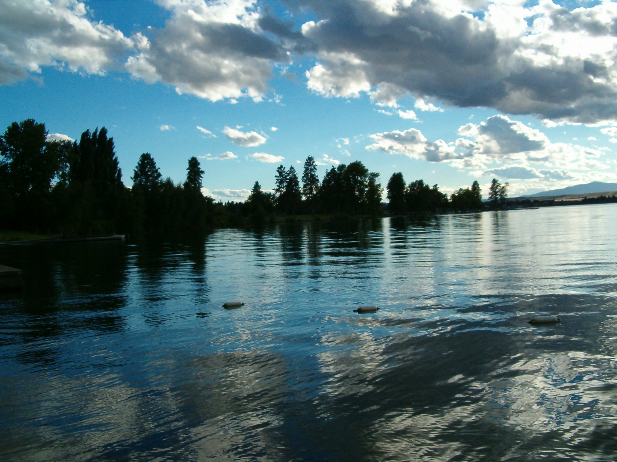
 Some clouds over Flathead Lake in Polson Montana
 KwaTuqNuk resort in Polson
 Polson, southern end of Flathead Lake


References
- "ArcGIS REST Services Directory". United States Census Bureau. Retrieved September 5, 2022.
- U.S. Geological Survey Geographic Names Information System: Polson, Montana
- Adam N. Johnson, Regina Sievert and Michael Durglo et al. Indigenous Knowledge and Geoscience on the Flathead Indian Reservation, Northwest Montana: Implications for Place-Based and Culturally Congruent Education. Journal of Geoscience Education. Vol. 62(2):187-202. DOI: 10.5408/12-393.1 https://files.eric.ed.gov/fulltext/EJ1163600.pdf
- "U.S. Census website". United States Census Bureau. Retrieved November 2, 2021.
- "Find a County". National Association of Counties. Retrieved 2011-06-07.
- "Polson". Montana Place Names Companion. Montana Historical Society. Retrieved 8 April 2021.
- "US Gazetteer files: 2010, 2000, and 1990". United States Census Bureau. 2011-02-12. Retrieved 2011-04-23.
- "US Gazetteer files 2010". United States Census Bureau. Archived from the original on 2012-01-25. Retrieved 2012-12-18.
- "U.S. Decennial Census". Census.gov. Retrieved 2013-12-20.
- "U.S. Census website". United States Census Bureau. Retrieved 2012-12-18.
- "U.S. Census website". United States Census Bureau. Retrieved 2008-01-31.
- "Mayor and City Commission - Polson Montana". City of Polson. Retrieved February 16, 2020.
- "Climatography of the United States NO.81" (PDF). National Oceanic and Atmospheric Administration. Archived from the original (PDF) on July 15, 2014. Retrieved January 15, 2011.
- "Monthly Averages for Polson, MT". The Weather Channel. Retrieved January 15, 2011.
- "Polson School District #23". Polson School District. Retrieved 17 April 2021.
- "North Lake County Public Library". North Lake County Public Library. Retrieved 13 April 2021.
- "flatheadbeacon.com". flatheadbeacon.com. 1970-01-01. Retrieved 2013-12-20.
- "leaderadvertiser.com". leaderadvertiser.com. 2013-12-13. Retrieved 2013-12-20.
- "valleyjournal.net". valleyjournal.net. Retrieved 2013-12-20.
- 750kerr.com
- "smoothkqjz.com". smoothkqjz.com. Archived from the original on 2013-12-20. Retrieved 2013-12-20.
- thebig100.com
- "star99hits.com". star99hits.com. 2013-09-15. Archived from the original on 2013-12-20. Retrieved 2013-12-20.
- power92rocks.com
- "TV Query Results - Video Division (FCC) USA". Fcc.gov. Retrieved 2013-12-20.
- "TV Query Results - Video Division (FCC) USA". Fcc.gov. Retrieved 2013-12-20.
- ]http://www.fcc.gov/fcc-bin/tvq?call=K16GJ
External links
 Polson travel guide from Wikivoyage
- Official website

- Photos of Polson
Municipalities and communities of Lake County, Montana, United States | ||
|---|---|---|
County seat: Polson | ||
| Cities |  | |
| Town | ||
| CDPs | ||
| Unincorporated community | ||
| Indian reservation |
| |
| Footnotes | ‡This populated place also has portions in an adjacent county or counties | |
| ||
State of Montana | |
|---|---|
Helena (capital) | |
| Topics | |
| Society |
|
| Regions |
|
| Largest cities | |
| Counties |
|
На других языках
[de] Polson (Montana)
Polson ist eine Stadt in Lake County im Bundesstaat Montana der Vereinigten Staaten und liegt am südlichen Ende des Flathead Lake im Flathead-Indianer-Reservat. Polson ist Sitz der Countyverwaltung (County Seat). Die Stadt ist an 18. Stelle in der Rangliste der größten Städte in Montana.[2]- [en] Polson, Montana
Другой контент может иметь иную лицензию. Перед использованием материалов сайта WikiSort.org внимательно изучите правила лицензирования конкретных элементов наполнения сайта.
WikiSort.org - проект по пересортировке и дополнению контента Википедии