world.wikisort.org - USA
Flathead County is in the U.S. state of Montana. At the 2020 census, its population was 104,357,[1] making it the state's fourth most populous county. Its county seat is Kalispell.[2] Its numerical designation (used in the issuance of license plates) is 7. Its northern border is on the state's north border, making it contiguous with the Canada–US border, facing British Columbia.
Flathead County | |
|---|---|
U.S. county | |
 Flathead County Courthouse in Kalispell | |
 Seal | |
 Location within the U.S. state of Montana | |
 Montana's location within the U.S. | |
| Coordinates: 48°17′N 114°01′W | |
| Country | |
| State | |
| Founded | 1893 |
| Named for | Flathead Indians |
| Seat | Kalispell |
| Largest city | Kalispell |
| Area | |
| • Total | 5,256 sq mi (13,610 km2) |
| • Land | 5,088 sq mi (13,180 km2) |
| • Water | 169 sq mi (440 km2) 3.2% |
| Population (2020) | |
| • Total | 104,357 |
| • Estimate (2021) | 108,454 |
| • Density | 20/sq mi (7.7/km2) |
| Time zone | UTC−7 (Mountain) |
| • Summer (DST) | UTC−6 (MDT) |
| Congressional district | At-large |
| Website | flathead |
| |
Flathead County comprises the Kalispell, Montana Micropolitan Statistical Area, with neighboring Lake County following soon after.
History
Flathead County was founded in 1893. Some sources cite the supposed practice of the Salish tribe flattening infants' heads as the origin of the name Flathead,[3] but there is no record of Salish Indians ever having that appearance.
Geography
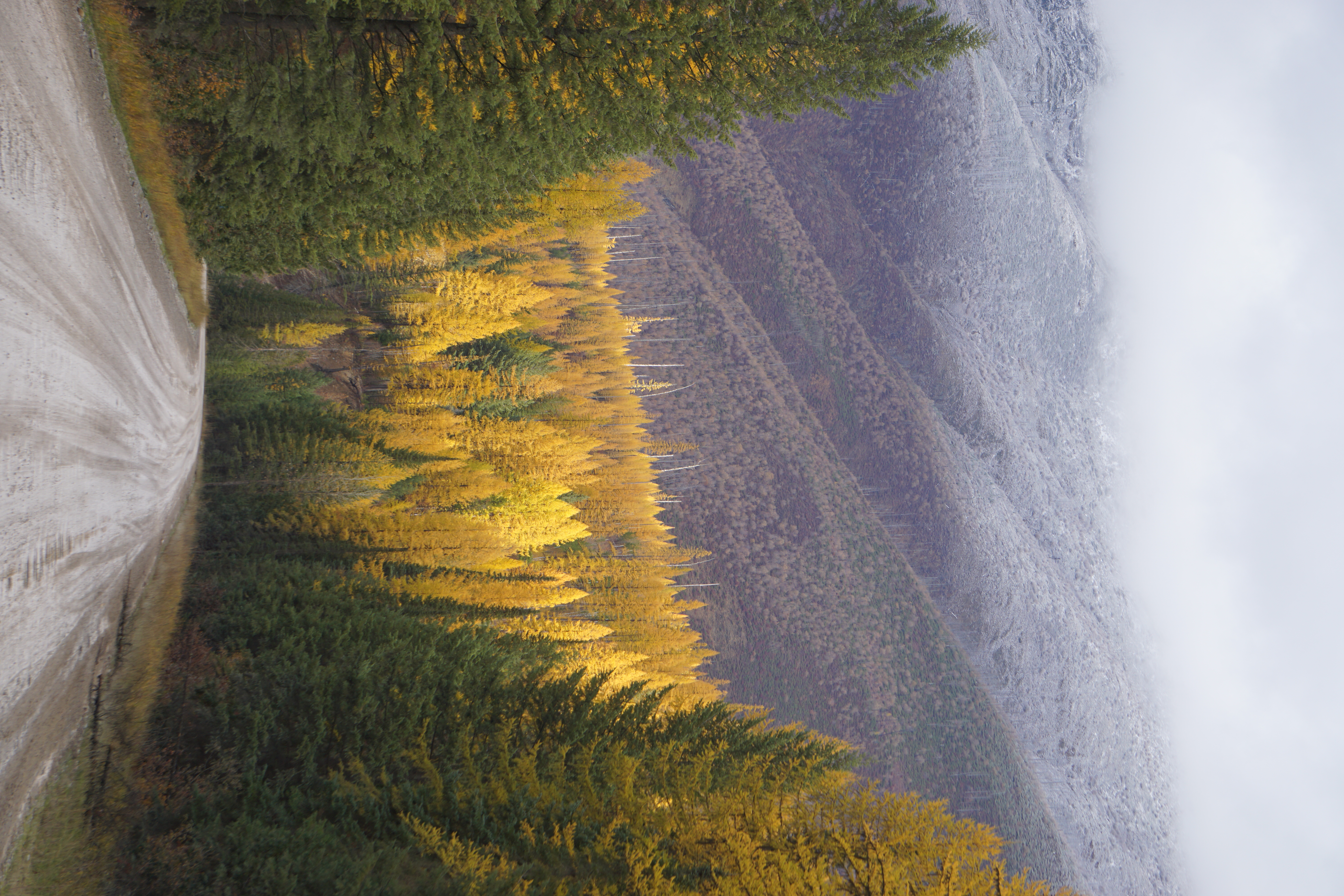
The county includes much of Flathead Lake, the Flathead Valley, and the Flathead River. These natural treasures, originated by glaciers, are named for the unique geological formation of a broad flat valley surrounded by mountains at the head of a deep glacial lake. Several tribes have long used the Flathead Lake, and the Bitterroot Salish, Kootenai, and Pend d'Oreilles tribes are represented on the Flathead Reservation. The western part of Glacier National Park is located in the county.
According to the United States Census Bureau, the county has a total area of 5,256 square miles (13,610 km2), of which 5,088 square miles (13,180 km2) is land and 169 square miles (440 km2) (3.2%) is water.[4] It is the third-largest county in Montana by land area and second-largest by total area.
Ecology
Wildlife includes bobcats, black bears, coyotes, deer, elk, grizzly bears, lynx, mountain lions, and wolves.[5]
National protected areas
- Pacific Northwest National Scenic Trail (part)
- Flathead National Forest (part)
- Glacier National Park (part)
- Kootenai National Forest (part)
- Lolo National Forest (part)
- Lost Trail National Wildlife Refuge
Demographics
| Historical population | |||
|---|---|---|---|
| Census | Pop. | %± | |
| 1900 | 9,375 | — | |
| 1910 | 14,079 | 50.2% | |
| 1920 | 21,705 | 54.2% | |
| 1930 | 19,200 | −11.5% | |
| 1940 | 24,271 | 26.4% | |
| 1950 | 31,495 | 29.8% | |
| 1960 | 32,965 | 4.7% | |
| 1970 | 39,460 | 19.7% | |
| 1980 | 51,966 | 31.7% | |
| 1990 | 59,218 | 14.0% | |
| 2000 | 74,471 | 25.8% | |
| 2010 | 90,928 | 22.1% | |
| 2020 | 104,357 | 14.8% | |
| 2021 (est.) | 108,454 | [6] | 3.9% |
| US Decennial Census[7] 1790–1960[8] 1900–1990[9] 1990–2000[10] 2010–2020[1] | |||
2000 census
As of the 2000 United States census,[11] there were 74,471 people, 29,588 households, and 20,415 families living in the county. The population density was 15 people per square mile (6/km2). There were 34,773 housing units at an average density of 7 per square mile (3/km2). The racial makeup of the county was 96.26% White, 0.15% Black or African American, 1.15% Native American, 0.46% Asian, 0.06% Pacific Islander, 0.41% from other races, and 1.50% from two or more races. 1.42% of the population were Hispanic or Latino of any race. 21.7% were of German, 11.3% Irish, 11.0% Norwegian, 10.3% English and 9.1% United States or American ancestry.
There were 29,588 households, out of which 32.50% had children under the age of 18 living with them, 56.90% were married couples living together, 8.30% had a female householder with no husband present, and 31.00% were non-families. 25.20% of all households were made up of individuals, and 8.90% had someone living alone who was 65 years of age or older. The average household size was 2.48, and the average family size was 2.97.
The county population contained 25.90% under 18, 7.40% from 18 to 24, 27.40% from 25 to 44, 26.40% from 45 to 64, and 13.00% who were 65 years of age or older. The median age was 39 years. For every 100 females, there were 98.30 males. For every 100 females age 18 and over, there were 96.10 males.
The median income for a household in the county was $34,466, and the median income for a family was $40,702. Males had a median income of $31,908 versus $20,619 for females. The per capita income for the county was $18,112. About 9.40% of families and 13.00% of the population were below the poverty line, including 16.70% of those under age 18 and 8.60% of those age 65 or over.
2010 census
As of the 2010 United States census, there were 90,928 people, 37,504 households, and 24,817 families living in the county.[12] The population density was 17.9 inhabitants per square mile (6.9/km2). There were 46,963 housing units at an average density of 9.2 per square mile (3.6/km2).[13] The racial makeup of the county was 95.5% white, 1.1% American Indian, 0.6% Asian, 0.2% black or African American, 0.1% Pacific islander, 0.4% from other races, and 2.1% from two or more races. Those of Hispanic or Latino origin made up 2.3% of the population.[12] In terms of ancestry, 28.1% were German, 15.0% were English, 14.8% were Irish, 9.3% were Norwegian, and 4.6% were American.[14]
Of the 37,504 households, 29.5% had children under the age of 18 living with them, 52.8% were married couples living together, 8.7% had a female householder with no husband present, 33.8% were non-families, and 27.2% of all households were made up of individuals. The average household size was 2.40, and the average family size was 2.91. The median age was 41.2 years.[12]
The median income for a household in the county was $44,998, and the median income for a family was $53,940. Males had a median income of $39,767 versus $28,026 for females. The per capita income for the county was $24,721. About 8.4% of families and 11.7% of the population were below the poverty line, including 17.8% of those under age 18 and 7.7% of those age 65 or over.[15]
Politics
Along with Yellowstone County (home to Billings), Flathead County is one of Montana's more populous counties that leans heavily Republican. It has last voted Democratic in 1964, and has voted over 60% Republican in every presidential election since 1996 save 2008.
| Year | Republican | Democratic | Third party | |||
|---|---|---|---|---|---|---|
| No. | % | No. | % | No. | % | |
| 2020 | 38,321 | 63.93% | 20,274 | 33.82% | 1,343 | 2.24% |
| 2016 | 30,240 | 63.67% | 13,293 | 27.99% | 3,963 | 8.34% |
| 2012 | 28,309 | 64.47% | 13,892 | 31.64% | 1,708 | 3.89% |
| 2008 | 25,559 | 58.43% | 16,138 | 36.89% | 2,047 | 4.68% |
| 2004 | 26,019 | 67.27% | 11,587 | 29.96% | 1,072 | 2.77% |
| 2000 | 22,519 | 66.55% | 8,329 | 24.61% | 2,991 | 8.84% |
| 1996 | 16,542 | 51.33% | 10,452 | 32.43% | 5,231 | 16.23% |
| 1992 | 11,699 | 37.24% | 9,746 | 31.02% | 9,971 | 31.74% |
| 1988 | 14,461 | 57.33% | 10,202 | 40.44% | 562 | 2.23% |
| 1984 | 17,012 | 65.93% | 8,310 | 32.21% | 481 | 1.86% |
| 1980 | 15,102 | 63.54% | 6,349 | 26.71% | 2,316 | 9.74% |
| 1976 | 10,494 | 55.69% | 7,827 | 41.53% | 524 | 2.78% |
| 1972 | 10,417 | 60.72% | 5,412 | 31.55% | 1,327 | 7.73% |
| 1968 | 7,215 | 51.54% | 5,253 | 37.52% | 1,532 | 10.94% |
| 1964 | 6,325 | 44.02% | 8,015 | 55.78% | 30 | 0.21% |
| 1960 | 7,554 | 52.95% | 6,689 | 46.88% | 24 | 0.17% |
| 1956 | 8,088 | 57.40% | 6,003 | 42.60% | 0 | 0.00% |
| 1952 | 7,372 | 59.09% | 4,994 | 40.03% | 110 | 0.88% |
| 1948 | 4,240 | 46.12% | 4,546 | 49.45% | 407 | 4.43% |
| 1944 | 4,066 | 52.22% | 3,608 | 46.34% | 112 | 1.44% |
| 1940 | 4,403 | 45.06% | 5,217 | 53.39% | 151 | 1.55% |
| 1936 | 2,460 | 28.83% | 5,408 | 63.38% | 664 | 7.78% |
| 1932 | 2,978 | 38.76% | 4,026 | 52.40% | 679 | 8.84% |
| 1928 | 4,098 | 66.61% | 1,972 | 32.05% | 82 | 1.33% |
| 1924 | 2,541 | 43.28% | 788 | 13.42% | 2,542 | 43.30% |
| 1920 | 3,900 | 59.26% | 2,241 | 34.05% | 440 | 6.69% |
| 1916 | 2,913 | 45.33% | 2,978 | 46.34% | 535 | 8.33% |
| 1912 | 493 | 14.93% | 1,106 | 33.50% | 1,702 | 51.56% |
| 1908 | 1,838 | 49.45% | 1,480 | 39.82% | 399 | 10.73% |
| 1904 | 1,969 | 64.54% | 861 | 28.22% | 221 | 7.24% |
| 1900 | 1,104 | 47.08% | 1,201 | 51.22% | 40 | 1.71% |
| 1896 | 413 | 23.22% | 1,360 | 76.45% | 6 | 0.34% |
Infrastructure
- Kalispell Regional Medical Center is the county's largest hospital.[18]
- North Valley Hospital is located in Whitefish
- Flathead County Library System has 4 locations:
- Bigfork
- Columbia Falls
- Kalispell
- Marion
- Whitefish Library is separate
- Flathead County Solid Waste (Landfill) is located between Kalispell and Whitefish
- There are 16 Fire Districts and 3 Fire Service Areas
- There are 6 High Schools including private
- There are 21 Public School Districts
- Legislature
- 3 County Commissioner Districts
- 11 House Districts
- 7 Senate Districts
Communities
Cities
- Columbia Falls
- Kalispell (county seat)
- Whitefish
Census-designated places
Other unincorporated communities
Adjacent counties
- Regional District of East Kootenay, British Columbia – north
- Waterton Lakes National Park (Improvement District No. 4), Alberta – northeast
- Glacier County – east
- Pondera County – east
- Teton County – east
- Lewis and Clark County – southeast
- Powell County – southeast
- Missoula County – southeast
- Lake County – south
- Sanders County – southwest
- Lincoln County – west
Notable people
- Joe Bereta, member of the sketch comedy duo Barats and Bereta based in Spokane, Washington. Currently co-hosts SourceFed on YouTube.
- Phil Jackson, NBA coach and player
- Dorothy M. Johnson, writer of Westerns
- Braxton Mitchell, Montana state representative
- Maury Povich, talk show host known for his TV show Maury
- Keith Regier, Montana state senator
- Alice Ritzman, LPGA golf professional
- Michelle Williams, actress who achieved recognition for her leading role in the TV teen drama series Dawson's Creek
- Derek Skees, Montana state representative
In popular culture
Miami Herald columnist Dave Barry frequently cites the police blotter of the Flathead Beacon in Flathead County as a source of humorous material. It is written in a spare, surrealist style by local man Justin Franz, following the pattern set by earlier writer Christie Burns.[citation needed]
See also
- List of lakes in Flathead County, Montana (A-L)
- List of lakes in Flathead County, Montana (M-Z)
- List of mountains in Flathead County, Montana (A-L)
- List of mountains in Flathead County, Montana (M-Z)
- National Register of Historic Places listings in Flathead County, Montana
References
- "State & County QuickFacts". U.S. Census Bureau. Retrieved February 13, 2022.
- "Find a County". National Association of Counties. Archived from the original on May 31, 2011. Retrieved June 7, 2011.
- Gannett, Henry (1905). The Origin of Certain Place Names in the United States. Govt. Print. Off. p. 126.
- "2010 Census Gazetteer Files". US Census Bureau. August 22, 2012. Archived from the original on December 5, 2014. Retrieved November 28, 2014.
- Long, Ben (March 6, 2020). "Finding a Middle Ground on Wolves and Wolf Management". Outdoor Life. Retrieved August 4, 2021.
{{cite web}}: CS1 maint: url-status (link) - "Annual Estimates of the Resident Population for Counties: April 1, 2020 to July 1, 2021". Retrieved June 26, 2022.
- "US Decennial Census". US Census Bureau. Retrieved November 28, 2014.
- "Historical Census Browser". University of Virginia Library. Retrieved November 28, 2014.
- "Population of Counties by Decennial Census: 1900 to 1990". US Census Bureau. Retrieved November 28, 2014.
- "Census 2000 PHC-T-4. Ranking Tables for Counties: 1990 and 2000" (PDF). US Census Bureau. Retrieved November 28, 2014.
- "U.S. Census website". US Census Bureau. Retrieved January 31, 2008.
- "Profile of General Population and Housing Characteristics: 2010 Demographic Profile Data". US Census Bureau. Archived from the original on February 13, 2020. Retrieved January 9, 2016.
- "Population, Housing Units, Area, and Density: 2010 – County". US Census Bureau. Archived from the original on February 13, 2020. Retrieved January 9, 2016.
- "Selected Social Characteristics in the US – 2006–2010 American Community Survey 5-Year Estimates". US Census Bureau. Archived from the original on February 13, 2020. Retrieved January 9, 2016.
- "Selected Economic Characteristics – 2006–2010 American Community Survey 5-Year Estimates". US Census Bureau. Archived from the original on February 13, 2020. Retrieved January 9, 2016.
- Leip, David. "Atlas of US Presidential Elections". uselectionatlas.org. Retrieved April 2, 2018.
- "Our Campaigns - U.S. President". Retrieved January 22, 2021.
- Read, Richard (October 24, 2020). "Coronavirus bears down on a small Montana town". Los Angeles Times. Retrieved October 24, 2020.
External links
- The Daily Inter Lake
- Flathead Beacon Newsletter Website
- References to Flathead County on Dave Barry's blog
Places adjacent to Flathead County, Montana | ||||||||||||||||
|---|---|---|---|---|---|---|---|---|---|---|---|---|---|---|---|---|
| ||||||||||||||||
Municipalities and communities of Flathead County, Montana, United States | ||
|---|---|---|
County seat: Kalispell | ||
| Cities |
|  |
| CDPs | ||
| Other communities | ||
| Indian reservation |
| |
| Ghost town |
| |
| Footnotes | ‡This populated place also has portions in an adjacent county or counties | |
| ||
State of Montana | |
|---|---|
Helena (capital) | |
| Topics | |
| Society |
|
| Regions |
|
| Largest cities | |
| Counties |
|
Authority control | |
|---|---|
| General | |
| National libraries | |
На других языках
[de] Flathead County
Flathead County[1] ist ein County im Bundesstaat Montana der Vereinigten Staaten. Der Sitz der Countyverwaltung (County Seat) befindet sich in Kalispell.- [en] Flathead County, Montana
[ru] Флатхед (округ)
Округ Флатхед (англ. Flathead County) располагается в штате Монтана, США. Официально образован в 1893 году. По состоянию на 2010 год, численность населения составляла 90 928 человек.Другой контент может иметь иную лицензию. Перед использованием материалов сайта WikiSort.org внимательно изучите правила лицензирования конкретных элементов наполнения сайта.
WikiSort.org - проект по пересортировке и дополнению контента Википедии