world.wikisort.org - USA
Hamilton is a city that serves as the county seat of Ravalli County, Montana, United States.[4] The population was 4,659 at the 2020 census.[5]
Hamilton | |
|---|---|
City | |
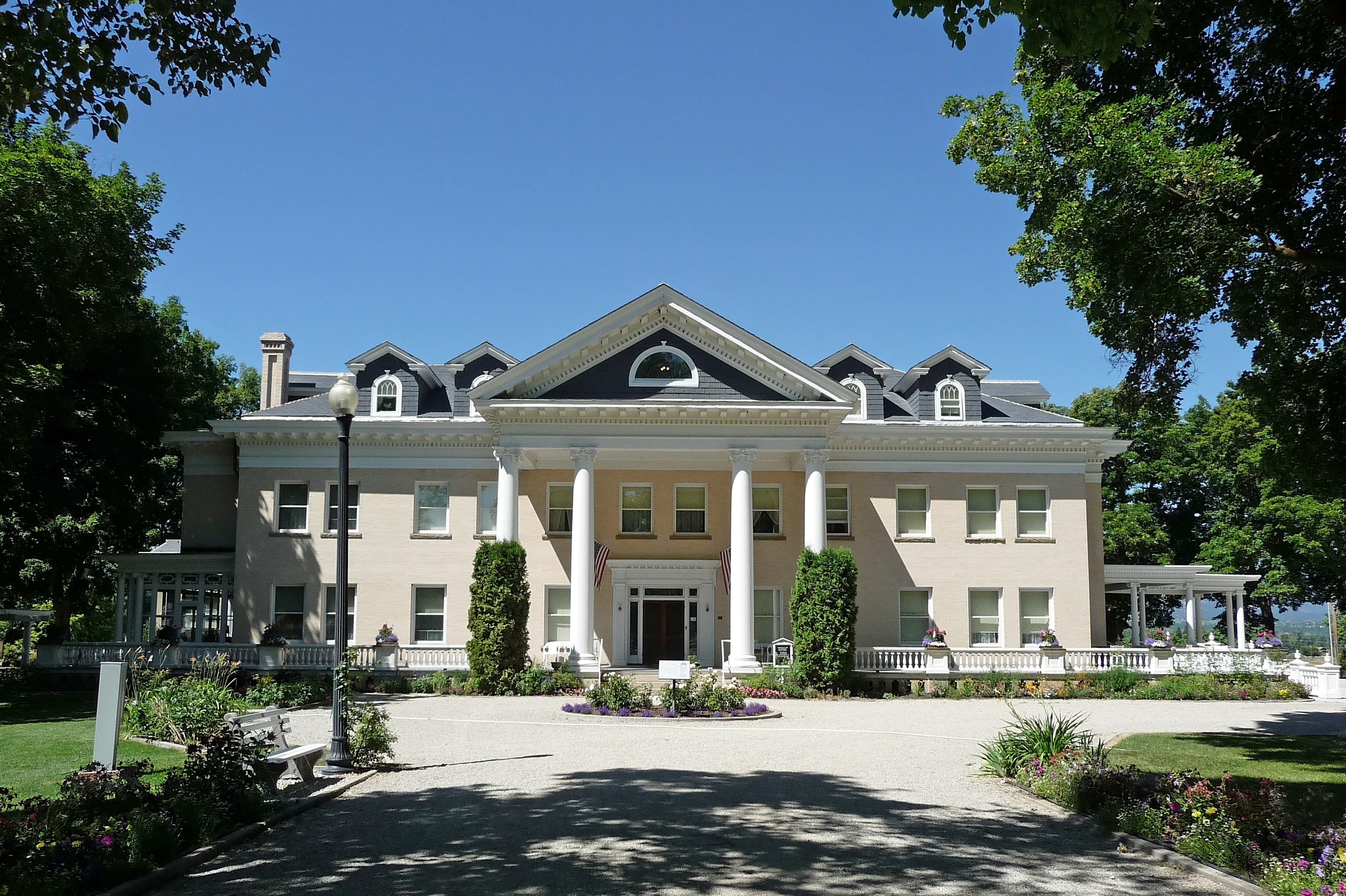
 Downtown Hamilton | |
 Location of Hamilton, Montana | |
| Coordinates: 46°14′54″N 114°9′35″W | |
| Country | United States |
| State | Montana |
| County | Ravalli |
| Government | |
| • Mayor | Dominic A Farrenkopf [1] |
| Area | |
| • Total | 2.60 sq mi (6.73 km2) |
| • Land | 2.54 sq mi (6.58 km2) |
| • Water | 0.06 sq mi (0.15 km2) |
| Elevation | 3,570 ft (1,090 m) |
| Population (2020) | |
| • Total | 4,659 |
| • Density | 1,832.81/sq mi (707.68/km2) |
| Time zone | UTC−7 (Mountain (MST)) |
| • Summer (DST) | UTC−6 (MDT) |
| ZIP code | 59840 |
| Area code | 406 |
| FIPS code | 30-33775 |
| GNIS feature ID | 0784496[3] |
| Website | www.cityofhamilton.net |
History
Hamilton was founded by copper king Marcus Daly in the late 19th century.[6] It was named for J.W. Hamilton, who provided the right-of-way to the railroad.[7] Daly is said to have wanted to begin business in the then county seat of Grantsdale, but was denied the opportunity. He supposedly founded Hamilton out of his own pocket as a reaction to being rebuffed at Grantsdale.
The Ravalli County Museum, founded in 1955, is located in the former Ravalli County Courthouse and focuses on County history, natural history and art.
In the summer of 2000, Hamilton made international headlines when forest fires throughout the Bitterroot Valley filled the area with smoke and prompted the evacuation of many residents. President Clinton declared a state of emergency in the area and dispatched National Guard troops to assist with fighting the fires.
Hamilton is, as of 2004, home to two microbiological research and production facilities: the government-run Rocky Mountain Laboratories, and a branch of the Corixa Corporation (bought in the late 1990s from Ribi ImmunoChem Research, Inc.). The Corixa Corporation was bought by GlaxoSmithKline in 2005. NIAID (National Institute of Allergy and Infectious Diseases) completed construction of a Biosafety Level 4 biohazard laboratory as part of the Rocky Mountain Laboratories (RML) facility in 2008. This facility has begun operations using highly-pathogenic organisms including the Lentivirus family of viruses.[8]
Hamilton has one of the last remaining Kmart stores in the United States, the only remaining one in the state of Montana and the entire Mountain time zone.[9] However, it was announced in January, 2022 that the Kmart will close in March, 2022.[10]
Geography and climate
Hamilton is located at 46°14′54″N 114°9′35″W (46.248412, -114.159852).[11]
According to the United States Census Bureau, the city has a total area of 2.57 square miles (6.66 km2), of which 2.53 square miles (6.55 km2) is land and 0.04 square miles (0.10 km2) is water.[12]
| Climate data for Hamilton, Montana (1981–2010) | |||||||||||||
|---|---|---|---|---|---|---|---|---|---|---|---|---|---|
| Month | Jan | Feb | Mar | Apr | May | Jun | Jul | Aug | Sep | Oct | Nov | Dec | Year |
| Average high °F (°C) | 36.7 (2.6) |
41.8 (5.4) |
51.4 (10.8) |
59.1 (15.1) |
67.6 (19.8) |
75.2 (24.0) |
85.1 (29.5) |
83.7 (28.7) |
72.8 (22.7) |
59.3 (15.2) |
44.2 (6.8) |
34.0 (1.1) |
59.2 (15.1) |
| Average low °F (°C) | 18.8 (−7.3) |
20.7 (−6.3) |
26.9 (−2.8) |
32.7 (0.4) |
39.5 (4.2) |
45.6 (7.6) |
50.2 (10.1) |
48.6 (9.2) |
40.8 (4.9) |
31.8 (−0.1) |
24.3 (−4.3) |
16.8 (−8.4) |
33.1 (0.6) |
| Average precipitation inches (mm) | 0.88 (22) |
0.86 (22) |
0.97 (25) |
0.99 (25) |
1.67 (42) |
1.61 (41) |
0.99 (25) |
1.06 (27) |
1.01 (26) |
0.76 (19) |
1.19 (30) |
1.17 (30) |
13.17 (335) |
| Average snowfall inches (cm) | 3.0 (7.6) |
3.2 (8.1) |
1.5 (3.8) |
0.3 (0.76) |
0.2 (0.51) |
0.0 (0.0) |
0.0 (0.0) |
0.0 (0.0) |
0.0 (0.0) |
0.1 (0.25) |
2.3 (5.8) |
3.5 (8.9) |
14.3 (36) |
| Source: NOAA[13] | |||||||||||||
According to the Köppen climate classification, Hamilton has a humid continental climate
Demographics
| Historical population | |||
|---|---|---|---|
| Census | Pop. | %± | |
| 1880 | 50 | — | |
| 1900 | 1,257 | — | |
| 1910 | 2,240 | 78.2% | |
| 1920 | 1,700 | −24.1% | |
| 1930 | 1,839 | 8.2% | |
| 1940 | 2,332 | 26.8% | |
| 1950 | 2,678 | 14.8% | |
| 1960 | 2,475 | −7.6% | |
| 1970 | 2,499 | 1.0% | |
| 1980 | 2,661 | 6.5% | |
| 1990 | 2,737 | 2.9% | |
| 2000 | 3,705 | 35.4% | |
| 2010 | 4,348 | 17.4% | |
| 2020 | 4,659 | 7.2% | |
| U.S. Decennial Census[14][5] | |||
2010 census
As of the census[15] of 2010, there were 4,348 people, 2,175 households, and 1,006 families living in the city. The population density was 1,718.6 inhabitants per square mile (663.6/km2). There were 2,456 housing units at an average density of 970.8 per square mile (374.8/km2). The racial makeup of the city was 95.0% White, 0.3% African American, 0.6% Native American, 1.4% Asian, 0.2% from other races, and 2.5% from two or more races. Hispanic or Latino of any race were 3.1% of the population.
There were 2,175 households, of which 23.6% had children under the age of 18 living with them, 30.6% were married couples living together, 11.7% had a female householder with no husband present, 3.9% had a male householder with no wife present, and 53.7% were non-families. 47.0% of all households were made up of individuals, and 22.8% had someone living alone who was 65 years of age or older. The average household size was 1.92 and the average family size was 2.72.
The median age in the city was 43 years. 20.1% of residents were under the age of 18; 7.4% were between the ages of 18 and 24; 24.4% were from 25 to 44; 23.4% were from 45 to 64; and 24.7% were 65 years of age or older. The gender makeup of the city was 46.6% male and 53.4% female.
2000 census
As of the census[16] of 2000, there were 3,705 people, 1,772 households, and 855 families living in the city. The population density was 1,603.6 people per square mile (619.3/km2). There were 1,915 housing units at an average density of 828.8 per square mile (320.1/km2). The racial makeup of the city was 96.22% White, 0.11% African American, 0.89% Native American, 0.78% Asian, 0.22% from other races, and 1.78% from two or more races. Hispanic or Latino of any race were 1.65% of the population.
There were 1,772 households, out of which 22.3% had children under the age of 18 living with them, 36.3% were married couples living together, 9.5% had a female householder with no husband present, and 51.7% were non-families. 47.6% of all households were made up of individuals, and 24.9% had someone living alone who was 65 years of age or older. The average household size was 1.95 and the average family size was 2.81.
In the city, the population was spread out, with 20.2% under the age of 18, 6.8% from 18 to 24, 24.0% from 25 to 44, 20.6% from 45 to 64, and 28.3% who were 65 years of age or older. The median age was 44 years. For every 100 females, there were 82.2 males. For every 100 females age 18 and over, there were 74.9 males.
The median income for a household in the city was $22,013, and the median income for a family was $30,665. Males had a median income of $25,795 versus $22,138 for females. The per capita income for the city was $14,689. About 14.3% of families and 17.8% of the population were below the poverty line, including 28.4% of those under age 18 and 15.3% of those age 65 or over.
Infrastructure
Ravalli County Airport is a public use airport 1 mile east of town.
Education
- Hamilton High School
- The Bitterroot College Program of the University of Montana is located in Hamilton.[17] In May 2012, it was renamed Bitterroot College University of Montana.[18][19]
The Bitterroot Public Library serves the town of Hamilton. It was one of the 17 Carnegie libraries built in Montana.[20]
City Council
Hamilton has three Wards with two representatives from each Ward.[21]
Notable people
- Willy Burgdorfer, scientist who discovered the cause of Lyme disease
- Herald Rea Cox, bacteriologist
- Marcus Daly, one of the "Copper Kings" of Butte, Montana, owned the Bitterroot Stock Farm near Hamilton
- Scott Lee Kimball, Colorado-born serial killer who lived in Hamilton during his teenage years.
- Henry L. Myers, United States Senator from Montana
- Jerry J. O'Connell, United States Representative from Montana, editor and publisher of local newspaper
- Val Skinner, golfer, winner of six LPGA Tour events
- Suzanna Son, film actress known for Red Rocket
- Michael D. Stevens, former Master Chief Petty Officer of the Navy
References
- "HAMILTON, MONTANA". City of Hamilton. City of Hamilton. Retrieved 9 August 2015.
- "ArcGIS REST Services Directory". United States Census Bureau. Retrieved September 5, 2022.
- U.S. Geological Survey Geographic Names Information System: Hamilton, Montana
- "Find a County". National Association of Counties. Retrieved 2011-06-07.
- "U.S. Census website". United States Census Bureau. Retrieved November 2, 2021.
- "Hamilton". Montana Place Names Companion. Montana Historical Society. Retrieved 5 April 2021.
- "Profile for Hamilton, Montana". ePodunk. Archived from the original on 2011-06-09. Retrieved 2010-05-28.
- "Rocky Mountain Laboratories, NIAID, NIH". NIH. Archived from the original on 2012-10-03. Retrieved 2012-09-24.
- "Kmart".
- "Hamilton Kmart to close in early March". 10 January 2022.
- "US Gazetteer files: 2010, 2000, and 1990". United States Census Bureau. 2011-02-12. Retrieved 2011-04-23.
- "US Gazetteer files 2010". United States Census Bureau. Archived from the original on 2012-01-25. Retrieved 2012-12-18.
- "NOWData - NOAA Online Weather Data". National Oceanic and Atmospheric Administration. Retrieved May 5, 2013.
- "Census of Population and Housing". Census.gov. Retrieved June 4, 2015.
- "U.S. Census website". United States Census Bureau. Retrieved 2012-12-18.
- "U.S. Census website". United States Census Bureau. Retrieved 2008-01-31.
- Bitterroot College Program
- Montana University System’s Board of Regents Approve Re-branding of Montana’s Two-Year Colleges and Programs of Higher Education, As Part of the Montana University System’s College!NOW Initiative, Helena, Montana: Montana University System Office of the Commissioner of Higher Education, May 25, 2012
- Montana Renames Technical Colleges, Inside Higher Ed, July 13, 2012
- "Bitterroot Public Library". Bitterroot Public Library. Retrieved 12 April 2021.
- "City of Hamilton - City Council". City of Hamilton. City of Hamilton. Retrieved 8 August 2015.
External links
Municipalities and communities of Ravalli County, Montana, United States | ||
|---|---|---|
County seat: Hamilton | ||
| City | 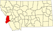 | |
| Towns | ||
| CDPs | ||
| Other communities |
| |
| ||
State of Montana | |
|---|---|
Helena (capital) | |
| Topics | |
| Society |
|
| Regions |
|
| Largest cities | |
| Counties |
|
Authority control | |
|---|---|
| General |
|
| National libraries | |
| Other |
|
На других языках
[de] Hamilton (Montana)
Hamilton ist eine Stadt in Ravalli County im US-Bundesstaat Montana und Sitz der County-Verwaltung (County Seat).- [en] Hamilton, Montana
Другой контент может иметь иную лицензию. Перед использованием материалов сайта WikiSort.org внимательно изучите правила лицензирования конкретных элементов наполнения сайта.
WikiSort.org - проект по пересортировке и дополнению контента Википедии