world.wikisort.org - USA
Blaine County is a county in the U.S. state of Montana. As of the 2020 census, the population was 7,044.[1] Its county seat is Chinook.[2] The county was named for James G. Blaine, former United States Secretary of State. It is on the north line of the state, and thus shares the southern border of Canada opposite Saskatchewan.
Blaine County | |
|---|---|
U.S. county | |
 Blaine County Courthouse in Chinook | |
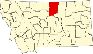 Location within the U.S. state of Montana | |
 Montana's location within the U.S. | |
| Coordinates: 48°26′N 108°58′W | |
| Country | |
| State | |
| Founded | 1912 |
| Named for | James G. Blaine |
| Seat | Chinook |
| Largest city | Chinook |
| Area | |
| • Total | 4,239 sq mi (10,980 km2) |
| • Land | 4,228 sq mi (10,950 km2) |
| • Water | 11 sq mi (30 km2) 0.3% |
| Population (2020) | |
| • Total | 7,044 |
| • Estimate (2021) | 6,980 |
| • Density | 1.7/sq mi (0.64/km2) |
| Time zone | UTC−7 (Mountain) |
| • Summer (DST) | UTC−6 (MDT) |
| Congressional district | At-large |
| Website | www |
| |
History
In 1912 Blaine, Phillips and Hill counties were formed from the area of Chouteau County. The original boundary of Blaine County included a portion of land in the west that is now included in Phillips County.
Geography
According to the United States Census Bureau, the county has a total area of 4,239 square miles (10,980 km2), of which 4,228 square miles (10,950 km2) is land and 11 square miles (28 km2) (0.3%) is water.[3]
The majority of Fort Belknap Indian Reservation is located in the southeastern part of the county.[4]
Features of the area include the Milk River, Bears Paw Mountains, and the Little Rocky Mountains.
Adjacent counties and rural municipalities
- Hill County - west
- Chouteau County - southwest
- Fergus County - south
- Phillips County - east
- Rural Municipality (RM) of Reno No. 51, Saskatchewan (SK) - northwest
- RM of Frontier No. 19, Saskatchewan, SK - north
- RM of Lone Tree No. 18, Saskatchewan, SK - northeast
National protected areas
- Black Coulee National Wildlife Refuge
- Nez Perce National Historical Park (part)
- Upper Missouri River Breaks National Monument (part)
Demographics
| Historical population | |||
|---|---|---|---|
| Census | Pop. | %± | |
| 1920 | 9,057 | — | |
| 1930 | 9,006 | −0.6% | |
| 1940 | 9,566 | 6.2% | |
| 1950 | 8,516 | −11.0% | |
| 1960 | 8,091 | −5.0% | |
| 1970 | 6,727 | −16.9% | |
| 1980 | 6,999 | 4.0% | |
| 1990 | 6,728 | −3.9% | |
| 2000 | 7,009 | 4.2% | |
| 2010 | 6,491 | −7.4% | |
| 2020 | 7,044 | 8.5% | |
| 2021 (est.) | 6,980 | [5] | −0.9% |
| U.S. Decennial Census[6] 1790-1960[7] 1900-1990[8] 1990-2000[9] 2010-2020[1] | |||
2000 census
As of the 2000 United States census,[10] there were 7,009 people, 2,501 households, and 1,793 families living in the county. The population density was 2 people per square mile (1/km2). There were 2,947 housing units at an average density of <1/km2 (1/sq mi). The racial makeup of the county was 52.58% White, 0.17% Black or African American, 45.37% Native American, 0.09% Asian, 0.03% Pacific Islander, 0.23% from other races, and 1.54% from two or more races. 1.00% of the population were Hispanic or Latino of any race. 18.8% were of German and 8.1% Norwegian ancestry. 91.7% spoke English, 3.8% German and 2.0% Dakota as their first language.
There were 2,501 households, out of which 36.00% had children under the age of 18 living with them, 52.30% were married couples living together, 14.40% had a female householder with no husband present, and 28.30% were non-families. 26.00% of all households were made up of individuals, and 10.80% had someone living alone who was 65 years of age or older. The average household size was 2.78 and the average family size was 3.36.
The county population contained 32.60% under the age of 18, 8.00% from 18 to 24, 24.80% from 25 to 44, 21.60% from 45 to 64, and 12.90% who were 65 years of age or older. The median age was 34 years. For every 100 females there were 97.50 males. For every 100 females age 18 and over, there were 96.30 males.
The median income for a household in the county was $25,247, and the median income for a family was $30,616. Males had a median income of $23,627 versus $20,469 for females. The per capita income for the county was $12,101. About 23.40% of families and 28.10% of the population were below the poverty line, including 36.50% of those under age 18 and 19.90% of those age 65 or over.
2010 census
As of the 2010 United States census, there were 6,491 people, 2,357 households, and 1,604 families living in the county.[11] The population density was 1.5 inhabitants per square mile (0.58/km2). There were 2,843 housing units at an average density of 0.7 per square mile (0.27/km2).[12] The racial makeup of the county was 49.4% American Indian, 48.2% white, 0.1% black or African American, 0.1% Asian, 0.2% from other races, and 2.0% from two or more races. Those of Hispanic or Latino origin made up 1.8% of the population.[11] In terms of ancestry, 23.0% were German, 9.2% were Norwegian, 6.6% were Irish, 5.7% were English, and 2.0% were American.[13]
Of the 2,357 households, 39.2% had children under the age of 18 living with them, 45.6% were married couples living together, 16.0% had a female householder with no husband present, 31.9% were non-families, and 28.7% of all households were made up of individuals. The average household size was 2.66 and the average family size was 3.28. The median age was 35.1 years.[11]
The median income for a household in the county was $37,034 and the median income for a family was $40,890. Males had a median income of $32,320 versus $28,986 for females. The per capita income for the county was $16,813. About 23.6% of families and 29.0% of the population were below the poverty line, including 44.6% of those under age 18 and 10.6% of those age 65 or over.[14]
Politics
Blaine County is one of the nation's most consistent long-term bellwether counties. Since 1916, the county has been won by the winner of the presidential election in every election except that of 1988, held during the aftermath of a major drought and farm crisis, when Michael Dukakis won the county by fifty-eight votes. During two other drought years on the Great Plains, Adlai Stevenson II in 1956 and Gerald Ford in 1976 also came close to breaking the county's streak, losing by even smaller vote margins than George H. W. Bush.
| Year | Republican | Democratic | Third party | |||
|---|---|---|---|---|---|---|
| No. | % | No. | % | No. | % | |
| 2020 | 1,469 | 47.07% | 1,589 | 50.91% | 63 | 2.02% |
| 2016 | 1,268 | 47.24% | 1,202 | 44.78% | 214 | 7.97% |
| 2012 | 1,178 | 41.20% | 1,616 | 56.52% | 65 | 2.27% |
| 2008 | 1,139 | 38.93% | 1,702 | 58.17% | 85 | 2.90% |
| 2004 | 1,424 | 51.45% | 1,300 | 46.97% | 44 | 1.59% |
| 2000 | 1,410 | 51.11% | 1,246 | 45.16% | 103 | 3.73% |
| 1996 | 1,127 | 38.96% | 1,316 | 45.49% | 450 | 15.55% |
| 1992 | 971 | 31.88% | 1,355 | 44.48% | 720 | 23.64% |
| 1988 | 1,402 | 48.15% | 1,460 | 50.14% | 50 | 1.72% |
| 1984 | 1,736 | 57.92% | 1,229 | 41.01% | 32 | 1.07% |
| 1980 | 1,686 | 56.29% | 1,107 | 36.96% | 202 | 6.74% |
| 1976 | 1,349 | 49.25% | 1,356 | 49.51% | 34 | 1.24% |
| 1972 | 1,513 | 54.44% | 1,151 | 41.42% | 115 | 4.14% |
| 1968 | 1,291 | 48.63% | 1,198 | 45.12% | 166 | 6.25% |
| 1964 | 961 | 35.55% | 1,742 | 64.45% | 0 | 0.00% |
| 1960 | 1,290 | 44.85% | 1,569 | 54.55% | 17 | 0.59% |
| 1956 | 1,460 | 50.38% | 1,438 | 49.62% | 0 | 0.00% |
| 1952 | 1,890 | 60.85% | 1,207 | 38.86% | 9 | 0.29% |
| 1948 | 997 | 36.28% | 1,669 | 60.74% | 82 | 2.98% |
| 1944 | 990 | 39.94% | 1,469 | 59.26% | 20 | 0.81% |
| 1940 | 1,165 | 35.02% | 2,129 | 63.99% | 33 | 0.99% |
| 1936 | 851 | 27.68% | 2,166 | 70.46% | 57 | 1.85% |
| 1932 | 1,063 | 33.64% | 1,977 | 62.56% | 120 | 3.80% |
| 1928 | 1,537 | 56.63% | 1,160 | 42.74% | 17 | 0.63% |
| 1924 | 827 | 45.74% | 337 | 18.64% | 644 | 35.62% |
| 1920 | 1,720 | 62.48% | 848 | 30.80% | 185 | 6.72% |
| 1916 | 857 | 39.13% | 1,261 | 57.58% | 72 | 3.29% |
| 1912 | 204 | 17.94% | 318 | 27.97% | 615 | 54.09% |
Economy
The main industry in Blaine County is agriculture.[16] The main employers on the Reservation are the Gros Ventre and Assiniboine tribes.[17]
Education
Fort Belknap College is located on the Fort Belknap Indian Reservation. Public high schools in the county include Harlem High School in Harlem, Chinook High School in Chinook, and Turner High School in Turner.
Communities
Cities
- Chinook (county seat)
- Harlem
Census-designated places
- Fort Belknap Agency
- Hartland Colony
- Hays
- Hogeland
- Lodge Pole
- North Harlem Colony
- Turner
- Turner Colony
- Zurich
Unincorporated communities
See also
- List of lakes of Blaine County, Montana
- List of mountains in Blaine County, Montana
- National Register of Historic Places listings in Blaine County, MT
References
- "U.S. Census Bureau QuickFacts: Blaine County, Montana". www.census.gov. United States Census Bureau. Retrieved February 19, 2022.
- "Find a County". National Association of Counties. Archived from the original on May 31, 2011. Retrieved June 7, 2011.
- "2010 Census Gazetteer Files". U.S. Census Bureau. August 22, 2012. Archived from the original on December 5, 2014. Retrieved November 27, 2014.
- Merrill, Andrea; Judy Jacobson (1997). Montana almanac. Helena MT: Falcon Publishing. p. 7. ISBN 1-56044-493-2.
- "Annual Estimates of the Resident Population for Counties: April 1, 2020 to July 1, 2021". Retrieved June 26, 2022.
- "U.S. Decennial Census". U.S. Census Bureau. Retrieved November 27, 2014.
- "Historical Census Browser". University of Virginia Library. Retrieved November 27, 2014.
- "Population of Counties by Decennial Census: 1900 to 1990". U.S. Census Bureau. Retrieved November 27, 2014.
- "Census 2000 PHC-T-4. Ranking Tables for Counties: 1990 and 2000" (PDF). U.S. Census Bureau. Retrieved November 27, 2014.
- "U.S. Census website". U.S. Census Bureau. Retrieved January 31, 2008.
- "Profile of General Population and Housing Characteristics: 2010 Demographic Profile Data". US Census Bureau]]. Archived from the original on February 13, 2020. Retrieved January 9, 2016.
- "Population, Housing Units, Area, and Density: 2010 - County". US Census Bureau]]. Archived from the original on February 13, 2020. Retrieved January 9, 2016.
- "Selectded Social Characteristics in the US – 2006-2010 American Community Survey 5-Year Estimates". US Census Bureau. Archived from the original on February 13, 2020. Retrieved January 9, 2016.
- "Selected Economic Characteristics – 2006-2010 American Community Survey 5-Year Estimates". US Census Bureau. Archived from the original on February 13, 2020. Retrieved January 9, 2016.
- Leip, David. "Atlas of US Presidential Elections". uselectionatlas.org. Retrieved November 16, 2020.
- Maxim Technologies. "Pre-Disaster Mitigation Plan" (PDF). Archived from the original (PDF) on August 14, 2011. Retrieved May 31, 2011.
- State of Montana, DLI. "Demographic & Economic Information for Fort Belknap Reservation" (PDF). Archived from the original (PDF) on September 6, 2011. Retrieved May 31, 2011.
- Cleveland, Blaine County MT Google Maps (accessed December 31, 2018)
- Lohman, Blaine County MT Google Maps (accessed December 31, 2018)
- North Fork, Blaine County MT Google Maps (accessed December 31, 2018)
- Rattlesnake, Blaine County MT Google Maps (accessed December 31, 2018)
- Savoy, Blaine County MT Google Maps (accessed December 31, 2018)
Further reading
- Noyes, Al. J. (1917). In the land of Chinook; or, The story of Blaine County. Helena MT: State Publishing Co. Retrieved May 21, 2014.
External links
Places adjacent to Blaine County, Montana | ||||||||||||||||
|---|---|---|---|---|---|---|---|---|---|---|---|---|---|---|---|---|
| ||||||||||||||||
Municipalities and communities of Blaine County, Montana, United States | ||
|---|---|---|
County seat: Chinook | ||
| Cities |
|  |
| CDPs |
| |
| Other community |
| |
| Indian reservations |
| |
| Footnotes | ‡This populated place also has portions in an adjacent county or counties | |
| ||
Helena (capital) | ||
| Topics |
|  Seal of Montana |
| Society |
| |
| Regions |
| |
| Largest cities | ||
| Counties |
| |
Authority control | |
|---|---|
| General |
|
| National libraries | |
На других языках
- [en] Blaine County, Montana
[ru] Блейн (округ, Монтана)
Блейн (англ. Blaine County) — один из 56 округов штата Монтана (США).Другой контент может иметь иную лицензию. Перед использованием материалов сайта WikiSort.org внимательно изучите правила лицензирования конкретных элементов наполнения сайта.
WikiSort.org - проект по пересортировке и дополнению контента Википедии