world.wikisort.org - Philippines
Dagupan, officially known as the City of Dagupan (Pangasinan: Siyudad na Dagupan, Ilocano: Siudad ti Dagupan, Tagalog: Lungsod ng Dagupan), is a 2nd class independent component city[9] in the Ilocos Region, Philippines. According to the 2020 census, it has a population of 174,302 people. [6]
Dagupan | |
|---|---|
Independent component city | |
| City of Dagupan | |
  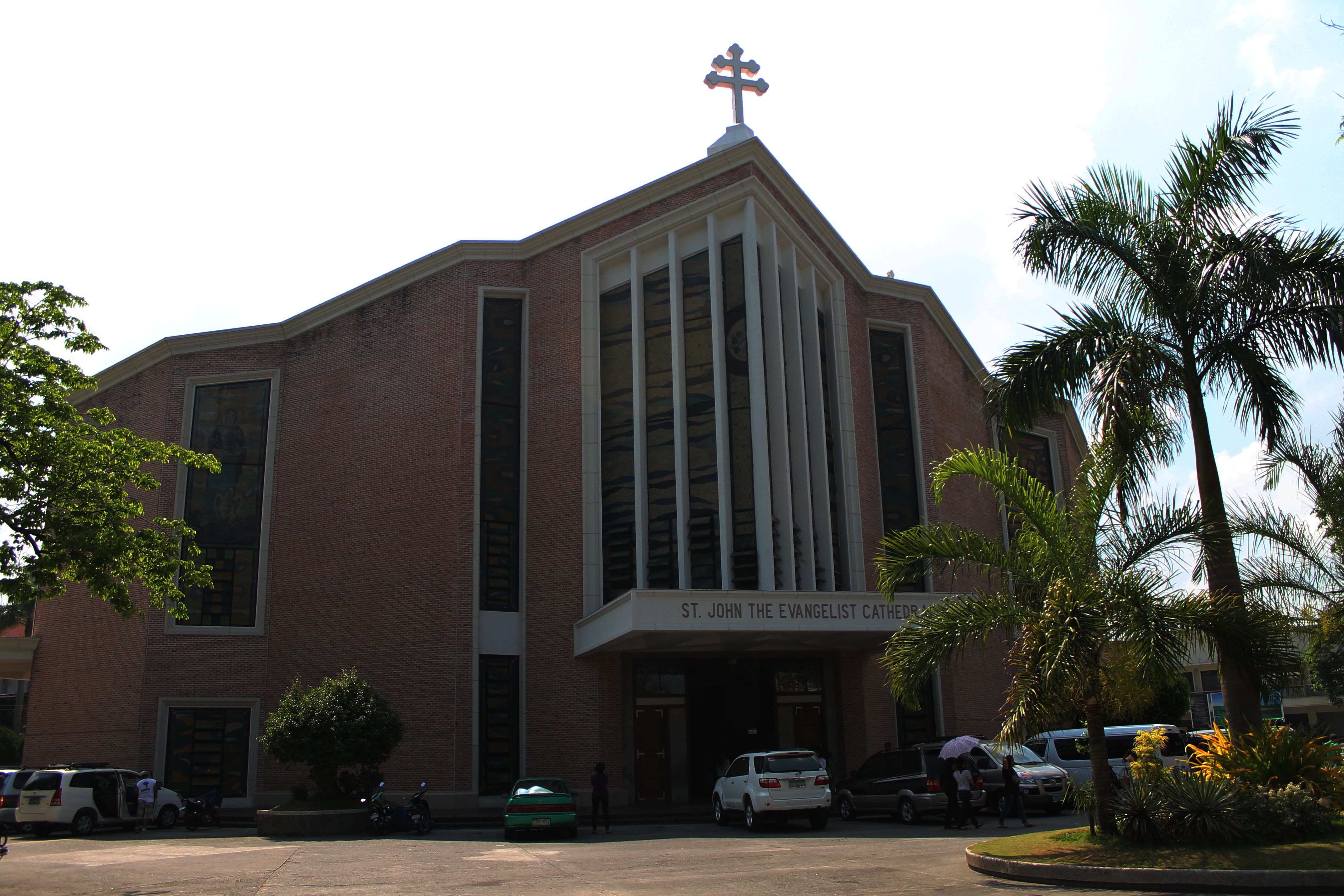   Clockwise from top-left: Dagupan City Welcome Arch, Metropolitan Cathedral of Saint John the Evangelist, CSI Supermarket, Dagupan Train Museum | |
 Flag  Seal | |
| Nickname(s): | |
 Map of Pangasinan with Dagupan highlighted | |
OpenStreetMap  | |
 Dagupan Location within the Philippines | |
| Coordinates: 16°02′35″N 120°20′02″E | |
| Country | Philippines |
| Region | Ilocos Region |
| Province | Pangasinan (geographically only) |
| District | 4th district |
| Founded | 1590 |
| Cityhood | June 20, 1947 |
| Barangays | 31 (see Barangays) |
| Government | |
| • Type | Sangguniang Panlungsod |
| • Mayor | Belen T. Fernandez (Aksyon) |
| • Vice Mayor | Dean Bryan L. Kua (Aksyon) |
| • Representative | Christopher P. de Venecia (Lakas-CMD) |
| • City Council | Members |
| • Electorate | 138,721 voters (2022) |
| Area | |
| • Total | 44.47 km2 (17.17 sq mi) |
| Elevation | 18 m (59 ft) |
| Highest elevation | 461 m (1,512 ft) |
| Lowest elevation | 0 m (0 ft) |
| Population | |
| • Total | 174,302 |
| • Density | 3,900/km2 (10,000/sq mi) |
| • Households | 42,017 |
| Demonym(s) | Dagupeño (masculine) Dagupeña (feminine) Dagupenean |
| Economy | |
| • Income class | 2nd city income class |
| • Poverty incidence | 9.19% (2018)[7] |
| • Revenue | ₱1,104,356,759.21 (2020)[8] |
| • Assets | ₱3,100,981,507.65 (2020) |
| • Expenditure | ₱1,016,850,298.56 (2020) |
| • Liabilities | ₱707,934,549.04 (2020) |
| Service provider | |
| • Electricity | Dagupan Electric Corporation (DECORP) |
| Time zone | UTC+8 (PST) |
| ZIP code | 2400 |
| PSGC | |
| IDD : area code | +63 (0)75 |
| Native languages | Pangasinan Ilocano Tagalog |
| Website | dagupan |
Located on the Lingayen Gulf on the northwest-central part of the island of Luzon, Dagupan is a major commercial and financial center north of Manila. Also, the city is one of the centers of modern medical services, media and communication in North-Central Luzon. The city is situated within the fertile Agno River Valley.

The city is among the top producers of milkfish (locally known as bangus) in the province. From 2001 to 2003, Dagupan's milkfish production totaled to 35,560.1 metric tons (MT), contributing 16.8 percent to the total provincial production. Of its total production in the past three years, 78.5 percent grew in fish pens/cages while the rest grew in brackish water fishponds.[10]
Dagupan is administratively and politically independent from the provincial government of Pangasinan and is only represented by the province's legislative district.
Dagupan City is one of the proposed metropolitan area in the Philippines.[11] Metro Dagupan is proposed to include the independent component city of Dagupan, as well as the towns of Binmaley, Calasiao, Lingayen, Manaoag, Mangaldan, Mapandan, San Fabian, San Jacinto, and Santa Barbara.
Etymology
The city's name was derived from the local Pangasinan word pandaragupan, meaning "gathering place" as the city has been a regional market center for centuries.
History
Kaboloan
During the 15th century, Pangasinan had been the site of an ancient polity called the Kaboloan (kingdom of Pangasinan), which sent emissaries to China in 1406–1411.[12]
Spanish Occupation
The area that is now known as Dagupan was described as marshland thickly covered with mangrove and nipa palm trees.[13] The natives lived along the shoreline and riverbanks of Calmay, Pantal, and Bonuan. But there were also communities in Malued, Lasip, Pogo, and Bacayao. The natives called the area Bacnotan which would later be incorporated into the encomienda of Lingayen that was established in 1583.[14]
The first long distance railroad in the Philippines connecting Manila and Dagupan was opened on November 24, 1892.
Japanese Occupation

The Japanese planes bombed in Dagupan City in December 1941; Dagupan City was occupied by Japanese forces starting in 1942.[15] The city also served as a wartime capital of Pangasinan.
Allied Liberation

On January 8–9, 1945, U.S. General Douglas MacArthur landed his amphibious liberation force in the city's "Blue Beach" section in Bonuan Gueset along the shores of Lingayen Gulf.[16][17] From his beachhead in Dagupan, along with those in neighboring towns Lingayen, Binmaley and San Fabian, MacArthur's forces under General Walter Krueger together with the Philippine Commonwealth troops under the Philippine Army and Philippine Constabulary units were able to penetrate Japanese defenses in Luzon island and liberate Filipino and allied prisoners of war near Cabanatuan in the province of Nueva Ecija, and in Manila's University of Santo Tomas, among others.
Cityhood

Dagupan became a city by virtue of Republic Act No. 170, authored by House Speaker Eugenio Pérez. It was signed into law by President Manuel Roxas on June 20, 1947.[18]
Contemporary History
The westward expansion of the city went as far as Lucao, which was also swampland. Local historian Restituto Basa surmised that the name Lucao may have been derived from the shellfish called lukan that used to abound in the swampy area. [citation needed]
In June 1962, Dagupan was shaken by a series of strong earthquakes which occurred at irregular intervals for about three weeks. The quakes toppled the belfry of the Roman Catholic Church. Many people from Calmay, Carael and island barrios evacuated to other towns. [citation needed]
In 1968, the national government agencies opened offices in Dagupan and other key cities across the country. The daytime population increased substantially, causing congestion in the city that began to see the appearance of public utility tricycles. [citation needed]
On July 16, 1990, a magnitude 7.7 earthquake struck northern Luzon, causing liquefaction, which made buildings tilt and sink due to their heavy weight and the looseness of the ground, which turned into sediment-rich mud. The Magsaysay Bridge, one of the two bridges especially spanning the Pantal River, collapsed, delaying people from crossing to the other banks and vice versa. Major damage caused businesses to be permanently transferred to the neighbouring towns of Mangaldan and Calasiao, but somehow, Dagupan and its inhabitants managed to recover from the earthquake.[19]
Geography
Dagupan City covers a total land area of 4,447.10 hectares (10,989.0 acres), bounded by the Lingayen Gulf in the north, San Fabian in the northeast, Mangaldan in the east, Calasiao in the south and Binmaley in the west. Land use is primarily for agriculture with 35.98% of the total land area, fishpond, cropland, residential with 22.88%; others uses are commercial, industrial, institutional, government private, parks and roads.
Dagupan is 14 kilometres (8.7 mi) from Lingayen and 220 kilometres (140 mi) from Manila.

Barangays
Dagupan City is politically subdivided into 31 barangays.[20] These barangays are headed by elected officials: Barangay Captain, Barangay Council, whose members are called Barangay Councilors. All are elected every three years.
|
|

Climate
| Climate data for Dagupan City (1981–2010, extremes 1903–2012) | |||||||||||||
|---|---|---|---|---|---|---|---|---|---|---|---|---|---|
| Month | Jan | Feb | Mar | Apr | May | Jun | Jul | Aug | Sep | Oct | Nov | Dec | Year |
| Record high °C (°F) | 36.0 (96.8) |
37.0 (98.6) |
38.7 (101.7) |
39.9 (103.8) |
39.6 (103.3) |
38.7 (101.7) |
38.2 (100.8) |
36.4 (97.5) |
36.6 (97.9) |
37.2 (99.0) |
36.9 (98.4) |
36.9 (98.4) |
39.9 (103.8) |
| Average high °C (°F) | 30.8 (87.4) |
31.8 (89.2) |
33.2 (91.8) |
34.7 (94.5) |
34.1 (93.4) |
33.1 (91.6) |
32.0 (89.6) |
31.3 (88.3) |
31.6 (88.9) |
31.9 (89.4) |
31.8 (89.2) |
30.9 (87.6) |
32.3 (90.1) |
| Daily mean °C (°F) | 25.8 (78.4) |
26.5 (79.7) |
27.9 (82.2) |
29.5 (85.1) |
29.4 (84.9) |
28.9 (84.0) |
28.2 (82.8) |
27.8 (82.0) |
27.9 (82.2) |
27.9 (82.2) |
27.4 (81.3) |
26.2 (79.2) |
27.8 (82.0) |
| Average low °C (°F) | 20.7 (69.3) |
21.2 (70.2) |
22.6 (72.7) |
24.4 (75.9) |
24.8 (76.6) |
24.7 (76.5) |
24.4 (75.9) |
24.3 (75.7) |
24.2 (75.6) |
24.0 (75.2) |
23.0 (73.4) |
21.4 (70.5) |
23.3 (73.9) |
| Record low °C (°F) | 14.3 (57.7) |
16.3 (61.3) |
16.7 (62.1) |
19.7 (67.5) |
19.0 (66.2) |
20.2 (68.4) |
20.4 (68.7) |
19.0 (66.2) |
20.5 (68.9) |
19.5 (67.1) |
17.2 (63.0) |
15.2 (59.4) |
14.3 (57.7) |
| Average rainfall mm (inches) | 6.7 (0.26) |
10.7 (0.42) |
22.2 (0.87) |
60.4 (2.38) |
209.8 (8.26) |
337.9 (13.30) |
499.6 (19.67) |
581.3 (22.89) |
368.4 (14.50) |
215.9 (8.50) |
53.9 (2.12) |
14.1 (0.56) |
2,380.9 (93.74) |
| Average rainy days (≥ 0.1 mm) | 1 | 1 | 2 | 5 | 12 | 17 | 21 | 22 | 20 | 11 | 5 | 2 | 119 |
| Average relative humidity (%) | 79 | 78 | 77 | 77 | 79 | 83 | 86 | 87 | 86 | 84 | 82 | 80 | 82 |
| Source: PAGASA[22][23] | |||||||||||||
Dagupan City has a tropical monsoon climate (Köppen climate classification: Am). It is in Type I climate zone in the Modified Coronas' Climate Classification, with a pronounced dry season from November to April.
Demographics
| Year | Pop. | ±% p.a. |
|---|---|---|
| 1903 | 20,357 | — |
| 1918 | 22,441 | +0.65% |
| 1939 | 32,602 | +1.79% |
| 1948 | 43,838 | +3.35% |
| 1960 | 63,191 | +3.09% |
| 1970 | 83,582 | +2.83% |
| 1975 | 90,092 | +1.52% |
| 1980 | 98,344 | +1.77% |
| 1990 | 122,247 | +2.20% |
| 1995 | 126,214 | +0.60% |
| 2000 | 130,328 | +0.69% |
| 2007 | 149,554 | +1.92% |
| 2010 | 163,676 | +3.34% |
| 2015 | 171,271 | +0.87% |
| 2020 | 174,302 | +0.35% |
| Source: Philippine Statistics Authority [24] [21] [25][26] | ||
In Dagupan, the Pangasinans are the predominant people and the Pangasinan language is predominantly used in the city and environs, followed by Filipino and English, as well as Ilocano, mainly in Calmay and Pantal. Chinese is mainly spoken only by a few city individuals of Chinese descent.
- Number of Registered Voters (2016): 105,183[20]
Economy

Dagupan is the economic center of Pangasinan.[34] As a major regional hub, many people in Pangasinan and nearby provinces commute to the city during the day. This causes the city's daytime population to rise and cause traffic to parts of the city, especially the downtown area. The city is a vital financial center housing numerous banks, non-bank financial institutions, headquarters of corporations and offices of major government departments and agencies.
Historically, Dagupan was a center for salt making in numerous salt evaporator beds in the low-lying swampy areas close to the Lingayen Gulf, Beginning in the 19th Century, some of the salt making operations gave way to pond culture of fish, most prominently the milkfish or as it is known locally as bangus for which the city has become famous. Fisheries, aquaculture and processed fisheries products are an important mainstay of the city's economy.[35]

Manila-based developers have also set shop in this bustling city due to its strategic location and growing population.
▪ Santa Lucia Land Inc. (Almeria Verde Subdivision)[36]
▪ Double Dragon Properties (CityMall Mayombo, opened 2018)
▪ SM Prime Holdings (SM Center Dagupan [opened 2019], planned SM Savemore Dagupan, and planned SM City Dagupan)[36]
▪ 11-storey Allied Care Experts Medical Center[36]
▪ Green Sun Management Inc. & Megaworld Construction and Development Corporation (5 storey Green Sun Hotel)[37]
▪ Filinvest (Fora Dagupan – a 6.3-hectare (16-acre) Townscape development)[38]
▪ Vester Corporation – Bayani Hall condominium, Arellano St., Dagupan City[39]
As of June 2020, Dagupan is one of the 25 cities in the country identified as an area with “high-potential in IT-BPM industry” for transformation into “digital cities” by 2025.[40]
Sitel, a global business process outsourcing (BPO) firm, has recently opened its first Sitel MAXhub in Dagupan City, bringing more jobs to aspiring BPO professionals in Dagupan city. The company is now actively seeking to expand more in the city.[41]
Local businessmen have also gone with the trend in developing their properties in different locations which further boosts the city's construction activities and secures the city's title as the economic hub of Pangasinan.
Another part of Dagupan's economy is the motor vehicle industry centered around Caranglaan and Lucao districts.[42] Many automotive companies have a dealership in the city's metropolitan area. Existing car dealerships from major companies including Ford, Hyundai, Chevrolet, Mazda and Isuzu are all found in Dagupan, while other companies such as Toyota, Honda, Mitsubishi, Nissan and many more are found at the neighbouring town of Calasiao.
Tourism
Dagupan is a historic city that boasts numerous historical, cultural heritage, recreational, ecotourism, business, and culinary tourism of national importance.[43]
Being at the center of trade in the north for centuries blessed with a geography crisscrossed by several rivers and sandy beaches, Dagupan has naturally become a multifaceted city in terms of tourism. Also, as the transportation hub of Pangasinan, the city is easily accessible to the public, whether coming from within or outside of the province.[44]
Historical & Heritage Tourism
Since the Spanish colonial times, the colonial government had put a great emphasis on the importance of the city due to being at the strategic center of the province and its accessibility to the sea for trading and transport. The first Philippine railroad system, the Manila-Dagupan railway, had its terminus in the city.[45] Remnant of the historic rail transport locomotive can be seen displayed infront of the city museum.[46]

During World War 2, Dagupan also served as the wartime capital of Pangasinan. The shores of Bonuan Gueset was a silent witness to the historic landing of Gen. MacArthur that eventually became one of the key historic points in the country's liberation.[47] To immortalize this important feat in the city's history, a MacArthur Landing Park was built to stand by the shore of Tondaligan Beach, adjacent to Filipino-Japanese Peace Park.
More structures and landmarks of historic importance still dot the city, some of which are already listed as heritage sites by the National Historical Commission of the Philippines (NHCP).[48] These include:
• Home Economics/Gabaldon Building at West Central Elementary School
• Old City Hall and Water Tower
• Metropolitan Cathedral of Saint John
• Philippine National Railways Tracks and Station
• Remnants of Franklin Bridge
• Lighthouse in Bonuan
Food Tourism

Aside from being the Bangus Capital of the Philippines, the city is also known as the Kitchen of the North. Many popular culinary traditions have originated in the city, including Pigar-Pigar, Kaleskes, and Bonuan Boneless Bangus. Plato Wraps, a contemporary food innovation that's now popularly sold in major shopping malls also hails from the city.[49][50]

Dagupan is home to popular homegrown restaurants that branched out in many parts of Luzon. These include Matutina's Restaurant, Dagupeña Restaurant, Pedritos Restaurant, and Silantro Fil-Mex Cantina, among others.[51]

Food Hubs:
• Metro Plaza (International and national food and resto chains such as Starbucks, Yellow Cab Pizza)[52]
• Galvan Street (The center for local Dagupan cuisines such as Pigar-Pigar, Kaleskes and other native dishes)[53]
• Tondaligan Food Hub (Alfresco dining by the beach hosting native delicacies, street foods and selected food kiosks)[54]
• Rivergrove Lifestyle Center (A modern food hub by the river hosting popular restaurants & cafes such as Tim Hortons, Army Navy, Cabalen)
• Plaza Del Carmen (Hosts traditional and innovative cafes, bars and restaurants such as Bside Bistro, Carne'val Mexican Grill, Mankape, among others)
• Royal Rays Food Hub (A hub for Filipino and Asian dining, such as Ikura by Hagemu, Juliana's Kitchen, Sangkalan and Moonleaf Cafe)
Ecotourism

Dagupan, being surrounded by rivers and sea, offers extensive ecotourism activities for recreation, relaxation and adventure.[55]

Tondaligan Beach is an urban beach park complex with numerous amenities. The extensive Tondaligan baywalk, dubbed as the longest in the region, is a prominent feature along the Bonuan shore wherein cyclists can enjoy biking and savor Lingayen Gulf's picturesque view.[56]

Tondaligan Beach Park also hosts many historical landmark of national importance such as:
- Gen. MacArthur Landing Park
- Filipino-Japanese Garden Park
- Tondaligan Grand Amphitheater

Other interesting spots and landmarks in the city that can be visited are as follows:
- Dawel River Cruise
- BFAR – NIFTDC
- Pugaro Beach
- Bonuan Golf Course
- Leisure Coast Resort
Festivities
Being the Bangus (Milkfish) Capital of the Philippines, Dagupan has been celebrating its well-renowned produce through Bangus Festival which started in 2002. It's a month-long celebration every April annually. A historic Guinness World Record for the longest barbecue measuring 1,007.56 meters (3,305.64 feet) was achieved by the people of Dagupan City on May 3, 2003.[57]

The festival features the famous bangusine (bangus cuisine) which is one of the main highlights of the event, street dancing where competing barangays parade in the city's main avenue wearing colorful Bangus Festival costumes, bangus grilling, deboning, variety shows, trade fairs, beauty pageants, sports fest, cooking show, medical mission, visual arts, band concerts, sports activities, dog show, fluvial parade, drum and lyre parade, and street party. The festival concludes every April 30 with main events: Kalutan ed Dalan in the daytime and Bangusan Street Party concerts in the nighttime.[58]

Pista'y Dayat (Festival of the Sea) is held the day after the conclusion of Bangus Festival. It is simultaneously being celebrated together with all the neighboring towns in the Lingayen Gulf area. It serves as a thanksgiving for the bountiful harvest and abundant fishing from the sea in the Province of Pangasinan.[59]
Dagupan City Fiesta is a month-long celebration held every December with a Catholic fiesta mass and Procession at St. John Cathedral in honor of St. John the Evangelist, the patron saint of Dagupan and of fishermen.

Since it coincides with the Christmas festivities, Christmas decoration-building, nativity scene displays and Christmas tree using indigenous materials has become a permanent fixture in the Dagupan City Fiesta.
On The Edades Day, events such as Arts and Painting Contests are held on December 23, honoring national artist on Modern Arts Victorio Edades, a Dagupeño from Barangay Bolosan. Other events such Miss Dagupan pageant, job fairs, NGO, Organizations, & Barangay Nights, various alumni homecoming Nights, Battle of Bands, and Hip Hop Dance Contest, among others are usually parts of the festivities. The Dagupan City fiesta ends on Rizal Day at the City Plaza.[60]
Government
Dagupan, belonging to the fourth congressional district of the province of Pangasinan, is governed by a mayor designated as its local chief executive and by a municipal council as its legislative body in accordance with the Local Government Code. The mayor, vice mayor, and the councilors are elected directly by the people through an election which is being held every three years.
Elected officials
| Position | Name |
|---|---|
| District Representative (4th Legislative District the Province of Pangasinan) |
Christopher George Martin P. de Venecia |
| Chief Executive of the City of Dagupan | Mayor Belen T. Fernandez |
| Presiding Officer of the City Council of Dagupan | Vice-Mayor Dean Bryan L. Kua |
| Councilors of the City of Dagupan | Maria Librada Fe M. Reyna |
| Jeslito C. Seen | |
| Alvin T. Coquia | |
| Celia C. Lim | |
| Dr. Maria Lourdes S. Fernandez | |
| Atty. Alipio Serafin D. Fernandez | |
| Redford Christian P. Erfe-Mejia | |
|
Dr. Dennis C. Canto | |
| Victoria Czarinna C. Lim-Acosta | |
| Michael B. Fernandez | |
Transportation
Road and Railway Systems
Dagupan is connected with other cities by networks of national roads. Romulo Highway and Pangasinan – La Union Road (N55) and Urdaneta – Dagupan Road (N56) are the principal highways that serve the city.

The Philippine National Railways (PNR) once served Dagupan through Dagupan station, that went defunct in the late 1980s. The first railroad in the Philippines, the Manila-Dagupan Railway, terminated at the city.
Bus

Intercity/interprovincial buses from Manila serve the city, and are usually operated by Dagupan Bus Company, Victory Liner, Five Star, and Pangasinan Solid North. Jeepneys provide intracity travel, as well as for towns and cities of close proximities.
Taxi Service

Since 2019, Taxi service becomes available as the newest transportation mode in the city.[62] It is the first ever taxi operation in Region 1 and is authorized to serve Pangasinan and the entire Region 1. Dagupan was chosen as the launching area being the center of business and education in North Central Luzon.[63]
Modern Jeepney

Modern PUVs, more commonly known as Modern Jeeps, are now plying in different parts of the city as part of the nationwide PUJs modernization campaign. They are equipped with CCTV camera, air conditioning, a television, and equipments to comply with the government’s health and safety protocols against COVID-19.[64]
Healthcare
Medical and health service centers abound in Dagupan. Out of 51 hospitals in Pangasinan, 12 are located in the city. The largest of these is the Region 1 Medical Center with hospital bed capacity of 1000. Other notable hospitals are Dagupan Doctors Villaflor Memorial Hospital, Nazareth General Hospital, and The Medical City Pangasinan.
Education
Since the colonial era, Dagupan has always been the center of education in Ilocos Region (Region 1). The private sector-driven centers of education University of Pangasinan, Universidad de Dagupan, University of Luzon and Lyceum-Northwestern University lead, 14 colleges and 18 vocational schools and 3 technical learning centers, 19 secondary schools and 53 elementary schools both in public and private.
Colleges and universities
Public secondary schools
|
Private primary and secondary schools
|
Media
Dagupan City is home to regional television stations of GMA Network, CNN Philippines, TV5, IBC 13 and ABS-CBN, nineteen radio broadcasting stations (9 AM and 10 FM), at least seventeen local newspapers and three cable television companies. There are two news programs TV Patrol North Luzon (ABS-CBN TV-32 Dagupan) and Balitang Amianan (GMA Dagupan).
Sister cities
 Guadalajara, Jalisco, Mexico[65]
 Iwata, Shizuoka, Japan[66]
 Milpitas, California, United States[67][68]
 Tangier, Tanger-Tetouan-Al Hoceima, Morocco
 Cabanatuan, Nueva Ecija, Philippines
References
- Visperas, Eva (January 29, 2017). "Dagupan makes strides in bangus deboning". The Philippine Star. Archived from the original on January 28, 2017. Retrieved April 19, 2019.
- "Dagupan City: Kitchen of the North". September 24, 2014.
- "Eating is more fun in Fun-gasinan". Manila Bulletin. June 29, 2021.
- City of Dagupan | (DILG)
- "Our City, Our Shared Responsibility". The Official Website of the City of Dagupan, Philippines.
- Census of Population (2020). "Region I (Ilocos Region)". Total Population by Province, City, Municipality and Barangay. PSA. Retrieved July 8, 2021.
- "PSA Releases the 2018 Municipal and City Level Poverty Estimates". Philippine Statistics Authority. December 15, 2021. Retrieved January 22, 2022.
- |url=https://www.coa.gov.ph/index.php/local-government-units/2019/category/8265-pangasinan#
- "Dagupan City | the Official Website of the Province of Pangasinan and its People". Archived from the original on June 27, 2017. Retrieved January 28, 2017.
- "Dagupan City: The Home of the World's Longest Barbecue" Archived July 26, 2014, at the Wayback Machine. National Statistical Coordination Board Profile. Retrieved on May 30, 2012.
- Dagupan Metropolitan Area or Metro Dagupan (DMA) is a metropolitan area in north central Luzon http://wowdagupantoday.blogspot.com/2011/01/new-metropolis-rising-in-pangasinan.html
- Scott, William Henry (1989). "Filipinos in China in 1500" (PDF). China Studies Program. De la Salle University. p. 8. Archived from the original (PDF) on July 24, 2015. Retrieved July 24, 2015.
- "Dagupan City in Pangasinan Luzon PhilippinesPhilippines". www.philippine-islands.ph. Archived from the original on December 8, 2015. Retrieved November 27, 2015.
- "Physiographic Setting of Affected Areas". Philippine Institute of Volcanology and Seismology. Retrieved July 27, 2019.
In 1590, the house clusters were resettled into compact communities and converted into a town named initially as Bacnotan and renamed later in 1720 as Dagupan.
- "Reporter Predicted Japanese Attack – Pearl Harbor – Hector C. Bywater". www.lindseywilliams.org. Retrieved November 27, 2015.
- "MacArthur landed in Dagupan, not Lingayen". The Philippine Star. January 10, 2017. Retrieved July 27, 2019.
- Cosgrove, Ben (November 10, 2014). "LIFE With MacArthur: The Landing at Luzon, the Philippines, 1945". Time. Archived from the original on November 18, 2014. Retrieved July 27, 2019.
- "Republic Act No. 170 – An Act Creating the City of Dagupan". Chan Robles Virtual Law Library. Retrieved January 31, 2016.
- Gabriel Cardinoza (July 24, 2012). "Dagupan Rises From 1990 Nightmare". Philippine Daily Inquirer.
- "Municipality/City: Dagupan City" Archived May 10, 2012, at the Wayback Machine. PSGC Interactive. Retrieved on May 29, 2012.
- Census of Population and Housing (2010). "Region I (Ilocos Region)". Total Population by Province, City, Municipality and Barangay. NSO. Retrieved June 29, 2016.
- "Dagupan City, Pangasinan Climatological Normal Values". Philippine Atmospheric, Geophysical and Astronomical Services Administration. Archived from the original on October 11, 2018. Retrieved October 11, 2018.
- "Dagupan City, Pangasinan Climatological Extremes". Philippine Atmospheric, Geophysical and Astronomical Services Administration. Archived from the original on October 11, 2018. Retrieved October 11, 2018.
- Census of Population (2015). "Region I (Ilocos Region)". Total Population by Province, City, Municipality and Barangay. PSA. Retrieved June 20, 2016.
- Censuses of Population (1903–2007). "Region I (Ilocos Region)". Table 1. Population Enumerated in Various Censuses by Province/Highly Urbanized City: 1903 to 2007. NSO.
- "Province of Pangasinan". Municipality Population Data. Local Water Utilities Administration Research Division. Retrieved December 17, 2016.
- "Poverty incidence (PI):". Philippine Statistics Authority. Retrieved December 28, 2020.
- https://psa.gov.ph/sites/default/files/NSCB_LocalPovertyPhilippines_0.pdf; publication date: 29 November 2005; publisher: Philippine Statistics Authority.
- https://psa.gov.ph/sites/default/files/2003%20SAE%20of%20poverty%20%28Full%20Report%29_1.pdf; publication date: 23 March 2009; publisher: Philippine Statistics Authority.
- https://psa.gov.ph/sites/default/files/2006%20and%202009%20City%20and%20Municipal%20Level%20Poverty%20Estimates_0_1.pdf; publication date: 3 August 2012; publisher: Philippine Statistics Authority.
- https://psa.gov.ph/sites/default/files/2012%20Municipal%20and%20City%20Level%20Poverty%20Estima7tes%20Publication%20%281%29.pdf; publication date: 31 May 2016; publisher: Philippine Statistics Authority.
- https://psa.gov.ph/sites/default/files/City%20and%20Municipal-level%20Small%20Area%20Poverty%20Estimates_%202009%2C%202012%20and%202015_0.xlsx; publication date: 10 July 2019; publisher: Philippine Statistics Authority.
- "PSA Releases the 2018 Municipal and City Level Poverty Estimates". Philippine Statistics Authority. December 15, 2021. Retrieved January 22, 2022.
- https://www.nicp.org.ph/next-cities/dagupan-city.
{{cite web}}: Missing or empty|title=(help) - "Aquaculture in Dagupan City, Philippines". World Aquaculture 29(1):18-24. March 1998. Retrieved July 3, 2018.
- Punch, Sunday. "Major estate developers bullish on Pangasinan, Dagupan".
- "More Investors Coming in Dagupan City".
- "The City of Dagupan". dagupan.gov.ph.
- "Home". www.vester.com.ph.
- "25 PH cities chosen to be next 'digital cities' by 2025". www.pna.gov.ph.
- "NEWS: Sitel offers more work from home opportunities with the launch of MAXhubs". June 30, 2020.
- "Mazda Philippines Expands Dealer Network for Upcoming Vehicle".
- "Dagupan Tourism".
- "The Location".
- "Manila-Dagupan Railroad".
- Peris Torner, Juan (November 13, 2018). "Ferrocarril de Manila a Dagupan – Plan General de Ferrocarriles de la Isla de Luzón – Filipinas". Ferrocarriles de España (in Spanish). Retrieved October 21, 2020.
- "Dagupan preserves MacArthur's memory in building he used as command post".
- "Cultural mapping in Dagupan City now 50% done". Philippine News Agency.
- "Dagupan City: 'Kitchen of the North'". September 24, 2014.
- "Pangasinan Food Trip: Must-Try Dishes in Dagupan City".
- "Get to Know More About Fil-Mex Cuisine Through Silantro Kapitolyo". October 18, 2019.
- "Metro Plaza Commercial Complex".
- "Dagupan City: Pigar-Pigar at Galvan Street – Pinas Muna".
- "Tondaligan Food Hub".
- "Dagupan resumes river tour to boost pandemic-hit tourism".
- "Villar impressed with Dagupan City's Tondaligan Baywalk, "It's like I'm in another country"". Manila Bulletin.
- "Dagupan topples Peru record for world's longest barbecue". The Philippine STAR.
- "Bangus Festival".
- "Pista'y Dayat".
- "2018 Dagupan City Fiesta Celebration Starts".
- "2019 National and Local Elections" (PDF). Commission on Elections. Archived (PDF) from the original on October 6, 2020. Retrieved March 7, 2022.
- "Taxi sa Daagupan".
- "Mga Bagong ATAXI bibyahe na sa Pangasinan".
- "FUSO turns over modern PUVs".
- "Sister Cities, Public Relations". Guadalajara municipal government. Archived from the original on March 2, 2012. Retrieved March 12, 2013.
- "30th year of Dagupan-Iwata sisterhood pact celebrated". Sunday Punch Line. Retrieved December 4, 2013.
- "Dagupan, Milpitas renew sisterhood pact – Sunday Punch". punch.dagupan.com. Retrieved July 4, 2016.
- www.taoti.com, Taoti Creative, Washington DC / May 2012 /. "Interactive City Directory". www.sister-cities.org. Archived from the original on August 17, 2016. Retrieved July 4, 2016.
Further reading
- Basa, Restituto (1972). Story of Dagupan. Manaois Press.
External links
- Official website
- Dagupan Tourism
- City Profile at the National Competitiveness Council of the Philippines
- Dagupan at the Pangasinan Government Website Archived June 27, 2017, at the Wayback Machine
- Local Governance Performance Management System
- Philippine Standard Geographic Code
- Philippine Census Information
Places adjacent to Dagupan | ||||||||||||||||
|---|---|---|---|---|---|---|---|---|---|---|---|---|---|---|---|---|
| ||||||||||||||||

Authority control | |
|---|---|
| General | |
| Other |
|
На других языках
[de] Dagupan
Dagupan City ist eine Stadt in der philippinischen Provinz Pangasinan, die am Golf von Lingayen liegt. Im Jahre 2015 zählte sie 171.271 Einwohner.- [en] Dagupan
Другой контент может иметь иную лицензию. Перед использованием материалов сайта WikiSort.org внимательно изучите правила лицензирования конкретных элементов наполнения сайта.
WikiSort.org - проект по пересортировке и дополнению контента Википедии