world.wikisort.org - Philippines
San Nicolas, officially the Municipality of San Nicolas (Pangasinan: Baley na San Nicolas; Ilocano: Ili ti San Nicolas; Tagalog: Bayan ng San Nicolas), is a 1st class municipality in the province of Pangasinan, Philippines. According to the 2020 census, it has a population of 39,778 people. [3]
San Nicolas | |
|---|---|
Municipality | |
| Municipality of San Nicolas | |
 Municipal Hall | |
 Seal | |
 Map of Pangasinan with San Nicolas highlighted | |
OpenStreetMap  | |
 San Nicolas Location within the Philippines | |
| Coordinates: 16°04′12″N 120°45′55″E | |
| Country | Philippines |
| Region | Ilocos Region |
| Province | Pangasinan |
| District | 6th district |
| Founded | 1610 |
| Named for | St. Nicholas of Tolentino |
| Barangays | 33 (see Barangays) |
| Government | |
| • Type | Sangguniang Bayan |
| • Mayor | Dr. Alicia Primicias-Enriquez |
| • Vice Mayor | Alvin O. Bravo |
| • Representative | Tyrone D. Agabas |
| • Municipal Council | Members |
| • Electorate | 26,109 voters (2019) |
| Area | |
| • Total | 210.20 km2 (81.16 sq mi) |
| Elevation | 102 m (335 ft) |
| Highest elevation | 529 m (1,736 ft) |
| Lowest elevation | 54 m (177 ft) |
| Population | |
| • Total | 39,778 |
| • Density | 190/km2 (490/sq mi) |
| • Households | 8,133 |
| Economy | |
| • Income class | 1st municipal income class |
| • Poverty incidence | 12.87% (2018)[4] |
| • Revenue | ₱177,262,668.16 (2020) |
| • Assets | ₱326,919,977.13 (2020) |
| • Expenditure | ₱180,873,506.61 (2020) |
| • Liabilities | ₱147,601,575.49 (2020) |
| Service provider | |
| • Electricity | Pangasinan 3 Electric Cooperative (PANELCO 3) |
| Time zone | UTC+8 (PST) |
| ZIP code | 2447 |
| PSGC | |
| IDD : area code | +63 (0)75 |
| Native languages | Pangasinan Ilocano Kallahan Tagalog |
Soon the completion building and concreting of the Villa Verde Road will be a short cut to go to Santa Fe, Nueva Vizcaya and easier access to the upland barangays of Malico and Fianza.
Geography
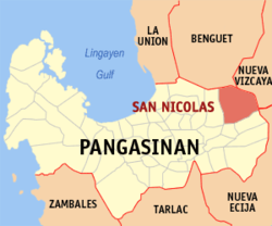
San Nicolas is located in north-eastern part of Pangasinan. It is the only town that borders Nueva Vizcaya.
Barangays
San Nicolas is politically subdivided into 33 barangays. These barangays are headed by elected officials: Barangay Captain, Barangay Council, whose members are called Barangay Councilors. All are elected every three years.
- Bensican
- Cabitnongan
- Cabuloan
- Cacabugaoan
- Calanutian
- Calaocan
- Camanggaan
- Camindoroan
- Casaratan
- Dalumpinas
- Fianza
- Lungao
- Malico
- Malilion
- Nagkaysa
- Nining
- Poblacion East
- Poblacion West
- Salingcob
- Salpad
- San Felipe East
- San Felipe West
- San Isidro (Santa Cruzan)
- San Jose
- San Rafael Centro
- San Rafael East
- San Rafael West
- San Roque
- Santa Maria East
- Santa Maria West
- Santo Tomas
- Siblot
- Sobol
Climate
| Climate data for San Nicolas, Pangasinan | |||||||||||||
|---|---|---|---|---|---|---|---|---|---|---|---|---|---|
| Month | Jan | Feb | Mar | Apr | May | Jun | Jul | Aug | Sep | Oct | Nov | Dec | Year |
| Average high °C (°F) | 31 (88) |
31 (88) |
32 (90) |
34 (93) |
35 (95) |
34 (93) |
32 (90) |
32 (90) |
32 (90) |
32 (90) |
32 (90) |
31 (88) |
32 (90) |
| Average low °C (°F) | 22 (72) |
22 (72) |
22 (72) |
24 (75) |
24 (75) |
24 (75) |
23 (73) |
23 (73) |
24 (75) |
23 (73) |
23 (73) |
22 (72) |
23 (73) |
| Average precipitation mm (inches) | 13.6 (0.54) |
10.4 (0.41) |
18.2 (0.72) |
15.7 (0.62) |
178.4 (7.02) |
227.9 (8.97) |
368 (14.5) |
306.6 (12.07) |
310.6 (12.23) |
215.7 (8.49) |
70.3 (2.77) |
31.1 (1.22) |
1,766.5 (69.56) |
| Average rainy days | 3 | 2 | 2 | 4 | 14 | 16 | 23 | 21 | 24 | 15 | 10 | 6 | 140 |
| Source: World Weather Online[5] | |||||||||||||
Demographics
| Year | Pop. | ±% p.a. |
|---|---|---|
| 1903 | 9,780 | — |
| 1918 | 12,628 | +1.72% |
| 1939 | 16,088 | +1.16% |
| 1948 | 18,218 | +1.39% |
| 1960 | 19,080 | +0.39% |
| 1970 | 21,687 | +1.29% |
| 1975 | 23,377 | +1.52% |
| 1980 | 23,243 | −0.11% |
| 1990 | 27,415 | +1.66% |
| 1995 | 29,058 | +1.10% |
| 2000 | 31,418 | +1.69% |
| 2007 | 33,419 | +0.86% |
| 2010 | 34,108 | +0.75% |
| 2015 | 35,574 | +0.80% |
| 2020 | 39,778 | +2.22% |
| Source: Philippine Statistics Authority [6] [7] [8][9] | ||
Economy
Government
San Nicolas, belonging to the sixth congressional district of the province of Pangasinan, is governed by a mayor designated as its local chief executive and by a municipal council as its legislative body in accordance with the Local Government Code. The mayor, vice mayor, and the councilors are elected directly by the people through an election which is being held every three years.
Elected officials
| Position | Name |
|---|---|
| Congressman | Tyrone D. Agabas |
| Mayor | Alicia P. Enriquez |
| Vice-Mayor | Alvin O. Bravo |
| Councilors | Francisco O. Bravo Jr. |
| Maricon Vindy A. Operaña | |
| Raymond C. Prestoza | |
| Leomar M. Saldivar | |
| Amorsolo R. Pulido | |
| Jose M. Serquiña Jr. | |
| Rosewill P. Descargar | |
| Leoncio V. Saldivar Jr. | |
Tourism
This section has multiple issues. Please help improve it or discuss these issues on the talk page. (Learn how and when to remove these template messages)
|

San Nicolas is a place with many waterfalls from the Caraballo Mountain Range and a number of rivers that serve as a picnic ground for vacationers during holidays and summertime.[18]
Lipit falls are located in Barangay Santa Maria East. It is an hour trail from the Red Arrow Monument along Cabalitian River. Best time to visit the place is during the summertime but it is also safe to go there during rainy seasons.
Agpay falls is in Barangay San Felipe East. During the 1970s up to the 1980s it was actually one of the best natural tourist spots in eastern Pangasinan.
Other waterfalls of interest include: Pinsal falls 1, 2 and 3, located in Sitio Nagsimbaoaan in Barangay Cacabugaoan; Mambolo falls, located at Barangay Salpad and Pinsal Bensican in brgy. Bensican; and Baracbac falls are located in Barangay Fianza just north of Sitio Puyao.
Mejias Resort is located at town proper of San Nicolas. It has a wide space for picnic area and reception hall for kinds of parties and events. They are accepting decorating services and catering for a variety of special events, including the concept and design, planning, day of coordination, and much more. They have also swimming pools for adults and children.
Krystala de Corazon is located at Barangay Calaocan, San Nicolas.
Esperanza's Garden is located at Barangay Cabitnongan, San Nicolas.
Cabalisian River - crystal clear water located at Barangay Santa Maria.
References
- Municipality of San Nicolas | (DILG)
- "2015 Census of Population, Report No. 3 – Population, Land Area, and Population Density" (PDF). Philippine Statistics Authority. Quezon City, Philippines. August 2016. ISSN 0117-1453. Archived (PDF) from the original on May 25, 2021. Retrieved July 16, 2021.
- Census of Population (2020). "Region I (Ilocos Region)". Total Population by Province, City, Municipality and Barangay. PSA. Retrieved 8 July 2021.
- "PSA Releases the 2018 Municipal and City Level Poverty Estimates". Philippine Statistics Authority. 15 December 2021. Retrieved 22 January 2022.
- "San Nicolas, Pangasinan: Average Temperatures and Rainfall". World Weather Online. Retrieved 31 October 2015.
- Census of Population (2015). "Region I (Ilocos Region)". Total Population by Province, City, Municipality and Barangay. PSA. Retrieved 20 June 2016.
- Census of Population and Housing (2010). "Region I (Ilocos Region)". Total Population by Province, City, Municipality and Barangay. NSO. Retrieved 29 June 2016.
- Censuses of Population (1903–2007). "Region I (Ilocos Region)". Table 1. Population Enumerated in Various Censuses by Province/Highly Urbanized City: 1903 to 2007. NSO.
- "Province of Pangasinan". Municipality Population Data. Local Water Utilities Administration Research Division. Retrieved 17 December 2016.
- "Poverty incidence (PI):". Philippine Statistics Authority. Retrieved 28 December 2020.
- https://psa.gov.ph/sites/default/files/NSCB_LocalPovertyPhilippines_0.pdf; publication date: 29 November 2005; publisher: Philippine Statistics Authority.
- https://psa.gov.ph/sites/default/files/2003%20SAE%20of%20poverty%20%28Full%20Report%29_1.pdf; publication date: 23 March 2009; publisher: Philippine Statistics Authority.
- https://psa.gov.ph/sites/default/files/2006%20and%202009%20City%20and%20Municipal%20Level%20Poverty%20Estimates_0_1.pdf; publication date: 3 August 2012; publisher: Philippine Statistics Authority.
- https://psa.gov.ph/sites/default/files/2012%20Municipal%20and%20City%20Level%20Poverty%20Estima7tes%20Publication%20%281%29.pdf; publication date: 31 May 2016; publisher: Philippine Statistics Authority.
- https://psa.gov.ph/sites/default/files/City%20and%20Municipal-level%20Small%20Area%20Poverty%20Estimates_%202009%2C%202012%20and%202015_0.xlsx; publication date: 10 July 2019; publisher: Philippine Statistics Authority.
- "PSA Releases the 2018 Municipal and City Level Poverty Estimates". Philippine Statistics Authority. 15 December 2021. Retrieved 22 January 2022.
- "2019 National and Local Elections" (PDF). Commission on Elections. Retrieved March 7, 2022.
{{cite web}}: CS1 maint: url-status (link) - "Cascadas de Huesna (Cascadas del Hueznar)". World of Waterfalls. Retrieved 2020-05-11.
External links
- San Nicolas Profile at PhilAtlas.com
- Official website
- Municipal Profile at the National Competitiveness Council of the Philippines
- San Nicolas at the Pangasinan Government Website
- Local Governance Performance Management System
- Philippine Standard Geographic Code
- Philippine Census Information
Places adjacent to San Nicolas, Pangasinan | ||||||||||||||||
|---|---|---|---|---|---|---|---|---|---|---|---|---|---|---|---|---|
| ||||||||||||||||
Lingayen (capital) | |
| Municipalities |
|
| Component cities |
|
| Independent component city |
|
| Barangays | See: List of barangays in Pangasinan |
На других языках
[de] San Nicolas (Pangasinan)
San Nicolas ist eine Stadtgemeinde in der philippinischen Provinz Pangasinan. Sie grenzt im Norden und Osten an die Provinzen Benguet und Nueva Vizcaya. In dem 208 km² großen Gebiet wohnten im Jahre 2015 35.574 Menschen, wodurch sich eine Bevölkerungsdichte von 171 Einwohnern pro km² ergibt. Wie in der Nachbargemeinde San Manuel leben hier die meisten Bewohner im flachen Süden des Gebietes. Im Norden und Osten steigt das Gelände aufgrund der philippinischen Kordilleren stark an. Zu San Nicolas gehört auch ein Teil der San-Roque-Talsperre. Die Stadtgemeinde wurde 1800 von Nicolas Patricio y Mejia gegründet und nach ihm benannt.- [en] San Nicolas, Pangasinan
Другой контент может иметь иную лицензию. Перед использованием материалов сайта WikiSort.org внимательно изучите правила лицензирования конкретных элементов наполнения сайта.
WikiSort.org - проект по пересортировке и дополнению контента Википедии