world.wikisort.org - Philippines
Sison, officially the Municipality of Sison (Pangasinan: Baley na Sison; Ilocano: Ili ti Sison; Tagalog: Bayan ng Sison), is a 3rd class municipality in the province of Pangasinan, Philippines. The town's original name was Alava. According to the 2020 census, it has a population of 52,320 people. [3]
Sison | |
|---|---|
Municipality | |
| Municipality of Sison | |
 Arch of welcome | |
 Seal | |
 Map of Pangasinan with Sison highlighted | |
OpenStreetMap  | |
 Sison Location within the Philippines | |
| Coordinates: 16°10′N 120°31′E | |
| Country | Philippines |
| Region | Ilocos Region |
| Province | Pangasinan |
| District | 5th district |
| Founded | December 14, 1862 |
| Barangays | 28 (see Barangays) |
| Government | |
| • Type | Sangguniang Bayan |
| • Mayor | Danilo C. Uy |
| • Vice Mayor | Edgar M. Jovenal |
| • Representative | Ramon V. Guico III |
| • Municipal Council | Members |
| • Electorate | 32,704 voters (2022) |
| Area | |
| • Total | 81.88 km2 (31.61 sq mi) |
| Elevation | 131 m (430 ft) |
| Population | |
| • Total | 52,320 |
| • Density | 640/km2 (1,700/sq mi) |
| • Households | 12,948 |
| Economy | |
| • Income class | 3rd municipal income class |
| • Poverty incidence | 10.03% (2015)[4] |
| • Revenue | ₱187,808,291.82 (2020) |
| • Assets | ₱711,164,133.19 (2020) |
| • Expenditure | ₱148,666,225.06 (2020) |
| • Liabilities | ₱109,824,683.61 (2020) |
| Service provider | |
| • Electricity | Pangasinan 3 Electric Cooperative (PANELCO 3) |
| Time zone | UTC+8 (PST) |
| ZIP code | 2434 |
| PSGC | |
| IDD : area code | +63 (0)75 |
| Native languages | Pangasinan Ilocano Tagalog |
| Website | www |
History
Sison was once part of San Fabian until petitioners from Barrio Bolaoen signed a manifesto on June 30, 1858, expressing their intention of creating a separate pueblo.[5] It was petitioned to the gobernadorcillo of San Fabian and was later endorsed to the Alcalde Mayor of Lingayen on August 8, 1858.[6] After the definition of the jurisdiction of the proposed new pueblo, the administrative proceedings began with the mayor of San Fabian himself, Don Enrique Casaoay, as among those who appeared in behalf of the petitioners. On December 15, 1862, a royal decree was finally issued declaring the creation of a pueblo independent of San Fabian's civil jurisdiction. The pueblo was called Alava.[7] Don Faustino Baclit served as its ad interim head until the pueblo's first elected president, Don Felix Genelazo, assumed his office on March 1, 1868.[8]
In 1907, Esperanza, north-east of Alava, was formed into Pinmilapil, Agat, Sagunto, Cauringan, Bila and Colisao (now in San Fabian). Labayug was formed also into Inmalog, Calunetan, San Andres, Alibeng, Bacayao and Killo. Esperanza and Labayug were joined as Artacho, its poblacion, which become a regular municipality.[9]
On March 25, 1918, Governor General Francis Burton Harrison signed Executive Order No. 12, s. 1918 consolidating the township of Artacho and the municipality of Alava as the Municipality of Sison.[10][11] Following this incorporation, Alava was renamed Sison in honor of Don Perfecto Sison, first provincial governor of Pangasinan.[12]
Geography
Sison is geographically located on the northern portion of Pangasinan, bordering the provincial boundaries of La Union and Benguet. It has a total land area of 81.88 square kilometers. It is bounded on the north by Rosario (La Union), Tuba (Benguet); on the south by Pozorrubio; on the southeast by San Manuel and Binalonan; on the west by San Fabian.
The municipality is 207 kilometres (129 mi) north of Manila, 62 kilometres (39 mi) south of San Fernando City, where the regional office of the national government agencies in Region I are located, 68 kilometres (42 mi) east of Lingayen, the provincial capital, and 43 kilometres (27 mi) south of Baguio.
Barangays
Sison is politically subdivided into 28 barangays. These barangays are headed by elected officials: Barangay Captain, Barangay Council, whose members are called Barangay Councilors. All are elected every three years.
- Agat
- Alibeng
- Amagbagan
- Artacho
- Asan Norte
- Asan Sur
- Bantay Insik
- Bila
- Binmeckeg
- Bulaoen East
- Bulaoen West
- Cabaritan
- Calunetan
- Camangaan
- Cauringan
- Dungon
- Esperanza
- Inmalog
- Killo
- Labayug
- Paldit
- Pindangan
- Pinmilapil
- Poblacion Central
- Poblacion Norte
- Poblacion Sur
- Sagunto
- Tara-tara
Climate
| Climate data for Sison, Pangasinan | |||||||||||||
|---|---|---|---|---|---|---|---|---|---|---|---|---|---|
| Month | Jan | Feb | Mar | Apr | May | Jun | Jul | Aug | Sep | Oct | Nov | Dec | Year |
| Average high °C (°F) | 31 (88) |
31 (88) |
32 (90) |
34 (93) |
35 (95) |
34 (93) |
32 (90) |
32 (90) |
32 (90) |
32 (90) |
32 (90) |
31 (88) |
32 (90) |
| Average low °C (°F) | 22 (72) |
22 (72) |
22 (72) |
24 (75) |
24 (75) |
24 (75) |
24 (75) |
24 (75) |
24 (75) |
23 (73) |
23 (73) |
22 (72) |
23 (74) |
| Average precipitation mm (inches) | 13.6 (0.54) |
10.4 (0.41) |
18.2 (0.72) |
15.7 (0.62) |
178.4 (7.02) |
227.9 (8.97) |
368 (14.5) |
306.6 (12.07) |
310.6 (12.23) |
215.7 (8.49) |
70.3 (2.77) |
31.1 (1.22) |
1,766.5 (69.56) |
| Average rainy days | 3 | 2 | 2 | 4 | 14 | 16 | 23 | 21 | 24 | 15 | 10 | 6 | 140 |
| Source: World Weather Online (modeled/calculated data, not measured locally)[13] | |||||||||||||
Demographics
|
| |||||||||||||||||||||||||||||||||||||||||||||||||||
| Source: Philippine Statistics Authority [14] [15] [16][17] | ||||||||||||||||||||||||||||||||||||||||||||||||||||
Religion
Diocesan Shrine of Our Lady of Mount Carmel

The Diocesan Shrine of Our Lady of Mount Carmel (Sison, 2434 Pangasinan) was canonically erected in 1896–1898. It is under the jurisdiction of the Roman Catholic Diocese of Urdaneta (from the Roman Catholic Archdiocese of Lingayen-Dagupan, Archdioecesis Lingayensis-Dagupanensis, created on May 19, 1928, elevated to Archdiocese on February 16, 1963, comprising the capital of the province, 2 cities and 15 municipalities in the central part of Pangasinan; Suffragans: Alaminos, Cabanatuan, San Fernando, La Union, San Jose, Nueva Ecija and Urdaneta; Titular: St. John the Apostle and Evangelist).[18][19][20][21]
The November 20, 1896 Spanish Royal Decree created Alava as a Parish of Diocese of Nueva Segovia. In 1918 the town was renamed to Sison honoring Senator Pedro Ma. Sison.
In 1928 the Parish Church was included into the Diocese of Lingayen-Pangasinan. In the 15th Centenary Anniversary of the Council of Ephesus, the Sison Parish was consecrated under “La Reina Del Monte Carmelo” (Our Lady of Mount Carmel), forming part of the Roman Catholic Diocese of Urdaneta in 1985. But it was only on its Centennial founding on November 20, 1996, that the Parish Church became a Diocesan Shrine. Its feast day is every 16 July. The Parish Priest is Rev. Fr. Bernardo Villanueva.[22][23]
Economy
Government

Just as the national government, the municipal government of Sison is divided into three branches: executive, legislative and judiciary. The judicial branch is administered solely by the Supreme Court of the Philippines. The LGUs have control of the executive and legislative branch.
The executive branch is composed of the mayor and the barangay captain for the barangays.[31] The legislative branch is composed of the Sangguniang Bayan (town assembly), and Sangguniang Barangay (barangay council).
The seat of Government is vested upon the Mayor and other elected officers who hold office at the Sison Town hall. The Sanguniang Bayan is the center of legislation, stationed in Sison Legislative Building or Town hall.
Elected officials
Specifically, Sison's mayor and Chief Executive is Danilo "Danny" C. Uy. The sangguniang bayan, the legislative body of the municipality is composed of the municipal vice mayor as the presiding officer, 8 Sanguniang Bayan Members, Indigenous People representative, ABC President, and Sangunian Kabataan (SK) Federation President. (Section 440, Local Government Code of 1991)[32]
| Position | Name |
|---|---|
| Congressman | Ramon V. Guico Jr. |
| Mayor | Danilo C. Uy |
| Vice-Mayor | Alma M. Lomibao |
| Councilors | Samson P. Murao |
| Dandan Tayag | |
| Ericson Biason | |
| Larry Benosa | |
| Benson Aquino | |
| Mina Joy C. Pangasinan | |
| Jomar Fabros | |
| Charipec G. Baoanan | |
| Indigenous People Mandatory
Representative (IPMR) President |
Dionesia Sidogen |
| ABC President | Carlito Queriones |
| SK Federation President | Gyle Nicollo Benosa |
Tourism

Sison has the following landmark attractions and events:
- Begnas: Sison celebrates the October Begnas festival at the New Public Market yearly with foreign residents participation (Sagada word, "thanksgiving"). National Cultural Minorities under the National Commission on Indigenous Peoples' October joined the yearly event with outsiders from Baguio, Laoac, Pozorrubio, Bago, Kankanaeys, Ibalois and the Aplays.[34]
- 34th Eastern Pangasinan BSP Mini Jamboree
- Antong Falls
- Bued Toll Bridge (Pangasinan-La Union boundary) Gloria Macapagal Arroyo (unveiled on June 21, 2010) the newly reconstructed three-span superstructure Bued Bridge marker in Sison, Pangasinan (destroyed by the October 2010 typhoon Pepeng) the restoration of the three-span superstructure started in January 2010(P120-million repair under the President's Bridge Program).[35][36]
Gallery
 Municipal Library
 Town plaza and state or auditorium
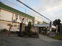 Northern Luzon Adventist Hospital
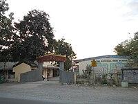 Artacho National High School


See also
- List of renamed cities and municipalities in the Philippines
References
- Municipality of Sison | (DILG)
- "2015 Census of Population, Report No. 3 – Population, Land Area, and Population Density" (PDF). Philippine Statistics Authority. Quezon City, Philippines. August 2016. ISSN 0117-1453. Archived (PDF) from the original on May 25, 2021. Retrieved July 16, 2021.
- Census of Population (2020). "Region I (Ilocos Region)". Total Population by Province, City, Municipality and Barangay. PSA. Retrieved 8 July 2021.
- "PSA releases the 2015 Municipal and City Level Poverty Estimates". Quezon City, Philippines. Retrieved 1 January 2020.
- Lagmay, Dionisio (1999). History of Sison: Pueblo de Alava and the Men at the Helm. Agoo: Agoo Printing Press. p. 1.
- Lagmay, Dionisio (1999). History of Sison: Pueblo de Alava and the Men at the Helm. Agoo: Agoo Printing Press. p. 6.
- Lagmay, Dionisio (1999). History of Sison: Pueblo de Alava and the Men at the Helm. Agoo: Agoo Printing Press. p. 6.
- Lagmay, Dionisio (1999). History of Sison: Pueblo de Alava and the Men at the Helm. Agoo: Agoo Printing Press. p. 17.
- Official Website of Sison,Pangasinan
- Cortes, Rosario (1990). Pangasinan: 1901-1986: A Political, Socioeconomic and Cultural History. Quezon City: New Day Publishers. p. 20.
- Lagmay, Dioniso (1999). History of Sison: Pueblo de Alava and the Men at the Helm. Agoo: Agoo Printing Press. p. 38.
- Lagmay, Dionisio (1999). History of Sison: Pueblo de Alava and the Men at the Helm. Agoo: Agoo Printing Press. p. 38.
- "Sison, Pangasinan: Average Temperatures and Rainfall". World Weather Online. Retrieved 31 October 2015.
- Census of Population (2015). "Region I (Ilocos Region)". Total Population by Province, City, Municipality and Barangay. PSA. Retrieved 20 June 2016.
- Census of Population and Housing (2010). "Region I (Ilocos Region)". Total Population by Province, City, Municipality and Barangay. NSO. Retrieved 29 June 2016.
- Censuses of Population (1903–2007). "Region I (Ilocos Region)". Table 1. Population Enumerated in Various Censuses by Province/Highly Urbanized City: 1903 to 2007. NSO.
- "Province of Pangasinan". Municipality Population Data. Local Water Utilities Administration Research Division. Retrieved 17 December 2016.
- "Dioceses in the Philippines: Archdiocese of Lingayen-Dagupan". Claretian Publications. Archived from the original on 2 February 2014. Retrieved 28 September 2014.
- "Diocese of Urdaneta". Catholic Hierarchy. Retrieved 28 September 2014.
- "Diocese of Urdaneta". CBCP Media Office. Catholic Bishops' Conference of the Philippines. Retrieved 28 September 2014.
- "List of Parishes of the Roman Catholic Diocese of Urdaneta". Philippine Churches. 26 June 2012. Archived from the original on 6 October 2014. Retrieved 28 September 2014.
- "Shrine of Our Lady of Mt Carmel/ Our Lady of Mt Carmel Parish/ The Church of Sison (Sison, Pangasinan)". Pinoy Churches. 23 September 2012. Retrieved 28 September 2014.
- "Our Lady of Mt. Carmel Parish". Wikimapia. Retrieved 28 September 2014.
- "Poverty incidence (PI):". Philippine Statistics Authority. Retrieved 28 December 2020.
- https://psa.gov.ph/sites/default/files/NSCB_LocalPovertyPhilippines_0.pdf; publication date: 29 November 2005; publisher: Philippine Statistics Authority.
- https://psa.gov.ph/sites/default/files/2003%20SAE%20of%20poverty%20%28Full%20Report%29_1.pdf; publication date: 23 March 2009; publisher: Philippine Statistics Authority.
- https://psa.gov.ph/sites/default/files/2006%20and%202009%20City%20and%20Municipal%20Level%20Poverty%20Estimates_0_1.pdf; publication date: 3 August 2012; publisher: Philippine Statistics Authority.
- https://psa.gov.ph/sites/default/files/2012%20Municipal%20and%20City%20Level%20Poverty%20Estima7tes%20Publication%20%281%29.pdf; publication date: 31 May 2016; publisher: Philippine Statistics Authority.
- https://psa.gov.ph/sites/default/files/City%20and%20Municipal-level%20Small%20Area%20Poverty%20Estimates_%202009%2C%202012%20and%202015_0.xlsx; publication date: 10 July 2019; publisher: Philippine Statistics Authority.
- "PSA Releases the 2018 Municipal and City Level Poverty Estimates". Philippine Statistics Authority. 15 December 2021. Retrieved 22 January 2022.
- Local Government Code of the Philippines, Book III Archived 2009-03-26 at the Wayback Machine, Department of the Interior and Local Government official website.
- Official Website of Sison,Pangasinan
- "2019 National and Local Elections" (PDF). Commission on Elections. Retrieved March 7, 2022.
{{cite web}}: CS1 maint: url-status (link) - Official Website of Sison,Pangasinan
- "PGMA unveils the marker of the newly-reconstructed Bued Bridge in Sison, Pangasinan". Balita. 21 June 2010. Retrieved 28 September 2014.
- Morden, Johanna (21 June 2010). "Arroyo reopens major bridge in N. Luzon". Philippine Daily Inquirer. Archived from the original on 6 October 2014. Retrieved 28 September 2014.
External links
- Sison Official Website
- Municipal Profile at the National Competitiveness Council of the Philippines
- Sison at the Pangasinan Government Website
- Local Governance Performance Management System
- Philippine Standard Geographic Code
- Philippine Census Information
Places adjacent to Sison, Pangasinan | ||||||||||||||||
|---|---|---|---|---|---|---|---|---|---|---|---|---|---|---|---|---|
| ||||||||||||||||
Lingayen (capital) | |
| Municipalities |
|
| Component cities | |
| Independent component city |
|
| Barangays | See: List of barangays in Pangasinan |
На других языках
[de] Sison (Pangasinan)
Sison ist eine Stadtgemeinde in der philippinischen Provinz Pangasinan und grenzt im Norden an die Provinzen La Union und Benguet. Das Gelände von Sison ist im Westen sehr flach und steigt im bergigen Osten bis auf 700 Meter über dem Meeresspiegel an.- [en] Sison, Pangasinan
Другой контент может иметь иную лицензию. Перед использованием материалов сайта WikiSort.org внимательно изучите правила лицензирования конкретных элементов наполнения сайта.
WikiSort.org - проект по пересортировке и дополнению контента Википедии